


5,4 km | 9,2 km-effort
Entlebuch: Ontdek de beste tochten: 10 te voet. Al deze tochten, trajecten, routes en outdoor activiteiten zijn beschikbaar in onze SityTrail-apps voor smartphones en tablets.
Te voet


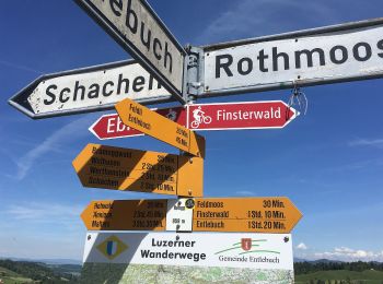
• Symbol: gelber Rhombus
Te voet
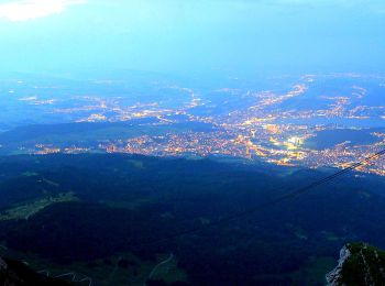
• PIlatus Kulm - Risete Symbol: weiss-rot-weiss
Te voet
• Chlosterwald - Rengg Symbol: gelber Rhombus

Te voet
• Chlosterwald - Chächebüel Symbol: gelber Rhombus
Te voet
• Trail created by Luzerner Wanderwege. Unt. Rotmoos - Feldmoos Symbol: gelber Rhombus
Te voet
• Trail created by Biosphärenzentrum Entlebuch.

Te voet
• Symbol: gelber Rhombus
Te voet
• Trail created by Luzerner Wanderwege. Symbol: gelber Rhombus
Te voet
• Gfellen - Finsterwald

Stappen
•
Andere activiteiten
•
11 tochten weergegeven op 11
Gratisgps-wandelapplicatie
 SityTrail
IGN / Geografische instituten
SityTrail World
De wereld gaat voor u open