![](/images/other/stat-length.png)
- Tochten
- Outdoor
- Austria
- Tirol
- Bezirk Kufstein
- Gemeinde Schwoich
Gemeinde Schwoich, Bezirk Kufstein: Top van de beste wandelroutes, trajecten, tochten en wandelingen
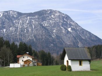
Gemeinde Schwoich: Ontdek de beste tochten: 6 te voet. Al deze tochten, trajecten, routes en outdoor activiteiten zijn beschikbaar in onze SityTrail-apps voor smartphones en tablets.
De beste trajecten (6)
![Tocht Te voet Gemeinde Schwoich - VBA-Runde - Photo](https://media.geolcdn.com/t/350/260/a2db4e88-f51b-4cd3-a9a0-def1d3cf7f1b.jpeg&format=jpg&maxdim=2)
![Te voet Te voet](https://static1.geolcdn.com/sitytour/trail-icons/100.png)
Km
Te voet
![](/images/other/stat-length.png)
![](https://static1.geolcdn.com/siteimages/upload/files/1508320355ic_sort_den_pos_24dp.png)
![](https://static1.geolcdn.com/siteimages/upload/files/1508320355ic_sort_den_neg_24dp.png)
![](https://static1.geolcdn.com/siteimages/upload/files/16400158638029165_repeat_loop_refresh_sync_direction_icon.png)
• Trail created by Gemeinde Bad Häring. Symbol: Hellgrüne Schilder mit dunkelgrünem, oberen Rand und Richtungspfeil
![Tocht Te voet Gemeinde Schwoich - Waldschönauer Runde - Photo](https://media.geolcdn.com/t/350/260/611dbb3a-95cb-44c3-b8d9-20a695284e74.jpeg&format=jpg&maxdim=2)
![Te voet Te voet](https://static1.geolcdn.com/sitytour/trail-icons/100.png)
Km
Te voet
![](/images/other/stat-length.png)
![](https://static1.geolcdn.com/siteimages/upload/files/1508320355ic_sort_den_pos_24dp.png)
![](https://static1.geolcdn.com/siteimages/upload/files/1508320355ic_sort_den_neg_24dp.png)
![](https://static1.geolcdn.com/siteimages/upload/files/16400158638029165_repeat_loop_refresh_sync_direction_icon.png)
• Trail created by Kufsteinerland. Symbol: Gelbe Schilder mit weißem Richtungspfeil und rotem Streifen mit dem Namen "...
![Tocht Te voet Gemeinde Schwoich - Schmieder Runde - Photo](https://media.geolcdn.com/t/350/260/b1044541-dd3e-49cc-bd81-37d812d18204.jpeg&format=jpg&maxdim=2)
![Te voet Te voet](https://static1.geolcdn.com/sitytour/trail-icons/100.png)
Km
Te voet
![](/images/other/stat-length.png)
![](https://static1.geolcdn.com/siteimages/upload/files/1508320355ic_sort_den_pos_24dp.png)
![](https://static1.geolcdn.com/siteimages/upload/files/1508320355ic_sort_den_neg_24dp.png)
![](https://static1.geolcdn.com/siteimages/upload/files/16400158638029165_repeat_loop_refresh_sync_direction_icon.png)
• Trail created by Kufsteinerland. Symbol: Gelbe Schilder mit weißem Richtungspfeil und violettem Streifen mit dem Nam...
![Tocht Te voet Gemeinde Schwoich - Achrainerrunde - Photo](https://media.geolcdn.com/t/350/260/611dbb3a-95cb-44c3-b8d9-20a695284e74.jpeg&format=jpg&maxdim=2)
![Te voet Te voet](https://static1.geolcdn.com/sitytour/trail-icons/100.png)
Km
Te voet
![](/images/other/stat-length.png)
![](https://static1.geolcdn.com/siteimages/upload/files/1508320355ic_sort_den_pos_24dp.png)
![](https://static1.geolcdn.com/siteimages/upload/files/1508320355ic_sort_den_neg_24dp.png)
![](https://static1.geolcdn.com/siteimages/upload/files/16400158638029165_repeat_loop_refresh_sync_direction_icon.png)
• Trail created by Kufsteinerland. Symbol: Gelbe Schilder mit weißem Richtungspfeil und blauem Streifen mit dem Namen ...
![Tocht Te voet Gemeinde Schwoich - Osterndorfer Runde - Photo](https://media.geolcdn.com/t/350/260/611dbb3a-95cb-44c3-b8d9-20a695284e74.jpeg&format=jpg&maxdim=2)
![Te voet Te voet](https://static1.geolcdn.com/sitytour/trail-icons/100.png)
Km
Te voet
![](/images/other/stat-length.png)
![](https://static1.geolcdn.com/siteimages/upload/files/1508320355ic_sort_den_pos_24dp.png)
![](https://static1.geolcdn.com/siteimages/upload/files/1508320355ic_sort_den_neg_24dp.png)
![](https://static1.geolcdn.com/siteimages/upload/files/16400158638029165_repeat_loop_refresh_sync_direction_icon.png)
• Trail created by Kufsteinerland. Symbol: Gelbe Schilder mit weißem Richtungspfeil und rotem Streifen mit dem Namen "...
![Tocht Te voet Gemeinde Schwoich - Locherer-Runde - Photo](https://media.geolcdn.com/t/350/260/f39ac2bc-285c-4db5-8941-07e4fc1afe27.jpeg&format=jpg&maxdim=2)
![Te voet Te voet](https://static1.geolcdn.com/sitytour/trail-icons/100.png)
Km
Te voet
![](/images/other/stat-length.png)
![](https://static1.geolcdn.com/siteimages/upload/files/1508320355ic_sort_den_pos_24dp.png)
![](https://static1.geolcdn.com/siteimages/upload/files/1508320355ic_sort_den_neg_24dp.png)
![](https://static1.geolcdn.com/siteimages/upload/files/16400158638029165_repeat_loop_refresh_sync_direction_icon.png)
• Trail created by Kufsteinerland. Symbol: Weiße Schilder mit Richtungspfeil und hellbraunem Streifen mit dem Namen "L...
6 tochten weergegeven op 6
Gratisgps-wandelapplicatie