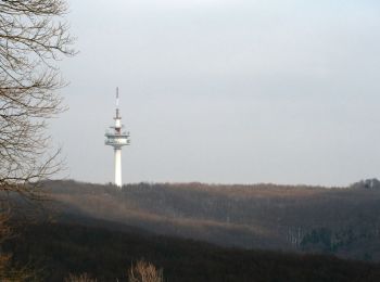
![](/images/other/stat-length.png)
Penzing, Onbekend: Top van de beste wandelroutes, trajecten, tochten en wandelingen
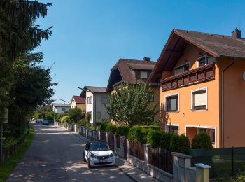
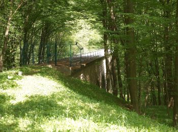
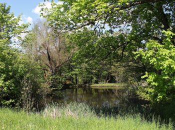
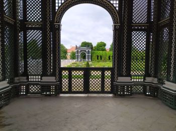
Penzing: Ontdek de beste tochten: 7 te voet. Al deze tochten, trajecten, routes en outdoor activiteiten zijn beschikbaar in onze SityTrail-apps voor smartphones en tablets.
De beste trajecten (7)
![Tocht Te voet Onbekend - Hadersdorf Bf. - Vorderhainbach (blaue Markierung) - Photo](https://media.geolcdn.com/t/350/260/5cf9ea40-1f6d-4e77-974a-4d4b825820b4.jpeg&format=jpg&maxdim=2)
![Te voet Te voet](https://static1.geolcdn.com/sitytour/trail-icons/100.png)
Km
Te voet
![](/images/other/stat-length.png)
![](https://static1.geolcdn.com/siteimages/upload/files/1508320355ic_sort_den_pos_24dp.png)
![](https://static1.geolcdn.com/siteimages/upload/files/1508320355ic_sort_den_neg_24dp.png)
![](https://static1.geolcdn.com/siteimages/upload/files/16400158638029165_repeat_loop_refresh_sync_direction_icon.png)
• Trail created by ÖTK-Klosterneuburg. Symbol: weiss-blau-weiss
![Tocht Te voet Onbekend - Sophienalpe - Scheiblingstein - Photo](https://media.geolcdn.com/t/350/260/d4c9f0e8-6c63-4664-8a2a-a66dd875a234.jpeg&format=jpg&maxdim=2)
![Te voet Te voet](https://static1.geolcdn.com/sitytour/trail-icons/100.png)
Km
Te voet
![](/images/other/stat-length.png)
![](https://static1.geolcdn.com/siteimages/upload/files/1508320355ic_sort_den_pos_24dp.png)
![](https://static1.geolcdn.com/siteimages/upload/files/1508320355ic_sort_den_neg_24dp.png)
![](https://static1.geolcdn.com/siteimages/upload/files/16400158638029165_repeat_loop_refresh_sync_direction_icon.png)
• Trail created by ÖTK-Klosterneuburg. Symbol: weiss-blau-weiss Website: https://www.oetk-klosterneuburg.at/index.ph...
![Tocht Te voet Onbekend - Hadersdorf Bf. - Vorderhainbach (grüne Markierung) - Photo](https://media.geolcdn.com/t/350/260/1bc19f13-a0be-439a-8303-aaf3ed6229ee.jpeg&format=jpg&maxdim=2)
![Te voet Te voet](https://static1.geolcdn.com/sitytour/trail-icons/100.png)
Km
Te voet
![](/images/other/stat-length.png)
![](https://static1.geolcdn.com/siteimages/upload/files/1508320355ic_sort_den_pos_24dp.png)
![](https://static1.geolcdn.com/siteimages/upload/files/1508320355ic_sort_den_neg_24dp.png)
![](https://static1.geolcdn.com/siteimages/upload/files/16400158638029165_repeat_loop_refresh_sync_direction_icon.png)
• Trail created by ÖTK-Klosterneuburg. Symbol: weiss-gruen-weiss Website: https://www.oetk-klosterneuburg.at/index.p...
![Tocht Te voet Onbekend - Hütteldorf/Endstation Linie 49 - Sophienalpe - Photo](https://media.geolcdn.com/t/350/260/253a6813-08fa-4a81-a70e-4b57f01b5ec7.jpeg&format=jpg&maxdim=2)
![Te voet Te voet](https://static1.geolcdn.com/sitytour/trail-icons/100.png)
Km
Te voet
![](/images/other/stat-length.png)
![](https://static1.geolcdn.com/siteimages/upload/files/1508320355ic_sort_den_pos_24dp.png)
![](https://static1.geolcdn.com/siteimages/upload/files/1508320355ic_sort_den_neg_24dp.png)
![](https://static1.geolcdn.com/siteimages/upload/files/16400158638029165_repeat_loop_refresh_sync_direction_icon.png)
• Trail created by ÖTK-Klosterneuburg. Symbol: weiss-blau-weiss Website: https://www.oetk-klosterneuburg.at/index.ph...
![Tocht Te voet Onbekend - Weidlingau - Laab im Walde - Photo](https://media.geolcdn.com/t/350/260/582cf4d3-de8a-49e5-81af-ec30df950023.jpeg&format=jpg&maxdim=2)
![Te voet Te voet](https://static1.geolcdn.com/sitytour/trail-icons/100.png)
Km
Te voet
![](/images/other/stat-length.png)
![](https://static1.geolcdn.com/siteimages/upload/files/1508320355ic_sort_den_pos_24dp.png)
![](https://static1.geolcdn.com/siteimages/upload/files/1508320355ic_sort_den_neg_24dp.png)
![](https://static1.geolcdn.com/siteimages/upload/files/16400158638029165_repeat_loop_refresh_sync_direction_icon.png)
• Trail created by Österreichischer Touristenklub. Symbol: grüner, waagrechter Balken
![Tocht Te voet Onbekend - Stadtwanderweg 4 - Jubiläumswarte - Photo](https://media.geolcdn.com/t/350/260/7b3ffae7-5c9d-4fff-b351-75c0699817ab.jpeg&format=jpg&maxdim=2)
![Te voet Te voet](https://static1.geolcdn.com/sitytour/trail-icons/100.png)
Km
Te voet
![](/images/other/stat-length.png)
![](https://static1.geolcdn.com/siteimages/upload/files/1508320355ic_sort_den_pos_24dp.png)
![](https://static1.geolcdn.com/siteimages/upload/files/1508320355ic_sort_den_neg_24dp.png)
![](https://static1.geolcdn.com/siteimages/upload/files/16400158638029165_repeat_loop_refresh_sync_direction_icon.png)
• Trail created by Stadt Wien (Forstamt). http://wiki.openstreetmap.org/index.php?title=WikiProject_Austria/Wanderwege
![Tocht Stappen Onbekend - Château de Sisi - Photo](https://media.geolcdn.com/t/350/260/a12d0b1a-1adb-4e7b-9a2c-575599550a51.jpg&format=jpg&maxdim=2)
![Stappen Stappen](https://static1.geolcdn.com/sitytour/trail-icons/101.png)
Km
Stappen
![](/images/other/stat-length.png)
![](https://static1.geolcdn.com/siteimages/upload/files/1508320355ic_sort_den_pos_24dp.png)
![](https://static1.geolcdn.com/siteimages/upload/files/1508320355ic_sort_den_neg_24dp.png)
![](https://static1.geolcdn.com/siteimages/upload/files/16400158638029165_repeat_loop_refresh_sync_direction_icon.png)
7 tochten weergegeven op 7
Gratisgps-wandelapplicatie