![](/images/other/stat-length.png)
- Tochten
- Outdoor
- Austria
- Stiermarken
- Bezirk Hartberg-Fürstenfeld
- Sankt Johann in der Haide
Sankt Johann in der Haide, Bezirk Hartberg-Fürstenfeld: Top van de beste wandelroutes, trajecten, tochten en wandelingen
Sankt Johann in der Haide: Ontdek de beste tochten: 7 te voet. Al deze tochten, trajecten, routes en outdoor activiteiten zijn beschikbaar in onze SityTrail-apps voor smartphones en tablets.
De beste trajecten (7)
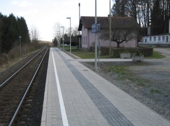
![Tocht Te voet Sankt Johann in der Haide - St. Johann i.d. Haide - Unterlungitz Rundewanderweg - Photo](https://media.geolcdn.com/t/350/260/11b7653b-2966-47f5-bae3-e1fb34a8f601.jpeg&format=jpg&maxdim=2)
![Te voet Te voet](https://static1.geolcdn.com/sitytour/trail-icons/100.png)
Km
Te voet
![](/images/other/stat-length.png)
![](https://static1.geolcdn.com/siteimages/upload/files/1508320355ic_sort_den_pos_24dp.png)
![](https://static1.geolcdn.com/siteimages/upload/files/1508320355ic_sort_den_neg_24dp.png)
![](https://static1.geolcdn.com/siteimages/upload/files/16400158638029165_repeat_loop_refresh_sync_direction_icon.png)
• Symbol: weiß-grün-weiß
![Tocht Te voet Sankt Johann in der Haide - Fischteich Rundwanderweg - Photo](https://media.geolcdn.com/t/350/260/11b7653b-2966-47f5-bae3-e1fb34a8f601.jpeg&format=jpg&maxdim=2)
![Te voet Te voet](https://static1.geolcdn.com/sitytour/trail-icons/100.png)
Km
Te voet
![](/images/other/stat-length.png)
![](https://static1.geolcdn.com/siteimages/upload/files/1508320355ic_sort_den_pos_24dp.png)
![](https://static1.geolcdn.com/siteimages/upload/files/1508320355ic_sort_den_neg_24dp.png)
![](https://static1.geolcdn.com/siteimages/upload/files/16400158638029165_repeat_loop_refresh_sync_direction_icon.png)
• Wegbezeichnung 14a, 14b Symbol: weiß-rot-weiß
![Tocht Te voet Sankt Johann in der Haide - Hartberg Altenberg Lorettokapelle - Photo](https://media.geolcdn.com/t/350/260/6cb6941c-a5cc-4aa8-bb21-255233858a71.jpeg&format=jpg&maxdim=2)
![Te voet Te voet](https://static1.geolcdn.com/sitytour/trail-icons/100.png)
Km
Te voet
![](/images/other/stat-length.png)
![](https://static1.geolcdn.com/siteimages/upload/files/1508320355ic_sort_den_pos_24dp.png)
![](https://static1.geolcdn.com/siteimages/upload/files/1508320355ic_sort_den_neg_24dp.png)
![](https://static1.geolcdn.com/siteimages/upload/files/16400158638029165_repeat_loop_refresh_sync_direction_icon.png)
• Trail created by Steirische Berg und Naturwacht Orsteinsatzstelle Hartberg. Symbol: Rot Weiss Rot 12
![Tocht Te voet Sankt Johann in der Haide - Ghartwald-Rundwanderweg - Photo](https://media.geolcdn.com/t/350/260/11b7653b-2966-47f5-bae3-e1fb34a8f601.jpeg&format=jpg&maxdim=2)
![Te voet Te voet](https://static1.geolcdn.com/sitytour/trail-icons/100.png)
Km
Te voet
![](/images/other/stat-length.png)
![](https://static1.geolcdn.com/siteimages/upload/files/1508320355ic_sort_den_pos_24dp.png)
![](https://static1.geolcdn.com/siteimages/upload/files/1508320355ic_sort_den_neg_24dp.png)
![](https://static1.geolcdn.com/siteimages/upload/files/16400158638029165_repeat_loop_refresh_sync_direction_icon.png)
![Tocht Te voet Sankt Johann in der Haide - Kalorienweg - Photo](https://media.geolcdn.com/t/350/260/a1f1cd84-62f8-49ea-820e-bbad58b6ae99.jpeg&format=jpg&maxdim=2)
![Te voet Te voet](https://static1.geolcdn.com/sitytour/trail-icons/100.png)
Km
Te voet
![](/images/other/stat-length.png)
![](https://static1.geolcdn.com/siteimages/upload/files/1508320355ic_sort_den_pos_24dp.png)
![](https://static1.geolcdn.com/siteimages/upload/files/1508320355ic_sort_den_neg_24dp.png)
![](https://static1.geolcdn.com/siteimages/upload/files/16400158638029165_repeat_loop_refresh_sync_direction_icon.png)
• Symbol: gelber Kreis auf grünem Grund
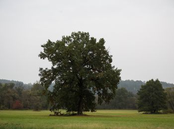
![Tocht Te voet Sankt Johann in der Haide - Rohr bei Hartberg Weg 10 - Photo](https://media.geolcdn.com/t/350/260/2332d3cf-3ad7-4413-9462-d656589c398d.jpeg&format=jpg&maxdim=2)
![Te voet Te voet](https://static1.geolcdn.com/sitytour/trail-icons/100.png)
Km
Te voet
![](/images/other/stat-length.png)
![](https://static1.geolcdn.com/siteimages/upload/files/1508320355ic_sort_den_pos_24dp.png)
![](https://static1.geolcdn.com/siteimages/upload/files/1508320355ic_sort_den_neg_24dp.png)
![](https://static1.geolcdn.com/siteimages/upload/files/16400158638029165_repeat_loop_refresh_sync_direction_icon.png)
• Trail created by Gemeinde Rohr bei Hartberg. Symbol: Grün Weiss 10
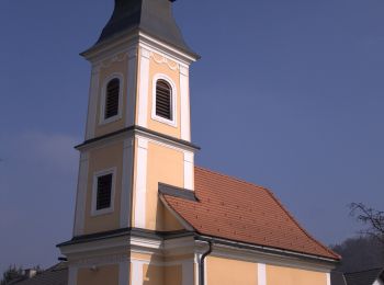
![Tocht Te voet Sankt Johann in der Haide - Maierhofermühle Weg MM - Photo](https://media.geolcdn.com/t/350/260/caea600f-3869-426f-997d-90f30f700632.jpeg&format=jpg&maxdim=2)
![Te voet Te voet](https://static1.geolcdn.com/sitytour/trail-icons/100.png)
Km
Te voet
![](/images/other/stat-length.png)
![](https://static1.geolcdn.com/siteimages/upload/files/1508320355ic_sort_den_pos_24dp.png)
![](https://static1.geolcdn.com/siteimages/upload/files/1508320355ic_sort_den_neg_24dp.png)
![](https://static1.geolcdn.com/siteimages/upload/files/16400158638029165_repeat_loop_refresh_sync_direction_icon.png)
• Trail created by Steirische Berg und Naturwacht Orsteinsatzstelle Hartberg. Symbol: weiss - rot - weiss MM
7 tochten weergegeven op 7
Gratisgps-wandelapplicatie