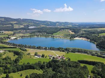
![](/images/other/stat-length.png)
- Tochten
- Outdoor
- Austria
- Stiermarken
- Bezirk Hartberg-Fürstenfeld
- Stubenberg
Stubenberg, Bezirk Hartberg-Fürstenfeld: Top van de beste wandelroutes, trajecten, tochten en wandelingen
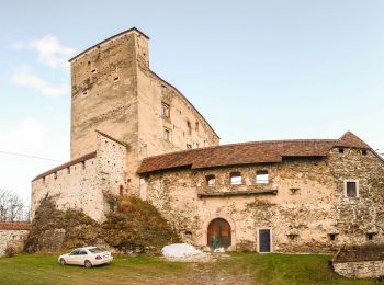
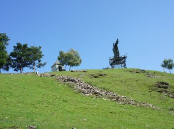
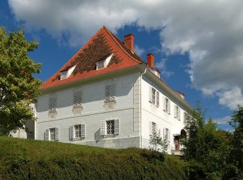
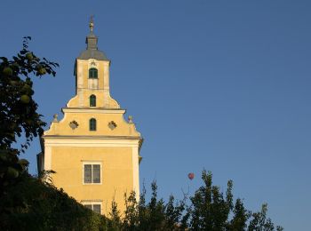
Stubenberg: Ontdek de beste tochten: 11 te voet. Al deze tochten, trajecten, routes en outdoor activiteiten zijn beschikbaar in onze SityTrail-apps voor smartphones en tablets.
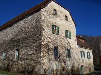
De beste trajecten (11)
![Tocht Te voet Stubenberg - Klammrunde - Photo](https://media.geolcdn.com/t/350/260/da81cdef-c26a-4882-b4e5-36b56d66709a.jpeg&format=jpg&maxdim=2)
![Te voet Te voet](https://static1.geolcdn.com/sitytour/trail-icons/100.png)
Km
Te voet
![](/images/other/stat-length.png)
![](https://static1.geolcdn.com/siteimages/upload/files/1508320355ic_sort_den_pos_24dp.png)
![](https://static1.geolcdn.com/siteimages/upload/files/1508320355ic_sort_den_neg_24dp.png)
![](https://static1.geolcdn.com/siteimages/upload/files/16400158638029165_repeat_loop_refresh_sync_direction_icon.png)
• Trail created by Gemeinde Stubenberg. http://wiki.openstreetmap.org/wiki/WikiProject_Austria/Wanderwege Symbol: rot...
![Tocht Te voet Stubenberg - Kulmkögerlweg - Photo](https://media.geolcdn.com/t/350/260/c0a498b6-2614-4b7d-bd33-755a963e6bde.jpeg&format=jpg&maxdim=2)
![Te voet Te voet](https://static1.geolcdn.com/sitytour/trail-icons/100.png)
Km
Te voet
![](/images/other/stat-length.png)
![](https://static1.geolcdn.com/siteimages/upload/files/1508320355ic_sort_den_pos_24dp.png)
![](https://static1.geolcdn.com/siteimages/upload/files/1508320355ic_sort_den_neg_24dp.png)
![](https://static1.geolcdn.com/siteimages/upload/files/16400158638029165_repeat_loop_refresh_sync_direction_icon.png)
• Trail created by ?. http://wiki.openstreetmap.org/w/index.php?title=WikiProject_Austria/Wanderwege Symbol: Schilder
![Tocht Te voet Stubenberg - Zeilrundweg - Photo](https://media.geolcdn.com/t/350/260/ad2859b9-8cfa-4bb8-8292-534fe281ec9d.jpeg&format=jpg&maxdim=2)
![Te voet Te voet](https://static1.geolcdn.com/sitytour/trail-icons/100.png)
Km
Te voet
![](/images/other/stat-length.png)
![](https://static1.geolcdn.com/siteimages/upload/files/1508320355ic_sort_den_pos_24dp.png)
![](https://static1.geolcdn.com/siteimages/upload/files/1508320355ic_sort_den_neg_24dp.png)
![](https://static1.geolcdn.com/siteimages/upload/files/16400158638029165_repeat_loop_refresh_sync_direction_icon.png)
• Trail created by Gemeinde Stubenberg. http://wiki.openstreetmap.org/wiki/WikiProject_Austria/Wanderwege Symbol: rot...
![Tocht Te voet Stubenberg - Kreilkogelrunde - Photo](https://media.geolcdn.com/t/350/260/ad2859b9-8cfa-4bb8-8292-534fe281ec9d.jpeg&format=jpg&maxdim=2)
![Te voet Te voet](https://static1.geolcdn.com/sitytour/trail-icons/100.png)
Km
Te voet
![](/images/other/stat-length.png)
![](https://static1.geolcdn.com/siteimages/upload/files/1508320355ic_sort_den_pos_24dp.png)
![](https://static1.geolcdn.com/siteimages/upload/files/1508320355ic_sort_den_neg_24dp.png)
![](https://static1.geolcdn.com/siteimages/upload/files/16400158638029165_repeat_loop_refresh_sync_direction_icon.png)
• Trail created by Gemeinde Stubenberg. http://wiki.openstreetmap.org/wiki/WikiProject_Austria/Wanderwege Symbol: rot...
![Tocht Te voet Stubenberg - Geierwandweg (23) - Photo](https://media.geolcdn.com/t/350/260/b41cfdee-dd06-4718-bc15-0ae2dc01030c.jpeg&format=jpg&maxdim=2)
![Te voet Te voet](https://static1.geolcdn.com/sitytour/trail-icons/100.png)
Km
Te voet
![](/images/other/stat-length.png)
![](https://static1.geolcdn.com/siteimages/upload/files/1508320355ic_sort_den_pos_24dp.png)
![](https://static1.geolcdn.com/siteimages/upload/files/1508320355ic_sort_den_neg_24dp.png)
![](https://static1.geolcdn.com/siteimages/upload/files/16400158638029165_repeat_loop_refresh_sync_direction_icon.png)
• Trail created by ?. http://wiki.openstreetmap.org/w/index.php?title=WikiProject_Austria/Wanderwege Symbol: Rot-Weis...
![Tocht Te voet Stubenberg - Fieberbründlweg (7) - Photo](https://media.geolcdn.com/t/350/260/ad2859b9-8cfa-4bb8-8292-534fe281ec9d.jpeg&format=jpg&maxdim=2)
![Te voet Te voet](https://static1.geolcdn.com/sitytour/trail-icons/100.png)
Km
Te voet
![](/images/other/stat-length.png)
![](https://static1.geolcdn.com/siteimages/upload/files/1508320355ic_sort_den_pos_24dp.png)
![](https://static1.geolcdn.com/siteimages/upload/files/1508320355ic_sort_den_neg_24dp.png)
![](https://static1.geolcdn.com/siteimages/upload/files/16400158638029165_repeat_loop_refresh_sync_direction_icon.png)
• Symbol: rot-weiss-rot 7
![Tocht Te voet Stubenberg - Buschenschankrundweg - Photo](https://media.geolcdn.com/t/350/260/9fd0bacb-cc5f-464f-ae2d-58df9aa1d854.jpeg&format=jpg&maxdim=2)
![Te voet Te voet](https://static1.geolcdn.com/sitytour/trail-icons/100.png)
Km
Te voet
![](/images/other/stat-length.png)
![](https://static1.geolcdn.com/siteimages/upload/files/1508320355ic_sort_den_pos_24dp.png)
![](https://static1.geolcdn.com/siteimages/upload/files/1508320355ic_sort_den_neg_24dp.png)
![](https://static1.geolcdn.com/siteimages/upload/files/16400158638029165_repeat_loop_refresh_sync_direction_icon.png)
• Symbol: rot-weiss-rot 10
![Tocht Te voet Stubenberg - Kulmweg - Photo](https://media.geolcdn.com/t/350/260/71dc2463-e0cc-4117-b356-d8e4a5e94d17.jpeg&format=jpg&maxdim=2)
![Te voet Te voet](https://static1.geolcdn.com/sitytour/trail-icons/100.png)
Km
Te voet
![](/images/other/stat-length.png)
![](https://static1.geolcdn.com/siteimages/upload/files/1508320355ic_sort_den_pos_24dp.png)
![](https://static1.geolcdn.com/siteimages/upload/files/1508320355ic_sort_den_neg_24dp.png)
![](https://static1.geolcdn.com/siteimages/upload/files/16400158638029165_repeat_loop_refresh_sync_direction_icon.png)
![Tocht Te voet Stubenberg - 7-Bacherl Weg - Photo](https://media.geolcdn.com/t/350/260/da81cdef-c26a-4882-b4e5-36b56d66709a.jpeg&format=jpg&maxdim=2)
![Te voet Te voet](https://static1.geolcdn.com/sitytour/trail-icons/100.png)
Km
Te voet
![](/images/other/stat-length.png)
![](https://static1.geolcdn.com/siteimages/upload/files/1508320355ic_sort_den_pos_24dp.png)
![](https://static1.geolcdn.com/siteimages/upload/files/1508320355ic_sort_den_neg_24dp.png)
![](https://static1.geolcdn.com/siteimages/upload/files/16400158638029165_repeat_loop_refresh_sync_direction_icon.png)
• Trail created by Gemeinde Stubenberg. http://wiki.openstreetmap.org/wiki/WikiProject_Austria/Wanderwege Symbol: rot...
![Tocht Te voet Stubenberg - Buchkogelrunde - Photo](https://media.geolcdn.com/t/350/260/ext.jpg?maxdim=2&url=https%3A%2F%2Fstatic1.geolcdn.com%2Fsiteimages%2Fupload%2Ffiles%2F1545311037marcheuse_200dpi.jpg)
![Te voet Te voet](https://static1.geolcdn.com/sitytour/trail-icons/100.png)
Km
Te voet
![](/images/other/stat-length.png)
![](https://static1.geolcdn.com/siteimages/upload/files/1508320355ic_sort_den_pos_24dp.png)
![](https://static1.geolcdn.com/siteimages/upload/files/1508320355ic_sort_den_neg_24dp.png)
![](https://static1.geolcdn.com/siteimages/upload/files/16400158638029165_repeat_loop_refresh_sync_direction_icon.png)
• Trail created by Gemeinde Stubenberg. http://wiki.openstreetmap.org/wiki/WikiProject_Austria/Wanderwege Symbol: rot...
![Tocht Te voet Stubenberg - Buchkogelhöhenweg - Photo](https://media.geolcdn.com/t/350/260/ext.jpg?maxdim=2&url=https%3A%2F%2Fstatic1.geolcdn.com%2Fsiteimages%2Fupload%2Ffiles%2F1545311037marcheuse_200dpi.jpg)
![Te voet Te voet](https://static1.geolcdn.com/sitytour/trail-icons/100.png)
Km
Te voet
![](/images/other/stat-length.png)
![](https://static1.geolcdn.com/siteimages/upload/files/1508320355ic_sort_den_pos_24dp.png)
![](https://static1.geolcdn.com/siteimages/upload/files/1508320355ic_sort_den_neg_24dp.png)
![](https://static1.geolcdn.com/siteimages/upload/files/16400158638029165_repeat_loop_refresh_sync_direction_icon.png)
• Trail created by Gemeinde Stubenberg. http://wiki.openstreetmap.org/wiki/WikiProject_Austria/Wanderwege Symbol: rot...
11 tochten weergegeven op 11
Gratisgps-wandelapplicatie