![](/images/other/stat-length.png)
- Tochten
- Outdoor
- Austria
- Neder-Oostenrijk
- Bezirk Wiener Neustadt
- Gemeinde Waldegg
Gemeinde Waldegg, Bezirk Wiener Neustadt: Top van de beste wandelroutes, trajecten, tochten en wandelingen
Gemeinde Waldegg: Ontdek de beste tochten: 10 te voet. Al deze tochten, trajecten, routes en outdoor activiteiten zijn beschikbaar in onze SityTrail-apps voor smartphones en tablets.
De beste trajecten (10)
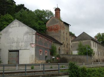
![Tocht Te voet Gemeinde Waldegg - Florianiweg (Oberpiesting) - Photo](https://media.geolcdn.com/t/350/260/cdf11d8b-7f6e-445a-8ac2-4abe508cf786.jpeg&format=jpg&maxdim=2)
![Te voet Te voet](https://static1.geolcdn.com/sitytour/trail-icons/100.png)
Km
Te voet
![](/images/other/stat-length.png)
![](https://static1.geolcdn.com/siteimages/upload/files/1508320355ic_sort_den_pos_24dp.png)
![](https://static1.geolcdn.com/siteimages/upload/files/1508320355ic_sort_den_neg_24dp.png)
![](https://static1.geolcdn.com/siteimages/upload/files/16400158638029165_repeat_loop_refresh_sync_direction_icon.png)
• Symbol: gelber, waagerechter Balken
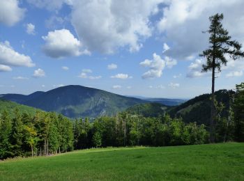
![Tocht Te voet Gemeinde Waldegg - Dürnbacher Höhenweg - Photo](https://media.geolcdn.com/t/350/260/df9f0f54-c84e-48fa-8dad-e3fcab23898b.jpeg&format=jpg&maxdim=2)
![Te voet Te voet](https://static1.geolcdn.com/sitytour/trail-icons/100.png)
Km
Te voet
![](/images/other/stat-length.png)
![](https://static1.geolcdn.com/siteimages/upload/files/1508320355ic_sort_den_pos_24dp.png)
![](https://static1.geolcdn.com/siteimages/upload/files/1508320355ic_sort_den_neg_24dp.png)
![](https://static1.geolcdn.com/siteimages/upload/files/16400158638029165_repeat_loop_refresh_sync_direction_icon.png)
• Trail created by Dorferneuerungsverein Gemeinde Waldegg. Symbol: gelber, waagerechter Balken
![Tocht Te voet Gemeinde Waldegg - Wopfing: Um den Sulzberg Rundwanderweg - Photo](https://media.geolcdn.com/t/350/260/ae2ca2b4-40d8-40a2-b035-07d0ded053cf.jpeg&format=jpg&maxdim=2)
![Te voet Te voet](https://static1.geolcdn.com/sitytour/trail-icons/100.png)
Km
Te voet
![](/images/other/stat-length.png)
![](https://static1.geolcdn.com/siteimages/upload/files/1508320355ic_sort_den_pos_24dp.png)
![](https://static1.geolcdn.com/siteimages/upload/files/1508320355ic_sort_den_neg_24dp.png)
![](https://static1.geolcdn.com/siteimages/upload/files/16400158638029165_repeat_loop_refresh_sync_direction_icon.png)
• Trail created by Dorferneuerungsverein Gemeinde Waldegg. Symbol: gelber, waagerechter Balken
![Tocht Te voet Gemeinde Waldegg - Wasserfallweg - Photo](https://media.geolcdn.com/t/350/260/0e4c3370-ed38-41d9-8dba-a82aa02353d1.jpeg&format=jpg&maxdim=2)
![Te voet Te voet](https://static1.geolcdn.com/sitytour/trail-icons/100.png)
Km
Te voet
![](/images/other/stat-length.png)
![](https://static1.geolcdn.com/siteimages/upload/files/1508320355ic_sort_den_pos_24dp.png)
![](https://static1.geolcdn.com/siteimages/upload/files/1508320355ic_sort_den_neg_24dp.png)
![](https://static1.geolcdn.com/siteimages/upload/files/16400158638029165_repeat_loop_refresh_sync_direction_icon.png)
• Trail created by Gemeinde Waldegg.
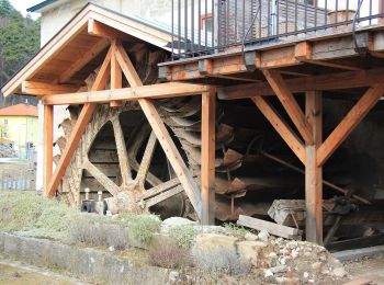
![Tocht Te voet Gemeinde Waldegg - Auf's Zimmermannplatzl (Rundwanderweg 02) - Photo](https://media.geolcdn.com/t/350/260/dcdc1313-5aa6-47e0-b23f-560905875218.jpeg&format=jpg&maxdim=2)
![Te voet Te voet](https://static1.geolcdn.com/sitytour/trail-icons/100.png)
Km
Te voet
![](/images/other/stat-length.png)
![](https://static1.geolcdn.com/siteimages/upload/files/1508320355ic_sort_den_pos_24dp.png)
![](https://static1.geolcdn.com/siteimages/upload/files/1508320355ic_sort_den_neg_24dp.png)
![](https://static1.geolcdn.com/siteimages/upload/files/16400158638029165_repeat_loop_refresh_sync_direction_icon.png)
• Trail created by Dorferneuerungsverein Gemeinde Waldegg.
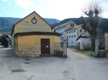
![Tocht Te voet Gemeinde Waldegg - Hammerlweg - Photo](https://media.geolcdn.com/t/350/260/cf00d390-2109-47d6-bfc1-6f8b2639c31c.jpeg&format=jpg&maxdim=2)
![Te voet Te voet](https://static1.geolcdn.com/sitytour/trail-icons/100.png)
Km
Te voet
![](/images/other/stat-length.png)
![](https://static1.geolcdn.com/siteimages/upload/files/1508320355ic_sort_den_pos_24dp.png)
![](https://static1.geolcdn.com/siteimages/upload/files/1508320355ic_sort_den_neg_24dp.png)
![](https://static1.geolcdn.com/siteimages/upload/files/16400158638029165_repeat_loop_refresh_sync_direction_icon.png)
• Trail created by ÖTK. Symbol: roter, waagrechter Balken
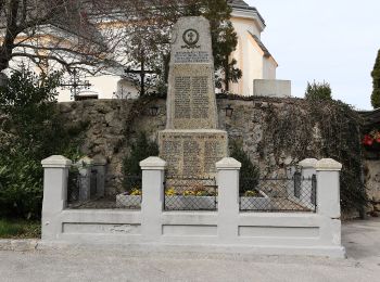
![Tocht Te voet Gemeinde Waldegg - Dürnbach (Nazwirt) - Klamm - Scheuchenstein - Photo](https://media.geolcdn.com/t/350/260/5a239cca-10cd-4648-91d9-dddff0688598.jpeg&format=jpg&maxdim=2)
![Te voet Te voet](https://static1.geolcdn.com/sitytour/trail-icons/100.png)
Km
Te voet
![](/images/other/stat-length.png)
![](https://static1.geolcdn.com/siteimages/upload/files/1508320355ic_sort_den_pos_24dp.png)
![](https://static1.geolcdn.com/siteimages/upload/files/1508320355ic_sort_den_neg_24dp.png)
![](https://static1.geolcdn.com/siteimages/upload/files/16400158638029165_repeat_loop_refresh_sync_direction_icon.png)
• Trail created by Österreichischer Touristenklub, Sektion Wiener Neustadt. Symbol: roter, waagrechter Balken
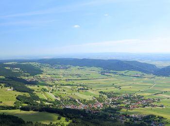
![Tocht Te voet Gemeinde Waldegg - Waldegg - Waldeggersteig - Waldeggerhaus - Eicherthaus - Turmsteighütte - Photo](https://media.geolcdn.com/t/350/260/4259e055-467c-4436-a359-c81bf734d24c.jpeg&format=jpg&maxdim=2)
![Te voet Te voet](https://static1.geolcdn.com/sitytour/trail-icons/100.png)
Km
Te voet
![](/images/other/stat-length.png)
![](https://static1.geolcdn.com/siteimages/upload/files/1508320355ic_sort_den_pos_24dp.png)
![](https://static1.geolcdn.com/siteimages/upload/files/1508320355ic_sort_den_neg_24dp.png)
![](https://static1.geolcdn.com/siteimages/upload/files/16400158638029165_repeat_loop_refresh_sync_direction_icon.png)
• Trail created by Österreichischer Touristenklub, Sektion Wiener Neustadt. Symbol: blauer, waagrechter Balken
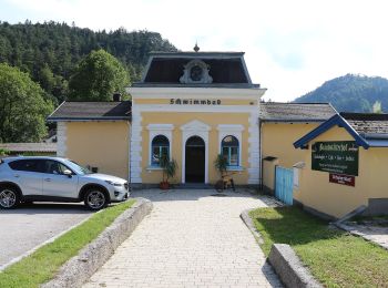
![Tocht Te voet Gemeinde Waldegg - Reichental Hst- Gr. Kitzberg - Ochsenheide - Gr. Neukogel - Gutenstein - Photo](https://media.geolcdn.com/t/350/260/67c73d6d-3fa9-4f06-a99e-14a517c7cf78.jpeg&format=jpg&maxdim=2)
![Te voet Te voet](https://static1.geolcdn.com/sitytour/trail-icons/100.png)
Km
Te voet
![](/images/other/stat-length.png)
![](https://static1.geolcdn.com/siteimages/upload/files/1508320355ic_sort_den_pos_24dp.png)
![](https://static1.geolcdn.com/siteimages/upload/files/1508320355ic_sort_den_neg_24dp.png)
![](https://static1.geolcdn.com/siteimages/upload/files/16400158638029165_repeat_loop_refresh_sync_direction_icon.png)
• Trail created by Österreichischer Touristenklub. Symbol: grüner, waagrechter Balken
![Tocht Te voet Gemeinde Waldegg - Über Vordere Mandling (Abstecher vom 01A) - Photo](https://media.geolcdn.com/t/350/260/ext.jpg?maxdim=2&url=https%3A%2F%2Fstatic1.geolcdn.com%2Fsiteimages%2Fupload%2Ffiles%2F1545311037marcheuse_200dpi.jpg)
![Te voet Te voet](https://static1.geolcdn.com/sitytour/trail-icons/100.png)
Km
Te voet
![](/images/other/stat-length.png)
![](https://static1.geolcdn.com/siteimages/upload/files/1508320355ic_sort_den_pos_24dp.png)
![](https://static1.geolcdn.com/siteimages/upload/files/1508320355ic_sort_den_neg_24dp.png)
![](https://static1.geolcdn.com/siteimages/upload/files/16400158638029165_repeat_loop_refresh_sync_direction_icon.png)
• Trail created by Österreichischer Touristenklub. Symbol: blauer, waagrechter Balken
10 tochten weergegeven op 10
Gratisgps-wandelapplicatie