![](/images/other/stat-length.png)
- Tochten
- Outdoor
- Austria
- Neder-Oostenrijk
- Bezirk Neunkirchen
- Gemeinde Aspang
Gemeinde Aspang, Bezirk Neunkirchen: Top van de beste wandelroutes, trajecten, tochten en wandelingen
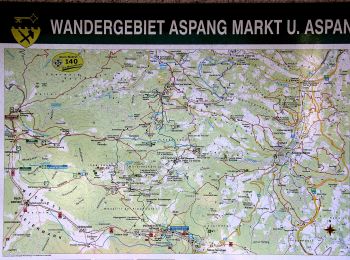
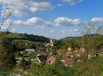
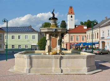
Gemeinde Aspang: Ontdek de beste tochten: 12 te voet. Al deze tochten, trajecten, routes en outdoor activiteiten zijn beschikbaar in onze SityTrail-apps voor smartphones en tablets.
De beste trajecten (12)
![Tocht Te voet Gemeinde Aspang - Unteraspang - Hottmannsgraben - Paßkapelle - Photo](https://media.geolcdn.com/t/350/260/8d66704e-3515-4205-b695-dbda7cfcd308.jpeg&format=jpg&maxdim=2)
![Te voet Te voet](https://static1.geolcdn.com/sitytour/trail-icons/100.png)
Km
Te voet
![](/images/other/stat-length.png)
![](https://static1.geolcdn.com/siteimages/upload/files/1508320355ic_sort_den_pos_24dp.png)
![](https://static1.geolcdn.com/siteimages/upload/files/1508320355ic_sort_den_neg_24dp.png)
![](https://static1.geolcdn.com/siteimages/upload/files/16400158638029165_repeat_loop_refresh_sync_direction_icon.png)
• Trail created by Österreichischer Touristenklub. Symbol: blauer,waagrechter Balken
![Tocht Te voet Gemeinde Aspang - Kleiner Königsbergweg (Aspang Markt) - Photo](https://media.geolcdn.com/t/350/260/4ca19e0f-af8e-427a-a54c-f08e95e9ad0b.jpeg&format=jpg&maxdim=2)
![Te voet Te voet](https://static1.geolcdn.com/sitytour/trail-icons/100.png)
Km
Te voet
![](/images/other/stat-length.png)
![](https://static1.geolcdn.com/siteimages/upload/files/1508320355ic_sort_den_pos_24dp.png)
![](https://static1.geolcdn.com/siteimages/upload/files/1508320355ic_sort_den_neg_24dp.png)
![](https://static1.geolcdn.com/siteimages/upload/files/16400158638029165_repeat_loop_refresh_sync_direction_icon.png)
• Trail created by Gemeinde Aspang-Markt. Symbol: A1 auf gelbem Hintergrund
![Tocht Te voet Gemeinde Aspang - Großer Königsbergweg (Aspang Markt) - Photo](https://media.geolcdn.com/t/350/260/376dd4ce-a305-439b-ba04-128f39ee9ebc.jpeg&format=jpg&maxdim=2)
![Te voet Te voet](https://static1.geolcdn.com/sitytour/trail-icons/100.png)
Km
Te voet
![](/images/other/stat-length.png)
![](https://static1.geolcdn.com/siteimages/upload/files/1508320355ic_sort_den_pos_24dp.png)
![](https://static1.geolcdn.com/siteimages/upload/files/1508320355ic_sort_den_neg_24dp.png)
![](https://static1.geolcdn.com/siteimages/upload/files/16400158638029165_repeat_loop_refresh_sync_direction_icon.png)
• Trail created by Gemeinde Aspang-Markt. Symbol: A2 auf gelbem Hintergrund
![Tocht Te voet Gemeinde Aspang - Rundwanderweg 7 (Aspang) - Photo](https://media.geolcdn.com/t/350/260/bc5f069b-09a4-4a1c-b041-dc765d3cd8e1.jpeg&format=jpg&maxdim=2)
![Te voet Te voet](https://static1.geolcdn.com/sitytour/trail-icons/100.png)
Km
Te voet
![](/images/other/stat-length.png)
![](https://static1.geolcdn.com/siteimages/upload/files/1508320355ic_sort_den_pos_24dp.png)
![](https://static1.geolcdn.com/siteimages/upload/files/1508320355ic_sort_den_neg_24dp.png)
![](https://static1.geolcdn.com/siteimages/upload/files/16400158638029165_repeat_loop_refresh_sync_direction_icon.png)
• Trail created by Region Pittental Hochwechsel.
![Tocht Te voet Gemeinde Aspang - Aspang-Markt - Spitzer Riegel - Photo](https://media.geolcdn.com/t/350/260/1a6b8d3e-2c51-48b9-b225-957cbf855d43.jpeg&format=jpg&maxdim=2)
![Te voet Te voet](https://static1.geolcdn.com/sitytour/trail-icons/100.png)
Km
Te voet
![](/images/other/stat-length.png)
![](https://static1.geolcdn.com/siteimages/upload/files/1508320355ic_sort_den_pos_24dp.png)
![](https://static1.geolcdn.com/siteimages/upload/files/1508320355ic_sort_den_neg_24dp.png)
![](https://static1.geolcdn.com/siteimages/upload/files/16400158638029165_repeat_loop_refresh_sync_direction_icon.png)
• Trail created by Österreichischer Alpenverein. Symbol: roter, waagrechter Balken
![Tocht Te voet Gemeinde Aspang - Aspang-Markt - Samberg - Ausschlag - Photo](https://media.geolcdn.com/t/350/260/d343a253-dbf7-4b3d-b51e-0304c2a0fd5e.jpeg&format=jpg&maxdim=2)
![Te voet Te voet](https://static1.geolcdn.com/sitytour/trail-icons/100.png)
Km
Te voet
![](/images/other/stat-length.png)
![](https://static1.geolcdn.com/siteimages/upload/files/1508320355ic_sort_den_pos_24dp.png)
![](https://static1.geolcdn.com/siteimages/upload/files/1508320355ic_sort_den_neg_24dp.png)
![](https://static1.geolcdn.com/siteimages/upload/files/16400158638029165_repeat_loop_refresh_sync_direction_icon.png)
• Trail created by Österreichischer Alpenverein. Symbol: blauer,waagrechter Balken
![Tocht Te voet Gemeinde Aspang - Aspang-Markt - Kulma - Leherbauer - Photo](https://media.geolcdn.com/t/350/260/96b1fca4-b27f-4d17-a9fe-0b194a0ba456.jpeg&format=jpg&maxdim=2)
![Te voet Te voet](https://static1.geolcdn.com/sitytour/trail-icons/100.png)
Km
Te voet
![](/images/other/stat-length.png)
![](https://static1.geolcdn.com/siteimages/upload/files/1508320355ic_sort_den_pos_24dp.png)
![](https://static1.geolcdn.com/siteimages/upload/files/1508320355ic_sort_den_neg_24dp.png)
![](https://static1.geolcdn.com/siteimages/upload/files/16400158638029165_repeat_loop_refresh_sync_direction_icon.png)
• Trail created by Gemeinde Aspang-Markt. Symbol: A7 auf gelbem Hintergrund
![Tocht Te voet Gemeinde Aspang - Grubhof - Samberg - Weg - Photo](https://media.geolcdn.com/t/350/260/cb142993-6b4f-423a-b33e-a7751dc2d82f.jpeg&format=jpg&maxdim=2)
![Te voet Te voet](https://static1.geolcdn.com/sitytour/trail-icons/100.png)
Km
Te voet
![](/images/other/stat-length.png)
![](https://static1.geolcdn.com/siteimages/upload/files/1508320355ic_sort_den_pos_24dp.png)
![](https://static1.geolcdn.com/siteimages/upload/files/1508320355ic_sort_den_neg_24dp.png)
![](https://static1.geolcdn.com/siteimages/upload/files/16400158638029165_repeat_loop_refresh_sync_direction_icon.png)
• Trail created by Gemeinde Aspang-Markt. Symbol: A9 auf gelbem Hintergrund
![Tocht Te voet Gemeinde Aspang - Hoffeld - Steinhöfen - Wh. Reithofer - Unternberg - Photo](https://media.geolcdn.com/t/350/260/cb289554-6ba7-4412-a7a6-3393ac3103d6.jpeg&format=jpg&maxdim=2)
![Te voet Te voet](https://static1.geolcdn.com/sitytour/trail-icons/100.png)
Km
Te voet
![](/images/other/stat-length.png)
![](https://static1.geolcdn.com/siteimages/upload/files/1508320355ic_sort_den_pos_24dp.png)
![](https://static1.geolcdn.com/siteimages/upload/files/1508320355ic_sort_den_neg_24dp.png)
![](https://static1.geolcdn.com/siteimages/upload/files/16400158638029165_repeat_loop_refresh_sync_direction_icon.png)
• Trail created by Tourismusgemeinde Aspangberg-St. Peter. Symbol: roter, waagrechter Balken
![Tocht Te voet Gemeinde Aspang - Vögelhöfenrundweg - Photo](https://media.geolcdn.com/t/350/260/96b1fca4-b27f-4d17-a9fe-0b194a0ba456.jpeg&format=jpg&maxdim=2)
![Te voet Te voet](https://static1.geolcdn.com/sitytour/trail-icons/100.png)
Km
Te voet
![](/images/other/stat-length.png)
![](https://static1.geolcdn.com/siteimages/upload/files/1508320355ic_sort_den_pos_24dp.png)
![](https://static1.geolcdn.com/siteimages/upload/files/1508320355ic_sort_den_neg_24dp.png)
![](https://static1.geolcdn.com/siteimages/upload/files/16400158638029165_repeat_loop_refresh_sync_direction_icon.png)
• Trail created by Gemeinde Aspang-Markt. Symbol: A5 auf gelbem Hintergrund
![Tocht Te voet Gemeinde Aspang - Unteraspang - Saurerhütte - Photo](https://media.geolcdn.com/t/350/260/37088529-8721-4633-b41a-c40d57bcc49b.jpeg&format=jpg&maxdim=2)
![Te voet Te voet](https://static1.geolcdn.com/sitytour/trail-icons/100.png)
Km
Te voet
![](/images/other/stat-length.png)
![](https://static1.geolcdn.com/siteimages/upload/files/1508320355ic_sort_den_pos_24dp.png)
![](https://static1.geolcdn.com/siteimages/upload/files/1508320355ic_sort_den_neg_24dp.png)
![](https://static1.geolcdn.com/siteimages/upload/files/16400158638029165_repeat_loop_refresh_sync_direction_icon.png)
• Symbol: blauer,waagrechter Balken
![Tocht Te voet Gemeinde Aspang - Aspang-Markt - Langegg - Heidstübl - Photo](https://media.geolcdn.com/t/350/260/7265fea1-9901-45c1-ae0a-7a288e06baa0.jpeg&format=jpg&maxdim=2)
![Te voet Te voet](https://static1.geolcdn.com/sitytour/trail-icons/100.png)
Km
Te voet
![](/images/other/stat-length.png)
![](https://static1.geolcdn.com/siteimages/upload/files/1508320355ic_sort_den_pos_24dp.png)
![](https://static1.geolcdn.com/siteimages/upload/files/1508320355ic_sort_den_neg_24dp.png)
![](https://static1.geolcdn.com/siteimages/upload/files/16400158638029165_repeat_loop_refresh_sync_direction_icon.png)
• Trail created by Österreichischer Touristenklub. Symbol: roter, waagrechter Balken
12 tochten weergegeven op 12
Gratisgps-wandelapplicatie