


11,2 km | 14,2 km-effort
Spain: Ontdek de 47 beste wandel- en fietstochten. Onze catalogus die helemaal is samengesteld door wandelaars en toerfietsers staat vol prachtige landschappen die erop wachten om verkend te worden. Download deze routes in SityTrail, onze gratis gps wandel-app beschikbaar op Android en iOS.
Sneeuwschoenen


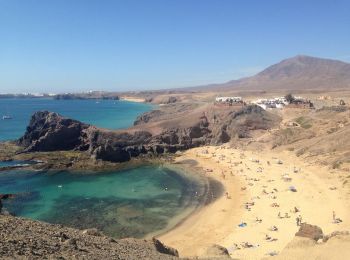
• Lanzarote marche le long de la cote, dépaart port de Playa Blanca jusqu'à la point de Papagayo, très belles plages (d...
Sneeuwschoenen
Sneeuwschoenen
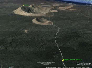
• Lanzarote-rando autour du Volcan Blanca 462m mesuré au sommet - prévoir de bonnes chaussure de rando semelles épaisses

Sneeuwschoenen
• Lanzarote marche le long de la cote, dépaart port de Playa Blanca jusqu'à la point de Papagayo, très belles plages (d...
Sneeuwschoenen
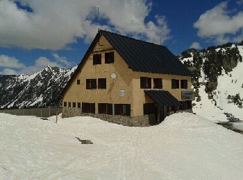
• Raquettes depuis le refuge de Colomers le 12 Avril 2014; Très beau cirque. Traversées sur de nombreux lacs gelés.
Sneeuwschoenen

Sneeuwschoenen
Sneeuwschoenen
Sneeuwschoenen
Sneeuwschoenen
Sneeuwschoenen
Sneeuwschoenen
Sneeuwschoenen

Ski randonnée
Ski randonnée
Ski randonnée
Sneeuwschoenen
Sneeuwschoenen
Sneeuwschoenen
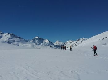
Ski randonnée
20 tochten weergegeven op 47
Gratisgps-wandelapplicatie
 SityTrail
IGN / Geografische instituten
SityTrail World
De wereld gaat voor u open