Harghita, Romania, Te voet: Top van de beste wandelroutes, trajecten, tochten en wandelingen

Harghita: Ontdek de beste tochten: 123 te voet en 1 stappen. Al deze tochten, trajecten, routes en outdoor activiteiten zijn beschikbaar in onze SityTrail-apps voor smartphones en tablets.


De beste trajecten (124)
Tocht Te voet Miercurea Ciuc - Csíksomlyói kör Piros pont (RO) - Photo
Te voet 5.846
Km
GUIDE+

Te voet

Gemakkelijk
Miercurea Ciuc, Harghita, Onbekend, Romania
5,8 km | 10,4 km-effort
2h 21min
339 m
341 m
Ja
SityTrail - itinéraires balisés pédestres

• Symbol: red dot

Tocht Te voet  - Via Mariae M12-12 - Photo
Te voet 19.984
Km
GUIDE+

Te voet

Medium
, Harghita, , Romania
20 km | 25 km-effort
5h 44min
399 m
380 m
Neen
SityTrail - itinéraires balisés pédestres

• Trail created by Asociația Via Mariae.
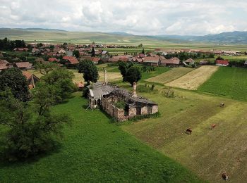
Tocht Te voet Miercurea Ciuc - Via Mariae M12-11 - Photo
Te voet 24.567
Km
GUIDE+

Te voet

Medium
Miercurea Ciuc, Harghita, Onbekend, Romania
25 km | 27 km-effort
6h 3min
147 m
180 m
Neen
SityTrail - itinéraires balisés pédestres

• Trail created by Asociația Via Mariae.

Tocht Te voet  - Via Mariae M12-10 - Photo
Te voet 25.665
Km
GUIDE+

Te voet

Medium
, Harghita, , Romania
26 km | 30 km-effort
6h 46min
310 m
320 m
Neen
SityTrail - itinéraires balisés pédestres

• Trail created by Asociația Via Mariae.
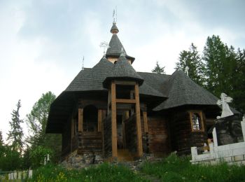
Tocht Te voet Toplița - Via Mariae M12-06 - Photo
Te voet 24.331
Km
GUIDE+

Te voet

Medium
Toplița, Harghita, Onbekend, Romania
24 km | 29 km-effort
6h 37min
422 m
187 m
Neen
SityTrail - itinéraires balisés pédestres

• Trail created by Asociația Via Mariae.
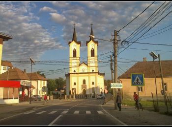
Tocht Te voet  - Via Mariae M12-07 - Photo
Te voet 21.069
Km
GUIDE+

Te voet

Medium
, Harghita, , Romania
21 km | 25 km-effort
5h 43min
296 m
344 m
Neen
SityTrail - itinéraires balisés pédestres

• Trail created by Asociația Via Mariae.
Tocht Te voet Gheorgheni - Pasul Pângărați – Poarta Lapoșului – Curmătura Pinticului (blue stripe) - Photo
Te voet 31.157
Km
GUIDE+

Te voet

Zeer moeilijk
Gheorgheni, Harghita, Onbekend, Romania
31 km | 47 km-effort
10h 47min
1184 m
1340 m
Neen
SityTrail - itinéraires balisés pédestres

• Symbol: blue stripe

Tocht Te voet  - Cozmeni - Băile Balvanyos - Photo
Te voet 15.781
Km
GUIDE+

Te voet

Medium
, Harghita, , Romania
15,8 km | 22 km-effort
5h 2min
554 m
253 m
Neen
SityTrail - itinéraires balisés pédestres

• Symbol: Red cross on white background
Tocht Te voet  - Pasul Bucin - Vf. Saca Mare - Photo
Te voet 7.148
Km
GUIDE+

Te voet

Gemakkelijk
, Harghita, , Romania
7,1 km | 13,7 km-effort
3h 7min
615 m
127 m
Neen
SityTrail - itinéraires balisés pédestres

• Symbol: triunghi roșu

Tocht Te voet  - sat Tușnadu Nou - Tinovul Mohos - Cabana Lacul Sfânta Ana - Photo
Te voet 10.098
Km
GUIDE+

Te voet

Gemakkelijk
, Harghita, , Romania
10,1 km | 12 km-effort
2h 43min
37 m
457 m
Neen
SityTrail - itinéraires balisés pédestres

• Symbol: Red dot

Tocht Te voet  - DN 12 (nord de orașul Băile Tușnad) - Tinovul Mohos - Cabana Lacul Sfânta Ana - Photo
Te voet 5.458
Km
GUIDE+

Te voet

Gemakkelijk
, Harghita, , Romania
5,5 km | 10,3 km-effort
2h 19min
450 m
90 m
Neen
SityTrail - itinéraires balisés pédestres

• Symbol: Yellow triangle

Tocht Te voet Onbekend - oraș Băile Tușnad - Pilișca Mare - Photo
Te voet 4.855
Km
GUIDE+

Te voet

Gemakkelijk
Onbekend, Harghita, Onbekend, Romania
4,9 km | 7 km-effort
1h 34min
23 m
561 m
Neen
SityTrail - itinéraires balisés pédestres

• Symbol: Blue cross

Tocht Te voet  - Cabana Sf. Ana - Băile-Balvanyos - Photo
Te voet 4.629
Km
GUIDE+

Te voet

Gemakkelijk
, Harghita, , Romania
4,6 km | 6,7 km-effort
1h 31min
124 m
245 m
Neen
SityTrail - itinéraires balisés pédestres

• Symbol: Yellow cross

Tocht Te voet Băile Tușnad - oraș Băile Tușnad - sub Vf. Ciomatul Mic - Cabana Lacul Sfânta Ana - Photo
Te voet 6.013
Km
GUIDE+

Te voet

Gemakkelijk
Băile Tușnad, Harghita, Onbekend, Romania
6 km | 12,7 km-effort
2h 52min
614 m
158 m
Neen
SityTrail - itinéraires balisés pédestres

• Symbol: Red cross

Tocht Te voet  - RO-blue cross - Photo
Te voet 8.055
Km
GUIDE+

Te voet

Gemakkelijk
, Harghita, , Romania
8,1 km | 13,6 km-effort
3h 5min
439 m
338 m
Neen
SityTrail - itinéraires balisés pédestres

• Symbol: Blue cross

Tocht Te voet  - C.N.I.PT. Vlăhița - Colțul Chirui - Peștera Orbán Balázs (Cheile Vârghișului) - Photo
Te voet 15.815
Km
GUIDE+

Te voet

Medium
, Harghita, , Romania
15,8 km | 20 km-effort
4h 33min
357 m
193 m
Neen
SityTrail - itinéraires balisés pédestres

• Symbol: Yellow stripe

Tocht Te voet  - RO-blue triangle - Photo
Te voet 10.824
Km
GUIDE+

Te voet

Gemakkelijk
, Harghita, , Romania
10,8 km | 12,7 km-effort
2h 53min
21 m
510 m
Neen
SityTrail - itinéraires balisés pédestres

• Symbol: Blue triangle

Tocht Te voet Toplița - RO-blue stripe - Photo
Te voet 13.577
Km
GUIDE+

Te voet

Gemakkelijk
Toplița, Harghita, Onbekend, Romania
13,6 km | 17,4 km-effort
3h 56min
50 m
991 m
Neen
SityTrail - itinéraires balisés pédestres

• Symbol: Blue stripe

Tocht Te voet  - sat Lueta - Dealul Merești - intersecție traseul PG - Photo
Te voet 8.189
Km
GUIDE+

Te voet

Gemakkelijk
, Harghita, , Romania
8,2 km | 13,5 km-effort
3h 4min
389 m
425 m
Neen
SityTrail - itinéraires balisés pédestres

• Symbol: Yellow cross

Tocht Te voet Gheorgheni - Valea Oii – Culmea lui Paleu – Lacu Roșu (red dot) - Photo
Te voet 12.751
Km
GUIDE+

Te voet

Gemakkelijk
Gheorgheni, Harghita, Onbekend, Romania
12,8 km | 19,2 km-effort
4h 22min
478 m
516 m
Neen
SityTrail - itinéraires balisés pédestres

• Symbol: red dot

20 tochten weergegeven op 124

Gratisgps-wandelapplicatie

Logo SityTrail SityTrail

IGN / Geografische instituten

SityTrail uit de App Store downloaden SityTrail uit Google Play downloaden

Logo SityTrail SityTrail World

De wereld gaat voor u open

SityTrail uit de App Store downloaden SityTrail uit Google Play downloaden SityTrail op Huawei AppGallery downloaden

Activiteiten

Nabije regio's

Sluiten
Mijn abonnementen