![](/images/other/stat-length.png)
São Vicente, Onbekend, Te voet: Top van de beste wandelroutes, trajecten, tochten en wandelingen
São Vicente: Ontdek de beste tochten: 5 stappen en 1 trail. Al deze tochten, trajecten, routes en outdoor activiteiten zijn beschikbaar in onze SityTrail-apps voor smartphones en tablets.
De beste trajecten (6)
![Tocht Stappen São Vicente - Sao Vicente - Chapelle sainte Fatima - Photo](https://media.geolcdn.com/t/350/260/29c666c0-fb2d-47b7-a2b5-306521c5b696.jpg&format=jpg&maxdim=2)
![Stappen Stappen](https://static1.geolcdn.com/sitytour/trail-icons/101.png)
Km
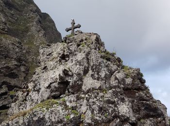
#1 - Sao Vicente - Chapelle sainte Fatima
Stappen
Medium
São Vicente,
Madeira,
Onbekend,
Portugal
![](/images/other/stat-length.png)
6,6 km | 10,4 km-effort
1h 37min
![](https://static1.geolcdn.com/siteimages/upload/files/1508320355ic_sort_den_pos_24dp.png)
296 m
![](https://static1.geolcdn.com/siteimages/upload/files/1508320355ic_sort_den_neg_24dp.png)
239 m
![](https://static1.geolcdn.com/siteimages/upload/files/16400158638029165_repeat_loop_refresh_sync_direction_icon.png)
Neen
Bart2015
![Tocht Stappen São Vicente - Levada da Faja do Rodrigues (Rother n°32) - Photo](https://media.geolcdn.com/t/350/260/a0ac5d9f-37de-4e30-ac38-6a9e8eb4ce99.jpg&format=jpg&maxdim=2)
![Stappen Stappen](https://static1.geolcdn.com/sitytour/trail-icons/101.png)
Km
#2 - Levada da Faja do Rodrigues (Rother n°32)
Stappen
Medium
São Vicente,
Madeira,
Onbekend,
Portugal
![](/images/other/stat-length.png)
9,1 km | 26 km-effort
2h 52min
![](https://static1.geolcdn.com/siteimages/upload/files/1508320355ic_sort_den_pos_24dp.png)
1251 m
![](https://static1.geolcdn.com/siteimages/upload/files/1508320355ic_sort_den_neg_24dp.png)
1263 m
![](https://static1.geolcdn.com/siteimages/upload/files/16400158638029165_repeat_loop_refresh_sync_direction_icon.png)
Ja
Bart2015
![Tocht Trail São Vicente - jour 1 test - Photo](https://media.geolcdn.com/t/350/260/ext.jpg?maxdim=2&url=https%3A%2F%2Fstatic1.geolcdn.com%2Fsiteimages%2Fupload%2Ffiles%2F1524743154running.jpg)
![Trail Trail](https://static1.geolcdn.com/sitytour/trail-icons/104.png)
Km
#3 - jour 1 test
Trail
Medium
São Vicente,
Madeira,
Onbekend,
Portugal
![](/images/other/stat-length.png)
9,3 km | 22 km-effort
1h 0min
![](https://static1.geolcdn.com/siteimages/upload/files/1508320355ic_sort_den_pos_24dp.png)
927 m
![](https://static1.geolcdn.com/siteimages/upload/files/1508320355ic_sort_den_neg_24dp.png)
926 m
![](https://static1.geolcdn.com/siteimages/upload/files/16400158638029165_repeat_loop_refresh_sync_direction_icon.png)
Ja
fanfan.hoffmann
![Tocht Stappen São Vicente - Madeira - PR21 - Caminho do Norte - Photo](https://media.geolcdn.com/t/350/260/ext.jpg?maxdim=2&url=https%3A%2F%2Fstatic1.geolcdn.com%2Fsiteimages%2Fupload%2Ffiles%2F1553511878bg_sport_marche.png)
![Stappen Stappen](https://static1.geolcdn.com/sitytour/trail-icons/101.png)
Km
#4 - Madeira - PR21 - Caminho do Norte
Stappen
Gemakkelijk
São Vicente,
Madeira,
Onbekend,
Portugal
![](/images/other/stat-length.png)
3,2 km | 5,6 km-effort
1h 16min
![](https://static1.geolcdn.com/siteimages/upload/files/1508320355ic_sort_den_pos_24dp.png)
13 m
![](https://static1.geolcdn.com/siteimages/upload/files/1508320355ic_sort_den_neg_24dp.png)
688 m
![](https://static1.geolcdn.com/siteimages/upload/files/16400158638029165_repeat_loop_refresh_sync_direction_icon.png)
Neen
Tournan
![Tocht Stappen São Vicente - Madeira - PR16 - Levada Fajã do Rodrigues - Photo](https://media.geolcdn.com/t/350/260/ext.jpg?maxdim=2&url=https%3A%2F%2Fstatic1.geolcdn.com%2Fsiteimages%2Fupload%2Ffiles%2F1553511878bg_sport_marche.png)
![Stappen Stappen](https://static1.geolcdn.com/sitytour/trail-icons/101.png)
Km
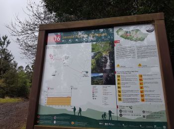
#5 - Madeira - PR16 - Levada Fajã do Rodrigues
Stappen
Medium
São Vicente,
Madeira,
Onbekend,
Portugal
![](/images/other/stat-length.png)
3,8 km | 11,1 km-effort
2h 32min
![](https://static1.geolcdn.com/siteimages/upload/files/1508320355ic_sort_den_pos_24dp.png)
559 m
![](https://static1.geolcdn.com/siteimages/upload/files/1508320355ic_sort_den_neg_24dp.png)
521 m
![](https://static1.geolcdn.com/siteimages/upload/files/16400158638029165_repeat_loop_refresh_sync_direction_icon.png)
Neen
Tournan
![Tocht Stappen São Vicente - Madeira - PR22 - Vereda do Chão do Louros - Photo](https://media.geolcdn.com/t/350/260/ext.jpg?maxdim=2&url=https%3A%2F%2Fstatic1.geolcdn.com%2Fsiteimages%2Fupload%2Ffiles%2F1553511878bg_sport_marche.png)
![Stappen Stappen](https://static1.geolcdn.com/sitytour/trail-icons/101.png)
Km
#6 - Madeira - PR22 - Vereda do Chão do Louros
Stappen
Gemakkelijk
São Vicente,
Madeira,
Onbekend,
Portugal
![](/images/other/stat-length.png)
1,8 km | 2,8 km-effort
38min
![](https://static1.geolcdn.com/siteimages/upload/files/1508320355ic_sort_den_pos_24dp.png)
77 m
![](https://static1.geolcdn.com/siteimages/upload/files/1508320355ic_sort_den_neg_24dp.png)
75 m
![](https://static1.geolcdn.com/siteimages/upload/files/16400158638029165_repeat_loop_refresh_sync_direction_icon.png)
Ja
Tournan
6 tochten weergegeven op 6
Gratisgps-wandelapplicatie