![](/images/other/stat-length.png)
- Tochten
- Te voet
- Italy
- Lombardije
- Bergamo
- Azzone
Azzone, Bergamo, Te voet: Top van de beste wandelroutes, trajecten, tochten en wandelingen
Azzone: Ontdek de beste tochten: 2 te voet. Al deze tochten, trajecten, routes en outdoor activiteiten zijn beschikbaar in onze SityTrail-apps voor smartphones en tablets.
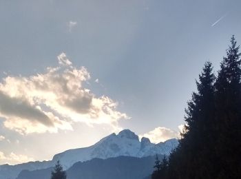
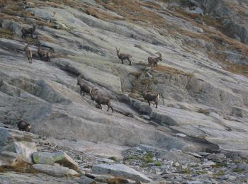
De beste trajecten (2)
![Tocht Te voet Azzone - Trekking tra malghe e menhir anello 3: Salven - Costone - San Fermo - Photo](https://media.geolcdn.com/t/350/260/ext.jpg?maxdim=2&url=https%3A%2F%2Fmedia.geolcdn.com%2Ff%2Fbd6171fc-f596-402b-93aa-c7a5279637c8.jpeg)
![Te voet Te voet](https://static1.geolcdn.com/sitytour/trail-icons/100.png)
Km
#1 - Trekking tra malghe e menhir anello 3: Salven - Costone - San Fermo
Te voet
Medium
Azzone,
Lombardije,
Bergamo,
Italy
![](/images/other/stat-length.png)
13,5 km | 25 km-effort
5h 45min
![](https://static1.geolcdn.com/siteimages/upload/files/1508320355ic_sort_den_pos_24dp.png)
887 m
![](https://static1.geolcdn.com/siteimages/upload/files/1508320355ic_sort_den_neg_24dp.png)
896 m
![](https://static1.geolcdn.com/siteimages/upload/files/16400158638029165_repeat_loop_refresh_sync_direction_icon.png)
Ja
SityTrail - itinéraires balisés pédestres
• Trail created by Consorzio Forestale Pizzo Camino. Symbol: unmarked
![Tocht Te voet Azzone - Sentiero 82 - Variante 82A - Photo](https://media.geolcdn.com/t/350/260/ext.jpg?maxdim=2&url=https%3A%2F%2Fmedia.geolcdn.com%2Ff%2F7153d9f3-c68d-46c9-b882-f35e83299d11.jpeg)
![Te voet Te voet](https://static1.geolcdn.com/sitytour/trail-icons/100.png)
Km
#2 - Sentiero 82 - Variante 82A
Te voet
Gemakkelijk
Azzone,
Lombardije,
Bergamo,
Italy
![](/images/other/stat-length.png)
4 km | 7,3 km-effort
1h 39min
![](https://static1.geolcdn.com/siteimages/upload/files/1508320355ic_sort_den_pos_24dp.png)
9 m
![](https://static1.geolcdn.com/siteimages/upload/files/1508320355ic_sort_den_neg_24dp.png)
975 m
![](https://static1.geolcdn.com/siteimages/upload/files/16400158638029165_repeat_loop_refresh_sync_direction_icon.png)
Neen
SityTrail - itinéraires balisés pédestres
• Trail created by Club Alpino Italiano - Sezione di Borno. DA VERIFICARE Symbol: 82A on white red flag
2 tochten weergegeven op 2
Gratisgps-wandelapplicatie