![](/images/other/stat-length.png)
- Tochten
- Te voet
- Italy
- Lombardije
- Bergamo
- Branzi
Branzi, Bergamo, Te voet: Top van de beste wandelroutes, trajecten, tochten en wandelingen
Branzi: Ontdek de beste tochten: 4 te voet. Al deze tochten, trajecten, routes en outdoor activiteiten zijn beschikbaar in onze SityTrail-apps voor smartphones en tablets.
De beste trajecten (4)
![Tocht Te voet Branzi - Rifugio Laghi Gemelli - Passo d'Aviasco - Photo](https://media.geolcdn.com/t/350/260/2f65df6b-db05-4818-a26d-7af006e6b5dc.jpeg&format=jpg&maxdim=2)
![Te voet Te voet](https://static1.geolcdn.com/sitytour/trail-icons/100.png)
Km
Te voet
![](/images/other/stat-length.png)
![](https://static1.geolcdn.com/siteimages/upload/files/1508320355ic_sort_den_pos_24dp.png)
![](https://static1.geolcdn.com/siteimages/upload/files/1508320355ic_sort_den_neg_24dp.png)
![](https://static1.geolcdn.com/siteimages/upload/files/16400158638029165_repeat_loop_refresh_sync_direction_icon.png)
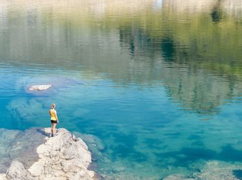
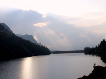
• Partendo dal rifugio Laghi Gemelli (1968 m) si attraversa la diga dell'omonimo lago. Girando a sinistra si sale al la...
![Tocht Te voet Branzi - Sentiero delle Orobie Orientali - Tappa 3 - Photo](https://media.geolcdn.com/t/350/260/c237ea19-da1c-4881-924c-cb207b0f18eb.jpeg&format=jpg&maxdim=2)
![Te voet Te voet](https://static1.geolcdn.com/sitytour/trail-icons/100.png)
Km
Te voet
![](/images/other/stat-length.png)
![](https://static1.geolcdn.com/siteimages/upload/files/1508320355ic_sort_den_pos_24dp.png)
![](https://static1.geolcdn.com/siteimages/upload/files/1508320355ic_sort_den_neg_24dp.png)
![](https://static1.geolcdn.com/siteimages/upload/files/16400158638029165_repeat_loop_refresh_sync_direction_icon.png)
• SENTIERO DELLE OROBIE (orientali) Website: http://geoportale.caibergamo.it/it/sentiero/213
![Tocht Te voet Branzi - Rifugio Laghi Gemelli - Laghi: Colombo, Becco, Marcio - Rifugio Laghi Gemelli - Photo](https://media.geolcdn.com/t/350/260/f3e4daa3-47f9-427a-a665-dfaad3be62d1.jpeg&format=jpg&maxdim=2)
![Te voet Te voet](https://static1.geolcdn.com/sitytour/trail-icons/100.png)
Km
Te voet
![](/images/other/stat-length.png)
![](https://static1.geolcdn.com/siteimages/upload/files/1508320355ic_sort_den_pos_24dp.png)
![](https://static1.geolcdn.com/siteimages/upload/files/1508320355ic_sort_den_neg_24dp.png)
![](https://static1.geolcdn.com/siteimages/upload/files/16400158638029165_repeat_loop_refresh_sync_direction_icon.png)
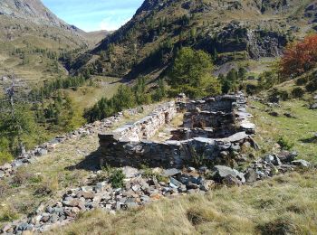
• Trail created by Club Alpino Italiano Bergamo. parte del sentiero delle Orobie Centro Orientali Symbol: vertical st...
![Tocht Te voet Branzi - Rifugio Baita Cernello - Passo d'Aviasco - Photo](https://media.geolcdn.com/t/350/260/66abd178-fe8b-4714-ba45-dedef489bb6a.jpeg&format=jpg&maxdim=2)
![Te voet Te voet](https://static1.geolcdn.com/sitytour/trail-icons/100.png)
Km
Te voet
![](/images/other/stat-length.png)
![](https://static1.geolcdn.com/siteimages/upload/files/1508320355ic_sort_den_pos_24dp.png)
![](https://static1.geolcdn.com/siteimages/upload/files/1508320355ic_sort_den_neg_24dp.png)
![](https://static1.geolcdn.com/siteimages/upload/files/16400158638029165_repeat_loop_refresh_sync_direction_icon.png)
• - ATTENZIONE: il sentiero 229 tra la Baita Cernello ed il Lago di Aviasco non è transitabile per pericolo di frana. I...
4 tochten weergegeven op 4
Gratisgps-wandelapplicatie