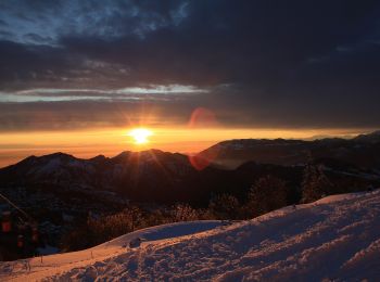
![](/images/other/stat-length.png)
- Tochten
- Te voet
- Italy
- Lombardije
- Bergamo
- Gazzaniga
Gazzaniga, Bergamo, Te voet: Top van de beste wandelroutes, trajecten, tochten en wandelingen
Gazzaniga: Ontdek de beste tochten: 3 te voet. Al deze tochten, trajecten, routes en outdoor activiteiten zijn beschikbaar in onze SityTrail-apps voor smartphones en tablets.
De beste trajecten (3)
![Tocht Te voet Gazzaniga - Sentiero 521: Rova (Gazzaniga) - Monte Cornagera - Photo](https://media.geolcdn.com/t/350/260/ext.jpg?maxdim=2&url=https%3A%2F%2Fmedia.geolcdn.com%2Ff%2Fd72bf981-700c-4b40-85ab-18249d2c50a7.jpeg)
![Te voet Te voet](https://static1.geolcdn.com/sitytour/trail-icons/100.png)
Km
Te voet
![](/images/other/stat-length.png)
![](https://static1.geolcdn.com/siteimages/upload/files/1508320355ic_sort_den_pos_24dp.png)
![](https://static1.geolcdn.com/siteimages/upload/files/1508320355ic_sort_den_neg_24dp.png)
![](https://static1.geolcdn.com/siteimages/upload/files/16400158638029165_repeat_loop_refresh_sync_direction_icon.png)
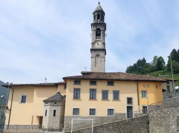
• Il tracciato inizia lungo la strada a destra della chiesetta in piazza S. Mauro a Rova, in comune di Gazzaniga, attra...
![Tocht Te voet Gazzaniga - Sentiero 522: Gazzaniga - Cà de Spì - Photo](https://media.geolcdn.com/t/350/260/ext.jpg?maxdim=2&url=https%3A%2F%2Fmedia.geolcdn.com%2Ff%2F9ca92b27-d19a-4869-838b-66199694d2a5.jpeg)
![Te voet Te voet](https://static1.geolcdn.com/sitytour/trail-icons/100.png)
Km
Te voet
![](/images/other/stat-length.png)
![](https://static1.geolcdn.com/siteimages/upload/files/1508320355ic_sort_den_pos_24dp.png)
![](https://static1.geolcdn.com/siteimages/upload/files/1508320355ic_sort_den_neg_24dp.png)
![](https://static1.geolcdn.com/siteimages/upload/files/16400158638029165_repeat_loop_refresh_sync_direction_icon.png)
• Dalla chiesa parrocchiale di Gazzaniga si sale alla chiesetta di S. Rocco, poi ci si inoltra nella valle sino a giung...
![Tocht Te voet Gazzaniga - Sentiero 524: Ösciöl (Orezzo) - incrocio sentiero 519 - Photo](https://media.geolcdn.com/t/350/260/ext.jpg?maxdim=2&url=https%3A%2F%2Fmedia.geolcdn.com%2Ff%2Fe697bc1e-fcc7-4b11-a263-f0b0ecb11810.jpeg)
![Te voet Te voet](https://static1.geolcdn.com/sitytour/trail-icons/100.png)
Km
Te voet
![](/images/other/stat-length.png)
![](https://static1.geolcdn.com/siteimages/upload/files/1508320355ic_sort_den_pos_24dp.png)
![](https://static1.geolcdn.com/siteimages/upload/files/1508320355ic_sort_den_neg_24dp.png)
![](https://static1.geolcdn.com/siteimages/upload/files/16400158638029165_repeat_loop_refresh_sync_direction_icon.png)
• Trail created by Club Alpino Italiano Bergamo. Symbol: red-white-red vertical bars
3 tochten weergegeven op 3
Gratisgps-wandelapplicatie