Concesio, Brescia, Te voet: Top van de beste wandelroutes, trajecten, tochten en wandelingen

Concesio: Ontdek de beste tochten: 10 te voet. Al deze tochten, trajecten, routes en outdoor activiteiten zijn beschikbaar in onze SityTrail-apps voor smartphones en tablets.


De beste trajecten (10)

Tocht Te voet Concesio - Concesio (Via Mandò) - Costa - Quarone di Sopra - Photo
Te voet 3.341
Km
PRO

Te voet

Gemakkelijk
Concesio, Lombardije, Brescia, Italy
3,3 km | 8,6 km-effort
1h 57min
495 m
88 m
Neen
SityTrail - itinéraires balisés pédestres

• Trail created by Comune di Concesio. Symbol: B on yellow-white horizontal bars

Tocht Te voet Concesio - Concesio - Valsorda - Photo
Te voet 6.071
Km
PRO

Te voet

Gemakkelijk
Concesio, Lombardije, Brescia, Italy
6,1 km | 8,9 km-effort
2h 1min
214 m
210 m
Ja
SityTrail - itinéraires balisés pédestres

• Trail created by Comune di Concesio. Symbol: E on yellow-white horizontal bars
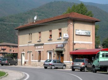
Tocht Te voet Concesio - Villa Carcina (Pregno) - Monte Palosso - Photo
Te voet 5.28
Km
PRO

Te voet

Gemakkelijk
Concesio, Lombardije, Brescia, Italy
5,3 km | 8,2 km-effort
1h 52min
0 m
891 m
Neen
SityTrail - itinéraires balisés pédestres

• Trail created by Club Alpino Italiano - Sezione di Villa Carcina. Symbol: 376 on white red flag

Tocht Te voet Concesio - Concesio (San Vigilio) - Quarone di Sopra (CAI) - Photo
Te voet 4.088
Km
PRO

Te voet

Gemakkelijk
Concesio, Lombardije, Brescia, Italy
4,1 km | 9,8 km-effort
2h 13min
545 m
76 m
Neen
SityTrail - itinéraires balisés pédestres

• Trail created by Comune di Concesio. Symbol: 304 on white red flag

Tocht Te voet Concesio - Lumezzane (Faidana) - Innesto Sentiero 371 - Photo
Te voet 3.235
Km
PRO

Te voet

Gemakkelijk
Concesio, Lombardije, Brescia, Italy
3,2 km | 4,9 km-effort
1h 7min
0 m
511 m
Neen
SityTrail - itinéraires balisés pédestres

• Trail created by Club Alpino Italiano - Sezione di Lumezzane. Symbol: red bar Website: http://www.cailumezzane.it/...

Tocht Te voet Concesio - Concesio (Via Mandò) - Quarone di Sopra - Photo
Te voet 3.146
Km
PRO

Te voet

Gemakkelijk
Concesio, Lombardije, Brescia, Italy
3,1 km | 7,8 km-effort
1h 46min
463 m
17 m
Neen
SityTrail - itinéraires balisés pédestres

• Trail created by Comune di Concesio. Symbol: A on yellow-white horizontal bars

Tocht Te voet Concesio - Concesio (Roncaglie) - Monte Palosso - Photo
Te voet 6.553
Km
PRO

Te voet

Gemakkelijk
Concesio, Lombardije, Brescia, Italy
6,6 km | 15,6 km-effort
3h 32min
893 m
30 m
Neen
SityTrail - itinéraires balisés pédestres

• Trail created by Comune di Concesio. Symbol: I on yellow-white horizontal bars

Tocht Te voet Concesio - Concesio (Costorio) - Grassi Carpini - Photo
Te voet 3.781
Km
PRO

Te voet

Gemakkelijk
Concesio, Lombardije, Brescia, Italy
3,8 km | 6,1 km-effort
1h 22min
21 m
618 m
Neen
SityTrail - itinéraires balisés pédestres

• Trail created by Comune di Concesio. Symbol: F on yellow-white horizontal bars

Tocht Te voet Concesio - Sentiero 378 - Variante 378A - Photo
Te voet 3.552
Km
PRO

Te voet

Gemakkelijk
Concesio, Lombardije, Brescia, Italy
3,6 km | 5,7 km-effort
1h 17min
11 m
613 m
Neen
SityTrail - itinéraires balisés pédestres

• Trail created by Club Alpino Italiano - Sottosezione di Villa Carcina. Symbol: 378A on white red flag

Tocht Te voet Concesio - Concesio (Roncaglie) - Monte Palosso (Innesto Sentiero 377) - Photo
Te voet 5.569
Km
PRO

Te voet

Gemakkelijk
Concesio, Lombardije, Brescia, Italy
5,6 km | 8,2 km-effort
1h 52min
28 m
715 m
Neen
SityTrail - itinéraires balisés pédestres

• Trail created by Club Alpino Italiano - Sottosezione di Villa Carcina. Symbol: 378 on white red flag

10 tochten weergegeven op 10

Gratisgps-wandelapplicatie

Logo SityTrail SityTrail

IGN / Geografische instituten

SityTrail uit de App Store downloaden SityTrail uit Google Play downloaden

Logo SityTrail SityTrail World

De wereld gaat voor u open

SityTrail uit de App Store downloaden SityTrail uit Google Play downloaden SityTrail op Huawei AppGallery downloaden

Activiteiten

Sluiten
Mijn abonnementen