Canale d'Agordo, Belluno, Te voet: Top van de beste wandelroutes, trajecten, tochten en wandelingen

Canale d'Agordo: Ontdek de beste tochten: 9 te voet en 3 stappen. Al deze tochten, trajecten, routes en outdoor activiteiten zijn beschikbaar in onze SityTrail-apps voor smartphones en tablets.


De beste trajecten (12)
Tocht Te voet Canale d'Agordo - IT-701 - Photo
Te voet 5.799
Km
GUIDE+

Te voet

Gemakkelijk
Canale d'Agordo, Veneto, Belluno, Italy
5,8 km | 9,9 km-effort
2h 14min
42 m
1099 m
Neen
SityTrail - itinéraires balisés pédestres

• Trail created by Parco naturale Paneveggio - Pale di San Martino.
Tocht Te voet Canale d'Agordo - IT-702 - Photo
Te voet 6.129
Km
GUIDE+

Te voet

Gemakkelijk
Canale d'Agordo, Veneto, Belluno, Italy
6,1 km | 9,8 km-effort
2h 13min
106 m
787 m
Neen
SityTrail - itinéraires balisés pédestres

• Trail created by Parco Paneveggio e Pale di San Martino.
Tocht Te voet Canale d'Agordo - IT-756 - Photo
Te voet 9.243
Km
GUIDE+

Te voet

Gemakkelijk
Canale d'Agordo, Veneto, Belluno, Italy
9,2 km | 14,3 km-effort
3h 15min
82 m
1273 m
Neen
SityTrail - itinéraires balisés pédestres

• Trail created by CAI Agordo.

Tocht Te voet Canale d'Agordo - IT-755 - Photo
Te voet 5.024
Km
GUIDE+

Te voet

Gemakkelijk
Canale d'Agordo, Veneto, Belluno, Italy
5 km | 10 km-effort
2h 16min
53 m
1343 m
Neen
SityTrail - itinéraires balisés pédestres

• Trail created by Club Alpino Italiano.
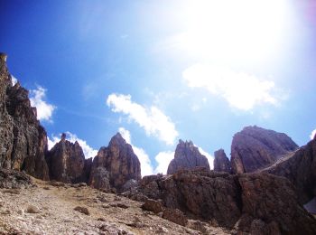
Tocht Te voet Canale d'Agordo - Via ferrata delle Farangole - Photo
Te voet 6.76
Km
GUIDE+

Te voet

Gemakkelijk
Canale d'Agordo, Veneto, Belluno, Italy
6,8 km | 16,2 km-effort
3h 40min
704 m
715 m
Neen
SityTrail - itinéraires balisés pédestres

• Trail created by Società degli Alpinisti Tridentini. Website: http://www.sat.tn.it/
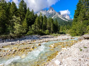
Tocht Te voet Canale d'Agordo - IT-E707 - Photo
Te voet 13.477
Km
GUIDE+

Te voet

Medium
Canale d'Agordo, Veneto, Belluno, Italy
13,5 km | 22 km-effort
5h 0min
296 m
1671 m
Neen
SityTrail - itinéraires balisés pédestres

• Trail created by Società degli Alpinisti Tridentini. Website: http://www.sat.tn.it/
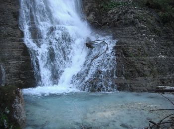
Tocht Te voet Canale d'Agordo - IT-704 - Photo
Te voet 4.155
Km
GUIDE+

Te voet

Gemakkelijk
Canale d'Agordo, Veneto, Belluno, Italy
4,2 km | 6,2 km-effort
1h 24min
28 m
537 m
Neen
SityTrail - itinéraires balisés pédestres

• Trail created by CAI Agordo.

Tocht Te voet Canale d'Agordo - IT-687 - Photo
Te voet 5.092
Km
GUIDE+

Te voet

Gemakkelijk
Canale d'Agordo, Veneto, Belluno, Italy
5,1 km | 14,9 km-effort
3h 22min
918 m
177 m
Neen
SityTrail - itinéraires balisés pédestres

• Trail created by Club Alpino Italiano. Symbol: 687 on white red tag

Tocht Te voet Canale d'Agordo - IT-754 - Photo
Te voet 7.492
Km
GUIDE+

Te voet

Gemakkelijk
Canale d'Agordo, Veneto, Belluno, Italy
7,5 km | 18,3 km-effort
4h 9min
762 m
951 m
Neen
SityTrail - itinéraires balisés pédestres

• Trail created by CAI Agordo.

Tocht Stappen Canale d'Agordo - Rosetta 2018 2 juillet - Photo
Stappen 9.204
Km

Stappen

Medium
Canale d'Agordo, Veneto, Belluno, Italy
9,2 km | 13,6 km-effort
5h 56min
323 m
346 m
Ja
ARPF

• Plateau

Tocht Stappen Canale d'Agordo - AV2 Étape 6 Refuge Rosetta Pedrotti - Refuge Treviso - Refuge Cereda - Photo
Stappen 17.051
Km

Stappen

Zeer moeilijk
Canale d'Agordo, Veneto, Belluno, Italy
17,1 km | 37 km-effort
8h 28min
1219 m
2409 m
Neen
verpoorten

Tocht Stappen Canale d'Agordo - Rosetta - Photo
Stappen 7.959
Km

Stappen

Medium
Canale d'Agordo, Veneto, Belluno, Italy
8 km | 12,1 km-effort
6min
305 m
314 m
Ja
ARPF

12 tochten weergegeven op 12

Gratisgps-wandelapplicatie

Logo SityTrail SityTrail

IGN / Geografische instituten

SityTrail uit de App Store downloaden SityTrail uit Google Play downloaden

Logo SityTrail SityTrail World

De wereld gaat voor u open

SityTrail uit de App Store downloaden SityTrail uit Google Play downloaden SityTrail op Huawei AppGallery downloaden

Activiteiten

Sluiten
Mijn abonnementen