![](/images/other/stat-length.png)
Coli, Piacenza, Te voet: Top van de beste wandelroutes, trajecten, tochten en wandelingen
Coli: Ontdek de beste tochten: 4 te voet. Al deze tochten, trajecten, routes en outdoor activiteiten zijn beschikbaar in onze SityTrail-apps voor smartphones en tablets.
De beste trajecten (4)
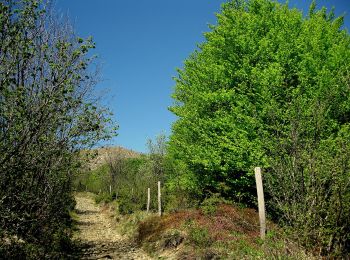
![Tocht Te voet Coli - I Mazzucchi - Monte Sant'Agostino - Monte Capra - Percorso 151 - Photo](https://media.geolcdn.com/t/350/260/ca11182b-31d6-4690-a43c-aaf6f405d613.jpeg&format=jpg&maxdim=2)
![Te voet Te voet](https://static1.geolcdn.com/sitytour/trail-icons/100.png)
Km
Te voet
![](/images/other/stat-length.png)
![](https://static1.geolcdn.com/siteimages/upload/files/1508320355ic_sort_den_pos_24dp.png)
![](https://static1.geolcdn.com/siteimages/upload/files/1508320355ic_sort_den_neg_24dp.png)
![](https://static1.geolcdn.com/siteimages/upload/files/16400158638029165_repeat_loop_refresh_sync_direction_icon.png)
• Symbol: 159 on white red flags
![Tocht Te voet Coli - Boioli - Caminata Boselli - Monte Tre Sorelle - Gavi - Photo](https://media.geolcdn.com/t/350/260/81b0a52f-55fe-476f-b674-7667d3b63ea1.jpeg&format=jpg&maxdim=2)
![Te voet Te voet](https://static1.geolcdn.com/sitytour/trail-icons/100.png)
Km
Te voet
![](/images/other/stat-length.png)
![](https://static1.geolcdn.com/siteimages/upload/files/1508320355ic_sort_den_pos_24dp.png)
![](https://static1.geolcdn.com/siteimages/upload/files/1508320355ic_sort_den_neg_24dp.png)
![](https://static1.geolcdn.com/siteimages/upload/files/16400158638029165_repeat_loop_refresh_sync_direction_icon.png)
• Symbol: 163 on white red flags
![Tocht Te voet Coli - Percorso 151 - Boioli - Monte Armelio - Percorso 163 - Photo](https://media.geolcdn.com/t/350/260/bd2359cf-3c7f-48b7-8667-45008a9e656b.jpeg&format=jpg&maxdim=2)
![Te voet Te voet](https://static1.geolcdn.com/sitytour/trail-icons/100.png)
Km
Te voet
![](/images/other/stat-length.png)
![](https://static1.geolcdn.com/siteimages/upload/files/1508320355ic_sort_den_pos_24dp.png)
![](https://static1.geolcdn.com/siteimages/upload/files/1508320355ic_sort_den_neg_24dp.png)
![](https://static1.geolcdn.com/siteimages/upload/files/16400158638029165_repeat_loop_refresh_sync_direction_icon.png)
• Symbol: 161 on white red flags
![Tocht Te voet Coli - Perino - Concrena - Passo di Santa Barbara - Sella del Generale - Monte Aserei - Percorso 001 - Photo](https://media.geolcdn.com/t/350/260/33b0c98a-ae0d-4ba2-952a-8b8bb9f73100.jpeg&format=jpg&maxdim=2)
![Te voet Te voet](https://static1.geolcdn.com/sitytour/trail-icons/100.png)
Km
Te voet
![](/images/other/stat-length.png)
![](https://static1.geolcdn.com/siteimages/upload/files/1508320355ic_sort_den_pos_24dp.png)
![](https://static1.geolcdn.com/siteimages/upload/files/1508320355ic_sort_den_neg_24dp.png)
![](https://static1.geolcdn.com/siteimages/upload/files/16400158638029165_repeat_loop_refresh_sync_direction_icon.png)
• Symbol: 151 on white red flags
4 tochten weergegeven op 4
Gratisgps-wandelapplicatie