![](/images/other/stat-length.png)
- Tochten
- Te voet
- Italy
- Emilia-Romagna
- Reggio nell'Emilia
- Vezzano sul Crostolo
Vezzano sul Crostolo, Reggio nell'Emilia, Te voet: Top van de beste wandelroutes, trajecten, tochten en wandelingen
Vezzano sul Crostolo: Ontdek de beste tochten: 4 te voet. Al deze tochten, trajecten, routes en outdoor activiteiten zijn beschikbaar in onze SityTrail-apps voor smartphones en tablets.
De beste trajecten (4)
![Tocht Te voet Vezzano sul Crostolo - Montalto - Monte Duro - Casa Cuccagna - Montalto - Photo](https://media.geolcdn.com/t/350/260/ext.jpg?maxdim=2&url=https%3A%2F%2Fmedia.geolcdn.com%2Ff%2Feea2b418-4e4f-4e81-967f-496c2b36ee36.jpeg)
![Te voet Te voet](https://static1.geolcdn.com/sitytour/trail-icons/100.png)
Km
Te voet
![](/images/other/stat-length.png)
![](https://static1.geolcdn.com/siteimages/upload/files/1508320355ic_sort_den_pos_24dp.png)
![](https://static1.geolcdn.com/siteimages/upload/files/1508320355ic_sort_den_neg_24dp.png)
![](https://static1.geolcdn.com/siteimages/upload/files/16400158638029165_repeat_loop_refresh_sync_direction_icon.png)
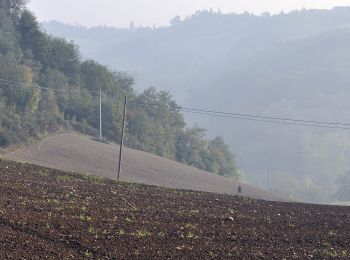
• Trail created by Comune di Vezzano sul Crostolo. Symbol: 622A on white red flags
![Tocht Te voet Vezzano sul Crostolo - Bettola - Casa Cuccagna - Casa di Casino - Riolo - Prediera - Case Schiavino - Casa Monteduro - Bettola - Photo](https://media.geolcdn.com/t/350/260/ext.jpg?maxdim=2&url=https%3A%2F%2Fmedia.geolcdn.com%2Ff%2F5ee45ff0-6daf-4cea-bd17-b807d4bddb8f.jpeg)
![Te voet Te voet](https://static1.geolcdn.com/sitytour/trail-icons/100.png)
Km
Te voet
![](/images/other/stat-length.png)
![](https://static1.geolcdn.com/siteimages/upload/files/1508320355ic_sort_den_pos_24dp.png)
![](https://static1.geolcdn.com/siteimages/upload/files/1508320355ic_sort_den_neg_24dp.png)
![](https://static1.geolcdn.com/siteimages/upload/files/16400158638029165_repeat_loop_refresh_sync_direction_icon.png)
• Trail created by Provincia di Reggio Emilia. Symbol: 622 on white red flags
![Tocht Te voet Vezzano sul Crostolo - Vezzano sul Crostolo - Pecorile - Casola Canossa - Vezzano sul Crostolo - Photo](https://media.geolcdn.com/t/350/260/ext.jpg?maxdim=2&url=https%3A%2F%2Fmedia.geolcdn.com%2Ff%2F53fd6dbf-535e-45c1-8c8d-d25a2b033f47.jpeg)
![Te voet Te voet](https://static1.geolcdn.com/sitytour/trail-icons/100.png)
Km
Te voet
![](/images/other/stat-length.png)
![](https://static1.geolcdn.com/siteimages/upload/files/1508320355ic_sort_den_pos_24dp.png)
![](https://static1.geolcdn.com/siteimages/upload/files/1508320355ic_sort_den_neg_24dp.png)
![](https://static1.geolcdn.com/siteimages/upload/files/16400158638029165_repeat_loop_refresh_sync_direction_icon.png)
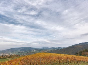
• Trail created by Provincia di Reggio Emilia. Symbol: 644 on white red flags
![Tocht Te voet Vezzano sul Crostolo - Salvarano - Cerro - Bedogno - Bercemme - Montebello - Salvarano - Photo](https://media.geolcdn.com/t/350/260/ext.jpg?maxdim=2&url=https%3A%2F%2Fmedia.geolcdn.com%2Ff%2Fc7358719-f4d2-43ea-81fd-620668635a33.jpeg)
![Te voet Te voet](https://static1.geolcdn.com/sitytour/trail-icons/100.png)
Km
Te voet
![](/images/other/stat-length.png)
![](https://static1.geolcdn.com/siteimages/upload/files/1508320355ic_sort_den_pos_24dp.png)
![](https://static1.geolcdn.com/siteimages/upload/files/1508320355ic_sort_den_neg_24dp.png)
![](https://static1.geolcdn.com/siteimages/upload/files/16400158638029165_repeat_loop_refresh_sync_direction_icon.png)
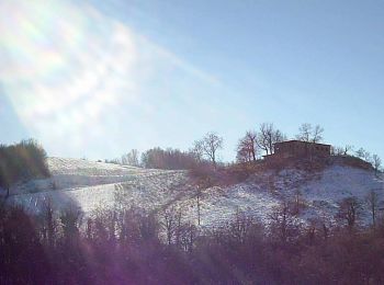
• Symbol: 640G on white red flags
4 tochten weergegeven op 4
Gratisgps-wandelapplicatie