The Municipal District of Wicklow, County Wicklow, Te voet: Top van de beste wandelroutes, trajecten, tochten en wandelingen

The Municipal District of Wicklow: Ontdek de beste tochten: 10 stappen. Al deze tochten, trajecten, routes en outdoor activiteiten zijn beschikbaar in onze SityTrail-apps voor smartphones en tablets.


De beste trajecten (10)
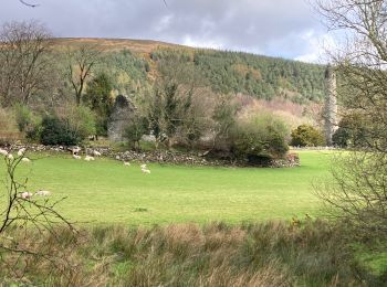
Tocht Stappen The Municipal District of Wicklow - Glendalough  - Photo
Stappen 9.409
Km

Stappen

Medium
The Municipal District of Wicklow, Onbekend, County Wicklow, Ireland
9,4 km | 13,7 km-effort
2h 21min
318 m
320 m
Ja
Lobin

Tocht Stappen The Municipal District of Wicklow - Glendalough - Photo
Stappen 9.568
Km

Stappen

Medium
The Municipal District of Wicklow, Onbekend, County Wicklow, Ireland
9,6 km | 14 km-effort
2h 59min
333 m
333 m
Ja
FabienneD

• Monastic city, Upper lake, Spinc cliffs

Tocht Stappen The Municipal District of Wicklow - Mountain Hike from Glendalough car park - Photo
Stappen 17.184
Km

Stappen

Heel gemakkelijk
The Municipal District of Wicklow, Onbekend, County Wicklow, Ireland
17,2 km | 26 km-effort
6h 1min
692 m
692 m
Ja
RVCrazy

Tocht Stappen The Municipal District of Wicklow - Knocknacloghoge and Fancy Mtn - Photo
Stappen 13.085
Km

Stappen

Heel gemakkelijk
The Municipal District of Wicklow, Onbekend, County Wicklow, Ireland
13,1 km | 22 km-effort
Onbekend
673 m
672 m
Ja
jaf299

Tocht Stappen The Municipal District of Wicklow - The Brockaghs and St Kevins Road - Photo
Stappen 16.696
Km

Stappen

Heel gemakkelijk
The Municipal District of Wicklow, Onbekend, County Wicklow, Ireland
16,7 km | 25 km-effort
Onbekend
646 m
644 m
Ja
jaf299

Tocht Stappen The Municipal District of Wicklow - Mullaghcleevaun and Tonelagee - Photo
Stappen 16.44
Km

Stappen

Heel gemakkelijk
The Municipal District of Wicklow, Onbekend, County Wicklow, Ireland
16,4 km | 26 km-effort
Onbekend
730 m
723 m
Ja
jaf299

Tocht Stappen The Municipal District of Wicklow - glendalough outer circuit - Photo
Stappen 20.709
Km

Stappen

Heel gemakkelijk
The Municipal District of Wicklow, Onbekend, County Wicklow, Ireland
21 km | 33 km-effort
Onbekend
900 m
945 m
Ja
isurgeon

Tocht Stappen The Municipal District of Wicklow - glendalough - Photo
Stappen 5.624
Km

Stappen

Medium
The Municipal District of Wicklow, Onbekend, County Wicklow, Ireland
5,6 km | 7,3 km-effort
1h 39min
128 m
128 m
Ja
bena42

Tocht Stappen The Municipal District of Wicklow - wiclow  - Photo
Stappen 17.969
Km

Stappen

Zeer moeilijk
The Municipal District of Wicklow, Onbekend, County Wicklow, Ireland
18 km | 27 km-effort
4h 11min
641 m
640 m
Ja
peuch4

Tocht Stappen The Municipal District of Wicklow - Wicklow4 - Photo
Stappen 18.909
Km

Stappen

Heel gemakkelijk
The Municipal District of Wicklow, Onbekend, County Wicklow, Ireland
18,9 km | 28 km-effort
6h 0min
648 m
762 m
Neen
dewaeph

10 tochten weergegeven op 10

Gratisgps-wandelapplicatie

Logo SityTrail SityTrail

IGN / Geografische instituten

SityTrail uit de App Store downloaden SityTrail uit Google Play downloaden

Logo SityTrail SityTrail World

De wereld gaat voor u open

SityTrail uit de App Store downloaden SityTrail uit Google Play downloaden SityTrail op Huawei AppGallery downloaden

Activiteiten

Nabije regio's

Sluiten
Mijn abonnementen