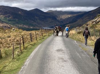
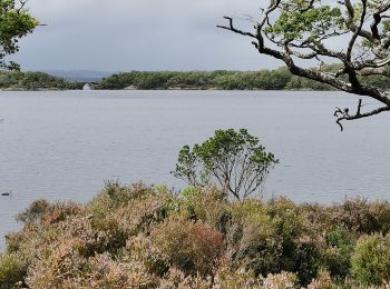
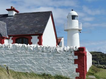
County Kerry, Onbekend, Te voet: Top van de beste wandelroutes, trajecten, tochten en wandelingen

County Kerry: Ontdek de beste tochten: 5 te voet, 53 stappen en 2 trail. Al deze tochten, trajecten, routes en outdoor activiteiten zijn beschikbaar in onze SityTrail-apps voor smartphones en tablets.


De beste trajecten (60)
Tocht Te voet Tralee Municipal District - Slí na Sláinte Tralee - Photo
Te voet 9.664
Km
GUIDE+

Te voet

Gemakkelijk
Tralee Municipal District, Onbekend, County Kerry, Ireland
9,7 km | 10,5 km-effort
2h 23min
62 m
64 m
Ja
SityTrail - itinéraires balisés pédestres

• Tocht aangemaakt door Slí na Sláinte - Irish Heart Foundation. Route is recommended as a day time walk only
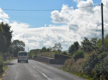
Tocht Te voet Kenmare Municipal District - Keel Uphill Downhill Loop - Photo
Te voet 12.013
Km
GUIDE+

Te voet

Gemakkelijk
Kenmare Municipal District, Onbekend, County Kerry, Ireland
12 km | 13,6 km-effort
3h 5min
119 m
120 m
Ja
SityTrail - itinéraires balisés pédestres

• OSi Discovery Series Sheet 71 Website: http://www.irishtrails.ie/Trail/Keel-Uphill-Downhill-Loop-Walk/666/
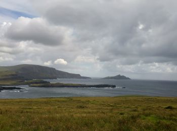
Tocht Te voet Kenmare Municipal District - Bray Head Loop - Photo
Te voet 4.477
Km
GUIDE+

Te voet

Gemakkelijk
Kenmare Municipal District, Onbekend, County Kerry, Ireland
4,5 km | 6,9 km-effort
1h 34min
182 m
182 m
Neen
SityTrail - itinéraires balisés pédestres

Tocht Te voet Kenmare Municipal District - Bray Head Loop - Photo
Te voet 5.415
Km
GUIDE+

Te voet

Gemakkelijk
Kenmare Municipal District, Onbekend, County Kerry, Ireland
5,4 km | 7,9 km-effort
1h 47min
184 m
187 m
Ja
SityTrail - itinéraires balisés pédestres

Tocht Te voet Kenmare Municipal District - Caher (Coomloughra) Route - Photo
Te voet 6.01
Km
GUIDE+

Te voet

Gemakkelijk
Kenmare Municipal District, Onbekend, County Kerry, Ireland
6 km | 15,8 km-effort
3h 35min
958 m
75 m
Neen
SityTrail - itinéraires balisés pédestres

Tocht Stappen Kenmare Municipal District - Parc National Killarney - Photo
Stappen 27.64
Km

Stappen

Zeer moeilijk
Kenmare Municipal District, Onbekend, County Kerry, Ireland
28 km | 32 km-effort
7h 10min
285 m
316 m
Neen
Z14

Tocht Stappen Kenmare Municipal District - Glencar - Glengeigh - Photo
Stappen 16.129
Km

Stappen

Zeer moeilijk
Kenmare Municipal District, Onbekend, County Kerry, Ireland
16,1 km | 24 km-effort
5h 20min
550 m
565 m
Neen
Z14

Tocht Stappen Kenmare Municipal District - Gap of Dunloe - Photo
Stappen 11.149
Km

Stappen

Medium
Kenmare Municipal District, Onbekend, County Kerry, Ireland
11,1 km | 14,2 km-effort
2h 26min
222 m
256 m
Neen
Lobin

Tocht Stappen Kenmare Municipal District - Gowlane - Killarney (Abbey Cross) - Photo
Stappen 17.768
Km

Stappen

Zeer moeilijk
Kenmare Municipal District, Onbekend, County Kerry, Ireland
17,8 km | 24 km-effort
5h 31min
450 m
604 m
Neen
Z14

Tocht Stappen Kenmare Municipal District - Rando Na Poirt - Photo
Stappen 18.669
Km

Stappen

Moeilijk
Kenmare Municipal District, Onbekend, County Kerry, Ireland
18,7 km | 31 km-effort
6h 5min
943 m
945 m
Ja
cl56

Tocht Stappen Killarney Municipal District - Mon parcours - Photo
Stappen 10.585
Km

Stappen

Moeilijk
Killarney Municipal District, Onbekend, County Kerry, Ireland
10,6 km | 12,7 km-effort
2h 45min
156 m
156 m
Ja
BureauChris

Tocht Stappen Kenmare Municipal District - Mon parcours - Photo
Stappen 8.184
Km

Stappen

Medium
Kenmare Municipal District, Onbekend, County Kerry, Ireland
8,2 km | 9 km-effort
1h 59min
60 m
60 m
Ja
BureauChris

Tocht Stappen Kenmare Municipal District - Bolus Head loop - Photo
Stappen 7.837
Km

Stappen

Medium
Kenmare Municipal District, Onbekend, County Kerry, Ireland
7,8 km | 12,2 km-effort
2h 31min
326 m
326 m
Ja
FabienneD

• Magnifiques vues sur la cote, les îles Skelling, les champs de moutons, etc.

Tocht Stappen Kenmare Municipal District - Purlp montain - Photo
Stappen 14.544
Km

Stappen

Moeilijk
Kenmare Municipal District, Onbekend, County Kerry, Ireland
14,5 km | 21 km-effort
Onbekend
469 m
469 m
Ja
zezette52

Tocht Stappen Tralee Municipal District - Derrymore Curcuit - Photo
Stappen 8.757
Km

Stappen

Medium
Tralee Municipal District, Onbekend, County Kerry, Ireland
8,8 km | 18,5 km-effort
Onbekend
750 m
674 m
Neen
RayB

• Circuit of Derrymore Glen

Tocht Stappen Kenmare Municipal District - Carrantoohil - Photo
Stappen 14.388
Km

Stappen

Moeilijk
Kenmare Municipal District, Onbekend, County Kerry, Ireland
14,4 km | 28 km-effort
Onbekend
1068 m
998 m
Neen
ljehannon

Tocht Stappen Killarney Municipal District - Irl 17 - Torc Mountain - Photo
Stappen 7.589
Km

Stappen

Moeilijk
Killarney Municipal District, Onbekend, County Kerry, Ireland
7,6 km | 12,6 km-effort
2h 51min
376 m
377 m
Ja
Z14

Tocht Stappen Kenmare Municipal District - Irl 12 - Photo
Stappen 14.91
Km

Stappen

Zeer moeilijk
Kenmare Municipal District, Onbekend, County Kerry, Ireland
14,9 km | 19,1 km-effort
4h 20min
287 m
401 m
Neen
Z14

Tocht Stappen Kenmare Municipal District - Kerry way Glenbeigh - Photo
Stappen 13.605
Km

Stappen

Medium
Kenmare Municipal District, Onbekend, County Kerry, Ireland
13,6 km | 21 km-effort
3h 50min
522 m
524 m
Ja
cl56

Tocht Stappen Killarney Municipal District - torc Waterfall  - Photo
Stappen 8.392
Km

Stappen

Medium
Killarney Municipal District, Onbekend, County Kerry, Ireland
8,4 km | 9,2 km-effort
1h 5min
62 m
68 m
Neen
bena42

20 tochten weergegeven op 60

Gratisgps-wandelapplicatie

Logo SityTrail SityTrail

IGN / Geografische instituten

SityTrail uit de App Store downloaden SityTrail uit Google Play downloaden

Logo SityTrail SityTrail World

De wereld gaat voor u open

SityTrail uit de App Store downloaden SityTrail uit Google Play downloaden SityTrail op Huawei AppGallery downloaden

Activiteiten

Nabije regio's

Sluiten
Mijn abonnementen