![](/images/other/stat-length.png)
- Tochten
- Te voet
- United Kingdom
- Engeland
- Surrey
Surrey, Engeland, Te voet: Top van de beste wandelroutes, trajecten, tochten en wandelingen
Surrey: Ontdek de beste tochten: 24 te voet, 6 stappen en 4 lopen. Al deze tochten, trajecten, routes en outdoor activiteiten zijn beschikbaar in onze SityTrail-apps voor smartphones en tablets.
De beste trajecten (34)
![Tocht Te voet Tandridge - Woldingham walk (SCC) - Photo](https://media.geolcdn.com/t/350/260/985ebdb6-3edd-4a8c-8eaf-5dd29b0ca9ae.jpeg&format=jpg&maxdim=2)
![Te voet Te voet](https://static1.geolcdn.com/sitytour/trail-icons/100.png)
Km
Te voet
![](/images/other/stat-length.png)
![](https://static1.geolcdn.com/siteimages/upload/files/1508320355ic_sort_den_pos_24dp.png)
![](https://static1.geolcdn.com/siteimages/upload/files/1508320355ic_sort_den_neg_24dp.png)
![](https://static1.geolcdn.com/siteimages/upload/files/16400158638029165_repeat_loop_refresh_sync_direction_icon.png)
• Woldingham walk from http://www.surreycc.gov.uk
![Tocht Te voet Guildford - Tillingbourne at work (short) (SCC) - Photo](https://media.geolcdn.com/t/350/260/31803d5f-d433-408c-9a9c-0abfc7eb4725.jpeg&format=jpg&maxdim=2)
![Te voet Te voet](https://static1.geolcdn.com/sitytour/trail-icons/100.png)
Km
Te voet
![](/images/other/stat-length.png)
![](https://static1.geolcdn.com/siteimages/upload/files/1508320355ic_sort_den_pos_24dp.png)
![](https://static1.geolcdn.com/siteimages/upload/files/1508320355ic_sort_den_neg_24dp.png)
![](https://static1.geolcdn.com/siteimages/upload/files/16400158638029165_repeat_loop_refresh_sync_direction_icon.png)
• Tillingbourne at work walk from http://www.surreycc.gov.uk
![Tocht Te voet Guildford - Tillingbourne at work (long) (SCC) - Photo](https://media.geolcdn.com/t/350/260/354c15c0-e4f7-46c3-9108-0f26f23a95ad.jpeg&format=jpg&maxdim=2)
![Te voet Te voet](https://static1.geolcdn.com/sitytour/trail-icons/100.png)
Km
Te voet
![](/images/other/stat-length.png)
![](https://static1.geolcdn.com/siteimages/upload/files/1508320355ic_sort_den_pos_24dp.png)
![](https://static1.geolcdn.com/siteimages/upload/files/1508320355ic_sort_den_neg_24dp.png)
![](https://static1.geolcdn.com/siteimages/upload/files/16400158638029165_repeat_loop_refresh_sync_direction_icon.png)
• Tillingbourne at work walk from http://www.surreycc.gov.uk
![Tocht Te voet Mole Valley - Ranmore (SCC) - Photo](https://media.geolcdn.com/t/350/260/a684d203-df59-45b4-9486-3dde83a48ea5.jpeg&format=jpg&maxdim=2)
![Te voet Te voet](https://static1.geolcdn.com/sitytour/trail-icons/100.png)
Km
Te voet
![](/images/other/stat-length.png)
![](https://static1.geolcdn.com/siteimages/upload/files/1508320355ic_sort_den_pos_24dp.png)
![](https://static1.geolcdn.com/siteimages/upload/files/1508320355ic_sort_den_neg_24dp.png)
![](https://static1.geolcdn.com/siteimages/upload/files/16400158638029165_repeat_loop_refresh_sync_direction_icon.png)
• Ranmore walk from http://www.surreycc.gov.uk
![Tocht Te voet Guildford - Puttenham walk (SCC) - Photo](https://media.geolcdn.com/t/350/260/b99b8dd3-43b5-4af6-bbc5-b03a3c41f665.jpeg&format=jpg&maxdim=2)
![Te voet Te voet](https://static1.geolcdn.com/sitytour/trail-icons/100.png)
Km
Te voet
![](/images/other/stat-length.png)
![](https://static1.geolcdn.com/siteimages/upload/files/1508320355ic_sort_den_pos_24dp.png)
![](https://static1.geolcdn.com/siteimages/upload/files/1508320355ic_sort_den_neg_24dp.png)
![](https://static1.geolcdn.com/siteimages/upload/files/16400158638029165_repeat_loop_refresh_sync_direction_icon.png)
• Puttenham walk from http://www.surreycc.gov.uk
![Tocht Te voet Mole Valley - Prospects of Polesden (SCC) - Photo](https://media.geolcdn.com/t/350/260/95d7f0be-16ad-4338-8dc3-292d14693fe8.jpeg&format=jpg&maxdim=2)
![Te voet Te voet](https://static1.geolcdn.com/sitytour/trail-icons/100.png)
Km
Te voet
![](/images/other/stat-length.png)
![](https://static1.geolcdn.com/siteimages/upload/files/1508320355ic_sort_den_pos_24dp.png)
![](https://static1.geolcdn.com/siteimages/upload/files/1508320355ic_sort_den_neg_24dp.png)
![](https://static1.geolcdn.com/siteimages/upload/files/16400158638029165_repeat_loop_refresh_sync_direction_icon.png)
• Prospects of Polesden walk from http://www.surreycc.gov.uk
![Tocht Te voet Guildford - Pirbright walk (SCC) - Photo](https://media.geolcdn.com/t/350/260/1bfde5ed-c593-4134-8be5-c5f5eeda4b5d.jpeg&format=jpg&maxdim=2)
![Te voet Te voet](https://static1.geolcdn.com/sitytour/trail-icons/100.png)
Km
Te voet
![](/images/other/stat-length.png)
![](https://static1.geolcdn.com/siteimages/upload/files/1508320355ic_sort_den_pos_24dp.png)
![](https://static1.geolcdn.com/siteimages/upload/files/1508320355ic_sort_den_neg_24dp.png)
![](https://static1.geolcdn.com/siteimages/upload/files/16400158638029165_repeat_loop_refresh_sync_direction_icon.png)
• Pirbright walk from http://www.surreycc.gov.uk
![Tocht Te voet Tandridge - Over the Downs to Oxted Mill walk (SCC) - Photo](https://media.geolcdn.com/t/350/260/179a9d2c-4aa4-4234-aa3e-8fe3d06d40e7.jpeg&format=jpg&maxdim=2)
![Te voet Te voet](https://static1.geolcdn.com/sitytour/trail-icons/100.png)
Km
Te voet
![](/images/other/stat-length.png)
![](https://static1.geolcdn.com/siteimages/upload/files/1508320355ic_sort_den_pos_24dp.png)
![](https://static1.geolcdn.com/siteimages/upload/files/1508320355ic_sort_den_neg_24dp.png)
![](https://static1.geolcdn.com/siteimages/upload/files/16400158638029165_repeat_loop_refresh_sync_direction_icon.png)
• Over the Downs to Oxted Mill walking route from http://www.surreycc.gov.uk
![Tocht Te voet Mole Valley - Norbury Park Off Road Cycle & Walk (SCC) - Photo](https://media.geolcdn.com/t/350/260/849c3c97-3577-449a-9dc3-9d99e5ecc2fe.jpeg&format=jpg&maxdim=2)
![Te voet Te voet](https://static1.geolcdn.com/sitytour/trail-icons/100.png)
Km
Te voet
![](/images/other/stat-length.png)
![](https://static1.geolcdn.com/siteimages/upload/files/1508320355ic_sort_den_pos_24dp.png)
![](https://static1.geolcdn.com/siteimages/upload/files/1508320355ic_sort_den_neg_24dp.png)
![](https://static1.geolcdn.com/siteimages/upload/files/16400158638029165_repeat_loop_refresh_sync_direction_icon.png)
• Norbury Park Off Road Cycle & Walk route from http://www.surreycc.gov.uk
![Tocht Te voet Mole Valley - Norbury Park walk (SCC) - Photo](https://media.geolcdn.com/t/350/260/dfc03276-6c3b-4fe7-be10-71c2c424f444.jpeg&format=jpg&maxdim=2)
![Te voet Te voet](https://static1.geolcdn.com/sitytour/trail-icons/100.png)
Km
Te voet
![](/images/other/stat-length.png)
![](https://static1.geolcdn.com/siteimages/upload/files/1508320355ic_sort_den_pos_24dp.png)
![](https://static1.geolcdn.com/siteimages/upload/files/1508320355ic_sort_den_neg_24dp.png)
![](https://static1.geolcdn.com/siteimages/upload/files/16400158638029165_repeat_loop_refresh_sync_direction_icon.png)
• Norbury Park walk from http://www.surreycc.gov.uk
![Tocht Te voet Reigate and Banstead - Mills & Pillboxes walk (SCC) - Photo](https://media.geolcdn.com/t/350/260/3ef36796-9f15-4769-af13-45999796b28b.jpeg&format=jpg&maxdim=2)
![Te voet Te voet](https://static1.geolcdn.com/sitytour/trail-icons/100.png)
Km
Te voet
![](/images/other/stat-length.png)
![](https://static1.geolcdn.com/siteimages/upload/files/1508320355ic_sort_den_pos_24dp.png)
![](https://static1.geolcdn.com/siteimages/upload/files/1508320355ic_sort_den_neg_24dp.png)
![](https://static1.geolcdn.com/siteimages/upload/files/16400158638029165_repeat_loop_refresh_sync_direction_icon.png)
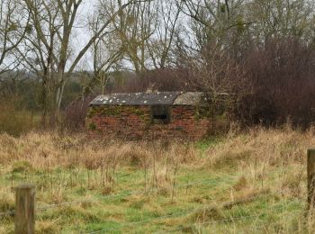
• Mills & Pillboxes walk from http://www.surreycc.gov.uk
![Tocht Te voet Elmbridge - Locks and Levels (SCC) - Photo](https://media.geolcdn.com/t/350/260/585086aa-1cc9-4ffa-9dc7-c48d9b58614c.jpeg&format=jpg&maxdim=2)
![Te voet Te voet](https://static1.geolcdn.com/sitytour/trail-icons/100.png)
Km
Te voet
![](/images/other/stat-length.png)
![](https://static1.geolcdn.com/siteimages/upload/files/1508320355ic_sort_den_pos_24dp.png)
![](https://static1.geolcdn.com/siteimages/upload/files/1508320355ic_sort_den_neg_24dp.png)
![](https://static1.geolcdn.com/siteimages/upload/files/16400158638029165_repeat_loop_refresh_sync_direction_icon.png)
• Locks and Levels walk from http://www.surreycc.gov.uk
![Tocht Te voet Waverley - Grayswood walk (SCC) - Photo](https://media.geolcdn.com/t/350/260/0c42e915-8058-4bc3-a4e9-165d65513008.jpeg&format=jpg&maxdim=2)
![Te voet Te voet](https://static1.geolcdn.com/sitytour/trail-icons/100.png)
Km
Te voet
![](/images/other/stat-length.png)
![](https://static1.geolcdn.com/siteimages/upload/files/1508320355ic_sort_den_pos_24dp.png)
![](https://static1.geolcdn.com/siteimages/upload/files/1508320355ic_sort_den_neg_24dp.png)
![](https://static1.geolcdn.com/siteimages/upload/files/16400158638029165_repeat_loop_refresh_sync_direction_icon.png)
• Grayswood walk from http://www.surreycc.gov.uk
![Tocht Te voet Tandridge - Dormans Park Walk (SCC) - Photo](https://media.geolcdn.com/t/350/260/2266ac33-4686-494e-a9b0-5fc9da178dc9.jpeg&format=jpg&maxdim=2)
![Te voet Te voet](https://static1.geolcdn.com/sitytour/trail-icons/100.png)
Km
Te voet
![](/images/other/stat-length.png)
![](https://static1.geolcdn.com/siteimages/upload/files/1508320355ic_sort_den_pos_24dp.png)
![](https://static1.geolcdn.com/siteimages/upload/files/1508320355ic_sort_den_neg_24dp.png)
![](https://static1.geolcdn.com/siteimages/upload/files/16400158638029165_repeat_loop_refresh_sync_direction_icon.png)
• Dormans Park walk from http://www.surreycc.gov.uk
![Tocht Te voet Tandridge - Corner of Four Counties walk (SCC) - Photo](https://media.geolcdn.com/t/350/260/a23f6a92-ad57-46aa-bcb2-ab9918608a34.jpeg&format=jpg&maxdim=2)
![Te voet Te voet](https://static1.geolcdn.com/sitytour/trail-icons/100.png)
Km
Te voet
![](/images/other/stat-length.png)
![](https://static1.geolcdn.com/siteimages/upload/files/1508320355ic_sort_den_pos_24dp.png)
![](https://static1.geolcdn.com/siteimages/upload/files/1508320355ic_sort_den_neg_24dp.png)
![](https://static1.geolcdn.com/siteimages/upload/files/16400158638029165_repeat_loop_refresh_sync_direction_icon.png)
• Corner of Four Counties walk from http://www.surreycc.gov.uk
![Tocht Te voet Reigate and Banstead - Chipstead walk (SCC) - Photo](https://media.geolcdn.com/t/350/260/26592039-837f-4650-805e-a9bb5e13df80.jpeg&format=jpg&maxdim=2)
![Te voet Te voet](https://static1.geolcdn.com/sitytour/trail-icons/100.png)
Km
Te voet
![](/images/other/stat-length.png)
![](https://static1.geolcdn.com/siteimages/upload/files/1508320355ic_sort_den_pos_24dp.png)
![](https://static1.geolcdn.com/siteimages/upload/files/1508320355ic_sort_den_neg_24dp.png)
![](https://static1.geolcdn.com/siteimages/upload/files/16400158638029165_repeat_loop_refresh_sync_direction_icon.png)
• Chipstead route from http://www.surreycc.gov.uk
![Tocht Te voet Mole Valley - Capel walk (SCC) - Photo](https://media.geolcdn.com/t/350/260/1f3a7838-f7bf-4b7a-9e60-ef25da3a5914.jpeg&format=jpg&maxdim=2)
![Te voet Te voet](https://static1.geolcdn.com/sitytour/trail-icons/100.png)
Km
Te voet
![](/images/other/stat-length.png)
![](https://static1.geolcdn.com/siteimages/upload/files/1508320355ic_sort_den_pos_24dp.png)
![](https://static1.geolcdn.com/siteimages/upload/files/1508320355ic_sort_den_neg_24dp.png)
![](https://static1.geolcdn.com/siteimages/upload/files/16400158638029165_repeat_loop_refresh_sync_direction_icon.png)
• Capel Walk from http://www.surreycc.gov.uk
![Tocht Te voet Woking - Canons and Cornmills - Photo](https://media.geolcdn.com/t/350/260/aa0b7dac-ba5c-43ce-9449-dad454bcba4f.jpeg&format=jpg&maxdim=2)
![Te voet Te voet](https://static1.geolcdn.com/sitytour/trail-icons/100.png)
Km
Te voet
![](/images/other/stat-length.png)
![](https://static1.geolcdn.com/siteimages/upload/files/1508320355ic_sort_den_pos_24dp.png)
![](https://static1.geolcdn.com/siteimages/upload/files/1508320355ic_sort_den_neg_24dp.png)
![](https://static1.geolcdn.com/siteimages/upload/files/16400158638029165_repeat_loop_refresh_sync_direction_icon.png)
• Canons and Cornmills Walk from http://www.surreycc.gov.uk
![Tocht Te voet Mole Valley - Beare Green walk (SCC) - Photo](https://media.geolcdn.com/t/350/260/630cbfa8-60c7-4049-abc3-32c016782c47.jpeg&format=jpg&maxdim=2)
![Te voet Te voet](https://static1.geolcdn.com/sitytour/trail-icons/100.png)
Km
Te voet
![](/images/other/stat-length.png)
![](https://static1.geolcdn.com/siteimages/upload/files/1508320355ic_sort_den_pos_24dp.png)
![](https://static1.geolcdn.com/siteimages/upload/files/1508320355ic_sort_den_neg_24dp.png)
![](https://static1.geolcdn.com/siteimages/upload/files/16400158638029165_repeat_loop_refresh_sync_direction_icon.png)
• Beare Green Walk from http://www.surreycc.gov.uk
![Tocht Stappen Woking - Lac de Goldsworth park par le canal - Photo](https://media.geolcdn.com/t/350/260/790fb817-e9c6-4f90-b43a-b65a1e45917b.jpg&format=jpg&maxdim=2)
![Stappen Stappen](https://static1.geolcdn.com/sitytour/trail-icons/101.png)
Km
Stappen
![](/images/other/stat-length.png)
![](https://static1.geolcdn.com/siteimages/upload/files/1508320355ic_sort_den_pos_24dp.png)
![](https://static1.geolcdn.com/siteimages/upload/files/1508320355ic_sort_den_neg_24dp.png)
![](https://static1.geolcdn.com/siteimages/upload/files/16400158638029165_repeat_loop_refresh_sync_direction_icon.png)
20 tochten weergegeven op 34
Gratisgps-wandelapplicatie