


3,6 km | 4,1 km-effort
Marennes-Hiers-Brouage: Ontdek de beste tochten: 2 te voet, 44 stappen en 1 lopen. Al deze tochten, trajecten, routes en outdoor activiteiten zijn beschikbaar in onze SityTrail-apps voor smartphones en tablets.

Stappen


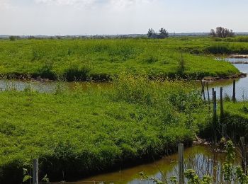
• Avec un peu de chance, beaux spécimens d'oiseaux à observer.

Stappen
• facile

Stappen
Stappen
• Au milieu des marais
Stappen
Stappen

Stappen
• Avec un peu de chance, beaux spécimens d'oiseaux à observer.

Stappen

Stappen
Stappen

Te voet

Stappen

Stappen

Stappen
Stappen
Stappen
Stappen
Stappen
Stappen
Te voet
20 tochten weergegeven op 47
Gratisgps-wandelapplicatie
 SityTrail
IGN / Geografische instituten
SityTrail World
De wereld gaat voor u open