![](/images/other/stat-length.png)
- Tochten
- Te voet
- France
- Pays de la Loire
- Mayenne
Mayenne, Pays de la Loire, Te voet: Top van de beste wandelroutes, trajecten, tochten en wandelingen
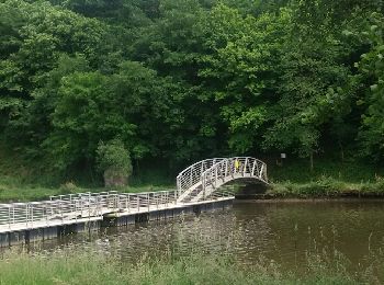
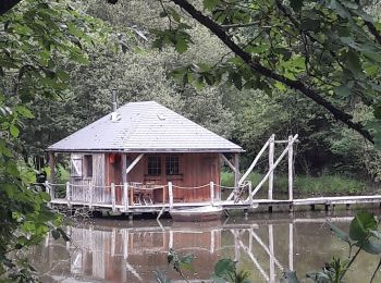
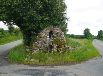
Mayenne: Ontdek de beste tochten: 104 te voet, 463 stappen, 29 noords wandelen, 1 lopen en 2 trail. Al deze tochten, trajecten, routes en outdoor activiteiten zijn beschikbaar in onze SityTrail-apps voor smartphones en tablets.
De beste trajecten (598)
![Tocht Stappen La Haie-Traversaine - rando autour du lac de Haute Mayenne - Photo](https://media.geolcdn.com/t/350/260/ext.jpg?maxdim=2&url=https%3A%2F%2Fservices.sitytrail.com%2FGeolivesWS%2FDownloadMedia.ashx%3FTrailID%3D583761%26Media%3Dfix__20160612164001.jpg)
![Stappen Stappen](https://static1.geolcdn.com/sitytour/trail-icons/101.png)
Km
Stappen
![](/images/other/stat-length.png)
![](https://static1.geolcdn.com/siteimages/upload/files/1508320355ic_sort_den_pos_24dp.png)
![](https://static1.geolcdn.com/siteimages/upload/files/1508320355ic_sort_den_neg_24dp.png)
![](https://static1.geolcdn.com/siteimages/upload/files/16400158638029165_repeat_loop_refresh_sync_direction_icon.png)
• Départ de la Haie Traversaine,prendre la route d'Ambrières Les Vallées et après avoir traverser La Colmont tourne...
![Tocht Stappen Forcé - tour forcé - Photo](https://media.geolcdn.com/t/350/260/0042aa54-0ec9-410d-80e6-bb08c22dfbbf.jpg&format=jpg&maxdim=2)
![Stappen Stappen](https://static1.geolcdn.com/sitytour/trail-icons/101.png)
Km
Stappen
![](/images/other/stat-length.png)
![](https://static1.geolcdn.com/siteimages/upload/files/1508320355ic_sort_den_pos_24dp.png)
![](https://static1.geolcdn.com/siteimages/upload/files/1508320355ic_sort_den_neg_24dp.png)
![](https://static1.geolcdn.com/siteimages/upload/files/16400158638029165_repeat_loop_refresh_sync_direction_icon.png)
![Tocht Te voet Le Ribay - FR-109 - Photo](https://media.geolcdn.com/t/350/260/0746fc10-822e-4d2e-8319-3e8efbb9fe20.jpeg&format=jpg&maxdim=2)
![Te voet Te voet](https://static1.geolcdn.com/sitytour/trail-icons/100.png)
Km
Te voet
![](/images/other/stat-length.png)
![](https://static1.geolcdn.com/siteimages/upload/files/1508320355ic_sort_den_pos_24dp.png)
![](https://static1.geolcdn.com/siteimages/upload/files/1508320355ic_sort_den_neg_24dp.png)
![](https://static1.geolcdn.com/siteimages/upload/files/16400158638029165_repeat_loop_refresh_sync_direction_icon.png)
• Website: http://randomontdesavaloirs.free.fr/
![Tocht Te voet Pré-en-Pail-Saint-Samson - Boucle du Bois Goude - Photo](https://media.geolcdn.com/t/350/260/a05d7528-5624-42b5-b6ce-fbdbd0f63bc6.jpeg&format=jpg&maxdim=2)
![Te voet Te voet](https://static1.geolcdn.com/sitytour/trail-icons/100.png)
Km
Te voet
![](/images/other/stat-length.png)
![](https://static1.geolcdn.com/siteimages/upload/files/1508320355ic_sort_den_pos_24dp.png)
![](https://static1.geolcdn.com/siteimages/upload/files/1508320355ic_sort_den_neg_24dp.png)
![](https://static1.geolcdn.com/siteimages/upload/files/16400158638029165_repeat_loop_refresh_sync_direction_icon.png)
• Website: http://randomontdesavaloirs.free.fr/
![Tocht Te voet Charchigné - Chemin du Bois Laurent - Photo](https://media.geolcdn.com/t/350/260/f9b6a605-b606-46b7-ace6-9cf6b65dc5c2.jpeg&format=jpg&maxdim=2)
![Te voet Te voet](https://static1.geolcdn.com/sitytour/trail-icons/100.png)
Km
Te voet
![](/images/other/stat-length.png)
![](https://static1.geolcdn.com/siteimages/upload/files/1508320355ic_sort_den_pos_24dp.png)
![](https://static1.geolcdn.com/siteimages/upload/files/1508320355ic_sort_den_neg_24dp.png)
![](https://static1.geolcdn.com/siteimages/upload/files/16400158638029165_repeat_loop_refresh_sync_direction_icon.png)
• Website: http://randomontdesavaloirs.free.fr/
![Tocht Te voet Pré-en-Pail-Saint-Samson - Boucle du Belvédère - Photo](https://media.geolcdn.com/t/350/260/86b01962-ba47-4a09-9125-4e227880329e.jpeg&format=jpg&maxdim=2)
![Te voet Te voet](https://static1.geolcdn.com/sitytour/trail-icons/100.png)
Km
Te voet
![](/images/other/stat-length.png)
![](https://static1.geolcdn.com/siteimages/upload/files/1508320355ic_sort_den_pos_24dp.png)
![](https://static1.geolcdn.com/siteimages/upload/files/1508320355ic_sort_den_neg_24dp.png)
![](https://static1.geolcdn.com/siteimages/upload/files/16400158638029165_repeat_loop_refresh_sync_direction_icon.png)
• Website: http://randomontdesavaloirs.free.fr/
![Tocht Te voet Saint-Pierre-des-Nids - Boucle du Moulin de Campas - Photo](https://media.geolcdn.com/t/350/260/98d53c49-9a56-4f6a-b411-1cf56960c8d1.jpeg&format=jpg&maxdim=2)
![Te voet Te voet](https://static1.geolcdn.com/sitytour/trail-icons/100.png)
Km
Te voet
![](/images/other/stat-length.png)
![](https://static1.geolcdn.com/siteimages/upload/files/1508320355ic_sort_den_pos_24dp.png)
![](https://static1.geolcdn.com/siteimages/upload/files/1508320355ic_sort_den_neg_24dp.png)
![](https://static1.geolcdn.com/siteimages/upload/files/16400158638029165_repeat_loop_refresh_sync_direction_icon.png)
• Website: http://randomontdesavaloirs.free.fr/
![Tocht Te voet Gesvres - Circuit du Pont de Cinq Pierres - Photo](https://media.geolcdn.com/t/350/260/92f847cb-3347-4063-a9e7-70d3d06941af.jpeg&format=jpg&maxdim=2)
![Te voet Te voet](https://static1.geolcdn.com/sitytour/trail-icons/100.png)
Km
Te voet
![](/images/other/stat-length.png)
![](https://static1.geolcdn.com/siteimages/upload/files/1508320355ic_sort_den_pos_24dp.png)
![](https://static1.geolcdn.com/siteimages/upload/files/1508320355ic_sort_den_neg_24dp.png)
![](https://static1.geolcdn.com/siteimages/upload/files/16400158638029165_repeat_loop_refresh_sync_direction_icon.png)
• Website: http://randomontdesavaloirs.free.fr/
![Tocht Te voet Ravigny - Chemin des 4 Saisons et des 5 Sens - Photo](https://media.geolcdn.com/t/350/260/795a9570-cdb6-408f-8e2b-549f63a6d1c5.jpeg&format=jpg&maxdim=2)
![Te voet Te voet](https://static1.geolcdn.com/sitytour/trail-icons/100.png)
Km
Te voet
![](/images/other/stat-length.png)
![](https://static1.geolcdn.com/siteimages/upload/files/1508320355ic_sort_den_pos_24dp.png)
![](https://static1.geolcdn.com/siteimages/upload/files/1508320355ic_sort_den_neg_24dp.png)
![](https://static1.geolcdn.com/siteimages/upload/files/16400158638029165_repeat_loop_refresh_sync_direction_icon.png)
• Website: http://randomontdesavaloirs.free.fr/
![Tocht Te voet Champfrémont - Sentier de Courtemiche - Photo](https://media.geolcdn.com/t/350/260/b07ef803-4de5-4243-9431-d78f0fa57af2.jpeg&format=jpg&maxdim=2)
![Te voet Te voet](https://static1.geolcdn.com/sitytour/trail-icons/100.png)
Km
Te voet
![](/images/other/stat-length.png)
![](https://static1.geolcdn.com/siteimages/upload/files/1508320355ic_sort_den_pos_24dp.png)
![](https://static1.geolcdn.com/siteimages/upload/files/1508320355ic_sort_den_neg_24dp.png)
![](https://static1.geolcdn.com/siteimages/upload/files/16400158638029165_repeat_loop_refresh_sync_direction_icon.png)
• Website: http://randomontdesavaloirs.free.fr/
![Tocht Te voet Pré-en-Pail-Saint-Samson - Circuit des Avaloirs - Photo](https://media.geolcdn.com/t/350/260/86b01962-ba47-4a09-9125-4e227880329e.jpeg&format=jpg&maxdim=2)
![Te voet Te voet](https://static1.geolcdn.com/sitytour/trail-icons/100.png)
Km
Te voet
![](/images/other/stat-length.png)
![](https://static1.geolcdn.com/siteimages/upload/files/1508320355ic_sort_den_pos_24dp.png)
![](https://static1.geolcdn.com/siteimages/upload/files/1508320355ic_sort_den_neg_24dp.png)
![](https://static1.geolcdn.com/siteimages/upload/files/16400158638029165_repeat_loop_refresh_sync_direction_icon.png)
• Website: http://randomontdesavaloirs.free.fr/
![Tocht Te voet Madré - Boucle du Tenet - Photo](https://media.geolcdn.com/t/350/260/77ecafcc-d5d6-435a-9ada-60f957559332.jpeg&format=jpg&maxdim=2)
![Te voet Te voet](https://static1.geolcdn.com/sitytour/trail-icons/100.png)
Km
Te voet
![](/images/other/stat-length.png)
![](https://static1.geolcdn.com/siteimages/upload/files/1508320355ic_sort_den_pos_24dp.png)
![](https://static1.geolcdn.com/siteimages/upload/files/1508320355ic_sort_den_neg_24dp.png)
![](https://static1.geolcdn.com/siteimages/upload/files/16400158638029165_repeat_loop_refresh_sync_direction_icon.png)
• Website: http://randomontdesavaloirs.free.fr/
![Tocht Te voet Madré - Boucle de Saint-Julien - Photo](https://media.geolcdn.com/t/350/260/d7ea690c-f0e6-4d1b-b47e-16db82a1d263.jpeg&format=jpg&maxdim=2)
![Te voet Te voet](https://static1.geolcdn.com/sitytour/trail-icons/100.png)
Km
Te voet
![](/images/other/stat-length.png)
![](https://static1.geolcdn.com/siteimages/upload/files/1508320355ic_sort_den_pos_24dp.png)
![](https://static1.geolcdn.com/siteimages/upload/files/1508320355ic_sort_den_neg_24dp.png)
![](https://static1.geolcdn.com/siteimages/upload/files/16400158638029165_repeat_loop_refresh_sync_direction_icon.png)
• Website: http://randomontdesavaloirs.free.fr/
![Tocht Te voet Madré - Boucle de l'Hirondelle - Photo](https://media.geolcdn.com/t/350/260/a3a9699e-267a-48b8-adbc-0e33c83e4c78.jpeg&format=jpg&maxdim=2)
![Te voet Te voet](https://static1.geolcdn.com/sitytour/trail-icons/100.png)
Km
Te voet
![](/images/other/stat-length.png)
![](https://static1.geolcdn.com/siteimages/upload/files/1508320355ic_sort_den_pos_24dp.png)
![](https://static1.geolcdn.com/siteimages/upload/files/1508320355ic_sort_den_neg_24dp.png)
![](https://static1.geolcdn.com/siteimages/upload/files/16400158638029165_repeat_loop_refresh_sync_direction_icon.png)
• Website: http://randomontdesavaloirs.free.fr/
![Tocht Te voet Javron-les-Chapelles - Boucle de la Grotte - Photo](https://media.geolcdn.com/t/350/260/2b935b0e-d295-4ba1-9313-73f2bb6243c7.jpeg&format=jpg&maxdim=2)
![Te voet Te voet](https://static1.geolcdn.com/sitytour/trail-icons/100.png)
Km
Te voet
![](/images/other/stat-length.png)
![](https://static1.geolcdn.com/siteimages/upload/files/1508320355ic_sort_den_pos_24dp.png)
![](https://static1.geolcdn.com/siteimages/upload/files/1508320355ic_sort_den_neg_24dp.png)
![](https://static1.geolcdn.com/siteimages/upload/files/16400158638029165_repeat_loop_refresh_sync_direction_icon.png)
• Website: http://randomontdesavaloirs.free.fr/
![Tocht Te voet Javron-les-Chapelles - Boucle des Ardoisières - Photo](https://media.geolcdn.com/t/350/260/2b935b0e-d295-4ba1-9313-73f2bb6243c7.jpeg&format=jpg&maxdim=2)
![Te voet Te voet](https://static1.geolcdn.com/sitytour/trail-icons/100.png)
Km
Te voet
![](/images/other/stat-length.png)
![](https://static1.geolcdn.com/siteimages/upload/files/1508320355ic_sort_den_pos_24dp.png)
![](https://static1.geolcdn.com/siteimages/upload/files/1508320355ic_sort_den_neg_24dp.png)
![](https://static1.geolcdn.com/siteimages/upload/files/16400158638029165_repeat_loop_refresh_sync_direction_icon.png)
• Website: http://randomontdesavaloirs.free.fr/
![Tocht Te voet Hardanges - Sentier des Buttes d'Hardanges - Photo](https://media.geolcdn.com/t/350/260/e103846b-6a6b-4884-bd81-7e1192a3b663.jpeg&format=jpg&maxdim=2)
![Te voet Te voet](https://static1.geolcdn.com/sitytour/trail-icons/100.png)
Km
Te voet
![](/images/other/stat-length.png)
![](https://static1.geolcdn.com/siteimages/upload/files/1508320355ic_sort_den_pos_24dp.png)
![](https://static1.geolcdn.com/siteimages/upload/files/1508320355ic_sort_den_neg_24dp.png)
![](https://static1.geolcdn.com/siteimages/upload/files/16400158638029165_repeat_loop_refresh_sync_direction_icon.png)
• Website: http://randomontdesavaloirs.free.fr/
![Tocht Te voet Pré-en-Pail-Saint-Samson - Boucle de l'Oratoire - Photo](https://media.geolcdn.com/t/350/260/a05d7528-5624-42b5-b6ce-fbdbd0f63bc6.jpeg&format=jpg&maxdim=2)
![Te voet Te voet](https://static1.geolcdn.com/sitytour/trail-icons/100.png)
Km
Te voet
![](/images/other/stat-length.png)
![](https://static1.geolcdn.com/siteimages/upload/files/1508320355ic_sort_den_pos_24dp.png)
![](https://static1.geolcdn.com/siteimages/upload/files/1508320355ic_sort_den_neg_24dp.png)
![](https://static1.geolcdn.com/siteimages/upload/files/16400158638029165_repeat_loop_refresh_sync_direction_icon.png)
• Website: http://randomontdesavaloirs.free.fr/
![Tocht Te voet Pré-en-Pail-Saint-Samson - Boucle du Souprat - Photo](https://media.geolcdn.com/t/350/260/a05d7528-5624-42b5-b6ce-fbdbd0f63bc6.jpeg&format=jpg&maxdim=2)
![Te voet Te voet](https://static1.geolcdn.com/sitytour/trail-icons/100.png)
Km
Te voet
![](/images/other/stat-length.png)
![](https://static1.geolcdn.com/siteimages/upload/files/1508320355ic_sort_den_pos_24dp.png)
![](https://static1.geolcdn.com/siteimages/upload/files/1508320355ic_sort_den_neg_24dp.png)
![](https://static1.geolcdn.com/siteimages/upload/files/16400158638029165_repeat_loop_refresh_sync_direction_icon.png)
• Website: http://randomontdesavaloirs.free.fr/
![Tocht Te voet Pré-en-Pail-Saint-Samson - Sentier de Prez - Photo](https://media.geolcdn.com/t/350/260/3d537184-058f-4b66-940b-1fd6e3936fd9.jpeg&format=jpg&maxdim=2)
![Te voet Te voet](https://static1.geolcdn.com/sitytour/trail-icons/100.png)
Km
Te voet
![](/images/other/stat-length.png)
![](https://static1.geolcdn.com/siteimages/upload/files/1508320355ic_sort_den_pos_24dp.png)
![](https://static1.geolcdn.com/siteimages/upload/files/1508320355ic_sort_den_neg_24dp.png)
![](https://static1.geolcdn.com/siteimages/upload/files/16400158638029165_repeat_loop_refresh_sync_direction_icon.png)
• Website: http://randomontdesavaloirs.free.fr/
20 tochten weergegeven op 598
Gratisgps-wandelapplicatie
Activiteiten
Nabije regio's
- Ahuillé
- Ambrières-les-Vallées
- Andouillé
- Argentré
- Aron
- Assé-le-Bérenger
- Athée
- Averton
- Bais
- Bazougers
- Beaulieu-sur-Oudon
- Bierné-les-Villages
- Blandouet-Saint Jean
- Bonchamp-lès-Laval
- Bouchamps-lès-Craon
- Bouère
- Boulay-les-Ifs
- Bourgon
- Brecé
- Brée
- Carelles
- Chailland
- Châlons-du-Maine
- Champéon
- Champfrémont
- Champgenéteux
- Changé
- Charchigné
- Château-Gontier-sur-Mayenne
- Châtillon-sur-Colmont
- Chemazé
- Chémeré-le-Roi
- Chevaigné-du-Maine
- Colombiers-du-Plessis
- Commer
- Contest
- Cosmes
- Cossé-le-Vivien
- Coudray
- Couesmes-Vaucé
- Couptrain
- Courbeveille
- Courcité
- Craon
- Crennes-sur-Fraubée
- Cuillé
- Daon
- Denazé
- Désertines
- Entrammes
- Ernée
- Évron
- Forcé
- Fougerolles-du-Plessis
- Fromentières
- Gennes-Longuefuye
- Gesnes
- Gesvres
- Gorron
- Grez-en-Bouère
- Hambers
- Hardanges
- Houssay
- Izé
- Javron-les-Chapelles
- Jublains
- Juvigné
- L'Huisserie
- La Baconnière
- La Bazouge-de-Chemeré
- La Bazouge-des-Alleux
- La Bigottière
- La Brûlatte
- La Chapelle-Anthenaise
- La Chapelle-Craonnaise
- La Chapelle-Rainsouin
- La Chapelle-au-Riboul
- La Croixille
- La Cropte
- La Dorée
- La Gravelle
- La Haie-Traversaine
- La Pallu
- La Pellerine
- La Roche-Neuville
- La Rouaudière
- La Selle-Craonnaise
- Landivy
- Larchamp
- Lassay-les-Châteaux
- Launay-Villiers
- Laval
- Le Bourgneuf-la-Forêt
- Le Genest-Saint-Isle
- Le Ham
- Le Ribay
- Levaré
- Lignières-Orgères
- Loiron-Ruillé
- Loupfougères
- Louverné
- Louvigné
- Madré
- Maisoncelles-du-Maine
- Marcillé-la-Ville
- Marigné-Peuton
- Martigné-sur-Mayenne
- Mayenne
- Ménil
- Méral
- Meslay-du-Maine
- Mézangers
- Montaudin
- Montenay
- Montflours
- Montigné-le-Brillant
- Montjean
- Montsûrs
- Moulay
- Neau
- Neuilly-le-Vendin
- Niafles
- Nuillé-sur-Vicoin
- Oisseau
- Olivet
- Origné
- Parigné-sur-Braye
- Parné-sur-Roc
- Placé
- Pommerieux
- Pontmain
- Port-Brillet
- Pré-en-Pail-Saint-Samson
- Prée-d'Anjou
- Quelaines-Saint-Gault
- Ravigny
- Renazé
- Ruillé-Froid-Fonds
- Sacé
- Saint-Aignan-de-Couptrain
- Saint-Aignan-sur-Roë
- Saint-Baudelle
- Saint-Berthevin
- Saint-Berthevin-la-Tannière
- Saint-Brice
- Saint-Calais-du-Désert
- Saint-Charles-la-Forêt
- Saint-Cyr-en-Pail
- Saint-Cyr-le-Gravelais
- Saint-Denis-d'Anjou
- Saint-Denis-de-Gastines
- Saint-Denis-du-Maine
- Saint-Fraimbault-de-Prières
- Saint-Georges-Buttavent
- Saint-Georges-sur-Erve
- Saint-Germain-d'Anxure
- Saint-Germain-de-Coulamer
- Saint-Germain-le-Fouilloux
- Saint-Hilaire-du-Maine
- Saint-Jean-sur-Mayenne
- Saint-Julien-du-Terroux
- Saint-Loup-du-Dorat
- Saint-Loup-du-Gast
- Saint-Mars-du-Désert
- Saint-Mars-sur-la-Futaie
- Saint-Ouën-des-Toits
- Saint-Pierre-des-Landes
- Saint-Pierre-des-Nids
- Saint-Pierre-la-Cour
- Saint-Pierre-sur-Erve
- Saint-Thomas-de-Courceriers
- Sainte-Gemmes-le-Robert
- Sainte-Suzanne-et-Chammes
- Saulges
- Soulgé-sur-Ouette
- Thorigné-en-Charnie
- Torcé-Viviers-en-Charnie
- Trans
- Vaiges
- Val-du-Maine
- Vautorte
- Villaines-la-Juhel
- Villepail
- Villiers-Charlemagne
- Vimartin-sur-Orthe
- Voutré