![](/images/other/stat-length.png)
- Tochten
- Te voet
- France
- Pays de la Loire
- Sarthe
Sarthe, Pays de la Loire, Te voet: Top van de beste wandelroutes, trajecten, tochten en wandelingen
Sarthe: Ontdek de beste tochten: 41 te voet, 548 stappen, 376 noords wandelen en 69 lopen. Al deze tochten, trajecten, routes en outdoor activiteiten zijn beschikbaar in onze SityTrail-apps voor smartphones en tablets.
De beste trajecten (1022)
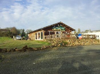
![Tocht Stappen Pontvallain - pontvallain circuit bleu - Photo](https://media.geolcdn.com/t/350/260/ext.jpg?maxdim=2&url=https%3A%2F%2Fservices.sitytrail.com%2FGeolivesWS%2FDownloadMedia.ashx%3FTrailID%3D162486%26Media%3D20121108100753.jpeg)
![Stappen Stappen](https://static1.geolcdn.com/sitytour/trail-icons/101.png)
Km
Stappen
![](/images/other/stat-length.png)
![](https://static1.geolcdn.com/siteimages/upload/files/1508320355ic_sort_den_pos_24dp.png)
![](https://static1.geolcdn.com/siteimages/upload/files/1508320355ic_sort_den_neg_24dp.png)
![](https://static1.geolcdn.com/siteimages/upload/files/16400158638029165_repeat_loop_refresh_sync_direction_icon.png)
![Tocht Stappen Sablé-sur-Sarthe - En forêt de Pincé - Photo](https://media.geolcdn.com/t/350/260/ext.jpg?maxdim=2&url=https%3A%2F%2Fservices.sitytrail.com%2FGeolivesWS%2FDownloadMedia.ashx%3FTrailID%3D102584%26Media%3D3480_1.jpg)
![Stappen Stappen](https://static1.geolcdn.com/sitytour/trail-icons/101.png)
Km
Stappen
![](/images/other/stat-length.png)
![](https://static1.geolcdn.com/siteimages/upload/files/1508320355ic_sort_den_pos_24dp.png)
![](https://static1.geolcdn.com/siteimages/upload/files/1508320355ic_sort_den_neg_24dp.png)
![](https://static1.geolcdn.com/siteimages/upload/files/16400158638029165_repeat_loop_refresh_sync_direction_icon.png)
![Tocht Stappen Bonnétable - la vive parence - Photo](https://media.geolcdn.com/t/350/260/ext.jpg?maxdim=2&url=https%3A%2F%2Fstatic1.geolcdn.com%2Fsiteimages%2Fupload%2Ffiles%2F1553511878bg_sport_marche.png)
![Stappen Stappen](https://static1.geolcdn.com/sitytour/trail-icons/101.png)
Km
Stappen
![](/images/other/stat-length.png)
![](https://static1.geolcdn.com/siteimages/upload/files/1508320355ic_sort_den_pos_24dp.png)
![](https://static1.geolcdn.com/siteimages/upload/files/1508320355ic_sort_den_neg_24dp.png)
![](https://static1.geolcdn.com/siteimages/upload/files/16400158638029165_repeat_loop_refresh_sync_direction_icon.png)
![Tocht Stappen Saint-Léonard-des-Bois - St Léonard Narbonne 10km - Photo](https://media.geolcdn.com/t/350/260/ext.jpg?maxdim=2&url=https%3A%2F%2Fstatic1.geolcdn.com%2Fsiteimages%2Fupload%2Ffiles%2F1553511878bg_sport_marche.png)
![Stappen Stappen](https://static1.geolcdn.com/sitytour/trail-icons/101.png)
Km
Stappen
![](/images/other/stat-length.png)
![](https://static1.geolcdn.com/siteimages/upload/files/1508320355ic_sort_den_pos_24dp.png)
![](https://static1.geolcdn.com/siteimages/upload/files/1508320355ic_sort_den_neg_24dp.png)
![](https://static1.geolcdn.com/siteimages/upload/files/16400158638029165_repeat_loop_refresh_sync_direction_icon.png)
![Tocht Te voet Saint-Paul-le-Gaultier - Le Bois de Chemasson - Photo](https://media.geolcdn.com/t/350/260/ff95c566-5307-4d11-b561-b3411b7fcbe5.jpeg&format=jpg&maxdim=2)
![Te voet Te voet](https://static1.geolcdn.com/sitytour/trail-icons/100.png)
Km
Te voet
![](/images/other/stat-length.png)
![](https://static1.geolcdn.com/siteimages/upload/files/1508320355ic_sort_den_pos_24dp.png)
![](https://static1.geolcdn.com/siteimages/upload/files/1508320355ic_sort_den_neg_24dp.png)
![](https://static1.geolcdn.com/siteimages/upload/files/16400158638029165_repeat_loop_refresh_sync_direction_icon.png)
• Envie de nature, envie de patrimoine, envie d’activités? Et si vous veniez explorer les Alpes Mancelles! Website: ht...
![Tocht Te voet Saint-Léonard-des-Bois - Vallée de Misère - Photo](https://media.geolcdn.com/t/350/260/7fc7be85-cc05-431c-a859-1b7cad4d3195.jpeg&format=jpg&maxdim=2)
![Te voet Te voet](https://static1.geolcdn.com/sitytour/trail-icons/100.png)
Km
Te voet
![](/images/other/stat-length.png)
![](https://static1.geolcdn.com/siteimages/upload/files/1508320355ic_sort_den_pos_24dp.png)
![](https://static1.geolcdn.com/siteimages/upload/files/1508320355ic_sort_den_neg_24dp.png)
![](https://static1.geolcdn.com/siteimages/upload/files/16400158638029165_repeat_loop_refresh_sync_direction_icon.png)
• Envie de nature, envie de patrimoine, envie d’activités? Et si vous veniez explorer les Alpes Mancelles! Website: ht...
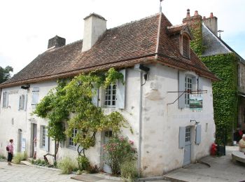
![Tocht Te voet Saint-Léonard-des-Bois - Les méandres de la Sarthe - Photo](https://media.geolcdn.com/t/350/260/59495368-fec3-427c-ab17-f336a308f404.jpeg&format=jpg&maxdim=2)
![Te voet Te voet](https://static1.geolcdn.com/sitytour/trail-icons/100.png)
Km
Te voet
![](/images/other/stat-length.png)
![](https://static1.geolcdn.com/siteimages/upload/files/1508320355ic_sort_den_pos_24dp.png)
![](https://static1.geolcdn.com/siteimages/upload/files/1508320355ic_sort_den_neg_24dp.png)
![](https://static1.geolcdn.com/siteimages/upload/files/16400158638029165_repeat_loop_refresh_sync_direction_icon.png)
• Website: http://randomontdesavaloirs.free.fr/
![Tocht Te voet Saint-Jean-de-la-Motte - Sentier de la Mare aux Cochons - Photo](https://media.geolcdn.com/t/350/260/57e54e19-dee3-4b3f-8763-a2fb5e9d29a7.jpeg&format=jpg&maxdim=2)
![Te voet Te voet](https://static1.geolcdn.com/sitytour/trail-icons/100.png)
Km
Te voet
![](/images/other/stat-length.png)
![](https://static1.geolcdn.com/siteimages/upload/files/1508320355ic_sort_den_pos_24dp.png)
![](https://static1.geolcdn.com/siteimages/upload/files/1508320355ic_sort_den_neg_24dp.png)
![](https://static1.geolcdn.com/siteimages/upload/files/16400158638029165_repeat_loop_refresh_sync_direction_icon.png)
• Trail created by Les Sentiers de la Motte.
![Tocht Te voet Saint-Jean-de-la-Motte - Sentier du Château de Gallerande - Photo](https://media.geolcdn.com/t/350/260/57e54e19-dee3-4b3f-8763-a2fb5e9d29a7.jpeg&format=jpg&maxdim=2)
![Te voet Te voet](https://static1.geolcdn.com/sitytour/trail-icons/100.png)
Km
Te voet
![](/images/other/stat-length.png)
![](https://static1.geolcdn.com/siteimages/upload/files/1508320355ic_sort_den_pos_24dp.png)
![](https://static1.geolcdn.com/siteimages/upload/files/1508320355ic_sort_den_neg_24dp.png)
![](https://static1.geolcdn.com/siteimages/upload/files/16400158638029165_repeat_loop_refresh_sync_direction_icon.png)
• Trail created by Les Sentiers de la Motte.
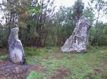
![Tocht Te voet Saint-Jean-de-la-Motte - Sentier des Menhirs - Photo](https://media.geolcdn.com/t/350/260/3b7462e0-43cd-484c-8512-9fdccca9e4e8.jpeg&format=jpg&maxdim=2)
![Te voet Te voet](https://static1.geolcdn.com/sitytour/trail-icons/100.png)
Km
Te voet
![](/images/other/stat-length.png)
![](https://static1.geolcdn.com/siteimages/upload/files/1508320355ic_sort_den_pos_24dp.png)
![](https://static1.geolcdn.com/siteimages/upload/files/1508320355ic_sort_den_neg_24dp.png)
![](https://static1.geolcdn.com/siteimages/upload/files/16400158638029165_repeat_loop_refresh_sync_direction_icon.png)
• Trail created by Les Sentiers de la Motte.
![Tocht Stappen Neufchâtel-en-Saosnois - Perseigne - Abbaye 8,3 km - Photo](https://media.geolcdn.com/t/350/260/ext.jpg?maxdim=2&url=https%3A%2F%2Fstatic1.geolcdn.com%2Fsiteimages%2Fupload%2Ffiles%2F1553511878bg_sport_marche.png)
![Stappen Stappen](https://static1.geolcdn.com/sitytour/trail-icons/101.png)
Km
Stappen
![](/images/other/stat-length.png)
![](https://static1.geolcdn.com/siteimages/upload/files/1508320355ic_sort_den_pos_24dp.png)
![](https://static1.geolcdn.com/siteimages/upload/files/1508320355ic_sort_den_neg_24dp.png)
![](https://static1.geolcdn.com/siteimages/upload/files/16400158638029165_repeat_loop_refresh_sync_direction_icon.png)
![Tocht Stappen Arçonnay - Arconnay - Photo](https://media.geolcdn.com/t/350/260/ext.jpg?maxdim=2&url=https%3A%2F%2Fstatic1.geolcdn.com%2Fsiteimages%2Fupload%2Ffiles%2F1553511878bg_sport_marche.png)
![Stappen Stappen](https://static1.geolcdn.com/sitytour/trail-icons/101.png)
Km
Stappen
![](/images/other/stat-length.png)
![](https://static1.geolcdn.com/siteimages/upload/files/1508320355ic_sort_den_pos_24dp.png)
![](https://static1.geolcdn.com/siteimages/upload/files/1508320355ic_sort_den_neg_24dp.png)
![](https://static1.geolcdn.com/siteimages/upload/files/16400158638029165_repeat_loop_refresh_sync_direction_icon.png)
•
![Tocht Stappen Fyé - château de Meslay - Fresnay - Photo](https://media.geolcdn.com/t/350/260/ext.jpg?maxdim=2&url=https%3A%2F%2Fstatic1.geolcdn.com%2Fsiteimages%2Fupload%2Ffiles%2F1553511878bg_sport_marche.png)
![Stappen Stappen](https://static1.geolcdn.com/sitytour/trail-icons/101.png)
Km
Stappen
![](/images/other/stat-length.png)
![](https://static1.geolcdn.com/siteimages/upload/files/1508320355ic_sort_den_pos_24dp.png)
![](https://static1.geolcdn.com/siteimages/upload/files/1508320355ic_sort_den_neg_24dp.png)
![](https://static1.geolcdn.com/siteimages/upload/files/16400158638029165_repeat_loop_refresh_sync_direction_icon.png)
![Tocht Stappen Saint-Mars-d'Outillé - Saint Mars d'Outillé - Circuit bleu - Photo](https://media.geolcdn.com/t/350/260/ext.jpg?maxdim=2&url=https%3A%2F%2Fstatic1.geolcdn.com%2Fsiteimages%2Fupload%2Ffiles%2F1553511878bg_sport_marche.png)
![Stappen Stappen](https://static1.geolcdn.com/sitytour/trail-icons/101.png)
Km
Stappen
![](/images/other/stat-length.png)
![](https://static1.geolcdn.com/siteimages/upload/files/1508320355ic_sort_den_pos_24dp.png)
![](https://static1.geolcdn.com/siteimages/upload/files/1508320355ic_sort_den_neg_24dp.png)
![](https://static1.geolcdn.com/siteimages/upload/files/16400158638029165_repeat_loop_refresh_sync_direction_icon.png)
![Tocht Stappen Saint-Georges-du-Rosay - Rosay et Jugeaux - Photo](https://media.geolcdn.com/t/350/260/af2a8428-78e5-4006-865e-2bb77d77453a.jpg&format=jpg&maxdim=2)
![Stappen Stappen](https://static1.geolcdn.com/sitytour/trail-icons/101.png)
Km
Stappen
![](/images/other/stat-length.png)
![](https://static1.geolcdn.com/siteimages/upload/files/1508320355ic_sort_den_pos_24dp.png)
![](https://static1.geolcdn.com/siteimages/upload/files/1508320355ic_sort_den_neg_24dp.png)
![](https://static1.geolcdn.com/siteimages/upload/files/16400158638029165_repeat_loop_refresh_sync_direction_icon.png)
![Tocht Stappen Saint-Léonard-des-Bois - 4 = St Léonard des bois - Mont St Jean - Photo](https://media.geolcdn.com/t/350/260/f028599f-c77e-4b20-be32-2c2027f75247.jpg&format=jpg&maxdim=2)
![Stappen Stappen](https://static1.geolcdn.com/sitytour/trail-icons/101.png)
Km
Stappen
![](/images/other/stat-length.png)
![](https://static1.geolcdn.com/siteimages/upload/files/1508320355ic_sort_den_pos_24dp.png)
![](https://static1.geolcdn.com/siteimages/upload/files/1508320355ic_sort_den_neg_24dp.png)
![](https://static1.geolcdn.com/siteimages/upload/files/16400158638029165_repeat_loop_refresh_sync_direction_icon.png)
![Tocht Stappen Fresnay-sur-Sarthe - 3 = Fresnay sur Sarthe - St Léonard des bois - Photo](https://media.geolcdn.com/t/350/260/8019252f-6fee-4100-8366-490c156746e2.jpg&format=jpg&maxdim=2)
![Stappen Stappen](https://static1.geolcdn.com/sitytour/trail-icons/101.png)
Km
Stappen
![](/images/other/stat-length.png)
![](https://static1.geolcdn.com/siteimages/upload/files/1508320355ic_sort_den_pos_24dp.png)
![](https://static1.geolcdn.com/siteimages/upload/files/1508320355ic_sort_den_neg_24dp.png)
![](https://static1.geolcdn.com/siteimages/upload/files/16400158638029165_repeat_loop_refresh_sync_direction_icon.png)
![Tocht Stappen Saint-Léonard-des-Bois - Saint Léonard des Bois - 30 mars 2022 - Photo](https://media.geolcdn.com/t/350/260/4e99ac1e-3e54-4b5b-8c44-bbd31402c1a6.jpg&format=jpg&maxdim=2)
![Stappen Stappen](https://static1.geolcdn.com/sitytour/trail-icons/101.png)
Km
Stappen
![](/images/other/stat-length.png)
![](https://static1.geolcdn.com/siteimages/upload/files/1508320355ic_sort_den_pos_24dp.png)
![](https://static1.geolcdn.com/siteimages/upload/files/1508320355ic_sort_den_neg_24dp.png)
![](https://static1.geolcdn.com/siteimages/upload/files/16400158638029165_repeat_loop_refresh_sync_direction_icon.png)
![Tocht Stappen Saint-Léonard-des-Bois - Saint Léonard des Bois - Photo](https://media.geolcdn.com/t/350/260/4e91d3f9-5d7e-4e92-8c1c-e6064c350a4e.jpg&format=jpg&maxdim=2)
![Stappen Stappen](https://static1.geolcdn.com/sitytour/trail-icons/101.png)
Km
Stappen
![](/images/other/stat-length.png)
![](https://static1.geolcdn.com/siteimages/upload/files/1508320355ic_sort_den_pos_24dp.png)
![](https://static1.geolcdn.com/siteimages/upload/files/1508320355ic_sort_den_neg_24dp.png)
![](https://static1.geolcdn.com/siteimages/upload/files/16400158638029165_repeat_loop_refresh_sync_direction_icon.png)
![Tocht Te voet Parcé-sur-Sarthe - Circuit du Bois du l'Hommeau - Photo](https://media.geolcdn.com/t/350/260/f033e7e3-b0c0-458d-a7d6-8285acd1b488.jpeg&format=jpg&maxdim=2)
![Te voet Te voet](https://static1.geolcdn.com/sitytour/trail-icons/100.png)
Km
Te voet
![](/images/other/stat-length.png)
![](https://static1.geolcdn.com/siteimages/upload/files/1508320355ic_sort_den_pos_24dp.png)
![](https://static1.geolcdn.com/siteimages/upload/files/1508320355ic_sort_den_neg_24dp.png)
![](https://static1.geolcdn.com/siteimages/upload/files/16400158638029165_repeat_loop_refresh_sync_direction_icon.png)
20 tochten weergegeven op 1022
Gratisgps-wandelapplicatie
Activiteiten
Nabije regio's
- Aigné
- Aillières-Beauvoir
- Allonnes
- Ancinnes
- Arçonnay
- Ardenay-sur-Mérize
- Arnage
- Arthezé
- Asnières-sur-Vègre
- Assé-le-Boisne
- Assé-le-Riboul
- Aubigné-Racan
- Auvers-le-Hamon
- Auvers-sous-Montfaucon
- Avessé
- Avezé
- Avoise
- Ballon-Saint Mars
- Bazouges Cré sur Loir
- Beaufay
- Beaumont-Pied-de-Bœuf
- Beaumont-sur-Dême
- Beaumont-sur-Sarthe
- Beillé
- Berfay
- Bernay-Neuvy-en-Champagne
- Bérus
- Bessé-sur-Braye
- Béthon
- Blèves
- Boëssé-le-Sec
- Bonnétable
- Bouër
- Bouloire
- Bourg-le-Roi
- Bousse
- Brains-sur-Gée
- Brette-les-Pins
- Briosne-lès-Sables
- Brûlon
- Cérans-Foulletourte
- Chahaignes
- Challes
- Champagné
- Champfleur
- Champrond
- Changé
- Chantenay-Villedieu
- Chassillé
- Château-l'Hermitage
- Chemiré-en-Charnie
- Chenay
- Chenu
- Chérancé
- Chérisay
- Cherré-Au
- Chevillé
- Clermont-Créans
- Conflans-sur-Anille
- Congé-sur-Orne
- Conlie
- Connerré
- Contilly
- Coudrecieux
- Coulaines
- Coulans-sur-Gée
- Coulongé
- Courcebœufs
- Courcelles-la-Forêt
- Courcemont
- Courdemanche
- Courgenard
- Courtillers
- Crannes-en-Champagne
- Crissé
- Crosmières
- Cures
- Dehault
- Dissay-sous-Courcillon
- Dollon
- Domfront-en-Champagne
- Douillet
- Duneau
- Dureil
- Écommoy
- Écorpain
- Épineu-le-Chevreuil
- Étival-lès-le-Mans
- Fatines
- Fercé-sur-Sarthe
- Fillé
- Flée
- Fresnay-sur-Sarthe
- Fyé
- Gesnes-le-Gandelin
- Grandchamp
- Gréez-sur-Roc
- Guécélard
- Joué-en-Charnie
- Joué-l'Abbé
- Juigné-sur-Sarthe
- Juillé
- Jupilles
- La Bazoge
- La Bosse
- La Bruère-sur-Loir
- La Chapelle-Huon
- La Chapelle-Saint-Aubin
- La Chapelle-Saint-Fray
- La Chapelle-Saint-Rémy
- La Chapelle-aux-Choux
- La Chapelle-d'Aligné
- La Chapelle-du-Bois
- La Chartre-sur-le-Loir
- La Ferté-Bernard
- La Flèche
- La Fontaine-Saint-Martin
- La Guierche
- La Milesse
- La Suze-sur-Sarthe
- Laigné-en-Belin
- Lamnay
- Lavardin
- Lavaré
- Lavernat
- Le Breil-sur-Mérize
- Le Grand-Lucé
- Le Grez
- Le Luart
- Le Lude
- Le Mans
- Les Mées
- Lhomme
- Ligron
- Livet-en-Saosnois
- Loir en Vallée
- Lombron
- Longnes
- Loué
- Louplande
- Louvigny
- Louzes
- Lucé-sous-Ballon
- Luceau
- Luché-Pringé
- Maigné
- Maisoncelles
- Malicorne-sur-Sarthe
- Mamers
- Mansigné
- Marçon
- Mareil-en-Champagne
- Maresché
- Marigné-Laillé
- Marolles-les-Braults
- Marolles-lès-Saint-Calais
- Mayet
- Melleray
- Mézeray
- Mézières-sous-Lavardin
- Mézières-sur-Ponthouin
- Moncé-en-Belin
- Mont-Saint-Jean
- Montaillé
- Montbizot
- Montfort-le-Gesnois
- Montmirail
- Montreuil-le-Chétif
- Montreuil-le-Henri
- Montval-sur-Loir
- Moulins-le-Carbonnel
- Mulsanne
- Neufchâtel-en-Saosnois
- Neuvillalais
- Neuville-sur-Sarthe
- Neuvillette-en-Charnie
- Nogent-le-Bernard
- Notre-Dame-du-Pé
- Noyen-sur-Sarthe
- Oisseau-le-Petit
- Oizé
- Parcé-sur-Sarthe
- Parennes
- Parigné-l'Évêque
- Parigné-le-Pôlin
- Pezé-le-Robert
- Piacé
- Pincé
- Pirmil
- Poillé-sur-Vègre
- Pontvallain
- Précigné
- Préval
- Prévelles
- Pruillé-l'Éguillé
- Pruillé-le-Chétif
- Requeil
- Roézé-sur-Sarthe
- Rouessé-Fontaine
- Rouessé-Vassé
- Rouez
- Rouillon
- Ruaudin
- Ruillé-en-Champagne
- Sablé-sur-Sarthe
- Saint-Aubin-de-Locquenay
- Saint-Aubin-des-Coudrais
- Saint-Biez-en-Belin
- Saint-Calais
- Saint-Célerin
- Saint-Christophe-du-Jambet
- Saint-Christophe-en-Champagne
- Saint-Corneille
- Saint-Cosme-en-Vairais
- Saint-Denis-d'Orques
- Saint-Denis-des-Coudrais
- Saint-Georges-de-la-Couée
- Saint-Georges-du-Bois
- Saint-Georges-du-Rosay
- Saint-Georges-le-Gaultier
- Saint-Germain-d'Arcé
- Saint-Gervais-de-Vic
- Saint-Gervais-en-Belin
- Saint-Jean-d'Assé
- Saint-Jean-de-la-Motte
- Saint-Jean-des-Échelles
- Saint-Jean-du-Bois
- Saint-Léonard-des-Bois
- Saint-Longis
- Saint-Maixent
- Saint-Mars-d'Outillé
- Saint-Mars-de-Locquenay
- Saint-Mars-la-Brière
- Saint-Martin-des-Monts
- Saint-Michel-de-Chavaignes
- Saint-Ouen-de-Mimbré
- Saint-Ouen-en-Belin
- Saint-Paterne - Le Chevain
- Saint-Paul-le-Gaultier
- Saint-Pavace
- Saint-Pierre-de-Chevillé
- Saint-Pierre-des-Ormes
- Saint-Pierre-du-Lorouër
- Saint-Rémy-de-Sillé
- Saint-Rémy-du-Val
- Saint-Saturnin
- Saint-Symphorien
- Saint-Ulphace
- Saint-Victeur
- Saint-Vincent-des-Prés
- Saint-Vincent-du-Lorouër
- Sainte-Jamme-sur-Sarthe
- Sainte-Sabine-sur-Longève
- Sarcé
- Sargé-lès-le-Mans
- Savigné-l'Évêque
- Sceaux-sur-Huisne
- Ségrie
- Semur-en-Vallon
- Sillé-le-Guillaume
- Sillé-le-Philippe
- Solesmes
- Sougé-le-Ganelon
- Souillé
- Souligné-Flacé
- Souligné-sous-Ballon
- Soulitré
- Souvigné-sur-Même
- Spay
- Surfonds
- Tassé
- Tassillé
- Teloché
- Tennie
- Thoiré-sur-Dinan
- Thorée-les-Pins
- Thorigné-sur-Dué
- Torcé-en-Vallée
- Trangé
- Tresson
- Tuffé Val de la Chéronne
- Vaas
- Val-d'Étangson
- Valennes
- Vallon-sur-Gée
- Vancé
- Verneil-le-Chétif
- Vezot
- Vibraye
- Villaines-la-Carelle
- Villaines-la-Gonais
- Villaines-sous-Lucé
- Villeneuve-en-Perseigne
- Vion
- Vivoin
- Voivres-lès-le-Mans
- Volnay
- Yvré-l'Évêque
- Yvré-le-Pôlin