![](/images/other/stat-length.png)
Rignac, Aveyron, Te voet: Top van de beste wandelroutes, trajecten, tochten en wandelingen
1 opmerkingen
Rignac: Ontdek de beste tochten: 1 te voet en 4 stappen. Al deze tochten, trajecten, routes en outdoor activiteiten zijn beschikbaar in onze SityTrail-apps voor smartphones en tablets.
De beste trajecten (5)
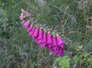
![Tocht Te voet Rignac - Sentier Ethno-Botanique en Ségala - Photo](https://media.geolcdn.com/t/350/260/846d9a77-ad67-4080-95df-3d254d9084ae.jpeg&format=jpg&maxdim=2)
![Te voet Te voet](https://static1.geolcdn.com/sitytour/trail-icons/100.png)
Km
#1 - Sentier Ethno-Botanique en Ségala
Te voet
Gemakkelijk
Rignac,
Occitanië,
Aveyron,
France
![](/images/other/stat-length.png)
7,2 km | 10,5 km-effort
2h 23min
![](https://static1.geolcdn.com/siteimages/upload/files/1508320355ic_sort_den_pos_24dp.png)
254 m
![](https://static1.geolcdn.com/siteimages/upload/files/1508320355ic_sort_den_neg_24dp.png)
252 m
![](https://static1.geolcdn.com/siteimages/upload/files/16400158638029165_repeat_loop_refresh_sync_direction_icon.png)
Ja
SityTrail - itinéraires balisés pédestres
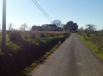
![Tocht Stappen Rignac - maquis de guesclins rignac - Photo](https://media.geolcdn.com/t/350/260/ext.jpg?maxdim=2&url=https%3A%2F%2Fservices.sitytrail.com%2FGeolivesWS%2FDownloadMedia.ashx%3FTrailID%3D404740%26Media%3Dfix__20150406182226.jpg)
![Stappen Stappen](https://static1.geolcdn.com/sitytour/trail-icons/101.png)
Km
#2 - maquis de guesclins rignac
Stappen
Medium
(1)
Rignac,
Occitanië,
Aveyron,
France
![](/images/other/stat-length.png)
14,8 km | 21 km-effort
4h 11min
![](https://static1.geolcdn.com/siteimages/upload/files/1508320355ic_sort_den_pos_24dp.png)
496 m
![](https://static1.geolcdn.com/siteimages/upload/files/1508320355ic_sort_den_neg_24dp.png)
498 m
![](https://static1.geolcdn.com/siteimages/upload/files/16400158638029165_repeat_loop_refresh_sync_direction_icon.png)
Ja
lascap12
![Tocht Stappen Rignac - Rignac Blaireaux - Photo](https://media.geolcdn.com/t/350/260/ext.jpg?maxdim=2&url=https%3A%2F%2Fstatic1.geolcdn.com%2Fsiteimages%2Fupload%2Ffiles%2F1553511878bg_sport_marche.png)
![Stappen Stappen](https://static1.geolcdn.com/sitytour/trail-icons/101.png)
Km
#3 - Rignac Blaireaux
Stappen
Heel gemakkelijk
Rignac,
Occitanië,
Aveyron,
France
![](/images/other/stat-length.png)
21 km | 26 km-effort
5h 37min
![](https://static1.geolcdn.com/siteimages/upload/files/1508320355ic_sort_den_pos_24dp.png)
415 m
![](https://static1.geolcdn.com/siteimages/upload/files/1508320355ic_sort_den_neg_24dp.png)
417 m
![](https://static1.geolcdn.com/siteimages/upload/files/16400158638029165_repeat_loop_refresh_sync_direction_icon.png)
Ja
bouscaillou
![Tocht Stappen Rignac - Rignac le buenne 2 - Photo](https://media.geolcdn.com/t/350/260/ext.jpg?maxdim=2&url=https%3A%2F%2Fstatic1.geolcdn.com%2Fsiteimages%2Fupload%2Ffiles%2F1553511878bg_sport_marche.png)
![Stappen Stappen](https://static1.geolcdn.com/sitytour/trail-icons/101.png)
Km
#4 - Rignac le buenne 2
Stappen
Heel gemakkelijk
Rignac,
Occitanië,
Aveyron,
France
![](/images/other/stat-length.png)
21 km | 27 km-effort
5h 16min
![](https://static1.geolcdn.com/siteimages/upload/files/1508320355ic_sort_den_pos_24dp.png)
445 m
![](https://static1.geolcdn.com/siteimages/upload/files/1508320355ic_sort_den_neg_24dp.png)
445 m
![](https://static1.geolcdn.com/siteimages/upload/files/16400158638029165_repeat_loop_refresh_sync_direction_icon.png)
Ja
bouscaillou
![Tocht Stappen Rignac - 12_Rignac_ maquis-de-guesclins - Photo](https://media.geolcdn.com/t/350/260/ext.jpg?maxdim=2&url=https%3A%2F%2Fstatic1.geolcdn.com%2Fsiteimages%2Fupload%2Ffiles%2F1553511878bg_sport_marche.png)
![Stappen Stappen](https://static1.geolcdn.com/sitytour/trail-icons/101.png)
Km
#5 - 12_Rignac_ maquis-de-guesclins
Stappen
Heel gemakkelijk
Rignac,
Occitanië,
Aveyron,
France
![](/images/other/stat-length.png)
14,8 km | 21 km-effort
Onbekend
![](https://static1.geolcdn.com/siteimages/upload/files/1508320355ic_sort_den_pos_24dp.png)
496 m
![](https://static1.geolcdn.com/siteimages/upload/files/1508320355ic_sort_den_neg_24dp.png)
498 m
![](https://static1.geolcdn.com/siteimages/upload/files/16400158638029165_repeat_loop_refresh_sync_direction_icon.png)
Ja
jab31
5 tochten weergegeven op 5
Gratisgps-wandelapplicatie