


11 km | 14,3 km-effort
Gaujac: Ontdek de beste tochten: 1 te voet, 19 stappen en 1 noords wandelen. Al deze tochten, trajecten, routes en outdoor activiteiten zijn beschikbaar in onze SityTrail-apps voor smartphones en tablets.

Stappen


Stappen

Stappen

Stappen

Stappen

Stappen

Stappen
Stappen
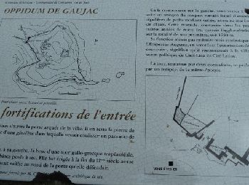
• opidum
Stappen
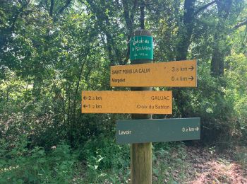
• GAUJAC – OPPIDUM 13.1Km - 04:00 Départ randonnée : du terrain de sport de Gaujac (Gard 30) Carte IGN 2941est. balisag...

Noords wandelen
Te voet
Stappen
Stappen
Stappen
Stappen
Stappen
Stappen
Stappen
Stappen
Stappen
20 tochten weergegeven op 21
Gratisgps-wandelapplicatie
 SityTrail
IGN / Geografische instituten
SityTrail World
De wereld gaat voor u open