![](/images/other/stat-length.png)
Rhône, Auvergne-Rhône-Alpes, Te voet: Top van de beste wandelroutes, trajecten, tochten en wandelingen
Rhône: Ontdek de beste tochten: 152 te voet, 2509 stappen, 34 noords wandelen, 56 lopen en 27 trail. Al deze tochten, trajecten, routes en outdoor activiteiten zijn beschikbaar in onze SityTrail-apps voor smartphones en tablets.
De beste trajecten (2766)
![Tocht Stappen L'Arbresle - 2022-04-18_21h43m42_Fiche Verte n°9_L_Arbresle-1 - Photo](https://media.geolcdn.com/t/350/260/00218e51-a692-486e-8923-38995b6815db.jpg&format=jpg&maxdim=2)
![Stappen Stappen](https://static1.geolcdn.com/sitytour/trail-icons/101.png)
Km
Stappen
![](/images/other/stat-length.png)
![](https://static1.geolcdn.com/siteimages/upload/files/1508320355ic_sort_den_pos_24dp.png)
![](https://static1.geolcdn.com/siteimages/upload/files/1508320355ic_sort_den_neg_24dp.png)
![](https://static1.geolcdn.com/siteimages/upload/files/16400158638029165_repeat_loop_refresh_sync_direction_icon.png)
![Tocht Stappen Mornant - Mornant-Lac de la Madone à St Sorlin - Photo](https://media.geolcdn.com/t/350/260/a7fe3626-6640-4450-bfe5-8d72b58566d1.jpg&format=jpg&maxdim=2)
![Stappen Stappen](https://static1.geolcdn.com/sitytour/trail-icons/101.png)
Km
Stappen
![](/images/other/stat-length.png)
![](https://static1.geolcdn.com/siteimages/upload/files/1508320355ic_sort_den_pos_24dp.png)
![](https://static1.geolcdn.com/siteimages/upload/files/1508320355ic_sort_den_neg_24dp.png)
![](https://static1.geolcdn.com/siteimages/upload/files/16400158638029165_repeat_loop_refresh_sync_direction_icon.png)
![Tocht Stappen Marennes - 69 marennes-villette-V2-17km-420m - Photo](https://media.geolcdn.com/t/350/260/25f97240-4655-4bff-897e-e00f442ce49e.jpg&format=jpg&maxdim=2)
![Stappen Stappen](https://static1.geolcdn.com/sitytour/trail-icons/101.png)
Km
Stappen
![](/images/other/stat-length.png)
![](https://static1.geolcdn.com/siteimages/upload/files/1508320355ic_sort_den_pos_24dp.png)
![](https://static1.geolcdn.com/siteimages/upload/files/1508320355ic_sort_den_neg_24dp.png)
![](https://static1.geolcdn.com/siteimages/upload/files/16400158638029165_repeat_loop_refresh_sync_direction_icon.png)
![Tocht Stappen Deux-Grosnes - Circuit de Saint-Jacques des Arrêts - Photo](https://media.geolcdn.com/t/350/260/ext.jpg?maxdim=2&url=https%3A%2F%2Fservices.sitytrail.com%2FGeolivesWS%2FDownloadMedia.ashx%3FTrailID%3D112082%26Media%3D9805_3.jpg)
![Stappen Stappen](https://static1.geolcdn.com/sitytour/trail-icons/101.png)
Km
Stappen
![](/images/other/stat-length.png)
![](https://static1.geolcdn.com/siteimages/upload/files/1508320355ic_sort_den_pos_24dp.png)
![](https://static1.geolcdn.com/siteimages/upload/files/1508320355ic_sort_den_neg_24dp.png)
![](https://static1.geolcdn.com/siteimages/upload/files/16400158638029165_repeat_loop_refresh_sync_direction_icon.png)
![Tocht Stappen Trèves - Chemin de Fer à Trèves - Photo](https://media.geolcdn.com/t/350/260/ext.jpg?maxdim=2&url=https%3A%2F%2Fservices.sitytrail.com%2FGeolivesWS%2FDownloadMedia.ashx%3FTrailID%3D107163%26Media%3D12007_3.jpg)
![Stappen Stappen](https://static1.geolcdn.com/sitytour/trail-icons/101.png)
Km
Stappen
![](/images/other/stat-length.png)
![](https://static1.geolcdn.com/siteimages/upload/files/1508320355ic_sort_den_pos_24dp.png)
![](https://static1.geolcdn.com/siteimages/upload/files/1508320355ic_sort_den_neg_24dp.png)
![](https://static1.geolcdn.com/siteimages/upload/files/16400158638029165_repeat_loop_refresh_sync_direction_icon.png)
![Tocht Stappen Saint-Just-d'Avray - Des mollets d'aciers - Saint Just d'Avray - Photo](https://media.geolcdn.com/t/350/260/ext.jpg?maxdim=2&url=https%3A%2F%2Fservices.sitytrail.com%2FGeolivesWS%2FDownloadMedia.ashx%3FTrailID%3D105228%26Media%3D8877_2.jpg)
![Stappen Stappen](https://static1.geolcdn.com/sitytour/trail-icons/101.png)
Km
Stappen
![](/images/other/stat-length.png)
![](https://static1.geolcdn.com/siteimages/upload/files/1508320355ic_sort_den_pos_24dp.png)
![](https://static1.geolcdn.com/siteimages/upload/files/1508320355ic_sort_den_neg_24dp.png)
![](https://static1.geolcdn.com/siteimages/upload/files/16400158638029165_repeat_loop_refresh_sync_direction_icon.png)
![Tocht Stappen Ranchal - Ranchal village vert - Photo](https://media.geolcdn.com/t/350/260/ext.jpg?maxdim=2&url=https%3A%2F%2Fservices.sitytrail.com%2FGeolivesWS%2FDownloadMedia.ashx%3FTrailID%3D105056%26Media%3D8641_6.jpg)
![Stappen Stappen](https://static1.geolcdn.com/sitytour/trail-icons/101.png)
Km
Stappen
![](/images/other/stat-length.png)
![](https://static1.geolcdn.com/siteimages/upload/files/1508320355ic_sort_den_pos_24dp.png)
![](https://static1.geolcdn.com/siteimages/upload/files/1508320355ic_sort_den_neg_24dp.png)
![](https://static1.geolcdn.com/siteimages/upload/files/16400158638029165_repeat_loop_refresh_sync_direction_icon.png)
![Tocht Stappen Pollionnay - Pollionnay, Croix du Ban, la Luère 7,5 Km - Photo](https://media.geolcdn.com/t/350/260/ext.jpg?maxdim=2&url=https%3A%2F%2Fservices.sitytrail.com%2FGeolivesWS%2FDownloadMedia.ashx%3FTrailID%3D104654%26Media%3D8048_4.jpg)
![Stappen Stappen](https://static1.geolcdn.com/sitytour/trail-icons/101.png)
Km
Stappen
![](/images/other/stat-length.png)
![](https://static1.geolcdn.com/siteimages/upload/files/1508320355ic_sort_den_pos_24dp.png)
![](https://static1.geolcdn.com/siteimages/upload/files/1508320355ic_sort_den_neg_24dp.png)
![](https://static1.geolcdn.com/siteimages/upload/files/16400158638029165_repeat_loop_refresh_sync_direction_icon.png)
![Tocht Stappen Ternand - 2022-04-07_21h47m08_Ternand_V2 - Photo](https://media.geolcdn.com/t/350/260/d73b31f3-847d-4c86-9759-810d2e04500a.jpg&format=jpg&maxdim=2)
![Stappen Stappen](https://static1.geolcdn.com/sitytour/trail-icons/101.png)
Km
Stappen
![](/images/other/stat-length.png)
![](https://static1.geolcdn.com/siteimages/upload/files/1508320355ic_sort_den_pos_24dp.png)
![](https://static1.geolcdn.com/siteimages/upload/files/1508320355ic_sort_den_neg_24dp.png)
![](https://static1.geolcdn.com/siteimages/upload/files/16400158638029165_repeat_loop_refresh_sync_direction_icon.png)
![Tocht Stappen Grézieu-le-Marché - Grézieu Le Marché - St Symphorien sur Coise - Photo](https://media.geolcdn.com/t/350/260/6498a247-2882-46f3-87b1-37d4824a8e43.jpg&format=jpg&maxdim=2)
![Stappen Stappen](https://static1.geolcdn.com/sitytour/trail-icons/101.png)
Km
Stappen
![](/images/other/stat-length.png)
![](https://static1.geolcdn.com/siteimages/upload/files/1508320355ic_sort_den_pos_24dp.png)
![](https://static1.geolcdn.com/siteimages/upload/files/1508320355ic_sort_den_neg_24dp.png)
![](https://static1.geolcdn.com/siteimages/upload/files/16400158638029165_repeat_loop_refresh_sync_direction_icon.png)
![Tocht Stappen Pollionnay - Pollionnay - Col de la Croix du Ban - Saint Bel - Photo](https://media.geolcdn.com/t/350/260/8ef9381a-0165-43ee-bec7-dd3c247c912c.jpg&format=jpg&maxdim=2)
![Stappen Stappen](https://static1.geolcdn.com/sitytour/trail-icons/101.png)
Km
Stappen
![](/images/other/stat-length.png)
![](https://static1.geolcdn.com/siteimages/upload/files/1508320355ic_sort_den_pos_24dp.png)
![](https://static1.geolcdn.com/siteimages/upload/files/1508320355ic_sort_den_neg_24dp.png)
![](https://static1.geolcdn.com/siteimages/upload/files/16400158638029165_repeat_loop_refresh_sync_direction_icon.png)
![Tocht Stappen Messimy - De Messimy au belvédère du Piragoy en boucle - Photo](https://media.geolcdn.com/t/350/260/4f6a03fe-103d-4ea3-ac7c-d9a11a0a7724.jpg&format=jpg&maxdim=2)
![Stappen Stappen](https://static1.geolcdn.com/sitytour/trail-icons/101.png)
Km
Stappen
![](/images/other/stat-length.png)
![](https://static1.geolcdn.com/siteimages/upload/files/1508320355ic_sort_den_pos_24dp.png)
![](https://static1.geolcdn.com/siteimages/upload/files/1508320355ic_sort_den_neg_24dp.png)
![](https://static1.geolcdn.com/siteimages/upload/files/16400158638029165_repeat_loop_refresh_sync_direction_icon.png)
![Tocht Stappen Lentilly - Santier des vaches LENTILLY - Photo](https://media.geolcdn.com/t/350/260/571590e7-6ce0-4ff1-b403-0f445cf01256.jpg&format=jpg&maxdim=2)
![Stappen Stappen](https://static1.geolcdn.com/sitytour/trail-icons/101.png)
Km
Stappen
![](/images/other/stat-length.png)
![](https://static1.geolcdn.com/siteimages/upload/files/1508320355ic_sort_den_pos_24dp.png)
![](https://static1.geolcdn.com/siteimages/upload/files/1508320355ic_sort_den_neg_24dp.png)
![](https://static1.geolcdn.com/siteimages/upload/files/16400158638029165_repeat_loop_refresh_sync_direction_icon.png)
![Tocht Te voet Les Halles - Les Halles - Photo](https://media.geolcdn.com/t/350/260/21d7aa2f-2038-49c8-b8b4-b2d7e33dc17c.jpg&format=jpg&maxdim=2)
![Te voet Te voet](https://static1.geolcdn.com/sitytour/trail-icons/100.png)
Km
Te voet
![](/images/other/stat-length.png)
![](https://static1.geolcdn.com/siteimages/upload/files/1508320355ic_sort_den_pos_24dp.png)
![](https://static1.geolcdn.com/siteimages/upload/files/1508320355ic_sort_den_neg_24dp.png)
![](https://static1.geolcdn.com/siteimages/upload/files/16400158638029165_repeat_loop_refresh_sync_direction_icon.png)
![Tocht Stappen Deux-Grosnes - Ouroux - Photo](https://media.geolcdn.com/t/350/260/8cef6e4d-d107-4e31-8a02-a874193353f3.jpg&format=jpg&maxdim=2)
![Stappen Stappen](https://static1.geolcdn.com/sitytour/trail-icons/101.png)
Km
Stappen
![](/images/other/stat-length.png)
![](https://static1.geolcdn.com/siteimages/upload/files/1508320355ic_sort_den_pos_24dp.png)
![](https://static1.geolcdn.com/siteimages/upload/files/1508320355ic_sort_den_neg_24dp.png)
![](https://static1.geolcdn.com/siteimages/upload/files/16400158638029165_repeat_loop_refresh_sync_direction_icon.png)
![Tocht Stappen Val d'Oingt - Oingt (69) Beaujolais - Photo](https://media.geolcdn.com/t/350/260/ext.jpg?maxdim=2&url=https%3A%2F%2Fservices.sitytrail.com%2FGeolivesWS%2FDownloadMedia.ashx%3FTrailID%3D717640%26Media%3D20161208145812.jpg)
![Stappen Stappen](https://static1.geolcdn.com/sitytour/trail-icons/101.png)
Km
Stappen
![](/images/other/stat-length.png)
![](https://static1.geolcdn.com/siteimages/upload/files/1508320355ic_sort_den_pos_24dp.png)
![](https://static1.geolcdn.com/siteimages/upload/files/1508320355ic_sort_den_neg_24dp.png)
![](https://static1.geolcdn.com/siteimages/upload/files/16400158638029165_repeat_loop_refresh_sync_direction_icon.png)
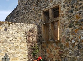
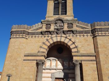
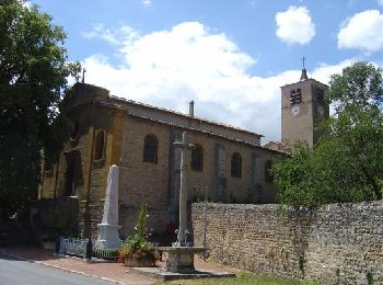
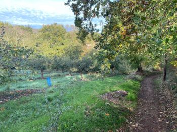
• Belle randonnée - Départ parking de l'école Gaspard de Riche de Prony
![Tocht Stappen Thurins - tour du bois du baron - Photo](https://media.geolcdn.com/t/350/260/ext.jpg?maxdim=2&url=https%3A%2F%2Fservices.sitytrail.com%2FGeolivesWS%2FDownloadMedia.ashx%3FTrailID%3D548394%26Media%3Dfix__20160403153341.jpg)
![Stappen Stappen](https://static1.geolcdn.com/sitytour/trail-icons/101.png)
Km
Stappen
![](/images/other/stat-length.png)
![](https://static1.geolcdn.com/siteimages/upload/files/1508320355ic_sort_den_pos_24dp.png)
![](https://static1.geolcdn.com/siteimages/upload/files/1508320355ic_sort_den_neg_24dp.png)
![](https://static1.geolcdn.com/siteimages/upload/files/16400158638029165_repeat_loop_refresh_sync_direction_icon.png)
![Tocht Stappen Deux-Grosnes - Circuit n°1 du Mont Saint-Rigaud - Monsols - Photo](https://media.geolcdn.com/t/350/260/ext.jpg?maxdim=2&url=https%3A%2F%2Fservices.sitytrail.com%2FGeolivesWS%2FDownloadMedia.ashx%3FTrailID%3D112077%26Media%3D9692_1.jpg)
![Stappen Stappen](https://static1.geolcdn.com/sitytour/trail-icons/101.png)
Km
Stappen
![](/images/other/stat-length.png)
![](https://static1.geolcdn.com/siteimages/upload/files/1508320355ic_sort_den_pos_24dp.png)
![](https://static1.geolcdn.com/siteimages/upload/files/1508320355ic_sort_den_neg_24dp.png)
![](https://static1.geolcdn.com/siteimages/upload/files/16400158638029165_repeat_loop_refresh_sync_direction_icon.png)
![Tocht Stappen Vaugneray - Sur les hauteurs de Vaugneray - Photo](https://media.geolcdn.com/t/350/260/ext.jpg?maxdim=2&url=https%3A%2F%2Fservices.sitytrail.com%2FGeolivesWS%2FDownloadMedia.ashx%3FTrailID%3D106070%26Media%3D10246_2.jpg)
![Stappen Stappen](https://static1.geolcdn.com/sitytour/trail-icons/101.png)
Km
Stappen
![](/images/other/stat-length.png)
![](https://static1.geolcdn.com/siteimages/upload/files/1508320355ic_sort_den_pos_24dp.png)
![](https://static1.geolcdn.com/siteimages/upload/files/1508320355ic_sort_den_neg_24dp.png)
![](https://static1.geolcdn.com/siteimages/upload/files/16400158638029165_repeat_loop_refresh_sync_direction_icon.png)
![Tocht Stappen Loire-sur-Rhône - 42 le grisard (vienne) - Photo](https://media.geolcdn.com/t/350/260/c8c552c2-c833-47f9-98c4-fadea207952f.jpg&format=jpg&maxdim=2)
![Stappen Stappen](https://static1.geolcdn.com/sitytour/trail-icons/101.png)
Km
Stappen
![](/images/other/stat-length.png)
![](https://static1.geolcdn.com/siteimages/upload/files/1508320355ic_sort_den_pos_24dp.png)
![](https://static1.geolcdn.com/siteimages/upload/files/1508320355ic_sort_den_neg_24dp.png)
![](https://static1.geolcdn.com/siteimages/upload/files/16400158638029165_repeat_loop_refresh_sync_direction_icon.png)
20 tochten weergegeven op 2766
Gratisgps-wandelapplicatie
Activiteiten
Nabije regio's
- Affoux
- Aigueperse
- Alix
- Ambérieux
- Amplepuis
- Ampuis
- Ancy
- Anse
- Arnas
- Aveize
- Azolette
- Bagnols
- Beaujeu
- Beauvallon
- Belleville-en-Beaujolais
- Belmont-d'Azergues
- Bessenay
- Bibost
- Blacé
- Brignais
- Brindas
- Brullioles
- Brussieu
- Bully
- Cenves
- Cercié
- Chabanière
- Chambost-Allières
- Chambost-Longessaigne
- Chamelet
- Chaponnay
- Chaponost
- Charentay
- Charnay
- Chasselay
- Châtillon
- Chaussan
- Chazay-d'Azergues
- Chénas
- Chénelette
- Chessy
- Chevinay
- Chiroubles
- Civrieux-d'Azergues
- Claveisolles
- Cogny
- Coise
- Colombier-Saugnieu
- Communay
- Condrieu
- Corcelles-en-Beaujolais
- Cours
- Courzieu
- Cublize
- Denicé
- Deux-Grosnes
- Dième
- Dommartin
- Dracé
- Duerne
- Échalas
- Émeringes
- Éveux
- Fleurie
- Fleurieux-sur-l'Arbresle
- Frontenas
- Genas
- Gleizé
- Grandris
- Grézieu-la-Varenne
- Grézieu-le-Marché
- Haute-Rivoire
- Jons
- Joux
- Juliénas
- Jullié
- L'Arbresle
- La Chapelle-sur-Coise
- Lacenas
- Lachassagne
- Lamure-sur-Azergues
- Lancié
- Lantignié
- Larajasse
- Le Breuil
- Le Perréon
- Légny
- Lentilly
- Les Ardillats
- Les Chères
- Les Haies
- Les Halles
- Les Sauvages
- Létra
- Limas
- Loire-sur-Rhône
- Longes
- Longessaigne
- Lozanne
- Lucenay
- Marchampt
- Marcilly-d'Azergues
- Marcy
- Marennes
- Meaux-la-Montagne
- Messimy
- Meys
- Millery
- Moiré
- Montagny
- Montmelas-Saint-Sorlin
- Montromant
- Montrottier
- Morancé
- Mornant
- Odenas
- Orliénas
- Pollionnay
- Pomeys
- Pommiers
- Porte des Pierres Dorées
- Poule-les-Écharmeaux
- Propières
- Pusignan
- Quincié-en-Beaujolais
- Ranchal
- Régnié-Durette
- Riverie
- Rivolet
- Ronno
- Rontalon
- Sain-Bel
- Saint-André-la-Côte
- Saint-Appolinaire
- Saint-Bonnet-de-Mure
- Saint-Bonnet-des-Bruyères
- Saint-Bonnet-le-Troncy
- Saint-Clément-de-Vers
- Saint-Clément-les-Places
- Saint-Clément-sur-Valsonne
- Saint-Cyr-le-Chatoux
- Saint-Cyr-sur-le-Rhône
- Saint-Didier-sur-Beaujeu
- Saint-Étienne-des-Oullières
- Saint-Étienne-la-Varenne
- Saint-Forgeux
- Saint-Genis-l'Argentière
- Saint-Georges-de-Reneins
- Saint-Germain-Nuelles
- Saint-Igny-de-Vers
- Saint-Jean-des-Vignes
- Saint-Jean-la-Bussière
- Saint-Julien
- Saint-Julien-sur-Bibost
- Saint-Just-d'Avray
- Saint-Lager
- Saint-Laurent-d'Agny
- Saint-Laurent-de-Chamousset
- Saint-Laurent-de-Mure
- Saint-Marcel-l'Éclairé
- Saint-Martin-en-Haut
- Saint-Nizier-d'Azergues
- Saint-Pierre-de-Chandieu
- Saint-Pierre-la-Palud
- Saint-Romain-de-Popey
- Saint-Romain-en-Gal
- Saint-Romain-en-Gier
- Saint-Symphorien-d'Ozon
- Saint-Symphorien-sur-Coise
- Saint-Vérand
- Saint-Vincent-de-Reins
- Sainte-Catherine
- Sainte-Colombe
- Sainte-Consorce
- Sainte-Foy-l'Argentière
- Sainte-Paule
- Salles-Arbuissonnas-en-Beaujolais
- Sarcey
- Savigny
- Sérézin-du-Rhône
- Simandres
- Soucieu-en-Jarrest
- Sourcieux-les-Mines
- Souzy
- Taluyers
- Taponas
- Tarare
- Ternand
- Ternay
- Theizé
- Thizy-les-Bourgs
- Thurins
- Toussieu
- Trèves
- Tupin-et-Semons
- Val d'Oingt
- Valsonne
- Vaugneray
- Vaux-en-Beaujolais
- Vauxrenard
- Vernay
- Ville-sur-Jarnioux
- Villechenève
- Villefranche-sur-Saône
- Villié-Morgon
- Vindry-sur-Turdine
- Vourles
- Yzeron