![](/images/other/stat-length.png)
Santa Eulalia la Mayor, Loporzano, Te voet: Top van de beste wandelroutes, trajecten, tochten en wandelingen
Santa Eulalia la Mayor: Ontdek de beste tochten: 5 stappen. Al deze tochten, trajecten, routes en outdoor activiteiten zijn beschikbaar in onze SityTrail-apps voor smartphones en tablets.
De beste trajecten (5)
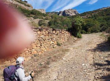
![Tocht Stappen Loporzano - Embase de Vadiello - Photo](https://media.geolcdn.com/t/350/260/0228e1d4-98e4-41f9-801a-ed477e2eb544.jpg&format=jpg&maxdim=2)
![Stappen Stappen](https://static1.geolcdn.com/sitytour/trail-icons/101.png)
Km
#1 - Embase de Vadiello
Stappen
Moeilijk
Loporzano,
Aragón,
Huesca,
Spain
![](/images/other/stat-length.png)
9,2 km | 13,9 km-effort
4h 1min
![](https://static1.geolcdn.com/siteimages/upload/files/1508320355ic_sort_den_pos_24dp.png)
353 m
![](https://static1.geolcdn.com/siteimages/upload/files/1508320355ic_sort_den_neg_24dp.png)
352 m
![](https://static1.geolcdn.com/siteimages/upload/files/16400158638029165_repeat_loop_refresh_sync_direction_icon.png)
Ja
bliguet
![Tocht Stappen Loporzano - 2017-05-08 Sortie CAF - Pico el Boron - Photo](https://media.geolcdn.com/t/350/260/ext.jpg?maxdim=2&url=https%3A%2F%2Fstatic1.geolcdn.com%2Fsiteimages%2Fupload%2Ffiles%2F1553511878bg_sport_marche.png)
![Stappen Stappen](https://static1.geolcdn.com/sitytour/trail-icons/101.png)
Km
#2 - 2017-05-08 Sortie CAF - Pico el Boron
Stappen
Moeilijk
Loporzano,
Aragón,
Huesca,
Spain
![](/images/other/stat-length.png)
5,8 km | 15 km-effort
5h 0min
![](https://static1.geolcdn.com/siteimages/upload/files/1508320355ic_sort_den_pos_24dp.png)
690 m
![](https://static1.geolcdn.com/siteimages/upload/files/1508320355ic_sort_den_neg_24dp.png)
702 m
![](https://static1.geolcdn.com/siteimages/upload/files/16400158638029165_repeat_loop_refresh_sync_direction_icon.png)
Ja
eric.mignot
![Tocht Stappen Loporzano - mallos de liguerre - Photo](https://media.geolcdn.com/t/350/260/ext.jpg?maxdim=2&url=https%3A%2F%2Fstatic1.geolcdn.com%2Fsiteimages%2Fupload%2Ffiles%2F1553511878bg_sport_marche.png)
![Stappen Stappen](https://static1.geolcdn.com/sitytour/trail-icons/101.png)
Km
#3 - mallos de liguerre
Stappen
Medium
Loporzano,
Aragón,
Huesca,
Spain
![](/images/other/stat-length.png)
5,6 km | 14,5 km-effort
3h 6min
![](https://static1.geolcdn.com/siteimages/upload/files/1508320355ic_sort_den_pos_24dp.png)
668 m
![](https://static1.geolcdn.com/siteimages/upload/files/1508320355ic_sort_den_neg_24dp.png)
656 m
![](https://static1.geolcdn.com/siteimages/upload/files/16400158638029165_repeat_loop_refresh_sync_direction_icon.png)
Ja
kicecodi
![Tocht Stappen Loporzano - Ermitage de San Cinés Sierra de Guara - Photo](https://media.geolcdn.com/t/350/260/ext.jpg?maxdim=2&url=https%3A%2F%2Fstatic1.geolcdn.com%2Fsiteimages%2Fupload%2Ffiles%2F1553511878bg_sport_marche.png)
![Stappen Stappen](https://static1.geolcdn.com/sitytour/trail-icons/101.png)
Km
#4 - Ermitage de San Cinés Sierra de Guara
Stappen
Medium
Loporzano,
Aragón,
Huesca,
Spain
![](/images/other/stat-length.png)
8,1 km | 13 km-effort
2h 57min
![](https://static1.geolcdn.com/siteimages/upload/files/1508320355ic_sort_den_pos_24dp.png)
370 m
![](https://static1.geolcdn.com/siteimages/upload/files/1508320355ic_sort_den_neg_24dp.png)
370 m
![](https://static1.geolcdn.com/siteimages/upload/files/16400158638029165_repeat_loop_refresh_sync_direction_icon.png)
Ja
alainleroyer
![Tocht Stappen Loporzano - Les Ermitages de Vadiello Sierra de Guara - Photo](https://media.geolcdn.com/t/350/260/ext.jpg?maxdim=2&url=https%3A%2F%2Fstatic1.geolcdn.com%2Fsiteimages%2Fupload%2Ffiles%2F1553511878bg_sport_marche.png)
![Stappen Stappen](https://static1.geolcdn.com/sitytour/trail-icons/101.png)
Km
#5 - Les Ermitages de Vadiello Sierra de Guara
Stappen
Medium
Loporzano,
Aragón,
Huesca,
Spain
![](/images/other/stat-length.png)
14,2 km | 22 km-effort
5h 19min
![](https://static1.geolcdn.com/siteimages/upload/files/1508320355ic_sort_den_pos_24dp.png)
559 m
![](https://static1.geolcdn.com/siteimages/upload/files/1508320355ic_sort_den_neg_24dp.png)
560 m
![](https://static1.geolcdn.com/siteimages/upload/files/16400158638029165_repeat_loop_refresh_sync_direction_icon.png)
Ja
alainleroyer
5 tochten weergegeven op 5
Gratisgps-wandelapplicatie