![](/images/other/stat-length.png)
Zaragoza, Aragón, Te voet: Top van de beste wandelroutes, trajecten, tochten en wandelingen
Zaragoza: Ontdek de beste tochten: 19 te voet en 10 stappen. Al deze tochten, trajecten, routes en outdoor activiteiten zijn beschikbaar in onze SityTrail-apps voor smartphones en tablets.
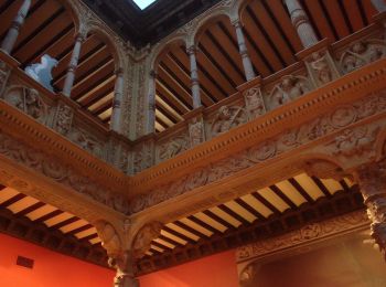
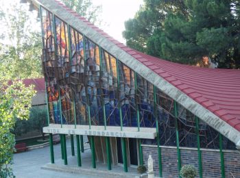
De beste trajecten (29)
![Tocht Te voet Zaragoza - Ruta de los Parques - Photo](https://media.geolcdn.com/t/350/260/20c2e90a-8d27-4f43-b0ba-c8e3ce82099e.jpeg&format=jpg&maxdim=2)
![Te voet Te voet](https://static1.geolcdn.com/sitytour/trail-icons/100.png)
Km
Te voet
![](/images/other/stat-length.png)
![](https://static1.geolcdn.com/siteimages/upload/files/1508320355ic_sort_den_pos_24dp.png)
![](https://static1.geolcdn.com/siteimages/upload/files/1508320355ic_sort_den_neg_24dp.png)
![](https://static1.geolcdn.com/siteimages/upload/files/16400158638029165_repeat_loop_refresh_sync_direction_icon.png)
• Trail created by Ayuntamiento de Zaragoza. Website: https://www.zaragoza.es/sede/portal/medioambiente/infraestruct...
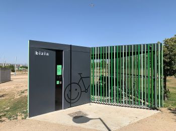
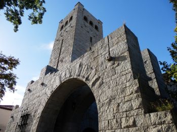
![Tocht Te voet Zaragoza - Valdespartera-Plaza - Photo](https://media.geolcdn.com/t/350/260/da5a88d4-7e53-40ac-bf12-348905ee1929.jpeg&format=jpg&maxdim=2)
![Te voet Te voet](https://static1.geolcdn.com/sitytour/trail-icons/100.png)
Km
Te voet
![](/images/other/stat-length.png)
![](https://static1.geolcdn.com/siteimages/upload/files/1508320355ic_sort_den_pos_24dp.png)
![](https://static1.geolcdn.com/siteimages/upload/files/1508320355ic_sort_den_neg_24dp.png)
![](https://static1.geolcdn.com/siteimages/upload/files/16400158638029165_repeat_loop_refresh_sync_direction_icon.png)
• Trail created by Zaragoza Deporte. Website: https://zaragozanda.zaragozadeporte.com/Ruta11.asp
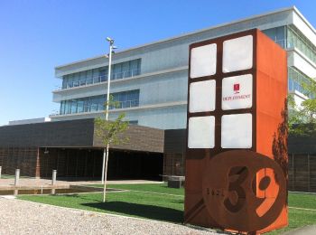
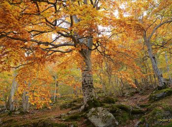
![Tocht Te voet Zaragoza - Valdefierro-Plaza - Photo](https://media.geolcdn.com/t/350/260/9374466b-ac68-4991-b37d-cc4da7c2c961.jpeg&format=jpg&maxdim=2)
![Te voet Te voet](https://static1.geolcdn.com/sitytour/trail-icons/100.png)
Km
Te voet
![](/images/other/stat-length.png)
![](https://static1.geolcdn.com/siteimages/upload/files/1508320355ic_sort_den_pos_24dp.png)
![](https://static1.geolcdn.com/siteimages/upload/files/1508320355ic_sort_den_neg_24dp.png)
![](https://static1.geolcdn.com/siteimages/upload/files/16400158638029165_repeat_loop_refresh_sync_direction_icon.png)
• Trail created by Zaragoza Deporte. Website: https://zaragozanda.zaragozadeporte.com/Ruta10.asp
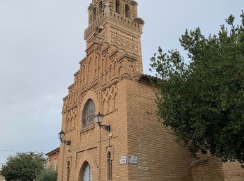
![Tocht Te voet Zaragoza - Ruta Alto Canal: Valdefierro-Torrero - Photo](https://media.geolcdn.com/t/350/260/757742e9-8375-4040-a123-38f838a3baf4.jpeg&format=jpg&maxdim=2)
![Te voet Te voet](https://static1.geolcdn.com/sitytour/trail-icons/100.png)
Km
Te voet
![](/images/other/stat-length.png)
![](https://static1.geolcdn.com/siteimages/upload/files/1508320355ic_sort_den_pos_24dp.png)
![](https://static1.geolcdn.com/siteimages/upload/files/1508320355ic_sort_den_neg_24dp.png)
![](https://static1.geolcdn.com/siteimages/upload/files/16400158638029165_repeat_loop_refresh_sync_direction_icon.png)
• Trail created by Zaragoza Deporte. Website: https://zaragozanda.zaragozadeporte.com/Ruta9.asp
![Tocht Te voet Zaragoza - Estación Goya-La Junquera - Photo](https://media.geolcdn.com/t/350/260/06c7be34-b44f-4670-b02e-9b4120c0ec3b.jpeg&format=jpg&maxdim=2)
![Te voet Te voet](https://static1.geolcdn.com/sitytour/trail-icons/100.png)
Km
Te voet
![](/images/other/stat-length.png)
![](https://static1.geolcdn.com/siteimages/upload/files/1508320355ic_sort_den_pos_24dp.png)
![](https://static1.geolcdn.com/siteimages/upload/files/1508320355ic_sort_den_neg_24dp.png)
![](https://static1.geolcdn.com/siteimages/upload/files/16400158638029165_repeat_loop_refresh_sync_direction_icon.png)
• Trail created by Zaragoza Deporte. Website: https://zaragozanda.zaragozadeporte.com/Ruta7.asp
![Tocht Te voet Zaragoza - Desembocadura del Gállego - Photo](https://media.geolcdn.com/t/350/260/c4e5fbee-ba95-4f95-a62d-76c502ba0314.jpeg&format=jpg&maxdim=2)
![Te voet Te voet](https://static1.geolcdn.com/sitytour/trail-icons/100.png)
Km
Te voet
![](/images/other/stat-length.png)
![](https://static1.geolcdn.com/siteimages/upload/files/1508320355ic_sort_den_pos_24dp.png)
![](https://static1.geolcdn.com/siteimages/upload/files/1508320355ic_sort_den_neg_24dp.png)
![](https://static1.geolcdn.com/siteimages/upload/files/16400158638029165_repeat_loop_refresh_sync_direction_icon.png)
• Trail created by Zaragoza Deporte. Website: https://zaragozanda.zaragozadeporte.com/Ruta3.asp
![Tocht Te voet Zaragoza - Paseando por los tres ríos - Photo](https://media.geolcdn.com/t/350/260/be816433-4bfc-43ba-98d2-a7158e283d93.jpeg&format=jpg&maxdim=2)
![Te voet Te voet](https://static1.geolcdn.com/sitytour/trail-icons/100.png)
Km
Te voet
![](/images/other/stat-length.png)
![](https://static1.geolcdn.com/siteimages/upload/files/1508320355ic_sort_den_pos_24dp.png)
![](https://static1.geolcdn.com/siteimages/upload/files/1508320355ic_sort_den_neg_24dp.png)
![](https://static1.geolcdn.com/siteimages/upload/files/16400158638029165_repeat_loop_refresh_sync_direction_icon.png)
• Trail created by Zaragoza Deporte. Website: https://zaragozanda.zaragozadeporte.com/Ruta2.asp
![Tocht Te voet Zaragoza - La margen izquierda, entre puentes - Photo](https://media.geolcdn.com/t/350/260/005040ae-58df-41b3-a633-d40a9669220b.jpeg&format=jpg&maxdim=2)
![Te voet Te voet](https://static1.geolcdn.com/sitytour/trail-icons/100.png)
Km
Te voet
![](/images/other/stat-length.png)
![](https://static1.geolcdn.com/siteimages/upload/files/1508320355ic_sort_den_pos_24dp.png)
![](https://static1.geolcdn.com/siteimages/upload/files/1508320355ic_sort_den_neg_24dp.png)
![](https://static1.geolcdn.com/siteimages/upload/files/16400158638029165_repeat_loop_refresh_sync_direction_icon.png)
• Trail created by Zaragoza Deporte. Website: https://zaragozanda.zaragozadeporte.com/Ruta1.asp
![Tocht Te voet Zaragoza - Camino Natural del Ebro de Zaragoza a La Cartuja - Photo](https://media.geolcdn.com/t/350/260/3f2c429e-c4f7-4370-8cd1-fcbe75bcd69e.jpeg&format=jpg&maxdim=2)
![Te voet Te voet](https://static1.geolcdn.com/sitytour/trail-icons/100.png)
Km
Te voet
![](/images/other/stat-length.png)
![](https://static1.geolcdn.com/siteimages/upload/files/1508320355ic_sort_den_pos_24dp.png)
![](https://static1.geolcdn.com/siteimages/upload/files/1508320355ic_sort_den_neg_24dp.png)
![](https://static1.geolcdn.com/siteimages/upload/files/16400158638029165_repeat_loop_refresh_sync_direction_icon.png)
• Trail created by Zaragoza Deporte. Website: https://zaragozanda.zaragozadeporte.com/Ruta4.asp
![Tocht Te voet Zaragoza - Ruta circular por el Canal y los pinares de Venecia - Photo](https://media.geolcdn.com/t/350/260/09b2353d-bca5-480a-bf9e-6901522de82c.jpeg&format=jpg&maxdim=2)
![Te voet Te voet](https://static1.geolcdn.com/sitytour/trail-icons/100.png)
Km
Te voet
![](/images/other/stat-length.png)
![](https://static1.geolcdn.com/siteimages/upload/files/1508320355ic_sort_den_pos_24dp.png)
![](https://static1.geolcdn.com/siteimages/upload/files/1508320355ic_sort_den_neg_24dp.png)
![](https://static1.geolcdn.com/siteimages/upload/files/16400158638029165_repeat_loop_refresh_sync_direction_icon.png)
• Trail created by Zaragoza Deporte. Website: https://zaragozanda.zaragozadeporte.com/Ruta6.asp
![Tocht Te voet Zaragoza - Torrero-Fuente de La Junquera - Photo](https://media.geolcdn.com/t/350/260/860f8256-979b-4f26-bac2-e8d707abb8f6.jpeg&format=jpg&maxdim=2)
![Te voet Te voet](https://static1.geolcdn.com/sitytour/trail-icons/100.png)
Km
Te voet
![](/images/other/stat-length.png)
![](https://static1.geolcdn.com/siteimages/upload/files/1508320355ic_sort_den_pos_24dp.png)
![](https://static1.geolcdn.com/siteimages/upload/files/1508320355ic_sort_den_neg_24dp.png)
![](https://static1.geolcdn.com/siteimages/upload/files/16400158638029165_repeat_loop_refresh_sync_direction_icon.png)
• Trail created by Zaragoza Deporte. Website: https://zaragozanda.zaragozadeporte.com/Ruta8.asp
![Tocht Te voet Tarazona - Sendero S-2 Barranco del Apio - Photo](https://media.geolcdn.com/t/350/260/6bd2bcce-b0cb-4a9b-8c20-4f91f33a192e.jpeg&format=jpg&maxdim=2)
![Te voet Te voet](https://static1.geolcdn.com/sitytour/trail-icons/100.png)
Km
Te voet
![](/images/other/stat-length.png)
![](https://static1.geolcdn.com/siteimages/upload/files/1508320355ic_sort_den_pos_24dp.png)
![](https://static1.geolcdn.com/siteimages/upload/files/1508320355ic_sort_den_neg_24dp.png)
![](https://static1.geolcdn.com/siteimages/upload/files/16400158638029165_repeat_loop_refresh_sync_direction_icon.png)
• Trail created by Parque Natural del Moncayo.
![Tocht Te voet Zaragoza - Camino del Monte de Peñaflor - Photo](https://media.geolcdn.com/t/350/260/555b41cd-8677-4d95-a2be-938b80d90245.jpeg&format=jpg&maxdim=2)
![Te voet Te voet](https://static1.geolcdn.com/sitytour/trail-icons/100.png)
Km
Te voet
![](/images/other/stat-length.png)
![](https://static1.geolcdn.com/siteimages/upload/files/1508320355ic_sort_den_pos_24dp.png)
![](https://static1.geolcdn.com/siteimages/upload/files/1508320355ic_sort_den_neg_24dp.png)
![](https://static1.geolcdn.com/siteimages/upload/files/16400158638029165_repeat_loop_refresh_sync_direction_icon.png)
• Trail created by Ayuntamiento de Zaragoza.
![Tocht Te voet Tarazona - Subida al Moncayo por el pinar - Photo](https://media.geolcdn.com/t/350/260/ff181cc9-6779-4d6f-a6e4-a49b79fa9e10.jpeg&format=jpg&maxdim=2)
![Te voet Te voet](https://static1.geolcdn.com/sitytour/trail-icons/100.png)
Km
Te voet
![](/images/other/stat-length.png)
![](https://static1.geolcdn.com/siteimages/upload/files/1508320355ic_sort_den_pos_24dp.png)
![](https://static1.geolcdn.com/siteimages/upload/files/1508320355ic_sort_den_neg_24dp.png)
![](https://static1.geolcdn.com/siteimages/upload/files/16400158638029165_repeat_loop_refresh_sync_direction_icon.png)
![Tocht Te voet Tarazona - Circular del Moncayo - Photo](https://media.geolcdn.com/t/350/260/21772260-4400-4c90-a138-4b9218ca3f0d.jpeg&format=jpg&maxdim=2)
![Te voet Te voet](https://static1.geolcdn.com/sitytour/trail-icons/100.png)
Km
Te voet
![](/images/other/stat-length.png)
![](https://static1.geolcdn.com/siteimages/upload/files/1508320355ic_sort_den_pos_24dp.png)
![](https://static1.geolcdn.com/siteimages/upload/files/1508320355ic_sort_den_neg_24dp.png)
![](https://static1.geolcdn.com/siteimages/upload/files/16400158638029165_repeat_loop_refresh_sync_direction_icon.png)
![Tocht Te voet Pedrola - 10K Villa de Pedrola 2017 - Photo](https://media.geolcdn.com/t/350/260/ext.jpg?maxdim=2&url=https%3A%2F%2Fstatic1.geolcdn.com%2Fsiteimages%2Fupload%2Ffiles%2F1545311037marcheuse_200dpi.jpg)
![Te voet Te voet](https://static1.geolcdn.com/sitytour/trail-icons/100.png)
Km
Te voet
![](/images/other/stat-length.png)
![](https://static1.geolcdn.com/siteimages/upload/files/1508320355ic_sort_den_pos_24dp.png)
![](https://static1.geolcdn.com/siteimages/upload/files/1508320355ic_sort_den_neg_24dp.png)
![](https://static1.geolcdn.com/siteimages/upload/files/16400158638029165_repeat_loop_refresh_sync_direction_icon.png)
• Website: http://www.pedrola-corre.com/p/10k.html?spref=fb
![Tocht Te voet Calatayud - SL Z 41: De Huérmeda al mirador de la Cocha - Photo](https://media.geolcdn.com/t/350/260/ext.jpg?maxdim=2&url=https%3A%2F%2Fstatic1.geolcdn.com%2Fsiteimages%2Fupload%2Ffiles%2F1545311037marcheuse_200dpi.jpg)
![Te voet Te voet](https://static1.geolcdn.com/sitytour/trail-icons/100.png)
Km
Te voet
![](/images/other/stat-length.png)
![](https://static1.geolcdn.com/siteimages/upload/files/1508320355ic_sort_den_pos_24dp.png)
![](https://static1.geolcdn.com/siteimages/upload/files/1508320355ic_sort_den_neg_24dp.png)
![](https://static1.geolcdn.com/siteimages/upload/files/16400158638029165_repeat_loop_refresh_sync_direction_icon.png)
• Website: http://www.caminosnaturales.com
![Tocht Te voet Calatayud - SL Z 8: Ruta de Calatayud - Photo](https://media.geolcdn.com/t/350/260/ext.jpg?maxdim=2&url=https%3A%2F%2Fstatic1.geolcdn.com%2Fsiteimages%2Fupload%2Ffiles%2F1545311037marcheuse_200dpi.jpg)
![Te voet Te voet](https://static1.geolcdn.com/sitytour/trail-icons/100.png)
Km
Te voet
![](/images/other/stat-length.png)
![](https://static1.geolcdn.com/siteimages/upload/files/1508320355ic_sort_den_pos_24dp.png)
![](https://static1.geolcdn.com/siteimages/upload/files/1508320355ic_sort_den_neg_24dp.png)
![](https://static1.geolcdn.com/siteimages/upload/files/16400158638029165_repeat_loop_refresh_sync_direction_icon.png)
• Website: http://www.caminosnaturales.com
![Tocht Te voet El Frasno - SL Z 36: Subida al pico del Rayo - Photo](https://media.geolcdn.com/t/350/260/805e6b3c-a4fc-457d-becb-23fa1d76a3b0.jpeg&format=jpg&maxdim=2)
![Te voet Te voet](https://static1.geolcdn.com/sitytour/trail-icons/100.png)
Km
Te voet
![](/images/other/stat-length.png)
![](https://static1.geolcdn.com/siteimages/upload/files/1508320355ic_sort_den_pos_24dp.png)
![](https://static1.geolcdn.com/siteimages/upload/files/1508320355ic_sort_den_neg_24dp.png)
![](https://static1.geolcdn.com/siteimages/upload/files/16400158638029165_repeat_loop_refresh_sync_direction_icon.png)
![Tocht Stappen Valpalmas - RIGLOS agaurales de valpalmas (10) - Photo](https://media.geolcdn.com/t/350/260/ext.jpg?maxdim=2&url=https%3A%2F%2Fstatic1.geolcdn.com%2Fsiteimages%2Fupload%2Ffiles%2F1553511878bg_sport_marche.png)
![Stappen Stappen](https://static1.geolcdn.com/sitytour/trail-icons/101.png)
Km
Stappen
![](/images/other/stat-length.png)
![](https://static1.geolcdn.com/siteimages/upload/files/1508320355ic_sort_den_pos_24dp.png)
![](https://static1.geolcdn.com/siteimages/upload/files/1508320355ic_sort_den_neg_24dp.png)
![](https://static1.geolcdn.com/siteimages/upload/files/16400158638029165_repeat_loop_refresh_sync_direction_icon.png)
20 tochten weergegeven op 29
Gratisgps-wandelapplicatie
Activiteiten
Nabije regio's
- Aguilón
- Alagón
- Alborge
- Alcalá de Moncayo
- Alhama de Aragón
- Aniñón
- Añón de Moncayo
- Ariza
- Artieda
- Atea
- Ateca
- Belchite
- Biel
- Biota
- Borja
- Bujaraloz
- Calatayud
- Caspe
- Castejón de Valdejasa
- Castiliscar
- Cervera de la Cañada
- Daroca
- Ejea de los Caballeros
- El Buste
- El Frasno
- Erla
- Escatrón
- Fabara / Favara
- Fuendetodos
- Fuentes de Ebro
- Gotor
- Grisén
- Jaraba
- Jarque de Moncayo
- Layana
- Lécera
- Los Pintanos
- Luesia
- Luna
- Maella
- Magallón
- María de Huerva
- Mianos
- Monegrillo
- Murillo de Gállego
- Navardún
- Nonaspe / Nonasp
- Nuévalos
- Orés
- Oseja
- Pedrola
- Pina de Ebro
- Plasencia de Jalón
- Purujosa
- Quinto
- Sádaba
- Sástago
- Sigüés
- Sos del Rey Católico
- Tabuenca
- Talamantes
- Tarazona
- Tauste
- Terrer
- Tierga
- Trasobares
- Uncastillo
- Undués de Lerda
- Urriés
- Valpalmas
- Vera de Moncayo
- Zaragoza