![](/images/other/stat-length.png)
- Tochten
- Te voet
- Germany
- Nedersaksen
- Landkreis Holzminden
Landkreis Holzminden, Nedersaksen, Te voet: Top van de beste wandelroutes, trajecten, tochten en wandelingen
Landkreis Holzminden: Ontdek de beste tochten: 13 te voet. Al deze tochten, trajecten, routes en outdoor activiteiten zijn beschikbaar in onze SityTrail-apps voor smartphones en tablets.
De beste trajecten (13)
![Tocht Te voet Bodenwerder - BW5 Weserhöhen - Photo](https://media.geolcdn.com/t/350/260/813561f0-10be-4d2b-b63f-245033fab8ef.jpeg&format=jpg&maxdim=2)
![Te voet Te voet](https://static1.geolcdn.com/sitytour/trail-icons/100.png)
Km
Te voet
![](/images/other/stat-length.png)
![](https://static1.geolcdn.com/siteimages/upload/files/1508320355ic_sort_den_pos_24dp.png)
![](https://static1.geolcdn.com/siteimages/upload/files/1508320355ic_sort_den_neg_24dp.png)
![](https://static1.geolcdn.com/siteimages/upload/files/16400158638029165_repeat_loop_refresh_sync_direction_icon.png)
• Symbol: blaue Buchstaben und Ziffer BW 5 auf gelbem Grund
![Tocht Te voet Bodenwerder - BW2 Zweitürmetour - Photo](https://media.geolcdn.com/t/350/260/db274ccc-b197-45fe-be6e-f9adadf1eb86.jpeg&format=jpg&maxdim=2)
![Te voet Te voet](https://static1.geolcdn.com/sitytour/trail-icons/100.png)
Km
Te voet
![](/images/other/stat-length.png)
![](https://static1.geolcdn.com/siteimages/upload/files/1508320355ic_sort_den_pos_24dp.png)
![](https://static1.geolcdn.com/siteimages/upload/files/1508320355ic_sort_den_neg_24dp.png)
![](https://static1.geolcdn.com/siteimages/upload/files/16400158638029165_repeat_loop_refresh_sync_direction_icon.png)
• Symbol: blaue Buchstaben und Ziffer BW2 auf gelbem Grund
![Tocht Te voet Stadtoldendorf - ST2 Durchs Fahrenbachtal zum Klostergut - Photo](https://media.geolcdn.com/t/350/260/bbee21e9-2227-4f7c-8d2f-d75e4e358977.jpeg&format=jpg&maxdim=2)
![Te voet Te voet](https://static1.geolcdn.com/sitytour/trail-icons/100.png)
Km
Te voet
![](/images/other/stat-length.png)
![](https://static1.geolcdn.com/siteimages/upload/files/1508320355ic_sort_den_pos_24dp.png)
![](https://static1.geolcdn.com/siteimages/upload/files/1508320355ic_sort_den_neg_24dp.png)
![](https://static1.geolcdn.com/siteimages/upload/files/16400158638029165_repeat_loop_refresh_sync_direction_icon.png)
• Symbol: blaue Buchstaben und Ziffer ST2 auf gelbem Grund
![Tocht Te voet Stadtoldendorf - ST1Klostertour - Photo](https://media.geolcdn.com/t/350/260/bbee21e9-2227-4f7c-8d2f-d75e4e358977.jpeg&format=jpg&maxdim=2)
![Te voet Te voet](https://static1.geolcdn.com/sitytour/trail-icons/100.png)
Km
Te voet
![](/images/other/stat-length.png)
![](https://static1.geolcdn.com/siteimages/upload/files/1508320355ic_sort_den_pos_24dp.png)
![](https://static1.geolcdn.com/siteimages/upload/files/1508320355ic_sort_den_neg_24dp.png)
![](https://static1.geolcdn.com/siteimages/upload/files/16400158638029165_repeat_loop_refresh_sync_direction_icon.png)
• Symbol: blaue Buchstaben und Ziffer ST1 auf gelbem Grund
![Tocht Te voet Kirchbrak - KI1 - Zum Ebersnacken - Photo](https://media.geolcdn.com/t/350/260/a276c1c2-bcf8-4614-ab80-a97bc9214cd6.jpeg&format=jpg&maxdim=2)
![Te voet Te voet](https://static1.geolcdn.com/sitytour/trail-icons/100.png)
Km
Te voet
![](/images/other/stat-length.png)
![](https://static1.geolcdn.com/siteimages/upload/files/1508320355ic_sort_den_pos_24dp.png)
![](https://static1.geolcdn.com/siteimages/upload/files/1508320355ic_sort_den_neg_24dp.png)
![](https://static1.geolcdn.com/siteimages/upload/files/16400158638029165_repeat_loop_refresh_sync_direction_icon.png)
• Symbol: blaue 1 auf gelbem Grund
![Tocht Te voet Kirchbrak - GO1 Wilder Vogler - Photo](https://media.geolcdn.com/t/350/260/a276c1c2-bcf8-4614-ab80-a97bc9214cd6.jpeg&format=jpg&maxdim=2)
![Te voet Te voet](https://static1.geolcdn.com/sitytour/trail-icons/100.png)
Km
Te voet
![](/images/other/stat-length.png)
![](https://static1.geolcdn.com/siteimages/upload/files/1508320355ic_sort_den_pos_24dp.png)
![](https://static1.geolcdn.com/siteimages/upload/files/1508320355ic_sort_den_neg_24dp.png)
![](https://static1.geolcdn.com/siteimages/upload/files/16400158638029165_repeat_loop_refresh_sync_direction_icon.png)
• Symbol: blaue Buchstaben und Ziffer GO1 auf gelbem Grund
![Tocht Te voet Bodenwerder - Auf den Weinberg zum Herzog Wilhelm - Photo](https://media.geolcdn.com/t/350/260/8547ddb4-b4c1-4143-a2ad-54f5b69d556c.jpeg&format=jpg&maxdim=2)
![Te voet Te voet](https://static1.geolcdn.com/sitytour/trail-icons/100.png)
Km
Te voet
![](/images/other/stat-length.png)
![](https://static1.geolcdn.com/siteimages/upload/files/1508320355ic_sort_den_pos_24dp.png)
![](https://static1.geolcdn.com/siteimages/upload/files/1508320355ic_sort_den_neg_24dp.png)
![](https://static1.geolcdn.com/siteimages/upload/files/16400158638029165_repeat_loop_refresh_sync_direction_icon.png)
• Symbol: blaue Buchstaben und Ziffer RÜ2 auf gelbem Grund
![Tocht Te voet Bodenwerder - Über die Himckeburg ins romantische Rühler Tal - Photo](https://media.geolcdn.com/t/350/260/c3d3fbd6-f66a-4322-ac78-d27d147d2431.jpeg&format=jpg&maxdim=2)
![Te voet Te voet](https://static1.geolcdn.com/sitytour/trail-icons/100.png)
Km
Te voet
![](/images/other/stat-length.png)
![](https://static1.geolcdn.com/siteimages/upload/files/1508320355ic_sort_den_pos_24dp.png)
![](https://static1.geolcdn.com/siteimages/upload/files/1508320355ic_sort_den_neg_24dp.png)
![](https://static1.geolcdn.com/siteimages/upload/files/16400158638029165_repeat_loop_refresh_sync_direction_icon.png)
• Symbol: blaue Buchstaben und Ziffer RÜ1 auf gelbem Grund
![Tocht Te voet Holzminden - LLR - Hochmoor - Photo](https://media.geolcdn.com/t/350/260/50629b99-de57-4793-81da-65a23924f6bf.jpeg&format=jpg&maxdim=2)
![Te voet Te voet](https://static1.geolcdn.com/sitytour/trail-icons/100.png)
Km
Te voet
![](/images/other/stat-length.png)
![](https://static1.geolcdn.com/siteimages/upload/files/1508320355ic_sort_den_pos_24dp.png)
![](https://static1.geolcdn.com/siteimages/upload/files/1508320355ic_sort_den_neg_24dp.png)
![](https://static1.geolcdn.com/siteimages/upload/files/16400158638029165_repeat_loop_refresh_sync_direction_icon.png)
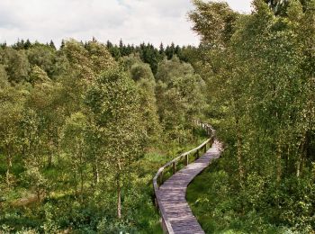
• Trail created by Naturpark Solling-Vogler. Website: https://www.naturpark-solling-vogler.de/index.php/hochmoor.html
![Tocht Te voet Grünenplan - HZ3 Auf dem Kammweg zum Raabe-Turm - Photo](https://media.geolcdn.com/t/350/260/bb4f132c-838d-43d7-b944-3ee07de6c057.jpeg&format=jpg&maxdim=2)
![Te voet Te voet](https://static1.geolcdn.com/sitytour/trail-icons/100.png)
Km
Te voet
![](/images/other/stat-length.png)
![](https://static1.geolcdn.com/siteimages/upload/files/1508320355ic_sort_den_pos_24dp.png)
![](https://static1.geolcdn.com/siteimages/upload/files/1508320355ic_sort_den_neg_24dp.png)
![](https://static1.geolcdn.com/siteimages/upload/files/16400158638029165_repeat_loop_refresh_sync_direction_icon.png)
![Tocht Te voet Hehlen - HE2 Wanderung Sievershagener Tal und Övelgönner Hochplateau - Photo](https://media.geolcdn.com/t/350/260/d6ede2f8-24a3-407e-842f-ec60385590d2.jpeg&format=jpg&maxdim=2)
![Te voet Te voet](https://static1.geolcdn.com/sitytour/trail-icons/100.png)
Km
Te voet
![](/images/other/stat-length.png)
![](https://static1.geolcdn.com/siteimages/upload/files/1508320355ic_sort_den_pos_24dp.png)
![](https://static1.geolcdn.com/siteimages/upload/files/1508320355ic_sort_den_neg_24dp.png)
![](https://static1.geolcdn.com/siteimages/upload/files/16400158638029165_repeat_loop_refresh_sync_direction_icon.png)
• Symbol: blaue Buchstaben und Ziffer HE2 auf gelbem Grund
![Tocht Te voet Hehlen - HE1 Rund um den Schiffberg - Photo](https://media.geolcdn.com/t/350/260/d6ede2f8-24a3-407e-842f-ec60385590d2.jpeg&format=jpg&maxdim=2)
![Te voet Te voet](https://static1.geolcdn.com/sitytour/trail-icons/100.png)
Km
Te voet
![](/images/other/stat-length.png)
![](https://static1.geolcdn.com/siteimages/upload/files/1508320355ic_sort_den_pos_24dp.png)
![](https://static1.geolcdn.com/siteimages/upload/files/1508320355ic_sort_den_neg_24dp.png)
![](https://static1.geolcdn.com/siteimages/upload/files/16400158638029165_repeat_loop_refresh_sync_direction_icon.png)
• Symbol: blaue Buchstaben und Ziffer HE1 auf gelbem Grund
![Tocht Te voet Bodenwerder - BW1 Hopfenberg und Kemnader Holz - Photo](https://media.geolcdn.com/t/350/260/ext.jpg?maxdim=2&url=https%3A%2F%2Fstatic1.geolcdn.com%2Fsiteimages%2Fupload%2Ffiles%2F1545311037marcheuse_200dpi.jpg)
![Te voet Te voet](https://static1.geolcdn.com/sitytour/trail-icons/100.png)
Km
Te voet
![](/images/other/stat-length.png)
![](https://static1.geolcdn.com/siteimages/upload/files/1508320355ic_sort_den_pos_24dp.png)
![](https://static1.geolcdn.com/siteimages/upload/files/1508320355ic_sort_den_neg_24dp.png)
![](https://static1.geolcdn.com/siteimages/upload/files/16400158638029165_repeat_loop_refresh_sync_direction_icon.png)
• Symbol: blaue Buchstaben und Ziffer BW 1 auf gelbem Grund
13 tochten weergegeven op 13
Gratisgps-wandelapplicatie