![](/images/other/stat-length.png)
Werra-Meißner-Kreis, Hessen, Te voet: Top van de beste wandelroutes, trajecten, tochten en wandelingen
Werra-Meißner-Kreis: Ontdek de beste tochten: 71 te voet. Al deze tochten, trajecten, routes en outdoor activiteiten zijn beschikbaar in onze SityTrail-apps voor smartphones en tablets.
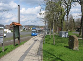
De beste trajecten (71)
![Tocht Te voet Bad Sooden-Allendorf - Rundweg Nr.7 Zielecke - Photo](https://media.geolcdn.com/t/350/260/355628d7-2a2a-4a88-bcbf-9e5d804971fb.jpeg&format=jpg&maxdim=2)
![Te voet Te voet](https://static1.geolcdn.com/sitytour/trail-icons/100.png)
Km
Te voet
![](/images/other/stat-length.png)
![](https://static1.geolcdn.com/siteimages/upload/files/1508320355ic_sort_den_pos_24dp.png)
![](https://static1.geolcdn.com/siteimages/upload/files/1508320355ic_sort_den_neg_24dp.png)
![](https://static1.geolcdn.com/siteimages/upload/files/16400158638029165_repeat_loop_refresh_sync_direction_icon.png)
• Symbol: gelbe 7 auf grünem Grund
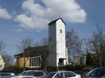
![Tocht Te voet Bad Sooden-Allendorf - Rundweg Nr.9](https://media.geolcdn.com/t/350/260/aa235e8c-56cd-4306-b756-70a76b09dafd.jpeg&format=jpg&maxdim=2)
![Te voet Te voet](https://static1.geolcdn.com/sitytour/trail-icons/100.png)
Km
Te voet
![](/images/other/stat-length.png)
![](https://static1.geolcdn.com/siteimages/upload/files/1508320355ic_sort_den_pos_24dp.png)
![](https://static1.geolcdn.com/siteimages/upload/files/1508320355ic_sort_den_neg_24dp.png)
![](https://static1.geolcdn.com/siteimages/upload/files/16400158638029165_repeat_loop_refresh_sync_direction_icon.png)
• Symbol: gelbe 9 auf grünem Grund
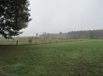
![Tocht Te voet Meißner - Premiumweg P 23 Höllental - Photo](https://media.geolcdn.com/t/350/260/16b41c48-9f90-4829-8f9c-584b4a29a346.jpeg&format=jpg&maxdim=2)
![Te voet Te voet](https://static1.geolcdn.com/sitytour/trail-icons/100.png)
Km
Te voet
![](/images/other/stat-length.png)
![](https://static1.geolcdn.com/siteimages/upload/files/1508320355ic_sort_den_pos_24dp.png)
![](https://static1.geolcdn.com/siteimages/upload/files/1508320355ic_sort_den_neg_24dp.png)
![](https://static1.geolcdn.com/siteimages/upload/files/16400158638029165_repeat_loop_refresh_sync_direction_icon.png)
• Symbol: gelbe P23 auf grünem Grund Website: http://www.naturparkfrauholle.land/wandern/premiumwege/detail?m=23
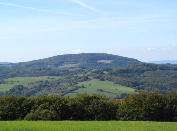
![Tocht Te voet Ringgau - Premiumweg P 19 Datterode, Gänsekerleweg - Photo](https://media.geolcdn.com/t/350/260/0af8dc96-5daf-43df-90dc-ace3edc5afd9.jpeg&format=jpg&maxdim=2)
![Te voet Te voet](https://static1.geolcdn.com/sitytour/trail-icons/100.png)
Km
Te voet
![](/images/other/stat-length.png)
![](https://static1.geolcdn.com/siteimages/upload/files/1508320355ic_sort_den_pos_24dp.png)
![](https://static1.geolcdn.com/siteimages/upload/files/1508320355ic_sort_den_neg_24dp.png)
![](https://static1.geolcdn.com/siteimages/upload/files/16400158638029165_repeat_loop_refresh_sync_direction_icon.png)
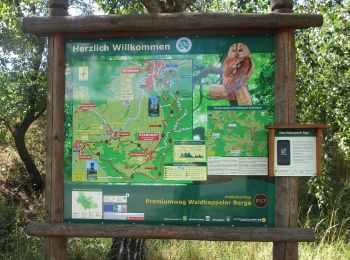
• Symbol: gelbe P19 auf grünem Grund Website: http://www.naturparkfrauholle.land/wandern/premiumwege/detail?m=19
![Tocht Te voet Ringgau - Premiumweg P20 Ulfener Karst - Photo](https://media.geolcdn.com/t/350/260/7e86ca89-e4a6-4631-b354-ae61be01e804.jpeg&format=jpg&maxdim=2)
![Te voet Te voet](https://static1.geolcdn.com/sitytour/trail-icons/100.png)
Km
Te voet
![](/images/other/stat-length.png)
![](https://static1.geolcdn.com/siteimages/upload/files/1508320355ic_sort_den_pos_24dp.png)
![](https://static1.geolcdn.com/siteimages/upload/files/1508320355ic_sort_den_neg_24dp.png)
![](https://static1.geolcdn.com/siteimages/upload/files/16400158638029165_repeat_loop_refresh_sync_direction_icon.png)
• Trail created by Naturpark Meißner Kaufunger Wald. Symbol: gelber Text P20 in gelbem Kreis
![Tocht Te voet Waldkappel - Premiumweg P17 Waldkappeler Berge - Photo](https://media.geolcdn.com/t/350/260/a8400b31-1405-4dce-9ab9-05316836d4cd.jpeg&format=jpg&maxdim=2)
![Te voet Te voet](https://static1.geolcdn.com/sitytour/trail-icons/100.png)
Km
Te voet
![](/images/other/stat-length.png)
![](https://static1.geolcdn.com/siteimages/upload/files/1508320355ic_sort_den_pos_24dp.png)
![](https://static1.geolcdn.com/siteimages/upload/files/1508320355ic_sort_den_neg_24dp.png)
![](https://static1.geolcdn.com/siteimages/upload/files/16400158638029165_repeat_loop_refresh_sync_direction_icon.png)
• Trail created by Werratalverein. Symbol: gelbe P17 auf grünem Grund
![Tocht Te voet Ringgau - Hasselbachtal - Photo](https://media.geolcdn.com/t/350/260/0af8dc96-5daf-43df-90dc-ace3edc5afd9.jpeg&format=jpg&maxdim=2)
![Te voet Te voet](https://static1.geolcdn.com/sitytour/trail-icons/100.png)
Km
Te voet
![](/images/other/stat-length.png)
![](https://static1.geolcdn.com/siteimages/upload/files/1508320355ic_sort_den_pos_24dp.png)
![](https://static1.geolcdn.com/siteimages/upload/files/1508320355ic_sort_den_neg_24dp.png)
![](https://static1.geolcdn.com/siteimages/upload/files/16400158638029165_repeat_loop_refresh_sync_direction_icon.png)
• Trail created by Geo Naturpark Frau Holle Land. Symbol: gelbe 1 in gelbem Kreis
![Tocht Te voet Eschwege - Premiumweg P3– Blaue Kuppe - Leuchtberge - Photo](https://media.geolcdn.com/t/350/260/6edceda2-c848-4407-af63-1b3d0585954a.jpeg&format=jpg&maxdim=2)
![Te voet Te voet](https://static1.geolcdn.com/sitytour/trail-icons/100.png)
Km
Te voet
![](/images/other/stat-length.png)
![](https://static1.geolcdn.com/siteimages/upload/files/1508320355ic_sort_den_pos_24dp.png)
![](https://static1.geolcdn.com/siteimages/upload/files/1508320355ic_sort_den_neg_24dp.png)
![](https://static1.geolcdn.com/siteimages/upload/files/16400158638029165_repeat_loop_refresh_sync_direction_icon.png)
• complete Symbol: gelber Text P3 in gelbem Kreis Website: https://www.naturparkfrauholle.land/wandern/premiumwege/d...
![Tocht Te voet Großalmerode - Großalmerode, Rundweg 21 - Photo](https://media.geolcdn.com/t/350/260/d5090863-04b8-41fa-9929-2442b2f82f57.jpeg&format=jpg&maxdim=2)
![Te voet Te voet](https://static1.geolcdn.com/sitytour/trail-icons/100.png)
Km
Te voet
![](/images/other/stat-length.png)
![](https://static1.geolcdn.com/siteimages/upload/files/1508320355ic_sort_den_pos_24dp.png)
![](https://static1.geolcdn.com/siteimages/upload/files/1508320355ic_sort_den_neg_24dp.png)
![](https://static1.geolcdn.com/siteimages/upload/files/16400158638029165_repeat_loop_refresh_sync_direction_icon.png)
• Trail created by Stadt Großalmerode. Wanderweg wird von der Stadt Großalmerode nicht mehr gepflegt
![Tocht Te voet Gutsbezirk Kaufunger Wald - Großalmerode, Rundweg 18 - Photo](https://media.geolcdn.com/t/350/260/a7004925-fa01-44e0-88fb-d4fe5055ba10.jpeg&format=jpg&maxdim=2)
![Te voet Te voet](https://static1.geolcdn.com/sitytour/trail-icons/100.png)
Km
Te voet
![](/images/other/stat-length.png)
![](https://static1.geolcdn.com/siteimages/upload/files/1508320355ic_sort_den_pos_24dp.png)
![](https://static1.geolcdn.com/siteimages/upload/files/1508320355ic_sort_den_neg_24dp.png)
![](https://static1.geolcdn.com/siteimages/upload/files/16400158638029165_repeat_loop_refresh_sync_direction_icon.png)
• Trail created by Stadt Großalmerode. Wanderweg wird von der Stadt Großalmerode nicht mehr gepflegt
![Tocht Te voet Großalmerode - Großalmerode, Rundweg 2 - Photo](https://media.geolcdn.com/t/350/260/4365a2ae-62cb-4ee3-b193-b3566a377c49.jpeg&format=jpg&maxdim=2)
![Te voet Te voet](https://static1.geolcdn.com/sitytour/trail-icons/100.png)
Km
Te voet
![](/images/other/stat-length.png)
![](https://static1.geolcdn.com/siteimages/upload/files/1508320355ic_sort_den_pos_24dp.png)
![](https://static1.geolcdn.com/siteimages/upload/files/1508320355ic_sort_den_neg_24dp.png)
![](https://static1.geolcdn.com/siteimages/upload/files/16400158638029165_repeat_loop_refresh_sync_direction_icon.png)
• Trail created by Stadt Großalmerode. Wanderweg wird von der Stadt Großalmerode nicht mehr gepflegt
![Tocht Te voet Hessisch Lichtenau - Hessisch Lichtenau-Eschenstruth - Photo](https://media.geolcdn.com/t/350/260/8cd56afa-1a04-40b5-813d-908ba7c05718.jpeg&format=jpg&maxdim=2)
![Te voet Te voet](https://static1.geolcdn.com/sitytour/trail-icons/100.png)
Km
Te voet
![](/images/other/stat-length.png)
![](https://static1.geolcdn.com/siteimages/upload/files/1508320355ic_sort_den_pos_24dp.png)
![](https://static1.geolcdn.com/siteimages/upload/files/1508320355ic_sort_den_neg_24dp.png)
![](https://static1.geolcdn.com/siteimages/upload/files/16400158638029165_repeat_loop_refresh_sync_direction_icon.png)
• Trail created by Stadt Hessisch Lichtenau. Symbol: weißer Punkt
![Tocht Te voet Hessisch Lichtenau - Hessisch Lichtenau-Bielstein - Photo](https://media.geolcdn.com/t/350/260/8cd56afa-1a04-40b5-813d-908ba7c05718.jpeg&format=jpg&maxdim=2)
![Te voet Te voet](https://static1.geolcdn.com/sitytour/trail-icons/100.png)
Km
Te voet
![](/images/other/stat-length.png)
![](https://static1.geolcdn.com/siteimages/upload/files/1508320355ic_sort_den_pos_24dp.png)
![](https://static1.geolcdn.com/siteimages/upload/files/1508320355ic_sort_den_neg_24dp.png)
![](https://static1.geolcdn.com/siteimages/upload/files/16400158638029165_repeat_loop_refresh_sync_direction_icon.png)
• Trail created by Stadt Hessisch Lichtenau. Symbol: weißes ungefülltes aufrechtstehendes Rechteck
![Tocht Te voet Hessisch Lichtenau - Hessisch Lichtenau-Helsa - Photo](https://media.geolcdn.com/t/350/260/81c6a10d-ba51-4efd-a5c8-f23fd42d33ff.jpeg&format=jpg&maxdim=2)
![Te voet Te voet](https://static1.geolcdn.com/sitytour/trail-icons/100.png)
Km
Te voet
![](/images/other/stat-length.png)
![](https://static1.geolcdn.com/siteimages/upload/files/1508320355ic_sort_den_pos_24dp.png)
![](https://static1.geolcdn.com/siteimages/upload/files/1508320355ic_sort_den_neg_24dp.png)
![](https://static1.geolcdn.com/siteimages/upload/files/16400158638029165_repeat_loop_refresh_sync_direction_icon.png)
• Trail created by Stadt Hessisch Lichtenau. Symbol: weißes auf dem Kopf stehendes T
![Tocht Te voet Hessisch Lichtenau - Rundwanderweg Hessisch Lichtenau HL1 - Photo](https://media.geolcdn.com/t/350/260/3138e4a9-8baf-48bb-ae2e-b3949e50fd62.jpeg&format=jpg&maxdim=2)
![Te voet Te voet](https://static1.geolcdn.com/sitytour/trail-icons/100.png)
Km
Te voet
![](/images/other/stat-length.png)
![](https://static1.geolcdn.com/siteimages/upload/files/1508320355ic_sort_den_pos_24dp.png)
![](https://static1.geolcdn.com/siteimages/upload/files/1508320355ic_sort_den_neg_24dp.png)
![](https://static1.geolcdn.com/siteimages/upload/files/16400158638029165_repeat_loop_refresh_sync_direction_icon.png)
• Trail created by Stadt Hessisch Lichtenau. Symbol: gelber Text HL1
![Tocht Te voet Hessisch Lichtenau - Rundwanderweg Hessisch Lichtenau HL5 - Photo](https://media.geolcdn.com/t/350/260/64a547b6-e44b-4e5d-b724-26717a71ba96.jpeg&format=jpg&maxdim=2)
![Te voet Te voet](https://static1.geolcdn.com/sitytour/trail-icons/100.png)
Km
Te voet
![](/images/other/stat-length.png)
![](https://static1.geolcdn.com/siteimages/upload/files/1508320355ic_sort_den_pos_24dp.png)
![](https://static1.geolcdn.com/siteimages/upload/files/1508320355ic_sort_den_neg_24dp.png)
![](https://static1.geolcdn.com/siteimages/upload/files/16400158638029165_repeat_loop_refresh_sync_direction_icon.png)
• Trail created by Stadt Hessisch Lichtenau. complete Symbol: gelber Text HL5
![Tocht Te voet Bad Sooden-Allendorf - BSA-Teufelskanzel - Photo](https://media.geolcdn.com/t/350/260/ec7c5bbf-dd40-4326-9f3a-784a4b47ee54.jpeg&format=jpg&maxdim=2)
![Te voet Te voet](https://static1.geolcdn.com/sitytour/trail-icons/100.png)
Km
Te voet
![](/images/other/stat-length.png)
![](https://static1.geolcdn.com/siteimages/upload/files/1508320355ic_sort_den_pos_24dp.png)
![](https://static1.geolcdn.com/siteimages/upload/files/1508320355ic_sort_den_neg_24dp.png)
![](https://static1.geolcdn.com/siteimages/upload/files/16400158638029165_repeat_loop_refresh_sync_direction_icon.png)
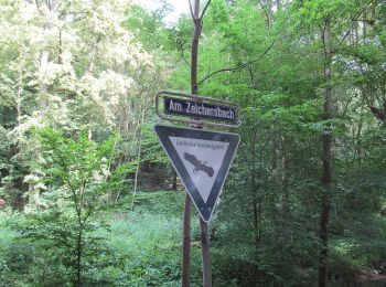
• Trail created by Werratalverein. Symbol: weißer Text "T" auf dunklem Grund
![Tocht Te voet Hessisch Lichtenau - Rundwanderweg Hessisch Lichtenau HL4 - Photo](https://media.geolcdn.com/t/350/260/c5e933ae-7ce9-4f45-9654-5a92a168a2a8.jpeg&format=jpg&maxdim=2)
![Te voet Te voet](https://static1.geolcdn.com/sitytour/trail-icons/100.png)
Km
Te voet
![](/images/other/stat-length.png)
![](https://static1.geolcdn.com/siteimages/upload/files/1508320355ic_sort_den_pos_24dp.png)
![](https://static1.geolcdn.com/siteimages/upload/files/1508320355ic_sort_den_neg_24dp.png)
![](https://static1.geolcdn.com/siteimages/upload/files/16400158638029165_repeat_loop_refresh_sync_direction_icon.png)
• Trail created by Stadt Hessisch Lichtenau. Symbol: gelber Text HL4
![Tocht Te voet Hessisch Lichtenau - Rundwanderweg Hessisch Lichtenau HL3 - Photo](https://media.geolcdn.com/t/350/260/c5e933ae-7ce9-4f45-9654-5a92a168a2a8.jpeg&format=jpg&maxdim=2)
![Te voet Te voet](https://static1.geolcdn.com/sitytour/trail-icons/100.png)
Km
Te voet
![](/images/other/stat-length.png)
![](https://static1.geolcdn.com/siteimages/upload/files/1508320355ic_sort_den_pos_24dp.png)
![](https://static1.geolcdn.com/siteimages/upload/files/1508320355ic_sort_den_neg_24dp.png)
![](https://static1.geolcdn.com/siteimages/upload/files/16400158638029165_repeat_loop_refresh_sync_direction_icon.png)
• Trail created by Stadt Hessisch Lichtenau. Symbol: gelber Text HL3
![Tocht Te voet Witzenhausen - Schneehagenweg - Photo](https://media.geolcdn.com/t/350/260/909c3640-0b2f-4808-a2fd-34f169601974.jpeg&format=jpg&maxdim=2)
![Te voet Te voet](https://static1.geolcdn.com/sitytour/trail-icons/100.png)
Km
Te voet
![](/images/other/stat-length.png)
![](https://static1.geolcdn.com/siteimages/upload/files/1508320355ic_sort_den_pos_24dp.png)
![](https://static1.geolcdn.com/siteimages/upload/files/1508320355ic_sort_den_neg_24dp.png)
![](https://static1.geolcdn.com/siteimages/upload/files/16400158638029165_repeat_loop_refresh_sync_direction_icon.png)
• Trail created by Werratalverein. Symbol: weißes LM auf schwarzem Grund
20 tochten weergegeven op 71
Gratisgps-wandelapplicatie