![](/images/other/stat-length.png)
- Tochten
- Te voet
- Germany
- Hessen
- Main-Kinzig-Kreis
- Steinau an der Straße
Steinau an der Straße, Steinau an der Straße, Te voet: Top van de beste wandelroutes, trajecten, tochten en wandelingen
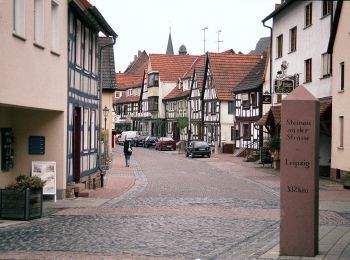
Steinau an der Straße: Ontdek de beste tochten: 15 te voet. Al deze tochten, trajecten, routes en outdoor activiteiten zijn beschikbaar in onze SityTrail-apps voor smartphones en tablets.
De beste trajecten (15)
![Tocht Te voet Steinau an der Straße - Steinau a. d. Straße, Wanderweg 3b - Photo](https://media.geolcdn.com/t/350/260/a727d70d-c791-4517-b7dc-042b076b4739.jpeg&format=jpg&maxdim=2)
![Te voet Te voet](https://static1.geolcdn.com/sitytour/trail-icons/100.png)
Km
Te voet
![](/images/other/stat-length.png)
![](https://static1.geolcdn.com/siteimages/upload/files/1508320355ic_sort_den_pos_24dp.png)
![](https://static1.geolcdn.com/siteimages/upload/files/1508320355ic_sort_den_neg_24dp.png)
![](https://static1.geolcdn.com/siteimages/upload/files/16400158638029165_repeat_loop_refresh_sync_direction_icon.png)
• Trail created by Vogelsberger Höhenclub. Symbol: Roter Text 3b auf weißem Grund
![Tocht Te voet Steinau an der Straße - Steinau a. d. Straße, Wanderweg 8 - Photo](https://media.geolcdn.com/t/350/260/13e1c0ae-984b-43bb-b023-48a13d337692.jpeg&format=jpg&maxdim=2)
![Te voet Te voet](https://static1.geolcdn.com/sitytour/trail-icons/100.png)
Km
Te voet
![](/images/other/stat-length.png)
![](https://static1.geolcdn.com/siteimages/upload/files/1508320355ic_sort_den_pos_24dp.png)
![](https://static1.geolcdn.com/siteimages/upload/files/1508320355ic_sort_den_neg_24dp.png)
![](https://static1.geolcdn.com/siteimages/upload/files/16400158638029165_repeat_loop_refresh_sync_direction_icon.png)
• Trail created by Vogelsberger Höhenclub. Symbol: Rote 8 auf weißem Hintergrund
![Tocht Te voet Steinau an der Straße - Steinau a.d. Straße - Wartenweg 1 - Photo](https://media.geolcdn.com/t/350/260/b8e05691-abbb-48d7-8d7c-199ee18beccd.jpeg&format=jpg&maxdim=2)
![Te voet Te voet](https://static1.geolcdn.com/sitytour/trail-icons/100.png)
Km
Te voet
![](/images/other/stat-length.png)
![](https://static1.geolcdn.com/siteimages/upload/files/1508320355ic_sort_den_pos_24dp.png)
![](https://static1.geolcdn.com/siteimages/upload/files/1508320355ic_sort_den_neg_24dp.png)
![](https://static1.geolcdn.com/siteimages/upload/files/16400158638029165_repeat_loop_refresh_sync_direction_icon.png)
• Trail created by Stadt Steinau a.d. Straße. Symbol: Schwarzer Turm auf weißem Hintergrund - W1 Website: https://ww...
![Tocht Te voet Steinau an der Straße - Steinau a.d. Straße - Wartenweg 4 - Photo](https://media.geolcdn.com/t/350/260/b8e05691-abbb-48d7-8d7c-199ee18beccd.jpeg&format=jpg&maxdim=2)
![Te voet Te voet](https://static1.geolcdn.com/sitytour/trail-icons/100.png)
Km
Te voet
![](/images/other/stat-length.png)
![](https://static1.geolcdn.com/siteimages/upload/files/1508320355ic_sort_den_pos_24dp.png)
![](https://static1.geolcdn.com/siteimages/upload/files/1508320355ic_sort_den_neg_24dp.png)
![](https://static1.geolcdn.com/siteimages/upload/files/16400158638029165_repeat_loop_refresh_sync_direction_icon.png)
• Trail created by Stadt Steinau a.d. Straße. Symbol: Schwarzer Turm auf weißem Hintergrund - W4 Website: https://ww...
![Tocht Te voet Steinau an der Straße - Steinau a. d. Straße, Wanderweg 5 - Photo](https://media.geolcdn.com/t/350/260/2f75ce78-7455-4a1f-a522-572d5daa3bf8.jpeg&format=jpg&maxdim=2)
![Te voet Te voet](https://static1.geolcdn.com/sitytour/trail-icons/100.png)
Km
Te voet
![](/images/other/stat-length.png)
![](https://static1.geolcdn.com/siteimages/upload/files/1508320355ic_sort_den_pos_24dp.png)
![](https://static1.geolcdn.com/siteimages/upload/files/1508320355ic_sort_den_neg_24dp.png)
![](https://static1.geolcdn.com/siteimages/upload/files/16400158638029165_repeat_loop_refresh_sync_direction_icon.png)
• Trail created by Vogelsberger Höhenclub. Symbol: Roter Text 5 auf weißem Grund
![Tocht Te voet Steinau an der Straße - Steinau a. d. Straße, Wanderweg 4 - Photo](https://media.geolcdn.com/t/350/260/70e32bfd-28e0-42b4-b181-05d76eecec73.jpeg&format=jpg&maxdim=2)
![Te voet Te voet](https://static1.geolcdn.com/sitytour/trail-icons/100.png)
Km
Te voet
![](/images/other/stat-length.png)
![](https://static1.geolcdn.com/siteimages/upload/files/1508320355ic_sort_den_pos_24dp.png)
![](https://static1.geolcdn.com/siteimages/upload/files/1508320355ic_sort_den_neg_24dp.png)
![](https://static1.geolcdn.com/siteimages/upload/files/16400158638029165_repeat_loop_refresh_sync_direction_icon.png)
• Trail created by Vogelsberger Höhenclub. Symbol: Roter Text 4 auf weißem Grund
![Tocht Te voet Steinau an der Straße - Steinau a. d. Straße, Wanderweg 4a - Photo](https://media.geolcdn.com/t/350/260/70e32bfd-28e0-42b4-b181-05d76eecec73.jpeg&format=jpg&maxdim=2)
![Te voet Te voet](https://static1.geolcdn.com/sitytour/trail-icons/100.png)
Km
Te voet
![](/images/other/stat-length.png)
![](https://static1.geolcdn.com/siteimages/upload/files/1508320355ic_sort_den_pos_24dp.png)
![](https://static1.geolcdn.com/siteimages/upload/files/1508320355ic_sort_den_neg_24dp.png)
![](https://static1.geolcdn.com/siteimages/upload/files/16400158638029165_repeat_loop_refresh_sync_direction_icon.png)
• Trail created by Vogelsberger Höhenclub. Symbol: Roter Text 4a auf weißem Grund
![Tocht Te voet Steinau an der Straße - Steinau a. d. Straße, Wanderweg 6 - Photo](https://media.geolcdn.com/t/350/260/70e32bfd-28e0-42b4-b181-05d76eecec73.jpeg&format=jpg&maxdim=2)
![Te voet Te voet](https://static1.geolcdn.com/sitytour/trail-icons/100.png)
Km
Te voet
![](/images/other/stat-length.png)
![](https://static1.geolcdn.com/siteimages/upload/files/1508320355ic_sort_den_pos_24dp.png)
![](https://static1.geolcdn.com/siteimages/upload/files/1508320355ic_sort_den_neg_24dp.png)
![](https://static1.geolcdn.com/siteimages/upload/files/16400158638029165_repeat_loop_refresh_sync_direction_icon.png)
• Trail created by Vogelsberger Höhenclub. Symbol: Rote 6 auf weißem Hintergrund
![Tocht Te voet Steinau an der Straße - Steinau a. d. Straße, Wanderweg 2 - Photo](https://media.geolcdn.com/t/350/260/0d6e6875-6c4f-4db2-8ad7-0d5a2f2beef1.jpeg&format=jpg&maxdim=2)
![Te voet Te voet](https://static1.geolcdn.com/sitytour/trail-icons/100.png)
Km
Te voet
![](/images/other/stat-length.png)
![](https://static1.geolcdn.com/siteimages/upload/files/1508320355ic_sort_den_pos_24dp.png)
![](https://static1.geolcdn.com/siteimages/upload/files/1508320355ic_sort_den_neg_24dp.png)
![](https://static1.geolcdn.com/siteimages/upload/files/16400158638029165_repeat_loop_refresh_sync_direction_icon.png)
• Trail created by Vogelsberger Höhenclub. Symbol: Rote 2 auf weißem Grund
![Tocht Te voet Steinau an der Straße - Steinau a.d. Straße - Wartenweg 2 - Photo](https://media.geolcdn.com/t/350/260/b8e05691-abbb-48d7-8d7c-199ee18beccd.jpeg&format=jpg&maxdim=2)
![Te voet Te voet](https://static1.geolcdn.com/sitytour/trail-icons/100.png)
Km
Te voet
![](/images/other/stat-length.png)
![](https://static1.geolcdn.com/siteimages/upload/files/1508320355ic_sort_den_pos_24dp.png)
![](https://static1.geolcdn.com/siteimages/upload/files/1508320355ic_sort_den_neg_24dp.png)
![](https://static1.geolcdn.com/siteimages/upload/files/16400158638029165_repeat_loop_refresh_sync_direction_icon.png)
• Trail created by Stadt Steinau a.d. Straße. Symbol: Schwarzer Turm auf weißem Hintergrund - W2 Website: https://ww...
![Tocht Te voet Steinau an der Straße - Steinauer Hochgefühl ( Spessartfährten ) - Photo](https://media.geolcdn.com/t/350/260/c0085337-021b-42b9-b4e6-257b85a337d0.jpeg&format=jpg&maxdim=2)
![Te voet Te voet](https://static1.geolcdn.com/sitytour/trail-icons/100.png)
Km
Te voet
![](/images/other/stat-length.png)
![](https://static1.geolcdn.com/siteimages/upload/files/1508320355ic_sort_den_pos_24dp.png)
![](https://static1.geolcdn.com/siteimages/upload/files/1508320355ic_sort_den_neg_24dp.png)
![](https://static1.geolcdn.com/siteimages/upload/files/16400158638029165_repeat_loop_refresh_sync_direction_icon.png)
• Trail created by Naturpark Hessischer Spessart, Main Kinzig Kreis. Symbol: blauer Strich und grüner Bogen über gelbe...
![Tocht Te voet Steinau an der Straße - Steinau a.d. Straße - Wartenrundweg - Photo](https://media.geolcdn.com/t/350/260/9651253a-8c0d-47f3-85e1-7b0f34df81c6.jpeg&format=jpg&maxdim=2)
![Te voet Te voet](https://static1.geolcdn.com/sitytour/trail-icons/100.png)
Km
Te voet
![](/images/other/stat-length.png)
![](https://static1.geolcdn.com/siteimages/upload/files/1508320355ic_sort_den_pos_24dp.png)
![](https://static1.geolcdn.com/siteimages/upload/files/1508320355ic_sort_den_neg_24dp.png)
![](https://static1.geolcdn.com/siteimages/upload/files/16400158638029165_repeat_loop_refresh_sync_direction_icon.png)
• Trail created by Stadt Steinau a.d. Straße. Symbol: Schwarzer Turm auf weißem Hintergrund Website: https://www.ste...
![Tocht Te voet Steinau an der Straße - Gebietswanderweg Rotes Dreieck, Steinau - Zubringer Eselsweg - Photo](https://media.geolcdn.com/t/350/260/0d6e6875-6c4f-4db2-8ad7-0d5a2f2beef1.jpeg&format=jpg&maxdim=2)
![Te voet Te voet](https://static1.geolcdn.com/sitytour/trail-icons/100.png)
Km
Te voet
![](/images/other/stat-length.png)
![](https://static1.geolcdn.com/siteimages/upload/files/1508320355ic_sort_den_pos_24dp.png)
![](https://static1.geolcdn.com/siteimages/upload/files/1508320355ic_sort_den_neg_24dp.png)
![](https://static1.geolcdn.com/siteimages/upload/files/16400158638029165_repeat_loop_refresh_sync_direction_icon.png)
• Trail created by Spessartbund. Symbol: Rotes Dreieck auf weißem Hintergrund
![Tocht Te voet Steinau an der Straße - Steinau a. d. Straße, Wanderweg 3a - Photo](https://media.geolcdn.com/t/350/260/a727d70d-c791-4517-b7dc-042b076b4739.jpeg&format=jpg&maxdim=2)
![Te voet Te voet](https://static1.geolcdn.com/sitytour/trail-icons/100.png)
Km
Te voet
![](/images/other/stat-length.png)
![](https://static1.geolcdn.com/siteimages/upload/files/1508320355ic_sort_den_pos_24dp.png)
![](https://static1.geolcdn.com/siteimages/upload/files/1508320355ic_sort_den_neg_24dp.png)
![](https://static1.geolcdn.com/siteimages/upload/files/16400158638029165_repeat_loop_refresh_sync_direction_icon.png)
• Trail created by Vogelsberger Höhenclub. Symbol: Roter Text 3a auf weißem Grund
![Tocht Te voet Steinau an der Straße - Steinau a. d. Straße, Wanderweg 7 - Photo](https://media.geolcdn.com/t/350/260/26ec76ea-3b09-4955-8351-ddb56efea190.jpeg&format=jpg&maxdim=2)
![Te voet Te voet](https://static1.geolcdn.com/sitytour/trail-icons/100.png)
Km
Te voet
![](/images/other/stat-length.png)
![](https://static1.geolcdn.com/siteimages/upload/files/1508320355ic_sort_den_pos_24dp.png)
![](https://static1.geolcdn.com/siteimages/upload/files/1508320355ic_sort_den_neg_24dp.png)
![](https://static1.geolcdn.com/siteimages/upload/files/16400158638029165_repeat_loop_refresh_sync_direction_icon.png)
• Trail created by Vogelsberger Höhenclub. Symbol: Roter Text 7 auf weißem Grund
15 tochten weergegeven op 15
Gratisgps-wandelapplicatie