![](/images/other/stat-length.png)
Saarland, Germany, Te voet: Top van de beste wandelroutes, trajecten, tochten en wandelingen
Saarland: Ontdek de beste tochten: 169 te voet en 35 stappen. Al deze tochten, trajecten, routes en outdoor activiteiten zijn beschikbaar in onze SityTrail-apps voor smartphones en tablets.
De beste trajecten (204)
![Tocht Stappen Merzig - Méandres côté rive droite de la Sarre - Photo](https://media.geolcdn.com/t/350/260/2b4c95b3-097a-458c-86c4-e30aa32a28b5.jpg&format=jpg&maxdim=2)
![Stappen Stappen](https://static1.geolcdn.com/sitytour/trail-icons/101.png)
Km
Stappen
![](/images/other/stat-length.png)
![](https://static1.geolcdn.com/siteimages/upload/files/1508320355ic_sort_den_pos_24dp.png)
![](https://static1.geolcdn.com/siteimages/upload/files/1508320355ic_sort_den_neg_24dp.png)
![](https://static1.geolcdn.com/siteimages/upload/files/16400158638029165_repeat_loop_refresh_sync_direction_icon.png)
![Tocht Stappen Mettlach - Randonnée au dessus de la boucle de la Sarre - Photo](https://media.geolcdn.com/t/350/260/1ec4c99f-6e1e-49de-a821-8974cc08752c.jpg&format=jpg&maxdim=2)
![Stappen Stappen](https://static1.geolcdn.com/sitytour/trail-icons/101.png)
Km
Stappen
![](/images/other/stat-length.png)
![](https://static1.geolcdn.com/siteimages/upload/files/1508320355ic_sort_den_pos_24dp.png)
![](https://static1.geolcdn.com/siteimages/upload/files/1508320355ic_sort_den_neg_24dp.png)
![](https://static1.geolcdn.com/siteimages/upload/files/16400158638029165_repeat_loop_refresh_sync_direction_icon.png)
![Tocht Te voet Überherrn - Circuit l'ancien Tramway - Photo](https://media.geolcdn.com/t/350/260/7e1691d1-ec8c-4da5-b694-c9e61533dbb2.jpeg&format=jpg&maxdim=2)
![Te voet Te voet](https://static1.geolcdn.com/sitytour/trail-icons/100.png)
Km
Te voet
![](/images/other/stat-length.png)
![](https://static1.geolcdn.com/siteimages/upload/files/1508320355ic_sort_den_pos_24dp.png)
![](https://static1.geolcdn.com/siteimages/upload/files/1508320355ic_sort_den_neg_24dp.png)
![](https://static1.geolcdn.com/siteimages/upload/files/16400158638029165_repeat_loop_refresh_sync_direction_icon.png)
• Trail created by MOSL.
![Tocht Te voet Saarbrücken - Rundweg Historischer Halberg - Photo](https://media.geolcdn.com/t/350/260/4559c55f-7c6f-4991-9ac9-1a91918d0127.jpeg&format=jpg&maxdim=2)
![Te voet Te voet](https://static1.geolcdn.com/sitytour/trail-icons/100.png)
Km
Te voet
![](/images/other/stat-length.png)
![](https://static1.geolcdn.com/siteimages/upload/files/1508320355ic_sort_den_pos_24dp.png)
![](https://static1.geolcdn.com/siteimages/upload/files/1508320355ic_sort_den_neg_24dp.png)
![](https://static1.geolcdn.com/siteimages/upload/files/16400158638029165_repeat_loop_refresh_sync_direction_icon.png)
• Der vom Saarländischen Rundfunk konzipierte Rundweg "Historischer Halberg" beginnt auf dem Parkplatz, linkerhand der ...
![Tocht Te voet Saarbrücken - Ensheimer Brunnenweg - Photo](https://media.geolcdn.com/t/350/260/86f5362b-0683-46dd-ac92-1c1dfdd922ac.jpeg&format=jpg&maxdim=2)
![Te voet Te voet](https://static1.geolcdn.com/sitytour/trail-icons/100.png)
Km
Te voet
![](/images/other/stat-length.png)
![](https://static1.geolcdn.com/siteimages/upload/files/1508320355ic_sort_den_pos_24dp.png)
![](https://static1.geolcdn.com/siteimages/upload/files/1508320355ic_sort_den_neg_24dp.png)
![](https://static1.geolcdn.com/siteimages/upload/files/16400158638029165_repeat_loop_refresh_sync_direction_icon.png)
• Trail created by Ensheimer Brunnenfreunde.
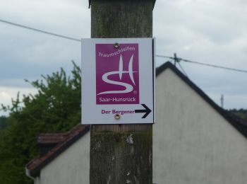
![Tocht Te voet Losheim am See - Greimerather Höhenweg - Photo](https://media.geolcdn.com/t/350/260/1618392c-19e8-4f3f-8467-e12887d06a5a.jpeg&format=jpg&maxdim=2)
![Te voet Te voet](https://static1.geolcdn.com/sitytour/trail-icons/100.png)
Km
Te voet
![](/images/other/stat-length.png)
![](https://static1.geolcdn.com/siteimages/upload/files/1508320355ic_sort_den_pos_24dp.png)
![](https://static1.geolcdn.com/siteimages/upload/files/1508320355ic_sort_den_neg_24dp.png)
![](https://static1.geolcdn.com/siteimages/upload/files/16400158638029165_repeat_loop_refresh_sync_direction_icon.png)
• Trail created by Hunsrueck-Touristik. Symbol: blue:blue::SH Greimerather Höhenweg:white
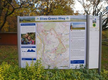
![Tocht Te voet Kleinblittersdorf - Circuit Franco-Allemand n°1 - Photo](https://media.geolcdn.com/t/350/260/34935902-1366-4ee6-be2d-fa527c83f2d7.jpeg&format=jpg&maxdim=2)
![Te voet Te voet](https://static1.geolcdn.com/sitytour/trail-icons/100.png)
Km
Te voet
![](/images/other/stat-length.png)
![](https://static1.geolcdn.com/siteimages/upload/files/1508320355ic_sort_den_pos_24dp.png)
![](https://static1.geolcdn.com/siteimages/upload/files/1508320355ic_sort_den_neg_24dp.png)
![](https://static1.geolcdn.com/siteimages/upload/files/16400158638029165_repeat_loop_refresh_sync_direction_icon.png)
• Trail created by Club vosgien.
![Tocht Te voet Mettlach - Verbindungsweg zum Europäischen Fernwanderweg E3 - Photo](https://media.geolcdn.com/t/350/260/6576b88e-784e-49f5-988b-1f07b71a267c.jpeg&format=jpg&maxdim=2)
![Te voet Te voet](https://static1.geolcdn.com/sitytour/trail-icons/100.png)
Km
Te voet
![](/images/other/stat-length.png)
![](https://static1.geolcdn.com/siteimages/upload/files/1508320355ic_sort_den_pos_24dp.png)
![](https://static1.geolcdn.com/siteimages/upload/files/1508320355ic_sort_den_neg_24dp.png)
![](https://static1.geolcdn.com/siteimages/upload/files/16400158638029165_repeat_loop_refresh_sync_direction_icon.png)
• Symbol: X-V
![Tocht Te voet Püttlingen - Pfarrer-Rug-Weg - Photo](https://media.geolcdn.com/t/350/260/35199d78-db73-436a-8685-d67217d3ea79.jpeg&format=jpg&maxdim=2)
![Te voet Te voet](https://static1.geolcdn.com/sitytour/trail-icons/100.png)
Km
Te voet
![](/images/other/stat-length.png)
![](https://static1.geolcdn.com/siteimages/upload/files/1508320355ic_sort_den_pos_24dp.png)
![](https://static1.geolcdn.com/siteimages/upload/files/1508320355ic_sort_den_neg_24dp.png)
![](https://static1.geolcdn.com/siteimages/upload/files/16400158638029165_repeat_loop_refresh_sync_direction_icon.png)
• Eurodistrict SaarMoselle Website: http://www.vianovis.net/saarmoselle/#SOURCE=saarmoselle-touren&FID=64&m=satellite&...
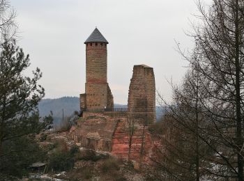
![Tocht Te voet Kirkel - Kirkeler Felsenpfad - Photo](https://media.geolcdn.com/t/350/260/959825cf-5233-4ca7-9695-d75e71c622c0.jpeg&format=jpg&maxdim=2)
![Te voet Te voet](https://static1.geolcdn.com/sitytour/trail-icons/100.png)
Km
Te voet
![](/images/other/stat-length.png)
![](https://static1.geolcdn.com/siteimages/upload/files/1508320355ic_sort_den_pos_24dp.png)
![](https://static1.geolcdn.com/siteimages/upload/files/1508320355ic_sort_den_neg_24dp.png)
![](https://static1.geolcdn.com/siteimages/upload/files/16400158638029165_repeat_loop_refresh_sync_direction_icon.png)
• Symbol: Schwarzer Steinbock auf weißem Grund
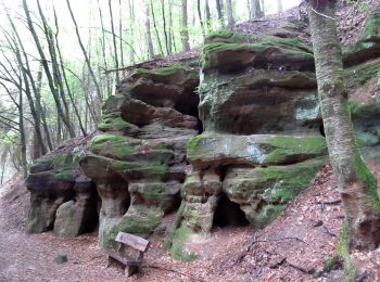
![Tocht Te voet Blieskastel - Erlebnisweg](https://media.geolcdn.com/t/350/260/ce79857c-ba71-4dc2-b57a-e23652e6ffb4.jpeg&format=jpg&maxdim=2)
![Te voet Te voet](https://static1.geolcdn.com/sitytour/trail-icons/100.png)
Km
Te voet
![](/images/other/stat-length.png)
![](https://static1.geolcdn.com/siteimages/upload/files/1508320355ic_sort_den_pos_24dp.png)
![](https://static1.geolcdn.com/siteimages/upload/files/1508320355ic_sort_den_neg_24dp.png)
![](https://static1.geolcdn.com/siteimages/upload/files/16400158638029165_repeat_loop_refresh_sync_direction_icon.png)
• Website: https://www.biosphaere-bliesgau.eu/index.php/de/bildung-und-forschung/erlebnisregion-bliesgau/erlebnisweg-...
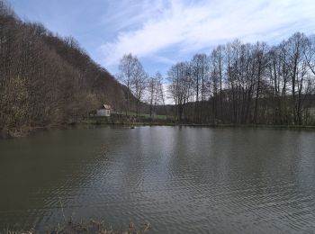
![Tocht Te voet Blieskastel - Eulenwanderweg - Photo](https://media.geolcdn.com/t/350/260/4d1df924-8c7c-42ab-a19e-46e254f40996.jpeg&format=jpg&maxdim=2)
![Te voet Te voet](https://static1.geolcdn.com/sitytour/trail-icons/100.png)
Km
Te voet
![](/images/other/stat-length.png)
![](https://static1.geolcdn.com/siteimages/upload/files/1508320355ic_sort_den_pos_24dp.png)
![](https://static1.geolcdn.com/siteimages/upload/files/1508320355ic_sort_den_neg_24dp.png)
![](https://static1.geolcdn.com/siteimages/upload/files/16400158638029165_repeat_loop_refresh_sync_direction_icon.png)
• Symbol: schwarze Eule auf weißem Grund
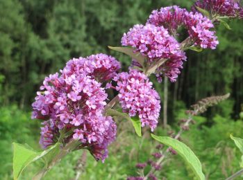
![Tocht Te voet Saarbrücken - Urwald-Tour - Photo](https://media.geolcdn.com/t/350/260/f5eb1be6-411d-4b94-ad7b-459672a8e3b3.jpeg&format=jpg&maxdim=2)
![Te voet Te voet](https://static1.geolcdn.com/sitytour/trail-icons/100.png)
Km
Te voet
![](/images/other/stat-length.png)
![](https://static1.geolcdn.com/siteimages/upload/files/1508320355ic_sort_den_pos_24dp.png)
![](https://static1.geolcdn.com/siteimages/upload/files/1508320355ic_sort_den_neg_24dp.png)
![](https://static1.geolcdn.com/siteimages/upload/files/16400158638029165_repeat_loop_refresh_sync_direction_icon.png)
• Urwald vor den Toren der Stadt Website: https://saar-urwald.de/den-urwald-erleben/wandern-im-urwald/urwaldtour-abent...
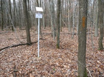
![Tocht Te voet Saarbrücken - Wilder Netzbachpfad - Photo](https://media.geolcdn.com/t/350/260/b4e628dc-dda2-464d-95b1-07f41bbf8f77.jpeg&format=jpg&maxdim=2)
![Te voet Te voet](https://static1.geolcdn.com/sitytour/trail-icons/100.png)
Km
Te voet
![](/images/other/stat-length.png)
![](https://static1.geolcdn.com/siteimages/upload/files/1508320355ic_sort_den_pos_24dp.png)
![](https://static1.geolcdn.com/siteimages/upload/files/1508320355ic_sort_den_neg_24dp.png)
![](https://static1.geolcdn.com/siteimages/upload/files/16400158638029165_repeat_loop_refresh_sync_direction_icon.png)
• Urwald vor den Toren der Stadt Website: http://www.saar-urwald.de/den-urwald-erleben/wandern-im-urwald/wilder-netzba...
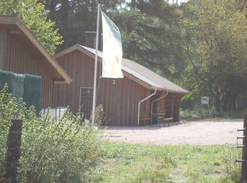
![Tocht Te voet Wadern - Traumschleife Almglück - Photo](https://media.geolcdn.com/t/350/260/f2cb7450-432a-4d17-8209-ec7484f0e8ce.jpeg&format=jpg&maxdim=2)
![Te voet Te voet](https://static1.geolcdn.com/sitytour/trail-icons/100.png)
Km
Te voet
![](/images/other/stat-length.png)
![](https://static1.geolcdn.com/siteimages/upload/files/1508320355ic_sort_den_pos_24dp.png)
![](https://static1.geolcdn.com/siteimages/upload/files/1508320355ic_sort_den_neg_24dp.png)
![](https://static1.geolcdn.com/siteimages/upload/files/16400158638029165_repeat_loop_refresh_sync_direction_icon.png)
• Trail created by Rheinland-Pfalz Tourismus GmbH.
![Tocht Te voet Blieskastel - Vogel-Rundwanderweg Webenheim/Mimbach? - Photo](https://media.geolcdn.com/t/350/260/4d1df924-8c7c-42ab-a19e-46e254f40996.jpeg&format=jpg&maxdim=2)
![Te voet Te voet](https://static1.geolcdn.com/sitytour/trail-icons/100.png)
Km
Te voet
![](/images/other/stat-length.png)
![](https://static1.geolcdn.com/siteimages/upload/files/1508320355ic_sort_den_pos_24dp.png)
![](https://static1.geolcdn.com/siteimages/upload/files/1508320355ic_sort_den_neg_24dp.png)
![](https://static1.geolcdn.com/siteimages/upload/files/16400158638029165_repeat_loop_refresh_sync_direction_icon.png)
• Symbol: roter Vogel auf weißem Grund
![Tocht Te voet Püttlingen - Haldenrundweg Südschleife - Photo](https://media.geolcdn.com/t/350/260/a8fb5704-6d35-4e87-bda8-aa7d53c655e6.jpeg&format=jpg&maxdim=2)
![Te voet Te voet](https://static1.geolcdn.com/sitytour/trail-icons/100.png)
Km
Te voet
![](/images/other/stat-length.png)
![](https://static1.geolcdn.com/siteimages/upload/files/1508320355ic_sort_den_pos_24dp.png)
![](https://static1.geolcdn.com/siteimages/upload/files/1508320355ic_sort_den_neg_24dp.png)
![](https://static1.geolcdn.com/siteimages/upload/files/16400158638029165_repeat_loop_refresh_sync_direction_icon.png)
• Trail created by Saarland. Symbol: Grünes Haldensymbol mit aufgestzter grüner Sonne im grünen Rahmen auf weißem Grund
![Tocht Te voet Quierschied - Haldenrundweg - Photo](https://media.geolcdn.com/t/350/260/d19d4dfb-59fb-4ef9-be87-0cee0524aa66.jpeg&format=jpg&maxdim=2)
![Te voet Te voet](https://static1.geolcdn.com/sitytour/trail-icons/100.png)
Km
Te voet
![](/images/other/stat-length.png)
![](https://static1.geolcdn.com/siteimages/upload/files/1508320355ic_sort_den_pos_24dp.png)
![](https://static1.geolcdn.com/siteimages/upload/files/1508320355ic_sort_den_neg_24dp.png)
![](https://static1.geolcdn.com/siteimages/upload/files/16400158638029165_repeat_loop_refresh_sync_direction_icon.png)
• Trail created by Saarland. Symbol: Grünes Haldensymbol mit aufgestzter grüner Sonne im grünen Rahmen auf weißem Grund
![Tocht Te voet Kirkel - DE-Ahorn - Photo](https://media.geolcdn.com/t/350/260/ce79857c-ba71-4dc2-b57a-e23652e6ffb4.jpeg&format=jpg&maxdim=2)
![Te voet Te voet](https://static1.geolcdn.com/sitytour/trail-icons/100.png)
Km
Te voet
![](/images/other/stat-length.png)
![](https://static1.geolcdn.com/siteimages/upload/files/1508320355ic_sort_den_pos_24dp.png)
![](https://static1.geolcdn.com/siteimages/upload/files/1508320355ic_sort_den_neg_24dp.png)
![](https://static1.geolcdn.com/siteimages/upload/files/16400158638029165_repeat_loop_refresh_sync_direction_icon.png)
• Symbol: rotes Ahornblatt
![Tocht Te voet Kirkel - Wildschwein-Rundwanderweg - Photo](https://media.geolcdn.com/t/350/260/90a7ee08-7bdb-4bfc-95ac-b4d770481c04.jpeg&format=jpg&maxdim=2)
![Te voet Te voet](https://static1.geolcdn.com/sitytour/trail-icons/100.png)
Km
Te voet
![](/images/other/stat-length.png)
![](https://static1.geolcdn.com/siteimages/upload/files/1508320355ic_sort_den_pos_24dp.png)
![](https://static1.geolcdn.com/siteimages/upload/files/1508320355ic_sort_den_neg_24dp.png)
![](https://static1.geolcdn.com/siteimages/upload/files/16400158638029165_repeat_loop_refresh_sync_direction_icon.png)
• Symbol: Wildschwein
20 tochten weergegeven op 204
Gratisgps-wandelapplicatie