![](/images/other/stat-length.png)
Landkreis Eichsfeld, Thüringen, Te voet: Top van de beste wandelroutes, trajecten, tochten en wandelingen
Landkreis Eichsfeld: Ontdek de beste tochten: 18 te voet. Al deze tochten, trajecten, routes en outdoor activiteiten zijn beschikbaar in onze SityTrail-apps voor smartphones en tablets.
De beste trajecten (18)
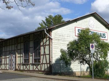
![Tocht Te voet Heilbad Heiligenstadt - Die Heidelbergrunde - Photo](https://media.geolcdn.com/t/350/260/d54794a1-00c5-434d-9208-0968bb150e66.jpeg&format=jpg&maxdim=2)
![Te voet Te voet](https://static1.geolcdn.com/sitytour/trail-icons/100.png)
Km
Te voet
![](/images/other/stat-length.png)
![](https://static1.geolcdn.com/siteimages/upload/files/1508320355ic_sort_den_pos_24dp.png)
![](https://static1.geolcdn.com/siteimages/upload/files/1508320355ic_sort_den_neg_24dp.png)
![](https://static1.geolcdn.com/siteimages/upload/files/16400158638029165_repeat_loop_refresh_sync_direction_icon.png)
• Trail created by Stadt Heilbad Heiligenstadt. Website: https://www.heilbad-heiligenstadt.de/tourismus-freizeit/akt...
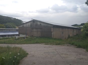
![Tocht Te voet Heilbad Heiligenstadt - Wanderweg von Heilbad Heiligenstadt zur Kapelle Steinhagen - Photo](https://media.geolcdn.com/t/350/260/1d1c05da-1f3a-4a22-9e17-5580051bc5da.jpeg&format=jpg&maxdim=2)
![Te voet Te voet](https://static1.geolcdn.com/sitytour/trail-icons/100.png)
Km
Te voet
![](/images/other/stat-length.png)
![](https://static1.geolcdn.com/siteimages/upload/files/1508320355ic_sort_den_pos_24dp.png)
![](https://static1.geolcdn.com/siteimages/upload/files/1508320355ic_sort_den_neg_24dp.png)
![](https://static1.geolcdn.com/siteimages/upload/files/16400158638029165_repeat_loop_refresh_sync_direction_icon.png)
• Trail created by Stadt Heilbad Heiligenstadt.
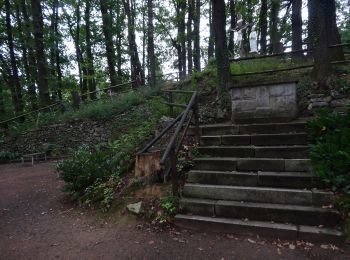
![Tocht Te voet Uder - Wanderweg von Uder nach Lutter (Grünes X) - Photo](https://media.geolcdn.com/t/350/260/5fd28731-1514-48b5-a34b-0d34447b1aa7.jpeg&format=jpg&maxdim=2)
![Te voet Te voet](https://static1.geolcdn.com/sitytour/trail-icons/100.png)
Km
Te voet
![](/images/other/stat-length.png)
![](https://static1.geolcdn.com/siteimages/upload/files/1508320355ic_sort_den_pos_24dp.png)
![](https://static1.geolcdn.com/siteimages/upload/files/1508320355ic_sort_den_neg_24dp.png)
![](https://static1.geolcdn.com/siteimages/upload/files/16400158638029165_repeat_loop_refresh_sync_direction_icon.png)
• Trail created by Stadt Heilbad Heiligenstadt.
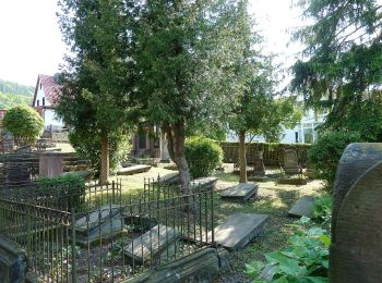
![Tocht Te voet Heilbad Heiligenstadt - Elisabethhöhe Rundwanderweg (Grüner Balken) - Photo](https://media.geolcdn.com/t/350/260/408f8191-52dd-4733-8a7c-8090ff022505.jpeg&format=jpg&maxdim=2)
![Te voet Te voet](https://static1.geolcdn.com/sitytour/trail-icons/100.png)
Km
Te voet
![](/images/other/stat-length.png)
![](https://static1.geolcdn.com/siteimages/upload/files/1508320355ic_sort_den_pos_24dp.png)
![](https://static1.geolcdn.com/siteimages/upload/files/1508320355ic_sort_den_neg_24dp.png)
![](https://static1.geolcdn.com/siteimages/upload/files/16400158638029165_repeat_loop_refresh_sync_direction_icon.png)
• Trail created by Stadt Heilbad Heiligenstadt.
![Tocht Te voet Heilbad Heiligenstadt - Wanderweg von Heilbad Heiligenstadt nach Uder (Roter Punkt) - Photo](https://media.geolcdn.com/t/350/260/408f8191-52dd-4733-8a7c-8090ff022505.jpeg&format=jpg&maxdim=2)
![Te voet Te voet](https://static1.geolcdn.com/sitytour/trail-icons/100.png)
Km
Te voet
![](/images/other/stat-length.png)
![](https://static1.geolcdn.com/siteimages/upload/files/1508320355ic_sort_den_pos_24dp.png)
![](https://static1.geolcdn.com/siteimages/upload/files/1508320355ic_sort_den_neg_24dp.png)
![](https://static1.geolcdn.com/siteimages/upload/files/16400158638029165_repeat_loop_refresh_sync_direction_icon.png)
• Trail created by Stadt Heilbad Heiligenstadt.
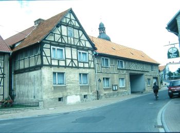
![Tocht Te voet Heilbad Heiligenstadt - Wanderweg nach Effelder (Roter Balken) - Photo](https://media.geolcdn.com/t/350/260/b6148d4c-aa26-4cf1-b368-6a4ea9996676.jpeg&format=jpg&maxdim=2)
![Te voet Te voet](https://static1.geolcdn.com/sitytour/trail-icons/100.png)
Km
Te voet
![](/images/other/stat-length.png)
![](https://static1.geolcdn.com/siteimages/upload/files/1508320355ic_sort_den_pos_24dp.png)
![](https://static1.geolcdn.com/siteimages/upload/files/1508320355ic_sort_den_neg_24dp.png)
![](https://static1.geolcdn.com/siteimages/upload/files/16400158638029165_repeat_loop_refresh_sync_direction_icon.png)
• Trail created by Stadt Heilbad Heiligenstadt.
![Tocht Te voet Heilbad Heiligenstadt - Iberg Rundwanderweg (Gelber Punkt) - Photo](https://media.geolcdn.com/t/350/260/408f8191-52dd-4733-8a7c-8090ff022505.jpeg&format=jpg&maxdim=2)
![Te voet Te voet](https://static1.geolcdn.com/sitytour/trail-icons/100.png)
Km
Te voet
![](/images/other/stat-length.png)
![](https://static1.geolcdn.com/siteimages/upload/files/1508320355ic_sort_den_pos_24dp.png)
![](https://static1.geolcdn.com/siteimages/upload/files/1508320355ic_sort_den_neg_24dp.png)
![](https://static1.geolcdn.com/siteimages/upload/files/16400158638029165_repeat_loop_refresh_sync_direction_icon.png)
• Trail created by Stadt Heilbad Heiligenstadt.
![Tocht Te voet Heilbad Heiligenstadt - Iberg Rundwanderweg (Gelber Balken) - Photo](https://media.geolcdn.com/t/350/260/408f8191-52dd-4733-8a7c-8090ff022505.jpeg&format=jpg&maxdim=2)
![Te voet Te voet](https://static1.geolcdn.com/sitytour/trail-icons/100.png)
Km
Te voet
![](/images/other/stat-length.png)
![](https://static1.geolcdn.com/siteimages/upload/files/1508320355ic_sort_den_pos_24dp.png)
![](https://static1.geolcdn.com/siteimages/upload/files/1508320355ic_sort_den_neg_24dp.png)
![](https://static1.geolcdn.com/siteimages/upload/files/16400158638029165_repeat_loop_refresh_sync_direction_icon.png)
• Trail created by Stadt Heilbad Heiligenstadt.
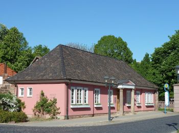
![Tocht Te voet Heilbad Heiligenstadt - Dün Rundwanderweg (Grüner Balken) - Photo](https://media.geolcdn.com/t/350/260/68e2d449-adf3-464d-b570-1d62214079d5.jpeg&format=jpg&maxdim=2)
![Te voet Te voet](https://static1.geolcdn.com/sitytour/trail-icons/100.png)
Km
Te voet
![](/images/other/stat-length.png)
![](https://static1.geolcdn.com/siteimages/upload/files/1508320355ic_sort_den_pos_24dp.png)
![](https://static1.geolcdn.com/siteimages/upload/files/1508320355ic_sort_den_neg_24dp.png)
![](https://static1.geolcdn.com/siteimages/upload/files/16400158638029165_repeat_loop_refresh_sync_direction_icon.png)
• Trail created by Stadt Heilbad Heiligenstadt.
![Tocht Te voet Heilbad Heiligenstadt - Dün Rundwanderweg (Gelber Balken) - Photo](https://media.geolcdn.com/t/350/260/68e2d449-adf3-464d-b570-1d62214079d5.jpeg&format=jpg&maxdim=2)
![Te voet Te voet](https://static1.geolcdn.com/sitytour/trail-icons/100.png)
Km
Te voet
![](/images/other/stat-length.png)
![](https://static1.geolcdn.com/siteimages/upload/files/1508320355ic_sort_den_pos_24dp.png)
![](https://static1.geolcdn.com/siteimages/upload/files/1508320355ic_sort_den_neg_24dp.png)
![](https://static1.geolcdn.com/siteimages/upload/files/16400158638029165_repeat_loop_refresh_sync_direction_icon.png)
• Trail created by Stadt Heilbad Heiligenstadt.
![Tocht Te voet Asbach-Sickenberg - Rundweg 1](https://media.geolcdn.com/t/350/260/38a9ad8d-7abe-441b-8ade-dc59d899c5f7.jpeg&format=jpg&maxdim=2)
![Te voet Te voet](https://static1.geolcdn.com/sitytour/trail-icons/100.png)
Km
Te voet
![](/images/other/stat-length.png)
![](https://static1.geolcdn.com/siteimages/upload/files/1508320355ic_sort_den_pos_24dp.png)
![](https://static1.geolcdn.com/siteimages/upload/files/1508320355ic_sort_den_neg_24dp.png)
![](https://static1.geolcdn.com/siteimages/upload/files/16400158638029165_repeat_loop_refresh_sync_direction_icon.png)
• Symbol: gelber Text 1 in gelbem Kreis
![Tocht Te voet Asbach-Sickenberg - Premiumweg P16 Asbach-Sickenberg - Photo](https://media.geolcdn.com/t/350/260/38a9ad8d-7abe-441b-8ade-dc59d899c5f7.jpeg&format=jpg&maxdim=2)
![Te voet Te voet](https://static1.geolcdn.com/sitytour/trail-icons/100.png)
Km
Te voet
![](/images/other/stat-length.png)
![](https://static1.geolcdn.com/siteimages/upload/files/1508320355ic_sort_den_pos_24dp.png)
![](https://static1.geolcdn.com/siteimages/upload/files/1508320355ic_sort_den_neg_24dp.png)
![](https://static1.geolcdn.com/siteimages/upload/files/16400158638029165_repeat_loop_refresh_sync_direction_icon.png)
• Symbol: gelber Text P16 in gelbem Kreis Website: https://www.naturparkfrauholle.land/wandern/premiumwege/detail/pre...
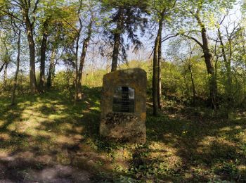
![Tocht Te voet Leinefelde-Worbis - Duderstadt-Worbis-Duderstadt - Photo](https://media.geolcdn.com/t/350/260/3bc37f71-ccda-4f89-8df7-7816cf18ba2f.jpeg&format=jpg&maxdim=2)
![Te voet Te voet](https://static1.geolcdn.com/sitytour/trail-icons/100.png)
Km
Te voet
![](/images/other/stat-length.png)
![](https://static1.geolcdn.com/siteimages/upload/files/1508320355ic_sort_den_pos_24dp.png)
![](https://static1.geolcdn.com/siteimages/upload/files/1508320355ic_sort_den_neg_24dp.png)
![](https://static1.geolcdn.com/siteimages/upload/files/16400158638029165_repeat_loop_refresh_sync_direction_icon.png)
• Symbol: Roter Adler
![Tocht Te voet Heilbad Heiligenstadt - Die Dünrunde - Photo](https://media.geolcdn.com/t/350/260/a0de1c7c-78b5-47cc-bb05-e951c34ff4f4.jpeg&format=jpg&maxdim=2)
![Te voet Te voet](https://static1.geolcdn.com/sitytour/trail-icons/100.png)
Km
Te voet
![](/images/other/stat-length.png)
![](https://static1.geolcdn.com/siteimages/upload/files/1508320355ic_sort_den_pos_24dp.png)
![](https://static1.geolcdn.com/siteimages/upload/files/1508320355ic_sort_den_neg_24dp.png)
![](https://static1.geolcdn.com/siteimages/upload/files/16400158638029165_repeat_loop_refresh_sync_direction_icon.png)
• Trail created by Stadt Heilbad Heiligenstadt. Website: https://www.heilbad-heiligenstadt.de/tourismus-freizeit/akt...
![Tocht Te voet Heilbad Heiligenstadt - Die Ibergrunde - Photo](https://media.geolcdn.com/t/350/260/408f8191-52dd-4733-8a7c-8090ff022505.jpeg&format=jpg&maxdim=2)
![Te voet Te voet](https://static1.geolcdn.com/sitytour/trail-icons/100.png)
Km
Te voet
![](/images/other/stat-length.png)
![](https://static1.geolcdn.com/siteimages/upload/files/1508320355ic_sort_den_pos_24dp.png)
![](https://static1.geolcdn.com/siteimages/upload/files/1508320355ic_sort_den_neg_24dp.png)
![](https://static1.geolcdn.com/siteimages/upload/files/16400158638029165_repeat_loop_refresh_sync_direction_icon.png)
• Trail created by Stadt Heilbad Heiligenstadt. Website: https://www.heilbad-heiligenstadt.de/tourismus-freizeit/akt...
![Tocht Te voet Heilbad Heiligenstadt - Top-Wanderweg](https://media.geolcdn.com/t/350/260/408f8191-52dd-4733-8a7c-8090ff022505.jpeg&format=jpg&maxdim=2)
![Te voet Te voet](https://static1.geolcdn.com/sitytour/trail-icons/100.png)
Km
Te voet
![](/images/other/stat-length.png)
![](https://static1.geolcdn.com/siteimages/upload/files/1508320355ic_sort_den_pos_24dp.png)
![](https://static1.geolcdn.com/siteimages/upload/files/1508320355ic_sort_den_neg_24dp.png)
![](https://static1.geolcdn.com/siteimages/upload/files/16400158638029165_repeat_loop_refresh_sync_direction_icon.png)
• Trail created by Tourist-Information Heilbad Heiligenstadt.
![Tocht Te voet Leinefelde-Worbis - Wanderweg von Heilbad Heiligenstadt nach Burg Scharfenstein - Photo](https://media.geolcdn.com/t/350/260/ext.jpg?maxdim=2&url=https%3A%2F%2Fstatic1.geolcdn.com%2Fsiteimages%2Fupload%2Ffiles%2F1545311037marcheuse_200dpi.jpg)
![Te voet Te voet](https://static1.geolcdn.com/sitytour/trail-icons/100.png)
Km
Te voet
![](/images/other/stat-length.png)
![](https://static1.geolcdn.com/siteimages/upload/files/1508320355ic_sort_den_pos_24dp.png)
![](https://static1.geolcdn.com/siteimages/upload/files/1508320355ic_sort_den_neg_24dp.png)
![](https://static1.geolcdn.com/siteimages/upload/files/16400158638029165_repeat_loop_refresh_sync_direction_icon.png)
• Trail created by Stadt Heilbad Heiligenstadt.
![Tocht Te voet Geisleden - Top-Wanderweg Warteberg - Photo](https://media.geolcdn.com/t/350/260/1d1c05da-1f3a-4a22-9e17-5580051bc5da.jpeg&format=jpg&maxdim=2)
![Te voet Te voet](https://static1.geolcdn.com/sitytour/trail-icons/100.png)
Km
Te voet
![](/images/other/stat-length.png)
![](https://static1.geolcdn.com/siteimages/upload/files/1508320355ic_sort_den_pos_24dp.png)
![](https://static1.geolcdn.com/siteimages/upload/files/1508320355ic_sort_den_neg_24dp.png)
![](https://static1.geolcdn.com/siteimages/upload/files/16400158638029165_repeat_loop_refresh_sync_direction_icon.png)
18 tochten weergegeven op 18
Gratisgps-wandelapplicatie