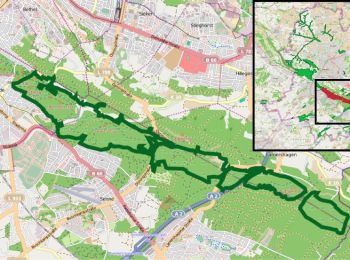
![](/images/other/stat-length.png)
Senne, Onbekend, Te voet: Top van de beste wandelroutes, trajecten, tochten en wandelingen
Senne: Ontdek de beste tochten: 6 te voet. Al deze tochten, trajecten, routes en outdoor activiteiten zijn beschikbaar in onze SityTrail-apps voor smartphones en tablets.
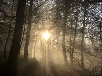
De beste trajecten (6)
![Tocht Te voet Onbekend - NaturZeitReise 4 - Verborgene Zeitzeichen - Photo](https://media.geolcdn.com/t/350/260/ff8cf8ce-cfb3-471f-8b2f-f1a77c0c410c.jpeg&format=jpg&maxdim=2)
![Te voet Te voet](https://static1.geolcdn.com/sitytour/trail-icons/100.png)
Km
Te voet
![](/images/other/stat-length.png)
![](https://static1.geolcdn.com/siteimages/upload/files/1508320355ic_sort_den_pos_24dp.png)
![](https://static1.geolcdn.com/siteimages/upload/files/1508320355ic_sort_den_neg_24dp.png)
![](https://static1.geolcdn.com/siteimages/upload/files/16400158638029165_repeat_loop_refresh_sync_direction_icon.png)
• Trail created by Naturpark Südlicher Teutoburger Wald. Symbol: weiße Sanduhr und Ziffer 4 auf schwarzem Grund
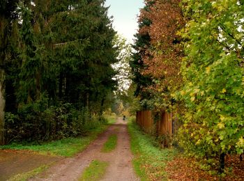
![Tocht Te voet Onbekend - Raute 9 - Senne - Lipperreihe - Photo](https://media.geolcdn.com/t/350/260/fa1913e3-e217-4f06-a3ff-303fe6d7ca67.jpeg&format=jpg&maxdim=2)
![Te voet Te voet](https://static1.geolcdn.com/sitytour/trail-icons/100.png)
Km
Te voet
![](/images/other/stat-length.png)
![](https://static1.geolcdn.com/siteimages/upload/files/1508320355ic_sort_den_pos_24dp.png)
![](https://static1.geolcdn.com/siteimages/upload/files/1508320355ic_sort_den_neg_24dp.png)
![](https://static1.geolcdn.com/siteimages/upload/files/16400158638029165_repeat_loop_refresh_sync_direction_icon.png)
• Trail created by Teutoburger-Wald-Verein. Symbol: weisse 9 in weisser Raute
![Tocht Te voet Onbekend - NaturZeitReise 6 - Geologie - Photo](https://media.geolcdn.com/t/350/260/fdb02d20-7473-433d-bcac-aac86575b63e.jpeg&format=jpg&maxdim=2)
![Te voet Te voet](https://static1.geolcdn.com/sitytour/trail-icons/100.png)
Km
Te voet
![](/images/other/stat-length.png)
![](https://static1.geolcdn.com/siteimages/upload/files/1508320355ic_sort_den_pos_24dp.png)
![](https://static1.geolcdn.com/siteimages/upload/files/1508320355ic_sort_den_neg_24dp.png)
![](https://static1.geolcdn.com/siteimages/upload/files/16400158638029165_repeat_loop_refresh_sync_direction_icon.png)
• Trail created by Naturpark Südlicher Teutoburger Wald. Symbol: weiße Sanduhr und Ziffer 6 auf schwarzem Grund
![Tocht Te voet Onbekend - NaturZeitReise 5 - Geologie - Photo](https://media.geolcdn.com/t/350/260/fdb02d20-7473-433d-bcac-aac86575b63e.jpeg&format=jpg&maxdim=2)
![Te voet Te voet](https://static1.geolcdn.com/sitytour/trail-icons/100.png)
Km
Te voet
![](/images/other/stat-length.png)
![](https://static1.geolcdn.com/siteimages/upload/files/1508320355ic_sort_den_pos_24dp.png)
![](https://static1.geolcdn.com/siteimages/upload/files/1508320355ic_sort_den_neg_24dp.png)
![](https://static1.geolcdn.com/siteimages/upload/files/16400158638029165_repeat_loop_refresh_sync_direction_icon.png)
• Trail created by Naturpark Südlicher Teutoburger Wald. Symbol: weiße Sanduhr und Ziffer 5 auf schwarzem Grund
![Tocht Te voet Onbekend - A4 - Eiserner Anton - Photo](https://media.geolcdn.com/t/350/260/fdb02d20-7473-433d-bcac-aac86575b63e.jpeg&format=jpg&maxdim=2)
![Te voet Te voet](https://static1.geolcdn.com/sitytour/trail-icons/100.png)
Km
Te voet
![](/images/other/stat-length.png)
![](https://static1.geolcdn.com/siteimages/upload/files/1508320355ic_sort_den_pos_24dp.png)
![](https://static1.geolcdn.com/siteimages/upload/files/1508320355ic_sort_den_neg_24dp.png)
![](https://static1.geolcdn.com/siteimages/upload/files/16400158638029165_repeat_loop_refresh_sync_direction_icon.png)
![Tocht Te voet Onbekend - Lämmershagen A2 - Photo](https://media.geolcdn.com/t/350/260/0a9ae7a4-e106-4c73-bc18-c28c5f524d9c.jpeg&format=jpg&maxdim=2)
![Te voet Te voet](https://static1.geolcdn.com/sitytour/trail-icons/100.png)
Km
Te voet
![](/images/other/stat-length.png)
![](https://static1.geolcdn.com/siteimages/upload/files/1508320355ic_sort_den_pos_24dp.png)
![](https://static1.geolcdn.com/siteimages/upload/files/1508320355ic_sort_den_neg_24dp.png)
![](https://static1.geolcdn.com/siteimages/upload/files/16400158638029165_repeat_loop_refresh_sync_direction_icon.png)
6 tochten weergegeven op 6
Gratisgps-wandelapplicatie