![](/images/other/stat-length.png)
Aidlingen, Landkreis Böblingen, Te voet: Top van de beste wandelroutes, trajecten, tochten en wandelingen
Aidlingen: Ontdek de beste tochten: 6 te voet. Al deze tochten, trajecten, routes en outdoor activiteiten zijn beschikbaar in onze SityTrail-apps voor smartphones en tablets.
De beste trajecten (6)
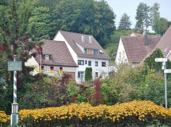
![Tocht Te voet Aidlingen - Land.Tour Venusberg - Photo](https://media.geolcdn.com/t/350/260/ba60b6f8-e49a-4e76-82e7-43cfb6dfee57.jpeg&format=jpg&maxdim=2)
![Te voet Te voet](https://static1.geolcdn.com/sitytour/trail-icons/100.png)
Km
Te voet
![](/images/other/stat-length.png)
![](https://static1.geolcdn.com/siteimages/upload/files/1508320355ic_sort_den_pos_24dp.png)
![](https://static1.geolcdn.com/siteimages/upload/files/1508320355ic_sort_den_neg_24dp.png)
![](https://static1.geolcdn.com/siteimages/upload/files/16400158638029165_repeat_loop_refresh_sync_direction_icon.png)
• Trail created by Schwarwaldverein.
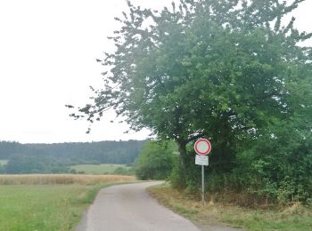
![Tocht Te voet Aidlingen - SchafSpuren - Photo](https://media.geolcdn.com/t/350/260/69322f55-f638-4b5e-beef-b335a87afd64.jpeg&format=jpg&maxdim=2)
![Te voet Te voet](https://static1.geolcdn.com/sitytour/trail-icons/100.png)
Km
Te voet
![](/images/other/stat-length.png)
![](https://static1.geolcdn.com/siteimages/upload/files/1508320355ic_sort_den_pos_24dp.png)
![](https://static1.geolcdn.com/siteimages/upload/files/1508320355ic_sort_den_neg_24dp.png)
![](https://static1.geolcdn.com/siteimages/upload/files/16400158638029165_repeat_loop_refresh_sync_direction_icon.png)
• Website: https://www.aidlingen.de/fileadmin/Dateien/Bilder/LandTouren/Beschreibung_LandTour_SchafSpuren.pdf
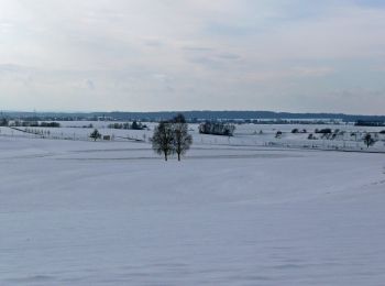
![Tocht Te voet Aidlingen - Gärtringer Rundweg 2 - Photo](https://media.geolcdn.com/t/350/260/29cbc548-32dc-423b-bdf4-261fb0206665.jpeg&format=jpg&maxdim=2)
![Te voet Te voet](https://static1.geolcdn.com/sitytour/trail-icons/100.png)
Km
Te voet
![](/images/other/stat-length.png)
![](https://static1.geolcdn.com/siteimages/upload/files/1508320355ic_sort_den_pos_24dp.png)
![](https://static1.geolcdn.com/siteimages/upload/files/1508320355ic_sort_den_neg_24dp.png)
![](https://static1.geolcdn.com/siteimages/upload/files/16400158638029165_repeat_loop_refresh_sync_direction_icon.png)
• Trail created by Schwarzwaldverein Gärtringen e.V.. Mit gelber und blauer Raute beschildert: yellow:white:yellow_dia...
![Tocht Te voet Aidlingen - DE-Dachtel Bürgerhaus - Bierkeller - Dachteler Linde - Photo](https://media.geolcdn.com/t/350/260/29cbc548-32dc-423b-bdf4-261fb0206665.jpeg&format=jpg&maxdim=2)
![Te voet Te voet](https://static1.geolcdn.com/sitytour/trail-icons/100.png)
Km
Te voet
![](/images/other/stat-length.png)
![](https://static1.geolcdn.com/siteimages/upload/files/1508320355ic_sort_den_pos_24dp.png)
![](https://static1.geolcdn.com/siteimages/upload/files/1508320355ic_sort_den_neg_24dp.png)
![](https://static1.geolcdn.com/siteimages/upload/files/16400158638029165_repeat_loop_refresh_sync_direction_icon.png)
• Trail created by Schwarzwaldverein. Dachtel Bürgerhaus - Bierkeller - Dachteler Linde Symbol: Gelbe Raute auf weiße...
![Tocht Te voet Aidlingen - Lerchenberg - Dachteler Linde - Photo](https://media.geolcdn.com/t/350/260/29cbc548-32dc-423b-bdf4-261fb0206665.jpeg&format=jpg&maxdim=2)
![Te voet Te voet](https://static1.geolcdn.com/sitytour/trail-icons/100.png)
Km
Te voet
![](/images/other/stat-length.png)
![](https://static1.geolcdn.com/siteimages/upload/files/1508320355ic_sort_den_pos_24dp.png)
![](https://static1.geolcdn.com/siteimages/upload/files/1508320355ic_sort_den_neg_24dp.png)
![](https://static1.geolcdn.com/siteimages/upload/files/16400158638029165_repeat_loop_refresh_sync_direction_icon.png)
• Trail created by Schwarzwaldverein. Symbol: Gelbe Route auf weißem Grund
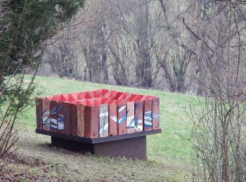
![Tocht Te voet Aidlingen - DE-SWV gelbe Raute, Mönchhalde - Würmhalde - Photo](https://media.geolcdn.com/t/350/260/d4d846f0-2f7c-441d-9e55-174b413b71fd.jpeg&format=jpg&maxdim=2)
![Te voet Te voet](https://static1.geolcdn.com/sitytour/trail-icons/100.png)
Km
Te voet
![](/images/other/stat-length.png)
![](https://static1.geolcdn.com/siteimages/upload/files/1508320355ic_sort_den_pos_24dp.png)
![](https://static1.geolcdn.com/siteimages/upload/files/1508320355ic_sort_den_neg_24dp.png)
![](https://static1.geolcdn.com/siteimages/upload/files/16400158638029165_repeat_loop_refresh_sync_direction_icon.png)
• Trail created by Schwarzwaldverein. SWV gelbe Raute, Mönchhalde - Würmhalde Symbol: Gelbe Route auf weißem Grund
6 tochten weergegeven op 6
Gratisgps-wandelapplicatie