Bad Rippoldsau-Schapbach, Landkreis Freudenstadt, Te voet: Top van de beste wandelroutes, trajecten, tochten en wandelingen

Bad Rippoldsau-Schapbach: Ontdek de beste tochten: 2 stappen en 12 te voet. Al deze tochten, trajecten, routes en outdoor activiteiten zijn beschikbaar in onze SityTrail-apps voor smartphones en tablets.


De beste trajecten (14)
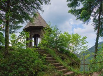
Tocht Te voet Bad Rippoldsau-Schapbach - Bad Rippoldsau - Burgbachhöhe (Mittelweg) - Photo
Te voet 5.415
Km
GUIDE+

Te voet

Gemakkelijk
Bad Rippoldsau-Schapbach, Baden-Württemberg, Landkreis Freudenstadt, Germany
5,4 km | 9,5 km-effort
2h 10min
385 m
83 m
Neen
SityTrail - itinéraires balisés pédestres

• Trail created by Schwarzwaldverein. Symbol: Blaue Raute auf weißem Grund

Tocht Te voet Bad Rippoldsau-Schapbach - Klösterle-Schleife - Photo
Te voet 4.931
Km
GUIDE+

Te voet

Gemakkelijk
Bad Rippoldsau-Schapbach, Baden-Württemberg, Landkreis Freudenstadt, Germany
4,9 km | 7,7 km-effort
1h 45min
208 m
208 m
Neen
SityTrail - itinéraires balisés pédestres

• Trail created by Tourist-Information Bad Rippoldsau-Schapbach. Symbol: Bollenhut
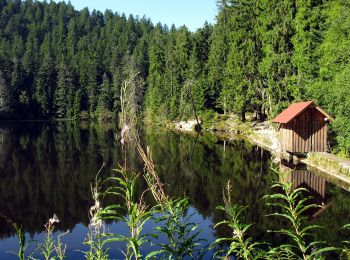
Tocht Te voet Bad Rippoldsau-Schapbach - Vor Seebach - Glaswaldsee - Photo
Te voet 6.652
Km
GUIDE+

Te voet

Gemakkelijk
Bad Rippoldsau-Schapbach, Baden-Württemberg, Landkreis Freudenstadt, Germany
6,7 km | 11,3 km-effort
2h 34min
440 m
73 m
Neen
SityTrail - itinéraires balisés pédestres

• Trail created by Schwarzwaldverein. Symbol: Blaue Raute auf weißem Grund

Tocht Te voet Bad Rippoldsau-Schapbach - Schapbach - See Ebene - Photo
Te voet 8.238
Km
GUIDE+

Te voet

Gemakkelijk
Bad Rippoldsau-Schapbach, Baden-Württemberg, Landkreis Freudenstadt, Germany
8,2 km | 14,4 km-effort
3h 16min
596 m
55 m
Neen
SityTrail - itinéraires balisés pédestres

• Trail created by Schwarzwaldverein. Symbol: Blaue Raute auf weißem Grund

Tocht Te voet Bad Rippoldsau-Schapbach - Wolftalweg - Photo
Te voet 30.47
Km
GUIDE+

Te voet

Moeilijk
Bad Rippoldsau-Schapbach, Baden-Württemberg, Landkreis Freudenstadt, Germany
30 km | 39 km-effort
8h 49min
456 m
1131 m
Neen
SityTrail - itinéraires balisés pédestres

• Trail created by Schwarzwaldverein. Symbol: Gelbe Raute auf weißem Grund
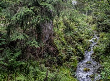
Tocht Te voet Bad Rippoldsau-Schapbach - Grenzweg - Photo
Te voet 9.491
Km
GUIDE+

Te voet

Gemakkelijk
Bad Rippoldsau-Schapbach, Baden-Württemberg, Landkreis Freudenstadt, Germany
9,5 km | 11,4 km-effort
2h 35min
115 m
219 m
Neen
SityTrail - itinéraires balisés pédestres

• Trail created by Schwarzwaldverein. Symbol: Blaue Raute auf weißem Grund
Tocht Stappen Bad Rippoldsau-Schapbach - Bad Rippoldsau - cascade de Burgbach – lac de retenue Kinzig -  cascade du Büstenloch - Photo
Stappen 21.149
Km

Stappen

Zeer moeilijk
Bad Rippoldsau-Schapbach, Baden-Württemberg, Landkreis Freudenstadt, Germany
21 km | 32 km-effort
7h 22min
848 m
848 m
Ja
Bart2015

Tocht Te voet Bad Rippoldsau-Schapbach - Bad Rippoldsau-Bad - Holzwald - Photo
Te voet 3.419
Km
GUIDE+

Te voet

Gemakkelijk
Bad Rippoldsau-Schapbach, Baden-Württemberg, Landkreis Freudenstadt, Germany
3,4 km | 5,2 km-effort
1h 11min
143 m
114 m
Neen
SityTrail - itinéraires balisés pédestres

• Trail created by Schwarzwaldverein. Symbol: Gelbe Raute auf weißem Grund
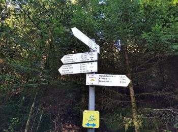
Tocht Te voet Bad Rippoldsau-Schapbach - Panoramaweg Bad Rippoldsau - Photo
Te voet 3.348
Km
GUIDE+

Te voet

Gemakkelijk
Bad Rippoldsau-Schapbach, Baden-Württemberg, Landkreis Freudenstadt, Germany
3,3 km | 4,9 km-effort
1h 7min
106 m
157 m
Neen
SityTrail - itinéraires balisés pédestres

• Trail created by Schwarzwaldverein. Symbol: Gelbe Raute auf weißem Grund

Tocht Te voet Bad Rippoldsau-Schapbach - Bad Rippoldsau - Grüne Sitzbank - Photo
Te voet 3.358
Km
GUIDE+

Te voet

Gemakkelijk
Bad Rippoldsau-Schapbach, Baden-Württemberg, Landkreis Freudenstadt, Germany
3,4 km | 6,9 km-effort
1h 33min
349 m
6 m
Neen
SityTrail - itinéraires balisés pédestres

• Trail created by Schwarzwaldverein. Symbol: Gelbe Raute auf weißem Grund

Tocht Te voet Bad Rippoldsau-Schapbach - Bad Rippoldsau - Glaswald-Sattelege - Photo
Te voet 6.823
Km
GUIDE+

Te voet

Gemakkelijk
Bad Rippoldsau-Schapbach, Baden-Württemberg, Landkreis Freudenstadt, Germany
6,8 km | 10,9 km-effort
2h 29min
358 m
163 m
Neen
SityTrail - itinéraires balisés pédestres

• Trail created by Schwarzwaldverein. Symbol: Gelbe Raute auf weißem Grund

Tocht Te voet Bad Rippoldsau-Schapbach - Am Wolfenberg - Kleiner Absbach - Photo
Te voet 3.898
Km
GUIDE+

Te voet

Gemakkelijk
Bad Rippoldsau-Schapbach, Baden-Württemberg, Landkreis Freudenstadt, Germany
3,9 km | 5,2 km-effort
1h 11min
114 m
63 m
Neen
SityTrail - itinéraires balisés pédestres

• Trail created by Schwarzwaldverein. Symbol: Gelbe Raute auf weißem Grund

Tocht Te voet Bad Rippoldsau-Schapbach - Bad Rippoldsau - Freudenstadt - Photo
Te voet 6.652
Km
GUIDE+

Te voet

Gemakkelijk
Bad Rippoldsau-Schapbach, Baden-Württemberg, Landkreis Freudenstadt, Germany
6,7 km | 8,4 km-effort
1h 54min
103 m
207 m
Neen
SityTrail - itinéraires balisés pédestres

• Trail created by Schwarzwaldverein. Symbol: Blaue Raute auf weißem Grund

Tocht Stappen Bad Rippoldsau-Schapbach - Kniebis shwarzwald - Photo
Stappen 7.19
Km

Stappen

Heel gemakkelijk
Bad Rippoldsau-Schapbach, Baden-Württemberg, Landkreis Freudenstadt, Germany
7,2 km | 9,4 km-effort
2h 32min
169 m
171 m
Ja
boscbilly

14 tochten weergegeven op 14

Gratisgps-wandelapplicatie

Logo SityTrail SityTrail

IGN / Geografische instituten

SityTrail uit de App Store downloaden SityTrail uit Google Play downloaden

Logo SityTrail SityTrail World

De wereld gaat voor u open

SityTrail uit de App Store downloaden SityTrail uit Google Play downloaden SityTrail op Huawei AppGallery downloaden

Activiteiten

Sluiten
Mijn abonnementen