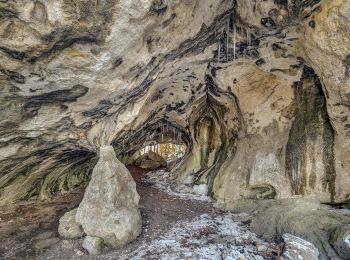
![](/images/other/stat-length.png)
Bamberg, Beieren, Te voet: Top van de beste wandelroutes, trajecten, tochten en wandelingen
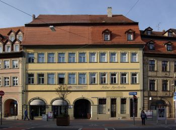
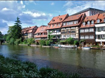
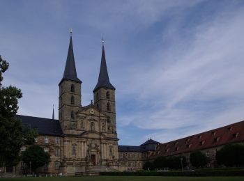
Bamberg: Ontdek de beste tochten: 6 te voet. Al deze tochten, trajecten, routes en outdoor activiteiten zijn beschikbaar in onze SityTrail-apps voor smartphones en tablets.
De beste trajecten (6)
![Tocht Te voet - Alter Roßdorfer Stadtweg - Photo](https://media.geolcdn.com/t/350/260/9ec5664a-6290-4815-9c62-3ff8302aa1e0.jpeg&format=jpg&maxdim=2)
![Te voet Te voet](https://static1.geolcdn.com/sitytour/trail-icons/100.png)
Km
Te voet
![](/images/other/stat-length.png)
![](https://static1.geolcdn.com/siteimages/upload/files/1508320355ic_sort_den_pos_24dp.png)
![](https://static1.geolcdn.com/siteimages/upload/files/1508320355ic_sort_den_neg_24dp.png)
![](https://static1.geolcdn.com/siteimages/upload/files/16400158638029165_repeat_loop_refresh_sync_direction_icon.png)
• Symbol: Stilisiertes rotes Pferdegespann auf weißem Grund
![Tocht Te voet - Spaziergang durch die Gärtnerstadt - Photo](https://media.geolcdn.com/t/350/260/cbf82746-32dd-40e1-b1ed-613e3a6881ee.jpeg&format=jpg&maxdim=2)
![Te voet Te voet](https://static1.geolcdn.com/sitytour/trail-icons/100.png)
Km
Te voet
![](/images/other/stat-length.png)
![](https://static1.geolcdn.com/siteimages/upload/files/1508320355ic_sort_den_pos_24dp.png)
![](https://static1.geolcdn.com/siteimages/upload/files/1508320355ic_sort_den_neg_24dp.png)
![](https://static1.geolcdn.com/siteimages/upload/files/16400158638029165_repeat_loop_refresh_sync_direction_icon.png)
• Trail created by Zentrum Welterbe Bamberg. keine Markierungen, nur Übersichtspläne
![Tocht Te voet - Tag und Nacht Trainigsstrecke Weltkulturerbelauf Bamberg - Photo](https://media.geolcdn.com/t/350/260/b1a34b7e-4a3b-4389-9f50-3ff3182441e2.jpeg&format=jpg&maxdim=2)
![Te voet Te voet](https://static1.geolcdn.com/sitytour/trail-icons/100.png)
Km
Te voet
![](/images/other/stat-length.png)
![](https://static1.geolcdn.com/siteimages/upload/files/1508320355ic_sort_den_pos_24dp.png)
![](https://static1.geolcdn.com/siteimages/upload/files/1508320355ic_sort_den_neg_24dp.png)
![](https://static1.geolcdn.com/siteimages/upload/files/16400158638029165_repeat_loop_refresh_sync_direction_icon.png)
• Trail created by Stadt Bamberg. Symbol: Stilisierter roter Läufer vor schwarzer Stadtsilhouette
![Tocht Te voet - Stadtökologischer Lehr- und Erlebnispfad Bamberg - Photo](https://media.geolcdn.com/t/350/260/f7ac5429-400b-4057-8630-d83ab96778d1.jpeg&format=jpg&maxdim=2)
![Te voet Te voet](https://static1.geolcdn.com/sitytour/trail-icons/100.png)
Km
Te voet
![](/images/other/stat-length.png)
![](https://static1.geolcdn.com/siteimages/upload/files/1508320355ic_sort_den_pos_24dp.png)
![](https://static1.geolcdn.com/siteimages/upload/files/1508320355ic_sort_den_neg_24dp.png)
![](https://static1.geolcdn.com/siteimages/upload/files/16400158638029165_repeat_loop_refresh_sync_direction_icon.png)
• Trail created by Stadt Bamberg. Symbol: Weiße Blüte auf grünem Grund
![Tocht Te voet - Flusspfad - Photo](https://media.geolcdn.com/t/350/260/d374cdc0-68f8-4b73-b5a1-2cd2092805ad.jpeg&format=jpg&maxdim=2)
![Te voet Te voet](https://static1.geolcdn.com/sitytour/trail-icons/100.png)
Km
Te voet
![](/images/other/stat-length.png)
![](https://static1.geolcdn.com/siteimages/upload/files/1508320355ic_sort_den_pos_24dp.png)
![](https://static1.geolcdn.com/siteimages/upload/files/1508320355ic_sort_den_neg_24dp.png)
![](https://static1.geolcdn.com/siteimages/upload/files/16400158638029165_repeat_loop_refresh_sync_direction_icon.png)
• Trail created by Stadt Bamberg. keine Markierung, nur Übersichtskarte
![Tocht Te voet - Bamberger Schöpfungweg - Photo](https://media.geolcdn.com/t/350/260/c3ac1076-e88e-432e-9357-cf8048612542.jpeg&format=jpg&maxdim=2)
![Te voet Te voet](https://static1.geolcdn.com/sitytour/trail-icons/100.png)
Km
Te voet
![](/images/other/stat-length.png)
![](https://static1.geolcdn.com/siteimages/upload/files/1508320355ic_sort_den_pos_24dp.png)
![](https://static1.geolcdn.com/siteimages/upload/files/1508320355ic_sort_den_neg_24dp.png)
![](https://static1.geolcdn.com/siteimages/upload/files/16400158638029165_repeat_loop_refresh_sync_direction_icon.png)
• Symbol: Violette Traube auf weißem Hintergrund
6 tochten weergegeven op 6
Gratisgps-wandelapplicatie