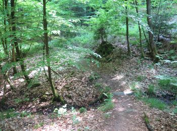
![](/images/other/stat-length.png)
- Tochten
- Te voet
- Germany
- Beieren
- Landkreis Haßberge
- Hofheim in Unterfranken
Hofheim in Unterfranken, Landkreis Haßberge, Te voet: Top van de beste wandelroutes, trajecten, tochten en wandelingen
Hofheim in Unterfranken: Ontdek de beste tochten: 4 te voet. Al deze tochten, trajecten, routes en outdoor activiteiten zijn beschikbaar in onze SityTrail-apps voor smartphones en tablets.
De beste trajecten (4)
![Tocht Te voet Hofheim in Unterfranken - Rundwanderweg Reh - Photo](https://media.geolcdn.com/t/350/260/ext.jpg?maxdim=2&url=https%3A%2F%2Fmedia.geolcdn.com%2Ff%2F89adcb71-198a-4a2f-a4df-8423dd793e6d.jpeg)
![Te voet Te voet](https://static1.geolcdn.com/sitytour/trail-icons/100.png)
Km
Te voet
![](/images/other/stat-length.png)
![](https://static1.geolcdn.com/siteimages/upload/files/1508320355ic_sort_den_pos_24dp.png)
![](https://static1.geolcdn.com/siteimages/upload/files/1508320355ic_sort_den_neg_24dp.png)
![](https://static1.geolcdn.com/siteimages/upload/files/16400158638029165_repeat_loop_refresh_sync_direction_icon.png)
• Trail created by Haßbergverein. Symbol: Schwarzes Reh auf gelbem Hintergrund
![Tocht Te voet Hofheim in Unterfranken - Auf Jägerpfaden zur Schwedenschanze - Photo](https://media.geolcdn.com/t/350/260/ext.jpg?maxdim=2&url=https%3A%2F%2Fmedia.geolcdn.com%2Ff%2F97f61133-c847-4e8d-b6d7-957345e91023.jpeg)
![Te voet Te voet](https://static1.geolcdn.com/sitytour/trail-icons/100.png)
Km
Te voet
![](/images/other/stat-length.png)
![](https://static1.geolcdn.com/siteimages/upload/files/1508320355ic_sort_den_pos_24dp.png)
![](https://static1.geolcdn.com/siteimages/upload/files/1508320355ic_sort_den_neg_24dp.png)
![](https://static1.geolcdn.com/siteimages/upload/files/16400158638029165_repeat_loop_refresh_sync_direction_icon.png)
• Trail created by Naturpark Haßberge. Symbol: Roter Burgturm weißer Grund Website: http://www.hassberge-tourismus.d...
![Tocht Te voet Hofheim in Unterfranken - Rundwanderweg Elster Hofheim - Photo](https://media.geolcdn.com/t/350/260/ext.jpg?maxdim=2&url=https%3A%2F%2Fmedia.geolcdn.com%2Ff%2Fa2f75853-9614-4b0b-a41c-1f990a7e7fda.jpeg)
![Te voet Te voet](https://static1.geolcdn.com/sitytour/trail-icons/100.png)
Km
Te voet
![](/images/other/stat-length.png)
![](https://static1.geolcdn.com/siteimages/upload/files/1508320355ic_sort_den_pos_24dp.png)
![](https://static1.geolcdn.com/siteimages/upload/files/1508320355ic_sort_den_neg_24dp.png)
![](https://static1.geolcdn.com/siteimages/upload/files/16400158638029165_repeat_loop_refresh_sync_direction_icon.png)
• Trail created by Haßbergverein. Symbol: Schwarze Elster auf gelbem Hintergrund
![Tocht Te voet Hofheim in Unterfranken - Lauftour HOH1 - Photo](https://media.geolcdn.com/t/350/260/ext.jpg?maxdim=2&url=https%3A%2F%2Fmedia.geolcdn.com%2Ff%2F66aaace9-bfa9-464a-a667-f0ac27bdc076.jpeg)
![Te voet Te voet](https://static1.geolcdn.com/sitytour/trail-icons/100.png)
Km
Te voet
![](/images/other/stat-length.png)
![](https://static1.geolcdn.com/siteimages/upload/files/1508320355ic_sort_den_pos_24dp.png)
![](https://static1.geolcdn.com/siteimages/upload/files/1508320355ic_sort_den_neg_24dp.png)
![](https://static1.geolcdn.com/siteimages/upload/files/16400158638029165_repeat_loop_refresh_sync_direction_icon.png)
• Trail created by Landkreis Haßberge/Laufparadies Haßberge. Symbol: Blaue HOH1 auf weißem Hintergrund
4 tochten weergegeven op 4
Gratisgps-wandelapplicatie