![](/images/other/stat-length.png)
- Tochten
- Te voet
- Germany
- Beieren
- Landkreis Regen
- Geiersthal
Geiersthal, Landkreis Regen, Te voet: Top van de beste wandelroutes, trajecten, tochten en wandelingen
Geiersthal: Ontdek de beste tochten: 7 te voet. Al deze tochten, trajecten, routes en outdoor activiteiten zijn beschikbaar in onze SityTrail-apps voor smartphones en tablets.
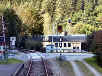
De beste trajecten (7)
![Tocht Te voet Geiersthal - Viechtach, Zielwanderweg 3 nach Gumpenried - Photo](https://media.geolcdn.com/t/350/260/4415a8ca-f550-4d93-bef8-c43ccc189119.jpeg&format=jpg&maxdim=2)
![Te voet Te voet](https://static1.geolcdn.com/sitytour/trail-icons/100.png)
Km
Te voet
![](/images/other/stat-length.png)
![](https://static1.geolcdn.com/siteimages/upload/files/1508320355ic_sort_den_pos_24dp.png)
![](https://static1.geolcdn.com/siteimages/upload/files/1508320355ic_sort_den_neg_24dp.png)
![](https://static1.geolcdn.com/siteimages/upload/files/16400158638029165_repeat_loop_refresh_sync_direction_icon.png)
• Trail created by Tourismusverband Viechtach. Symbol: Blaues Rechteck mit weißer 3
![Tocht Te voet Geiersthal - Rundwanderweg Nr. 4 durch die Gemeinde Geiersthal - Photo](https://media.geolcdn.com/t/350/260/a500e00a-b7ac-4747-a48b-be7209c92562.jpeg&format=jpg&maxdim=2)
![Te voet Te voet](https://static1.geolcdn.com/sitytour/trail-icons/100.png)
Km
Te voet
![](/images/other/stat-length.png)
![](https://static1.geolcdn.com/siteimages/upload/files/1508320355ic_sort_den_pos_24dp.png)
![](https://static1.geolcdn.com/siteimages/upload/files/1508320355ic_sort_den_neg_24dp.png)
![](https://static1.geolcdn.com/siteimages/upload/files/16400158638029165_repeat_loop_refresh_sync_direction_icon.png)
• Trail created by Gemeinde Geiersthal. Symbol: weiße 4 auf rotem Kreis
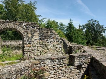
![Tocht Te voet Geiersthal - DE-3 - Photo](https://media.geolcdn.com/t/350/260/d1f96aee-a479-476a-9375-89a4c7ff0c8b.jpeg&format=jpg&maxdim=2)
![Te voet Te voet](https://static1.geolcdn.com/sitytour/trail-icons/100.png)
Km
Te voet
![](/images/other/stat-length.png)
![](https://static1.geolcdn.com/siteimages/upload/files/1508320355ic_sort_den_pos_24dp.png)
![](https://static1.geolcdn.com/siteimages/upload/files/1508320355ic_sort_den_neg_24dp.png)
![](https://static1.geolcdn.com/siteimages/upload/files/16400158638029165_repeat_loop_refresh_sync_direction_icon.png)
• Trail created by Gemeinde Geiersthal. Symbol: weiße 3 auf rotem Kreis
![Tocht Te voet Geiersthal - WW 21 Panoramasteig - Photo](https://media.geolcdn.com/t/350/260/09cc8ad9-9513-4c99-bc1f-25430e366bf0.jpeg&format=jpg&maxdim=2)
![Te voet Te voet](https://static1.geolcdn.com/sitytour/trail-icons/100.png)
Km
Te voet
![](/images/other/stat-length.png)
![](https://static1.geolcdn.com/siteimages/upload/files/1508320355ic_sort_den_pos_24dp.png)
![](https://static1.geolcdn.com/siteimages/upload/files/1508320355ic_sort_den_neg_24dp.png)
![](https://static1.geolcdn.com/siteimages/upload/files/16400158638029165_repeat_loop_refresh_sync_direction_icon.png)
• Trail created by Gemeinde Patersdorf. Symbol: weiße 21 auf rotem Kreis
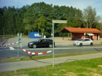
![Tocht Te voet Geiersthal - Vorderpiflitzer Rundweg - Photo](https://media.geolcdn.com/t/350/260/bac36942-70c2-456f-b990-095f987d26cc.jpeg&format=jpg&maxdim=2)
![Te voet Te voet](https://static1.geolcdn.com/sitytour/trail-icons/100.png)
Km
Te voet
![](/images/other/stat-length.png)
![](https://static1.geolcdn.com/siteimages/upload/files/1508320355ic_sort_den_pos_24dp.png)
![](https://static1.geolcdn.com/siteimages/upload/files/1508320355ic_sort_den_neg_24dp.png)
![](https://static1.geolcdn.com/siteimages/upload/files/16400158638029165_repeat_loop_refresh_sync_direction_icon.png)
• Trail created by Markt Teisnach. Symbol: weiße 11 auf rotem Kreis
![Tocht Te voet Geiersthal - Katzensteinrundweg - Photo](https://media.geolcdn.com/t/350/260/d1f96aee-a479-476a-9375-89a4c7ff0c8b.jpeg&format=jpg&maxdim=2)
![Te voet Te voet](https://static1.geolcdn.com/sitytour/trail-icons/100.png)
Km
Te voet
![](/images/other/stat-length.png)
![](https://static1.geolcdn.com/siteimages/upload/files/1508320355ic_sort_den_pos_24dp.png)
![](https://static1.geolcdn.com/siteimages/upload/files/1508320355ic_sort_den_neg_24dp.png)
![](https://static1.geolcdn.com/siteimages/upload/files/16400158638029165_repeat_loop_refresh_sync_direction_icon.png)
• Trail created by Gemeinde Geiersthal. Symbol: weiße 2 auf rotem Kreis
![Tocht Te voet Geiersthal - DE-1 - Photo](https://media.geolcdn.com/t/350/260/d1f96aee-a479-476a-9375-89a4c7ff0c8b.jpeg&format=jpg&maxdim=2)
![Te voet Te voet](https://static1.geolcdn.com/sitytour/trail-icons/100.png)
Km
Te voet
![](/images/other/stat-length.png)
![](https://static1.geolcdn.com/siteimages/upload/files/1508320355ic_sort_den_pos_24dp.png)
![](https://static1.geolcdn.com/siteimages/upload/files/1508320355ic_sort_den_neg_24dp.png)
![](https://static1.geolcdn.com/siteimages/upload/files/16400158638029165_repeat_loop_refresh_sync_direction_icon.png)
• Trail created by Gemeinde Geiersthal. Symbol: weiße 1 auf rotem Kreis
7 tochten weergegeven op 7
Gratisgps-wandelapplicatie