![](/images/other/stat-length.png)
- Tochten
- Te voet
- Czech Republic
- Centraal-Moravië
- Zlínský kraj
Zlínský kraj, Centraal-Moravië, Te voet: Top van de beste wandelroutes, trajecten, tochten en wandelingen
Zlínský kraj: Ontdek de beste tochten: 75 te voet. Al deze tochten, trajecten, routes en outdoor activiteiten zijn beschikbaar in onze SityTrail-apps voor smartphones en tablets.
De beste trajecten (75)
![Tocht Te voet Popovice - CZ-Turistický okruh Bukovina - Photo](https://media.geolcdn.com/t/350/260/d55da369-d29d-435b-ae09-8b1115b167ec.jpeg&format=jpg&maxdim=2)
![Te voet Te voet](https://static1.geolcdn.com/sitytour/trail-icons/100.png)
Km
Te voet
![](/images/other/stat-length.png)
![](https://static1.geolcdn.com/siteimages/upload/files/1508320355ic_sort_den_pos_24dp.png)
![](https://static1.geolcdn.com/siteimages/upload/files/1508320355ic_sort_den_neg_24dp.png)
![](https://static1.geolcdn.com/siteimages/upload/files/16400158638029165_repeat_loop_refresh_sync_direction_icon.png)
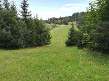
• Tocht aangemaakt door cz:KČT. Turistický okruh Bukovina
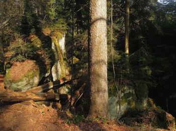
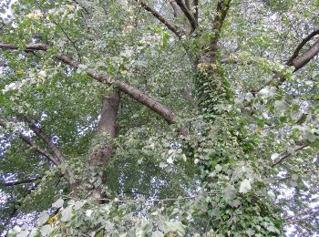
![Tocht Te voet Ludkovice - [Z] Lukáščena - Provodov - Photo](https://media.geolcdn.com/t/350/260/e1671f19-b9cb-4aa1-a32b-4cbea8d7ce75.jpeg&format=jpg&maxdim=2)
![Te voet Te voet](https://static1.geolcdn.com/sitytour/trail-icons/100.png)
Km
Te voet
![](/images/other/stat-length.png)
![](https://static1.geolcdn.com/siteimages/upload/files/1508320355ic_sort_den_pos_24dp.png)
![](https://static1.geolcdn.com/siteimages/upload/files/1508320355ic_sort_den_neg_24dp.png)
![](https://static1.geolcdn.com/siteimages/upload/files/16400158638029165_repeat_loop_refresh_sync_direction_icon.png)
• Tocht aangemaakt door cz:KČT.
![Tocht Te voet Velké Karlovice - Okruh Galik - Horal - Photo](https://media.geolcdn.com/t/350/260/55a9f7db-9dd0-4d44-884a-90affea5c38d.jpeg&format=jpg&maxdim=2)
![Te voet Te voet](https://static1.geolcdn.com/sitytour/trail-icons/100.png)
Km
Te voet
![](/images/other/stat-length.png)
![](https://static1.geolcdn.com/siteimages/upload/files/1508320355ic_sort_den_pos_24dp.png)
![](https://static1.geolcdn.com/siteimages/upload/files/1508320355ic_sort_den_neg_24dp.png)
![](https://static1.geolcdn.com/siteimages/upload/files/16400158638029165_repeat_loop_refresh_sync_direction_icon.png)
• Tocht aangemaakt door cz:KČT.
![Tocht Te voet Zděchov - NS Zděchov - Photo](https://media.geolcdn.com/t/350/260/834c9a92-81c9-46c8-87cf-bf97a4d4f5b7.jpeg&format=jpg&maxdim=2)
![Te voet Te voet](https://static1.geolcdn.com/sitytour/trail-icons/100.png)
Km
Te voet
![](/images/other/stat-length.png)
![](https://static1.geolcdn.com/siteimages/upload/files/1508320355ic_sort_den_pos_24dp.png)
![](https://static1.geolcdn.com/siteimages/upload/files/1508320355ic_sort_den_neg_24dp.png)
![](https://static1.geolcdn.com/siteimages/upload/files/16400158638029165_repeat_loop_refresh_sync_direction_icon.png)
• NS
![Tocht Te voet Chvalčov - Naučná stezka Chodník Masarykových - Photo](https://media.geolcdn.com/t/350/260/03db5ef3-b518-44ba-91e0-022ae3b0ed84.jpeg&format=jpg&maxdim=2)
![Te voet Te voet](https://static1.geolcdn.com/sitytour/trail-icons/100.png)
Km
Te voet
![](/images/other/stat-length.png)
![](https://static1.geolcdn.com/siteimages/upload/files/1508320355ic_sort_den_pos_24dp.png)
![](https://static1.geolcdn.com/siteimages/upload/files/1508320355ic_sort_den_neg_24dp.png)
![](https://static1.geolcdn.com/siteimages/upload/files/16400158638029165_repeat_loop_refresh_sync_direction_icon.png)
• Tocht aangemaakt door obec Chvalčov.
![Tocht Te voet Nový Hrozenkov - Velka- Studanky - Photo](https://media.geolcdn.com/t/350/260/f5f78048-1bf5-4521-b4f0-e61c3e953709.jpeg&format=jpg&maxdim=2)
![Te voet Te voet](https://static1.geolcdn.com/sitytour/trail-icons/100.png)
Km
Te voet
![](/images/other/stat-length.png)
![](https://static1.geolcdn.com/siteimages/upload/files/1508320355ic_sort_den_pos_24dp.png)
![](https://static1.geolcdn.com/siteimages/upload/files/1508320355ic_sort_den_neg_24dp.png)
![](https://static1.geolcdn.com/siteimages/upload/files/16400158638029165_repeat_loop_refresh_sync_direction_icon.png)
• Tocht aangemaakt door cz:KČT.
![Tocht Te voet Valašská Polanka - NS Vartovna - Photo](https://media.geolcdn.com/t/350/260/e054a369-61d5-4cdb-bc7a-0b1e53e974f6.jpeg&format=jpg&maxdim=2)
![Te voet Te voet](https://static1.geolcdn.com/sitytour/trail-icons/100.png)
Km
Te voet
![](/images/other/stat-length.png)
![](https://static1.geolcdn.com/siteimages/upload/files/1508320355ic_sort_den_pos_24dp.png)
![](https://static1.geolcdn.com/siteimages/upload/files/1508320355ic_sort_den_neg_24dp.png)
![](https://static1.geolcdn.com/siteimages/upload/files/16400158638029165_repeat_loop_refresh_sync_direction_icon.png)
• Tocht aangemaakt door cz:KČT.
![Tocht Te voet Lačnov - NS Varakovy paseky - Photo](https://media.geolcdn.com/t/350/260/5384b13d-0a01-44ad-b4b1-991d0110f8ae.jpeg&format=jpg&maxdim=2)
![Te voet Te voet](https://static1.geolcdn.com/sitytour/trail-icons/100.png)
Km
Te voet
![](/images/other/stat-length.png)
![](https://static1.geolcdn.com/siteimages/upload/files/1508320355ic_sort_den_pos_24dp.png)
![](https://static1.geolcdn.com/siteimages/upload/files/1508320355ic_sort_den_neg_24dp.png)
![](https://static1.geolcdn.com/siteimages/upload/files/16400158638029165_repeat_loop_refresh_sync_direction_icon.png)
• Tocht aangemaakt door cz:KČT.
![Tocht Te voet Francova Lhota - NS Pulčínská cesta - Photo](https://media.geolcdn.com/t/350/260/f8b0f0ba-7d80-46c9-8ae5-48edc92855f3.jpeg&format=jpg&maxdim=2)
![Te voet Te voet](https://static1.geolcdn.com/sitytour/trail-icons/100.png)
Km
Te voet
![](/images/other/stat-length.png)
![](https://static1.geolcdn.com/siteimages/upload/files/1508320355ic_sort_den_pos_24dp.png)
![](https://static1.geolcdn.com/siteimages/upload/files/1508320355ic_sort_den_neg_24dp.png)
![](https://static1.geolcdn.com/siteimages/upload/files/16400158638029165_repeat_loop_refresh_sync_direction_icon.png)
• Tocht aangemaakt door cz:KČT.
![Tocht Te voet Poličná - NS T.G. Masaryka - Photo](https://media.geolcdn.com/t/350/260/5a1be994-7043-478b-8e05-cbbf0ba96ef6.jpeg&format=jpg&maxdim=2)
![Te voet Te voet](https://static1.geolcdn.com/sitytour/trail-icons/100.png)
Km
Te voet
![](/images/other/stat-length.png)
![](https://static1.geolcdn.com/siteimages/upload/files/1508320355ic_sort_den_pos_24dp.png)
![](https://static1.geolcdn.com/siteimages/upload/files/1508320355ic_sort_den_neg_24dp.png)
![](https://static1.geolcdn.com/siteimages/upload/files/16400158638029165_repeat_loop_refresh_sync_direction_icon.png)
• Tocht aangemaakt door ČSOP Valašské Meziříčí.
![Tocht Te voet Růžďka - NS Kllenov - Photo](https://media.geolcdn.com/t/350/260/e7afc6f6-9a48-41b7-9ed8-5d69d9991048.jpeg&format=jpg&maxdim=2)
![Te voet Te voet](https://static1.geolcdn.com/sitytour/trail-icons/100.png)
Km
Te voet
![](/images/other/stat-length.png)
![](https://static1.geolcdn.com/siteimages/upload/files/1508320355ic_sort_den_pos_24dp.png)
![](https://static1.geolcdn.com/siteimages/upload/files/1508320355ic_sort_den_neg_24dp.png)
![](https://static1.geolcdn.com/siteimages/upload/files/16400158638029165_repeat_loop_refresh_sync_direction_icon.png)
• Tocht aangemaakt door cz:KČT.
![Tocht Te voet Uherský Brod - Blue_Tesov-Zadni Zakrov - Photo](https://media.geolcdn.com/t/350/260/af1b856a-d104-4323-9f2c-2d0c909e8630.jpeg&format=jpg&maxdim=2)
![Te voet Te voet](https://static1.geolcdn.com/sitytour/trail-icons/100.png)
Km
Te voet
![](/images/other/stat-length.png)
![](https://static1.geolcdn.com/siteimages/upload/files/1508320355ic_sort_den_pos_24dp.png)
![](https://static1.geolcdn.com/siteimages/upload/files/1508320355ic_sort_den_neg_24dp.png)
![](https://static1.geolcdn.com/siteimages/upload/files/16400158638029165_repeat_loop_refresh_sync_direction_icon.png)
• Tocht aangemaakt door cz:KČT.
![Tocht Te voet Uherský Brod - Ujezdecka NS - Photo](https://media.geolcdn.com/t/350/260/5a776685-3a12-43c8-8d5d-1ee988e423b8.jpeg&format=jpg&maxdim=2)
![Te voet Te voet](https://static1.geolcdn.com/sitytour/trail-icons/100.png)
Km
Te voet
![](/images/other/stat-length.png)
![](https://static1.geolcdn.com/siteimages/upload/files/1508320355ic_sort_den_pos_24dp.png)
![](https://static1.geolcdn.com/siteimages/upload/files/1508320355ic_sort_den_neg_24dp.png)
![](https://static1.geolcdn.com/siteimages/upload/files/16400158638029165_repeat_loop_refresh_sync_direction_icon.png)
• Tocht aangemaakt door cz:KČT.
![Tocht Te voet Uherský Brod - Nivnicka NS - Photo](https://media.geolcdn.com/t/350/260/b26b17ac-9ba7-454c-a501-2e92990712b7.jpeg&format=jpg&maxdim=2)
![Te voet Te voet](https://static1.geolcdn.com/sitytour/trail-icons/100.png)
Km
Te voet
![](/images/other/stat-length.png)
![](https://static1.geolcdn.com/siteimages/upload/files/1508320355ic_sort_den_pos_24dp.png)
![](https://static1.geolcdn.com/siteimages/upload/files/1508320355ic_sort_den_neg_24dp.png)
![](https://static1.geolcdn.com/siteimages/upload/files/16400158638029165_repeat_loop_refresh_sync_direction_icon.png)
• Tocht aangemaakt door cz:KČT.
![Tocht Te voet Uherský Brod - NS Havricka - Photo](https://media.geolcdn.com/t/350/260/0397ceb2-c656-4476-97f2-ec19697878be.jpeg&format=jpg&maxdim=2)
![Te voet Te voet](https://static1.geolcdn.com/sitytour/trail-icons/100.png)
Km
Te voet
![](/images/other/stat-length.png)
![](https://static1.geolcdn.com/siteimages/upload/files/1508320355ic_sort_den_pos_24dp.png)
![](https://static1.geolcdn.com/siteimages/upload/files/1508320355ic_sort_den_neg_24dp.png)
![](https://static1.geolcdn.com/siteimages/upload/files/16400158638029165_repeat_loop_refresh_sync_direction_icon.png)
• Tocht aangemaakt door cz:KČT.
![Tocht Te voet Komňa - NS Komenka - Photo](https://media.geolcdn.com/t/350/260/9b0e3633-73b0-4000-82db-9b71e16d40d0.jpeg&format=jpg&maxdim=2)
![Te voet Te voet](https://static1.geolcdn.com/sitytour/trail-icons/100.png)
Km
Te voet
![](/images/other/stat-length.png)
![](https://static1.geolcdn.com/siteimages/upload/files/1508320355ic_sort_den_pos_24dp.png)
![](https://static1.geolcdn.com/siteimages/upload/files/1508320355ic_sort_den_neg_24dp.png)
![](https://static1.geolcdn.com/siteimages/upload/files/16400158638029165_repeat_loop_refresh_sync_direction_icon.png)
• Tocht aangemaakt door cz:KČT.
![Tocht Te voet Vsetín - NS Okolo Vsetina - Photo](https://media.geolcdn.com/t/350/260/fee9b947-f436-42f5-af46-d845f6752a60.jpeg&format=jpg&maxdim=2)
![Te voet Te voet](https://static1.geolcdn.com/sitytour/trail-icons/100.png)
Km
Te voet
![](/images/other/stat-length.png)
![](https://static1.geolcdn.com/siteimages/upload/files/1508320355ic_sort_den_pos_24dp.png)
![](https://static1.geolcdn.com/siteimages/upload/files/1508320355ic_sort_den_neg_24dp.png)
![](https://static1.geolcdn.com/siteimages/upload/files/16400158638029165_repeat_loop_refresh_sync_direction_icon.png)
• Tocht aangemaakt door cz:KČT.
![Tocht Te voet Střílky - Naučná stezka - Příroda a okolí Střílek - Photo](https://media.geolcdn.com/t/350/260/c2e15a02-414f-40eb-b2e6-17a8fcbe22ed.jpeg&format=jpg&maxdim=2)
![Te voet Te voet](https://static1.geolcdn.com/sitytour/trail-icons/100.png)
Km
Te voet
![](/images/other/stat-length.png)
![](https://static1.geolcdn.com/siteimages/upload/files/1508320355ic_sort_den_pos_24dp.png)
![](https://static1.geolcdn.com/siteimages/upload/files/1508320355ic_sort_den_neg_24dp.png)
![](https://static1.geolcdn.com/siteimages/upload/files/16400158638029165_repeat_loop_refresh_sync_direction_icon.png)
• Tocht aangemaakt door cz:KČT.
![Tocht Te voet Chvalčov - Naučná stezka Hostýnské vrchy - Photo](https://media.geolcdn.com/t/350/260/afb9c90f-8d61-44df-ae02-9db8f8d69bee.jpeg&format=jpg&maxdim=2)
![Te voet Te voet](https://static1.geolcdn.com/sitytour/trail-icons/100.png)
Km
Te voet
![](/images/other/stat-length.png)
![](https://static1.geolcdn.com/siteimages/upload/files/1508320355ic_sort_den_pos_24dp.png)
![](https://static1.geolcdn.com/siteimages/upload/files/1508320355ic_sort_den_neg_24dp.png)
![](https://static1.geolcdn.com/siteimages/upload/files/16400158638029165_repeat_loop_refresh_sync_direction_icon.png)
• Tocht aangemaakt door cz:KČT. Website: http://cspop.cz/stezka.htm
![Tocht Te voet Chropyně - NS Okolo Chropyně - Photo](https://media.geolcdn.com/t/350/260/f211b143-74eb-44c0-8e6f-e5a22c61754e.jpeg&format=jpg&maxdim=2)
![Te voet Te voet](https://static1.geolcdn.com/sitytour/trail-icons/100.png)
Km
Te voet
![](/images/other/stat-length.png)
![](https://static1.geolcdn.com/siteimages/upload/files/1508320355ic_sort_den_pos_24dp.png)
![](https://static1.geolcdn.com/siteimages/upload/files/1508320355ic_sort_den_neg_24dp.png)
![](https://static1.geolcdn.com/siteimages/upload/files/16400158638029165_repeat_loop_refresh_sync_direction_icon.png)
• Tocht aangemaakt door ZŠ Chropyně. Website: http://www.sagittaria.cz/cs/naucna-stezka-okolo-chropyne
20 tochten weergegeven op 75
Gratisgps-wandelapplicatie
Activiteiten
Nabije regio's
- Bánov
- Bojkovice
- Brumov-Bylnice
- Buchlovice
- Bystřička
- Choryně
- Chropyně
- Chvalčov
- Drslavice
- Francova Lhota
- Fryšták
- Halenkov
- Hluk
- Hostětín
- Hovězí
- Hutisko-Solanec
- Jasenná
- Komňa
- Kroměříž
- Kunovice
- Lačnov
- Lidečko
- Liptál
- Lopeník
- Ludkovice
- Malá Bystřice
- Napajedla
- Nová Dědina
- Nový Hrozenkov
- Osvětimany
- Pačlavice
- Poličná
- Popovice
- Pozděchov
- Pozlovice
- Prostřední Bečva
- Rajnochovice
- Roštín
- Rožnov pod Radhoštěm
- Růžďka
- Salaš
- Šanov
- Sehradice
- Slopné
- Staré Hutě
- Staré Město
- Starý Hrozenkov
- Strání
- Střílky
- Uherské Hradiště
- Uherský Brod
- Valašská Polanka
- Valašské Klobouky
- Valašské Meziříčí
- Valašské Příkazy
- Velké Karlovice
- Vizovice
- Vlachovice
- Vsetín
- Zděchov
- Zdounky
- Zlín
- Zubří