![](/images/other/stat-length.png)
- Tochten
- Te voet
- Czech Republic
- Centraal-Bohemen
- Onbekend
- Obecnice
Obecnice, Onbekend, Te voet: Top van de beste wandelroutes, trajecten, tochten en wandelingen
Obecnice: Ontdek de beste tochten: 4 te voet. Al deze tochten, trajecten, routes en outdoor activiteiten zijn beschikbaar in onze SityTrail-apps voor smartphones en tablets.
De beste trajecten (4)
![Tocht Te voet Obecnice - Lesnická naučná stezka Klobouček - Photo](https://media.geolcdn.com/t/350/260/d6dd3647-c2e5-4711-b472-86975ef68c78.jpeg&format=jpg&maxdim=2)
![Te voet Te voet](https://static1.geolcdn.com/sitytour/trail-icons/100.png)
Km
Te voet
![](/images/other/stat-length.png)
![](https://static1.geolcdn.com/siteimages/upload/files/1508320355ic_sort_den_pos_24dp.png)
![](https://static1.geolcdn.com/siteimages/upload/files/1508320355ic_sort_den_neg_24dp.png)
![](https://static1.geolcdn.com/siteimages/upload/files/16400158638029165_repeat_loop_refresh_sync_direction_icon.png)
• Realizaci naučné stezky mají na starosti Vojenské lesy a statky ČR, s.p., grafický design Tereza Pejřimovská & Lucie ...
![Tocht Te voet Obecnice - [M] Orlov - Třemošná , místní okruh - Photo](https://media.geolcdn.com/t/350/260/eba4fd36-4577-4ad0-82a2-9f28ca4bc9f7.jpeg&format=jpg&maxdim=2)
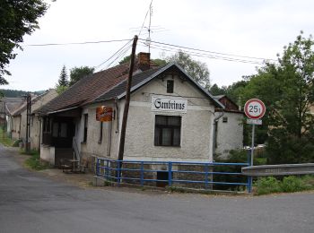
![Te voet Te voet](https://static1.geolcdn.com/sitytour/trail-icons/100.png)
Km
Te voet
![](/images/other/stat-length.png)
![](https://static1.geolcdn.com/siteimages/upload/files/1508320355ic_sort_den_pos_24dp.png)
![](https://static1.geolcdn.com/siteimages/upload/files/1508320355ic_sort_den_neg_24dp.png)
![](https://static1.geolcdn.com/siteimages/upload/files/16400158638029165_repeat_loop_refresh_sync_direction_icon.png)
• Tocht aangemaakt door cz:KČT.
![Tocht Te voet Obecnice - [Z] Křesín - Dlouhý kámen - Photo](https://media.geolcdn.com/t/350/260/a0381e44-f2e0-4d28-a412-1a9454739cbf.jpeg&format=jpg&maxdim=2)
![Te voet Te voet](https://static1.geolcdn.com/sitytour/trail-icons/100.png)
Km
Te voet
![](/images/other/stat-length.png)
![](https://static1.geolcdn.com/siteimages/upload/files/1508320355ic_sort_den_pos_24dp.png)
![](https://static1.geolcdn.com/siteimages/upload/files/1508320355ic_sort_den_neg_24dp.png)
![](https://static1.geolcdn.com/siteimages/upload/files/16400158638029165_repeat_loop_refresh_sync_direction_icon.png)
• Tocht aangemaakt door cz:KČT.
![Tocht Te voet Obecnice - [Z] Pila - Bohutín - Photo](https://media.geolcdn.com/t/350/260/ed2c13c9-f98d-44a7-859e-fcc2745957f4.jpeg&format=jpg&maxdim=2)
![Te voet Te voet](https://static1.geolcdn.com/sitytour/trail-icons/100.png)
Km
Te voet
![](/images/other/stat-length.png)
![](https://static1.geolcdn.com/siteimages/upload/files/1508320355ic_sort_den_pos_24dp.png)
![](https://static1.geolcdn.com/siteimages/upload/files/1508320355ic_sort_den_neg_24dp.png)
![](https://static1.geolcdn.com/siteimages/upload/files/16400158638029165_repeat_loop_refresh_sync_direction_icon.png)
• Tocht aangemaakt door cz:KČT.
4 tochten weergegeven op 4
Gratisgps-wandelapplicatie