![](/images/other/stat-length.png)
- Tochten
- Te voet
- Switzerland
- Luzern
- Onbekend
- Willisau
Willisau, Onbekend, Te voet: Top van de beste wandelroutes, trajecten, tochten en wandelingen
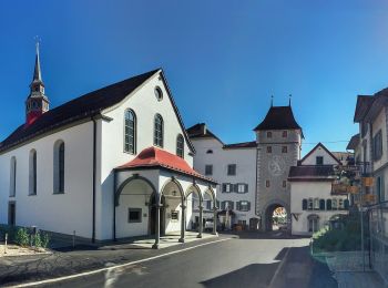
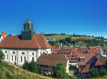
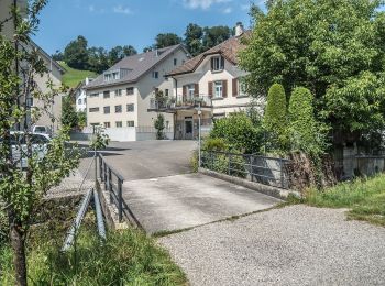
Willisau: Ontdek de beste tochten: 7 te voet. Al deze tochten, trajecten, routes en outdoor activiteiten zijn beschikbaar in onze SityTrail-apps voor smartphones en tablets.
De beste trajecten (7)
![Tocht Te voet Willisau - Obere Stalde - Willisau - Photo](https://media.geolcdn.com/t/350/260/2856643f-b04f-40c3-8ad6-480023ee8377.jpeg&format=jpg&maxdim=2)
![Te voet Te voet](https://static1.geolcdn.com/sitytour/trail-icons/100.png)
Km
Te voet
![](/images/other/stat-length.png)
![](https://static1.geolcdn.com/siteimages/upload/files/1508320355ic_sort_den_pos_24dp.png)
![](https://static1.geolcdn.com/siteimages/upload/files/1508320355ic_sort_den_neg_24dp.png)
![](https://static1.geolcdn.com/siteimages/upload/files/16400158638029165_repeat_loop_refresh_sync_direction_icon.png)
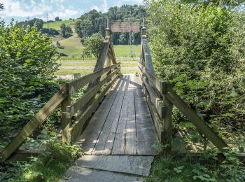
• Obere Stalde - Willisau Symbol: gelber Rhombus
![Tocht Te voet Willisau - Jubiläumsweg - Photo](https://media.geolcdn.com/t/350/260/1fa682f8-d1a0-4b3d-a3bd-58137261651e.jpeg&format=jpg&maxdim=2)
![Te voet Te voet](https://static1.geolcdn.com/sitytour/trail-icons/100.png)
Km
Te voet
![](/images/other/stat-length.png)
![](https://static1.geolcdn.com/siteimages/upload/files/1508320355ic_sort_den_pos_24dp.png)
![](https://static1.geolcdn.com/siteimages/upload/files/1508320355ic_sort_den_neg_24dp.png)
![](https://static1.geolcdn.com/siteimages/upload/files/16400158638029165_repeat_loop_refresh_sync_direction_icon.png)
• Jubiläumsweg Symbol: Brauner Rhombus
![Tocht Te voet Willisau - Birchbüel - Honegg - Willisau - Photo](https://media.geolcdn.com/t/350/260/ac14bfde-3738-4f83-ae81-1aa9bb4800dd.jpeg&format=jpg&maxdim=2)
![Te voet Te voet](https://static1.geolcdn.com/sitytour/trail-icons/100.png)
Km
Te voet
![](/images/other/stat-length.png)
![](https://static1.geolcdn.com/siteimages/upload/files/1508320355ic_sort_den_pos_24dp.png)
![](https://static1.geolcdn.com/siteimages/upload/files/1508320355ic_sort_den_neg_24dp.png)
![](https://static1.geolcdn.com/siteimages/upload/files/16400158638029165_repeat_loop_refresh_sync_direction_icon.png)
• Birchbüel - Honegg - Willisau Symbol: gelber Rhombus
![Tocht Te voet Willisau - Wilisau Schlossfeld - Mörisegg - Photo](https://media.geolcdn.com/t/350/260/b344b958-3fc9-4e13-bb32-52432a5ee9eb.jpeg&format=jpg&maxdim=2)
![Te voet Te voet](https://static1.geolcdn.com/sitytour/trail-icons/100.png)
Km
Te voet
![](/images/other/stat-length.png)
![](https://static1.geolcdn.com/siteimages/upload/files/1508320355ic_sort_den_pos_24dp.png)
![](https://static1.geolcdn.com/siteimages/upload/files/1508320355ic_sort_den_neg_24dp.png)
![](https://static1.geolcdn.com/siteimages/upload/files/16400158638029165_repeat_loop_refresh_sync_direction_icon.png)
• Trail created by Luzerner Wanderwege. Wilisau Schlossfeld - Mörisegg Symbol: gelber Rhombus
![Tocht Te voet Willisau - Willisau (Schwyzermatt) - Hergiswil - Photo](https://media.geolcdn.com/t/350/260/3ee561ec-7bb8-4bb2-9676-b4f737e9ee14.jpeg&format=jpg&maxdim=2)
![Te voet Te voet](https://static1.geolcdn.com/sitytour/trail-icons/100.png)
Km
Te voet
![](/images/other/stat-length.png)
![](https://static1.geolcdn.com/siteimages/upload/files/1508320355ic_sort_den_pos_24dp.png)
![](https://static1.geolcdn.com/siteimages/upload/files/1508320355ic_sort_den_neg_24dp.png)
![](https://static1.geolcdn.com/siteimages/upload/files/16400158638029165_repeat_loop_refresh_sync_direction_icon.png)
• Trail created by Luzerner Wanderwege. Willisau (Schwyzermatt) - Hergiswil Symbol: gelber Rhombus
![Tocht Te voet Willisau - St. Niklausen - Daiwil - Photo](https://media.geolcdn.com/t/350/260/1fa682f8-d1a0-4b3d-a3bd-58137261651e.jpeg&format=jpg&maxdim=2)
![Te voet Te voet](https://static1.geolcdn.com/sitytour/trail-icons/100.png)
Km
Te voet
![](/images/other/stat-length.png)
![](https://static1.geolcdn.com/siteimages/upload/files/1508320355ic_sort_den_pos_24dp.png)
![](https://static1.geolcdn.com/siteimages/upload/files/1508320355ic_sort_den_neg_24dp.png)
![](https://static1.geolcdn.com/siteimages/upload/files/16400158638029165_repeat_loop_refresh_sync_direction_icon.png)
• Trail created by Luzerner Wanderwege. St. Niklausen - Daiwil Symbol: gelber Rhombus
![Tocht Te voet Willisau - Chanzelsagen - Daiwil - Photo](https://media.geolcdn.com/t/350/260/ext.jpg?maxdim=2&url=https%3A%2F%2Fstatic1.geolcdn.com%2Fsiteimages%2Fupload%2Ffiles%2F1545311037marcheuse_200dpi.jpg)
![Te voet Te voet](https://static1.geolcdn.com/sitytour/trail-icons/100.png)
Km
Te voet
![](/images/other/stat-length.png)
![](https://static1.geolcdn.com/siteimages/upload/files/1508320355ic_sort_den_pos_24dp.png)
![](https://static1.geolcdn.com/siteimages/upload/files/1508320355ic_sort_den_neg_24dp.png)
![](https://static1.geolcdn.com/siteimages/upload/files/16400158638029165_repeat_loop_refresh_sync_direction_icon.png)
• Trail created by Luzerner Wanderwege. Chanzelsagen - Daiwil Symbol: gelber Rhombus
7 tochten weergegeven op 7
Gratisgps-wandelapplicatie