![](/images/other/stat-length.png)
Pfäfers, Wahlkreis Sarganserland, Te voet: Top van de beste wandelroutes, trajecten, tochten en wandelingen
Pfäfers: Ontdek de beste tochten: 9 te voet. Al deze tochten, trajecten, routes en outdoor activiteiten zijn beschikbaar in onze SityTrail-apps voor smartphones en tablets.
De beste trajecten (9)
![Tocht Te voet Pfäfers - Pfäfers - Spig - Photo](https://media.geolcdn.com/t/350/260/960a57d7-2229-4f75-a454-13f455f6e1e8.jpeg&format=jpg&maxdim=2)
![Te voet Te voet](https://static1.geolcdn.com/sitytour/trail-icons/100.png)
Km
Te voet
![](/images/other/stat-length.png)
![](https://static1.geolcdn.com/siteimages/upload/files/1508320355ic_sort_den_pos_24dp.png)
![](https://static1.geolcdn.com/siteimages/upload/files/1508320355ic_sort_den_neg_24dp.png)
![](https://static1.geolcdn.com/siteimages/upload/files/16400158638029165_repeat_loop_refresh_sync_direction_icon.png)
• Symbol: weiss-rot-weiss
![Tocht Te voet Pfäfers - Bad Pfäfers - Pfäfers - Photo](https://media.geolcdn.com/t/350/260/4c6ea9a3-1f12-4209-af1f-6fbd72b66fe4.jpeg&format=jpg&maxdim=2)
![Te voet Te voet](https://static1.geolcdn.com/sitytour/trail-icons/100.png)
Km
Te voet
![](/images/other/stat-length.png)
![](https://static1.geolcdn.com/siteimages/upload/files/1508320355ic_sort_den_pos_24dp.png)
![](https://static1.geolcdn.com/siteimages/upload/files/1508320355ic_sort_den_neg_24dp.png)
![](https://static1.geolcdn.com/siteimages/upload/files/16400158638029165_repeat_loop_refresh_sync_direction_icon.png)
• Symbol: gelber Diamant
![Tocht Te voet Pfäfers - CH-Gigerwald - Pizolsattel - Photo](https://media.geolcdn.com/t/350/260/4aeb6c2b-35b2-4f9e-b572-18242fb45494.jpeg&format=jpg&maxdim=2)
![Te voet Te voet](https://static1.geolcdn.com/sitytour/trail-icons/100.png)
Km
Te voet
![](/images/other/stat-length.png)
![](https://static1.geolcdn.com/siteimages/upload/files/1508320355ic_sort_den_pos_24dp.png)
![](https://static1.geolcdn.com/siteimages/upload/files/1508320355ic_sort_den_neg_24dp.png)
![](https://static1.geolcdn.com/siteimages/upload/files/16400158638029165_repeat_loop_refresh_sync_direction_icon.png)
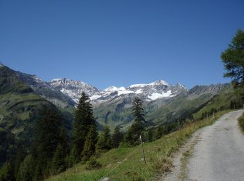
• Gigerwald - Pizolsattel Symbol: weiss-blau-weiss
![Tocht Te voet Pfäfers - Staumauer Gigerwald-St.Martin - Photo](https://media.geolcdn.com/t/350/260/4aeb6c2b-35b2-4f9e-b572-18242fb45494.jpeg&format=jpg&maxdim=2)
![Te voet Te voet](https://static1.geolcdn.com/sitytour/trail-icons/100.png)
Km
Te voet
![](/images/other/stat-length.png)
![](https://static1.geolcdn.com/siteimages/upload/files/1508320355ic_sort_den_pos_24dp.png)
![](https://static1.geolcdn.com/siteimages/upload/files/1508320355ic_sort_den_neg_24dp.png)
![](https://static1.geolcdn.com/siteimages/upload/files/16400158638029165_repeat_loop_refresh_sync_direction_icon.png)
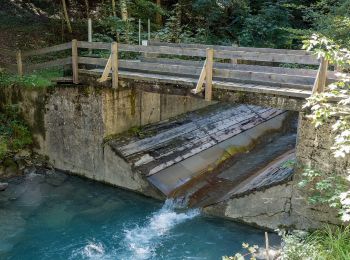
• Staumauer Gigerwald-St.Martin Symbol: gelbe Raute
![Tocht Te voet Pfäfers - Brugg-Staumauer Gigerwald - Photo](https://media.geolcdn.com/t/350/260/ec9444dd-58bf-48db-90fe-1b2c67a9c02c.jpeg&format=jpg&maxdim=2)
![Te voet Te voet](https://static1.geolcdn.com/sitytour/trail-icons/100.png)
Km
Te voet
![](/images/other/stat-length.png)
![](https://static1.geolcdn.com/siteimages/upload/files/1508320355ic_sort_den_pos_24dp.png)
![](https://static1.geolcdn.com/siteimages/upload/files/1508320355ic_sort_den_neg_24dp.png)
![](https://static1.geolcdn.com/siteimages/upload/files/16400158638029165_repeat_loop_refresh_sync_direction_icon.png)
• Alter Walserweg Symbol: weiss-rot-weiss
![Tocht Te voet Pfäfers - Spazier Rundweg Radein - Photo](https://media.geolcdn.com/t/350/260/1091933a-8457-4f2f-a3a4-10b386e3aec9.jpeg&format=jpg&maxdim=2)
![Te voet Te voet](https://static1.geolcdn.com/sitytour/trail-icons/100.png)
Km
Te voet
![](/images/other/stat-length.png)
![](https://static1.geolcdn.com/siteimages/upload/files/1508320355ic_sort_den_pos_24dp.png)
![](https://static1.geolcdn.com/siteimages/upload/files/1508320355ic_sort_den_neg_24dp.png)
![](https://static1.geolcdn.com/siteimages/upload/files/16400158638029165_repeat_loop_refresh_sync_direction_icon.png)
• Trail created by Kurverein Vättis. Symbol: rote Dreiecke ohne Hintergrund auf Zäune, Pfosten usw.
![Tocht Te voet Pfäfers - Malanseralp - Brennboden - Photo](https://media.geolcdn.com/t/350/260/8728391e-edc2-437a-8151-b46275b47d8d.jpeg&format=jpg&maxdim=2)
![Te voet Te voet](https://static1.geolcdn.com/sitytour/trail-icons/100.png)
Km
Te voet
![](/images/other/stat-length.png)
![](https://static1.geolcdn.com/siteimages/upload/files/1508320355ic_sort_den_pos_24dp.png)
![](https://static1.geolcdn.com/siteimages/upload/files/1508320355ic_sort_den_neg_24dp.png)
![](https://static1.geolcdn.com/siteimages/upload/files/16400158638029165_repeat_loop_refresh_sync_direction_icon.png)
• Symbol: weiss-rot-weiss
![Tocht Te voet Pfäfers - Tüfwald - Hintere Ebni - Photo](https://media.geolcdn.com/t/350/260/8728391e-edc2-437a-8151-b46275b47d8d.jpeg&format=jpg&maxdim=2)
![Te voet Te voet](https://static1.geolcdn.com/sitytour/trail-icons/100.png)
Km
Te voet
![](/images/other/stat-length.png)
![](https://static1.geolcdn.com/siteimages/upload/files/1508320355ic_sort_den_pos_24dp.png)
![](https://static1.geolcdn.com/siteimages/upload/files/1508320355ic_sort_den_neg_24dp.png)
![](https://static1.geolcdn.com/siteimages/upload/files/16400158638029165_repeat_loop_refresh_sync_direction_icon.png)
• Symbol: weiss-rot-weiss
![Tocht Te voet Pfäfers - Sardonahütte-Heubützlipass - Photo](https://media.geolcdn.com/t/350/260/9db0d7fd-45f2-484f-b9cc-2c0365df441f.jpeg&format=jpg&maxdim=2)
![Te voet Te voet](https://static1.geolcdn.com/sitytour/trail-icons/100.png)
Km
Te voet
![](/images/other/stat-length.png)
![](https://static1.geolcdn.com/siteimages/upload/files/1508320355ic_sort_den_pos_24dp.png)
![](https://static1.geolcdn.com/siteimages/upload/files/1508320355ic_sort_den_neg_24dp.png)
![](https://static1.geolcdn.com/siteimages/upload/files/16400158638029165_repeat_loop_refresh_sync_direction_icon.png)
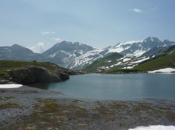
• Sardonahütte-Heubützlipass Symbol: weiss-rot-weiss
9 tochten weergegeven op 9
Gratisgps-wandelapplicatie