![](/images/other/stat-length.png)
Bezirk Schwaz, Tirol, Te voet: Top van de beste wandelroutes, trajecten, tochten en wandelingen
Bezirk Schwaz: Ontdek de beste tochten: 23 te voet en 24 stappen. Al deze tochten, trajecten, routes en outdoor activiteiten zijn beschikbaar in onze SityTrail-apps voor smartphones en tablets.
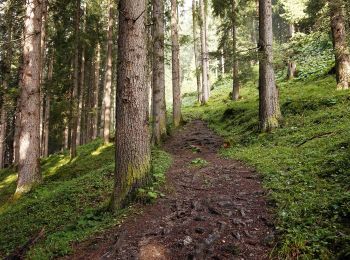
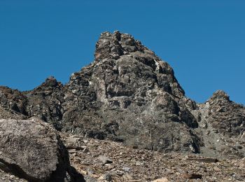
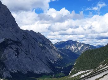
De beste trajecten (47)
![Tocht Te voet Gemeinde Finkenberg - 4 - Photo](https://media.geolcdn.com/t/350/260/93e85014-e1f1-49fc-a3c7-73607a07ee42.jpeg&format=jpg&maxdim=2)
![Te voet Te voet](https://static1.geolcdn.com/sitytour/trail-icons/100.png)
Km
Te voet
![](/images/other/stat-length.png)
![](https://static1.geolcdn.com/siteimages/upload/files/1508320355ic_sort_den_pos_24dp.png)
![](https://static1.geolcdn.com/siteimages/upload/files/1508320355ic_sort_den_neg_24dp.png)
![](https://static1.geolcdn.com/siteimages/upload/files/16400158638029165_repeat_loop_refresh_sync_direction_icon.png)
• Trail created by Alpenverein Südtirol (AVS).
![Tocht Te voet Gemeinde Gerlos - Wasserfall-Trail - Photo](https://media.geolcdn.com/t/350/260/9f60ade8-b829-49f6-a230-4db6b4604c2c.jpeg&format=jpg&maxdim=2)
![Te voet Te voet](https://static1.geolcdn.com/sitytour/trail-icons/100.png)
Km
Te voet
![](/images/other/stat-length.png)
![](https://static1.geolcdn.com/siteimages/upload/files/1508320355ic_sort_den_pos_24dp.png)
![](https://static1.geolcdn.com/siteimages/upload/files/1508320355ic_sort_den_neg_24dp.png)
![](https://static1.geolcdn.com/siteimages/upload/files/16400158638029165_repeat_loop_refresh_sync_direction_icon.png)
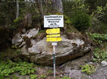
• Trail created by Gerlos. Symbol: Gelbe Blechschilder mit schwarzem Richtungspfeil und blauem, unteren Rand
![Tocht Te voet Gemeinde Gerlos - Wanderweg 7a - Gerlos - Photo](https://media.geolcdn.com/t/350/260/e1afe855-32ad-4494-8d21-68f75dd359af.jpeg&format=jpg&maxdim=2)
![Te voet Te voet](https://static1.geolcdn.com/sitytour/trail-icons/100.png)
Km
Te voet
![](/images/other/stat-length.png)
![](https://static1.geolcdn.com/siteimages/upload/files/1508320355ic_sort_den_pos_24dp.png)
![](https://static1.geolcdn.com/siteimages/upload/files/1508320355ic_sort_den_neg_24dp.png)
![](https://static1.geolcdn.com/siteimages/upload/files/16400158638029165_repeat_loop_refresh_sync_direction_icon.png)
• Trail created by TVB Gerlos. Symbol: Gelbe Wegweisschilder mit schwarzer Schrift
![Tocht Te voet Gemeinde Gerlos - Wanderweg 4 - Gerlos - Photo](https://media.geolcdn.com/t/350/260/f0fbe92e-5b0f-48d8-90ce-de9f38e1cbd5.jpeg&format=jpg&maxdim=2)
![Te voet Te voet](https://static1.geolcdn.com/sitytour/trail-icons/100.png)
Km
Te voet
![](/images/other/stat-length.png)
![](https://static1.geolcdn.com/siteimages/upload/files/1508320355ic_sort_den_pos_24dp.png)
![](https://static1.geolcdn.com/siteimages/upload/files/1508320355ic_sort_den_neg_24dp.png)
![](https://static1.geolcdn.com/siteimages/upload/files/16400158638029165_repeat_loop_refresh_sync_direction_icon.png)
• Trail created by TVB Zell-Gerlos. Symbol: Gelbe Wegweisschilder mit schwarzer Schrift
![Tocht Te voet Gemeinde Gerlos - Innertal-Runde - Photo](https://media.geolcdn.com/t/350/260/70c476f7-e8d3-4b76-a1cb-9a4ae4ca99a5.jpeg&format=jpg&maxdim=2)
![Te voet Te voet](https://static1.geolcdn.com/sitytour/trail-icons/100.png)
Km
Te voet
![](/images/other/stat-length.png)
![](https://static1.geolcdn.com/siteimages/upload/files/1508320355ic_sort_den_pos_24dp.png)
![](https://static1.geolcdn.com/siteimages/upload/files/1508320355ic_sort_den_neg_24dp.png)
![](https://static1.geolcdn.com/siteimages/upload/files/16400158638029165_repeat_loop_refresh_sync_direction_icon.png)
• Trail created by Gerlos. Symbol: Gelbe Blechschilder mit rotem Richtungspfeil und grünem, unteren Rand
![Tocht Te voet Gemeinde Finkenberg - 7 - Photo](https://media.geolcdn.com/t/350/260/5dbbd9cb-02a4-441e-8ff9-29f15dac3e34.jpeg&format=jpg&maxdim=2)
![Te voet Te voet](https://static1.geolcdn.com/sitytour/trail-icons/100.png)
Km
Te voet
![](/images/other/stat-length.png)
![](https://static1.geolcdn.com/siteimages/upload/files/1508320355ic_sort_den_pos_24dp.png)
![](https://static1.geolcdn.com/siteimages/upload/files/1508320355ic_sort_den_neg_24dp.png)
![](https://static1.geolcdn.com/siteimages/upload/files/16400158638029165_repeat_loop_refresh_sync_direction_icon.png)
• Trail created by Alpenverein Südtirol (AVS).
![Tocht Stappen Marktgemeinde Vomp - La Voie de l’Aigle : J6 - Photo](https://media.geolcdn.com/t/350/260/5609364f-e5c4-47bf-bb71-733cbf599c19.jpg&format=jpg&maxdim=2)
![Stappen Stappen](https://static1.geolcdn.com/sitytour/trail-icons/101.png)
Km
Stappen
![](/images/other/stat-length.png)
![](https://static1.geolcdn.com/siteimages/upload/files/1508320355ic_sort_den_pos_24dp.png)
![](https://static1.geolcdn.com/siteimages/upload/files/1508320355ic_sort_den_neg_24dp.png)
![](https://static1.geolcdn.com/siteimages/upload/files/16400158638029165_repeat_loop_refresh_sync_direction_icon.png)
![Tocht Te voet Gemeinde Finkenberg - Wanderweg 24 - Photo](https://media.geolcdn.com/t/350/260/adbe11eb-c846-42c9-a7d8-a2795d8b7971.jpeg&format=jpg&maxdim=2)
![Te voet Te voet](https://static1.geolcdn.com/sitytour/trail-icons/100.png)
Km
Te voet
![](/images/other/stat-length.png)
![](https://static1.geolcdn.com/siteimages/upload/files/1508320355ic_sort_den_pos_24dp.png)
![](https://static1.geolcdn.com/siteimages/upload/files/1508320355ic_sort_den_neg_24dp.png)
![](https://static1.geolcdn.com/siteimages/upload/files/16400158638029165_repeat_loop_refresh_sync_direction_icon.png)
![Tocht Te voet Gemeinde Schwendau - Wanderweg 24b - Photo](https://media.geolcdn.com/t/350/260/a66d6a84-45fd-4851-9231-b73592a34700.jpeg&format=jpg&maxdim=2)
![Te voet Te voet](https://static1.geolcdn.com/sitytour/trail-icons/100.png)
Km
Te voet
![](/images/other/stat-length.png)
![](https://static1.geolcdn.com/siteimages/upload/files/1508320355ic_sort_den_pos_24dp.png)
![](https://static1.geolcdn.com/siteimages/upload/files/1508320355ic_sort_den_neg_24dp.png)
![](https://static1.geolcdn.com/siteimages/upload/files/16400158638029165_repeat_loop_refresh_sync_direction_icon.png)
![Tocht Te voet Gemeinde Schwendau - Wanderweg 9 - Photo](https://media.geolcdn.com/t/350/260/3c2f3adb-cac7-45fd-815f-7df93e0624cd.jpeg&format=jpg&maxdim=2)
![Te voet Te voet](https://static1.geolcdn.com/sitytour/trail-icons/100.png)
Km
Te voet
![](/images/other/stat-length.png)
![](https://static1.geolcdn.com/siteimages/upload/files/1508320355ic_sort_den_pos_24dp.png)
![](https://static1.geolcdn.com/siteimages/upload/files/1508320355ic_sort_den_neg_24dp.png)
![](https://static1.geolcdn.com/siteimages/upload/files/16400158638029165_repeat_loop_refresh_sync_direction_icon.png)
![Tocht Te voet Gemeinde Tux - Wanderweg 57 - Photo](https://media.geolcdn.com/t/350/260/0bd63ea7-df4b-4d03-8ca9-b58a051eff36.jpeg&format=jpg&maxdim=2)
![Te voet Te voet](https://static1.geolcdn.com/sitytour/trail-icons/100.png)
Km
Te voet
![](/images/other/stat-length.png)
![](https://static1.geolcdn.com/siteimages/upload/files/1508320355ic_sort_den_pos_24dp.png)
![](https://static1.geolcdn.com/siteimages/upload/files/1508320355ic_sort_den_neg_24dp.png)
![](https://static1.geolcdn.com/siteimages/upload/files/16400158638029165_repeat_loop_refresh_sync_direction_icon.png)
![Tocht Te voet Gemeinde Gerlos - Gmündner Seemeile - Photo](https://media.geolcdn.com/t/350/260/52cba597-4e8b-4777-af27-bb3644f93dd2.jpeg&format=jpg&maxdim=2)
![Te voet Te voet](https://static1.geolcdn.com/sitytour/trail-icons/100.png)
Km
Te voet
![](/images/other/stat-length.png)
![](https://static1.geolcdn.com/siteimages/upload/files/1508320355ic_sort_den_pos_24dp.png)
![](https://static1.geolcdn.com/siteimages/upload/files/1508320355ic_sort_den_neg_24dp.png)
![](https://static1.geolcdn.com/siteimages/upload/files/16400158638029165_repeat_loop_refresh_sync_direction_icon.png)
• Trail created by Gerlos. Symbol: Gelbe Blechschilder mit blauem Richtungspfeil und violettem, unteren Rand
![Tocht Te voet Gemeinde Tux - AT-23 - Photo](https://media.geolcdn.com/t/350/260/aa7e000b-2ac4-4f62-9f64-edc9f498c5c4.jpeg&format=jpg&maxdim=2)
![Te voet Te voet](https://static1.geolcdn.com/sitytour/trail-icons/100.png)
Km
Te voet
![](/images/other/stat-length.png)
![](https://static1.geolcdn.com/siteimages/upload/files/1508320355ic_sort_den_pos_24dp.png)
![](https://static1.geolcdn.com/siteimages/upload/files/1508320355ic_sort_den_neg_24dp.png)
![](https://static1.geolcdn.com/siteimages/upload/files/16400158638029165_repeat_loop_refresh_sync_direction_icon.png)
![Tocht Te voet Gemeinde Tux - AT-33 - Photo](https://media.geolcdn.com/t/350/260/b0aaf850-0b84-49ed-b7f8-5ec409474902.jpeg&format=jpg&maxdim=2)
![Te voet Te voet](https://static1.geolcdn.com/sitytour/trail-icons/100.png)
Km
Te voet
![](/images/other/stat-length.png)
![](https://static1.geolcdn.com/siteimages/upload/files/1508320355ic_sort_den_pos_24dp.png)
![](https://static1.geolcdn.com/siteimages/upload/files/1508320355ic_sort_den_neg_24dp.png)
![](https://static1.geolcdn.com/siteimages/upload/files/16400158638029165_repeat_loop_refresh_sync_direction_icon.png)
![Tocht Te voet Gemeinde Tux - AT-24 - Photo](https://media.geolcdn.com/t/350/260/4367f796-1b2e-4ff0-b71f-c7cd9979bb8b.jpeg&format=jpg&maxdim=2)
![Te voet Te voet](https://static1.geolcdn.com/sitytour/trail-icons/100.png)
Km
Te voet
![](/images/other/stat-length.png)
![](https://static1.geolcdn.com/siteimages/upload/files/1508320355ic_sort_den_pos_24dp.png)
![](https://static1.geolcdn.com/siteimages/upload/files/1508320355ic_sort_den_neg_24dp.png)
![](https://static1.geolcdn.com/siteimages/upload/files/16400158638029165_repeat_loop_refresh_sync_direction_icon.png)
![Tocht Te voet Gemeinde Tux - AT-21 - Photo](https://media.geolcdn.com/t/350/260/d87d8977-295a-4e6a-b380-13b08cfbc529.jpeg&format=jpg&maxdim=2)
![Te voet Te voet](https://static1.geolcdn.com/sitytour/trail-icons/100.png)
Km
Te voet
![](/images/other/stat-length.png)
![](https://static1.geolcdn.com/siteimages/upload/files/1508320355ic_sort_den_pos_24dp.png)
![](https://static1.geolcdn.com/siteimages/upload/files/1508320355ic_sort_den_neg_24dp.png)
![](https://static1.geolcdn.com/siteimages/upload/files/16400158638029165_repeat_loop_refresh_sync_direction_icon.png)
![Tocht Te voet Gemeinde Tux - AT-322 - Photo](https://media.geolcdn.com/t/350/260/4765abd1-cba2-4715-bf03-50eeb002fd3b.jpeg&format=jpg&maxdim=2)
![Te voet Te voet](https://static1.geolcdn.com/sitytour/trail-icons/100.png)
Km
Te voet
![](/images/other/stat-length.png)
![](https://static1.geolcdn.com/siteimages/upload/files/1508320355ic_sort_den_pos_24dp.png)
![](https://static1.geolcdn.com/siteimages/upload/files/1508320355ic_sort_den_neg_24dp.png)
![](https://static1.geolcdn.com/siteimages/upload/files/16400158638029165_repeat_loop_refresh_sync_direction_icon.png)
![Tocht Stappen Gemeinde Eben am Achensee - La Voie de l’Aigle : J5 - Photo](https://media.geolcdn.com/t/350/260/0979ac60-95cc-4b4a-b5ac-19f4fe7653bc.jpg&format=jpg&maxdim=2)
![Stappen Stappen](https://static1.geolcdn.com/sitytour/trail-icons/101.png)
Km
Stappen
![](/images/other/stat-length.png)
![](https://static1.geolcdn.com/siteimages/upload/files/1508320355ic_sort_den_pos_24dp.png)
![](https://static1.geolcdn.com/siteimages/upload/files/1508320355ic_sort_den_neg_24dp.png)
![](https://static1.geolcdn.com/siteimages/upload/files/16400158638029165_repeat_loop_refresh_sync_direction_icon.png)
![Tocht Te voet Gemeinde Gerlos - Bachrunde - Photo](https://media.geolcdn.com/t/350/260/ext.jpg?maxdim=2&url=https%3A%2F%2Fstatic1.geolcdn.com%2Fsiteimages%2Fupload%2Ffiles%2F1545311037marcheuse_200dpi.jpg)
![Te voet Te voet](https://static1.geolcdn.com/sitytour/trail-icons/100.png)
Km
Te voet
![](/images/other/stat-length.png)
![](https://static1.geolcdn.com/siteimages/upload/files/1508320355ic_sort_den_pos_24dp.png)
![](https://static1.geolcdn.com/siteimages/upload/files/1508320355ic_sort_den_neg_24dp.png)
![](https://static1.geolcdn.com/siteimages/upload/files/16400158638029165_repeat_loop_refresh_sync_direction_icon.png)
• Trail created by Gerlos. Symbol: Gelbe Blechschilder mit rotem Richtungspfeil und hellblauem, unteren Rand
![Tocht Te voet Gemeinde Gerlos - Wanderweg 7 - Gerlos - Photo](https://media.geolcdn.com/t/350/260/ext.jpg?maxdim=2&url=https%3A%2F%2Fstatic1.geolcdn.com%2Fsiteimages%2Fupload%2Ffiles%2F1545311037marcheuse_200dpi.jpg)
![Te voet Te voet](https://static1.geolcdn.com/sitytour/trail-icons/100.png)
Km
Te voet
![](/images/other/stat-length.png)
![](https://static1.geolcdn.com/siteimages/upload/files/1508320355ic_sort_den_pos_24dp.png)
![](https://static1.geolcdn.com/siteimages/upload/files/1508320355ic_sort_den_neg_24dp.png)
![](https://static1.geolcdn.com/siteimages/upload/files/16400158638029165_repeat_loop_refresh_sync_direction_icon.png)
• Trail created by TVB Zell-Gerlos. Symbol: Gelbe Wegweisschilder mit schwarzer Schrift
20 tochten weergegeven op 47
Gratisgps-wandelapplicatie
Activiteiten
Nabije regio's
- Gemeinde Achenkirch
- Gemeinde Aschau im Zillertal
- Gemeinde Brandberg
- Gemeinde Eben am Achensee
- Gemeinde Finkenberg
- Gemeinde Fügen
- Gemeinde Fügenberg
- Gemeinde Gerlos
- Gemeinde Hart im Zillertal
- Gemeinde Hippach
- Gemeinde Kaltenbach
- Gemeinde Pill
- Gemeinde Ried im Zillertal
- Gemeinde Rohrberg
- Gemeinde Schwendau
- Gemeinde Stans
- Gemeinde Steinberg am Rofan
- Gemeinde Strass im Zillertal
- Gemeinde Terfens
- Gemeinde Tux
- Gemeinde Weer
- Gemeinde Weerberg
- Gemeinde Wiesing
- Gemeinde Zellberg
- Marktgemeinde Jenbach
- Marktgemeinde Mayrhofen
- Marktgemeinde Vomp
- Marktgemeinde Zell am Ziller
- Stadt Schwaz