![](/images/other/stat-length.png)
- Tochten
- Te voet
- Austria
- Burgenland
- Bezirk Oberwart
- Gemeinde Bernstein
Gemeinde Bernstein, Bezirk Oberwart, Te voet: Top van de beste wandelroutes, trajecten, tochten en wandelingen
Gemeinde Bernstein: Ontdek de beste tochten: 10 te voet. Al deze tochten, trajecten, routes en outdoor activiteiten zijn beschikbaar in onze SityTrail-apps voor smartphones en tablets.
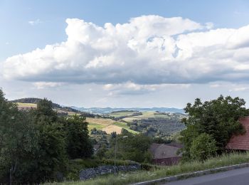
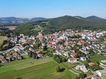
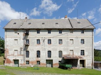
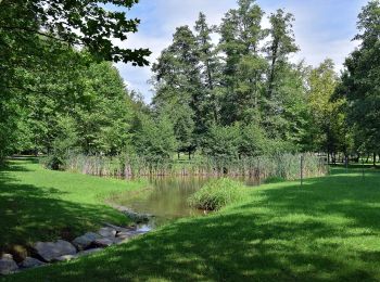
De beste trajecten (10)
![Tocht Te voet Gemeinde Bernstein - Redlschlag - Bernstein über Bienenhaus - Photo](https://media.geolcdn.com/t/350/260/defb3ed7-487a-44ef-821f-092680c7915b.jpeg&format=jpg&maxdim=2)
![Te voet Te voet](https://static1.geolcdn.com/sitytour/trail-icons/100.png)
Km
Te voet
![](/images/other/stat-length.png)
![](https://static1.geolcdn.com/siteimages/upload/files/1508320355ic_sort_den_pos_24dp.png)
![](https://static1.geolcdn.com/siteimages/upload/files/1508320355ic_sort_den_neg_24dp.png)
![](https://static1.geolcdn.com/siteimages/upload/files/16400158638029165_repeat_loop_refresh_sync_direction_icon.png)
• Trail created by ehemals Österreichischer Touristenklub. Symbol: blauer, waagerechter Balken
![Tocht Te voet Gemeinde Bernstein - Redlschlag - Salmannsdorf (erst rot dann grün) - Photo](https://media.geolcdn.com/t/350/260/defb3ed7-487a-44ef-821f-092680c7915b.jpeg&format=jpg&maxdim=2)
![Te voet Te voet](https://static1.geolcdn.com/sitytour/trail-icons/100.png)
Km
Te voet
![](/images/other/stat-length.png)
![](https://static1.geolcdn.com/siteimages/upload/files/1508320355ic_sort_den_pos_24dp.png)
![](https://static1.geolcdn.com/siteimages/upload/files/1508320355ic_sort_den_neg_24dp.png)
![](https://static1.geolcdn.com/siteimages/upload/files/16400158638029165_repeat_loop_refresh_sync_direction_icon.png)
• Trail created by ehemals Österreichischer Touristenklub. red symbols very rarely Symbol: roter, waagrechter Balken
![Tocht Te voet Gemeinde Bernstein - Planetenwanderweg - Photo](https://media.geolcdn.com/t/350/260/43aeb149-dce6-479b-8528-01a0a2ff1338.jpeg&format=jpg&maxdim=2)
![Te voet Te voet](https://static1.geolcdn.com/sitytour/trail-icons/100.png)
Km
Te voet
![](/images/other/stat-length.png)
![](https://static1.geolcdn.com/siteimages/upload/files/1508320355ic_sort_den_pos_24dp.png)
![](https://static1.geolcdn.com/siteimages/upload/files/1508320355ic_sort_den_neg_24dp.png)
![](https://static1.geolcdn.com/siteimages/upload/files/16400158638029165_repeat_loop_refresh_sync_direction_icon.png)
• Trail created by www.laufarena.at. Symbol: weiß-blau
![Tocht Te voet Gemeinde Bernstein - Waldlehrpfad (Redlschlag - Steinbruch) - Photo](https://media.geolcdn.com/t/350/260/defb3ed7-487a-44ef-821f-092680c7915b.jpeg&format=jpg&maxdim=2)
![Te voet Te voet](https://static1.geolcdn.com/sitytour/trail-icons/100.png)
Km
Te voet
![](/images/other/stat-length.png)
![](https://static1.geolcdn.com/siteimages/upload/files/1508320355ic_sort_den_pos_24dp.png)
![](https://static1.geolcdn.com/siteimages/upload/files/1508320355ic_sort_den_neg_24dp.png)
![](https://static1.geolcdn.com/siteimages/upload/files/16400158638029165_repeat_loop_refresh_sync_direction_icon.png)
• Trail created by www.laufarena.at. Symbol: weiß-blau
![Tocht Te voet Gemeinde Bernstein - Höhenwanderweg (Ortsteile der Großgemeinde Bernstein) - Photo](https://media.geolcdn.com/t/350/260/11a33809-0ad3-455a-9d9a-6601971b10d4.jpeg&format=jpg&maxdim=2)
![Te voet Te voet](https://static1.geolcdn.com/sitytour/trail-icons/100.png)
Km
Te voet
![](/images/other/stat-length.png)
![](https://static1.geolcdn.com/siteimages/upload/files/1508320355ic_sort_den_pos_24dp.png)
![](https://static1.geolcdn.com/siteimages/upload/files/1508320355ic_sort_den_neg_24dp.png)
![](https://static1.geolcdn.com/siteimages/upload/files/16400158638029165_repeat_loop_refresh_sync_direction_icon.png)
• Trail created by www.laufarena.at. Symbol: weiß-blau
![Tocht Te voet Gemeinde Bernstein - Bernsteinweg - Photo](https://media.geolcdn.com/t/350/260/ac4d0ad1-b457-4752-af07-86c04d97c8f4.jpeg&format=jpg&maxdim=2)
![Te voet Te voet](https://static1.geolcdn.com/sitytour/trail-icons/100.png)
Km
Te voet
![](/images/other/stat-length.png)
![](https://static1.geolcdn.com/siteimages/upload/files/1508320355ic_sort_den_pos_24dp.png)
![](https://static1.geolcdn.com/siteimages/upload/files/1508320355ic_sort_den_neg_24dp.png)
![](https://static1.geolcdn.com/siteimages/upload/files/16400158638029165_repeat_loop_refresh_sync_direction_icon.png)
• Trail created by Lauf-& Walkingarena. Symbol: Weiße Schrift auf blauem Grund
![Tocht Te voet Gemeinde Bernstein - Alpanonia Zubringer - Photo](https://media.geolcdn.com/t/350/260/ac4d0ad1-b457-4752-af07-86c04d97c8f4.jpeg&format=jpg&maxdim=2)
![Te voet Te voet](https://static1.geolcdn.com/sitytour/trail-icons/100.png)
Km
Te voet
![](/images/other/stat-length.png)
![](https://static1.geolcdn.com/siteimages/upload/files/1508320355ic_sort_den_pos_24dp.png)
![](https://static1.geolcdn.com/siteimages/upload/files/1508320355ic_sort_den_neg_24dp.png)
![](https://static1.geolcdn.com/siteimages/upload/files/16400158638029165_repeat_loop_refresh_sync_direction_icon.png)
• Symbol: Weiße, geschwungene Wege auf gelbem Grund
![Tocht Te voet Gemeinde Bernstein - Speckkammerl Rundwanderweg (Bernstein - Stuben) - Photo](https://media.geolcdn.com/t/350/260/54a09cdf-6c28-42ef-8c84-35ea0072aa22.jpeg&format=jpg&maxdim=2)
![Te voet Te voet](https://static1.geolcdn.com/sitytour/trail-icons/100.png)
Km
Te voet
![](/images/other/stat-length.png)
![](https://static1.geolcdn.com/siteimages/upload/files/1508320355ic_sort_den_pos_24dp.png)
![](https://static1.geolcdn.com/siteimages/upload/files/1508320355ic_sort_den_neg_24dp.png)
![](https://static1.geolcdn.com/siteimages/upload/files/16400158638029165_repeat_loop_refresh_sync_direction_icon.png)
• Symbol: weiß-blau
![Tocht Te voet Gemeinde Bernstein - Redlschlager Höhenluftweg - Photo](https://media.geolcdn.com/t/350/260/50a95790-a169-4359-8d1d-41b1de3ed7db.jpeg&format=jpg&maxdim=2)
![Te voet Te voet](https://static1.geolcdn.com/sitytour/trail-icons/100.png)
Km
Te voet
![](/images/other/stat-length.png)
![](https://static1.geolcdn.com/siteimages/upload/files/1508320355ic_sort_den_pos_24dp.png)
![](https://static1.geolcdn.com/siteimages/upload/files/1508320355ic_sort_den_neg_24dp.png)
![](https://static1.geolcdn.com/siteimages/upload/files/16400158638029165_repeat_loop_refresh_sync_direction_icon.png)
![Tocht Te voet Gemeinde Bernstein - Kienbergweg - Photo](https://media.geolcdn.com/t/350/260/ext.jpg?maxdim=2&url=https%3A%2F%2Fstatic1.geolcdn.com%2Fsiteimages%2Fupload%2Ffiles%2F1545311037marcheuse_200dpi.jpg)
![Te voet Te voet](https://static1.geolcdn.com/sitytour/trail-icons/100.png)
Km
Te voet
![](/images/other/stat-length.png)
![](https://static1.geolcdn.com/siteimages/upload/files/1508320355ic_sort_den_pos_24dp.png)
![](https://static1.geolcdn.com/siteimages/upload/files/1508320355ic_sort_den_neg_24dp.png)
![](https://static1.geolcdn.com/siteimages/upload/files/16400158638029165_repeat_loop_refresh_sync_direction_icon.png)
• Trail created by Lauf- & Walkingarena.
10 tochten weergegeven op 10
Gratisgps-wandelapplicatie