![](/images/other/stat-length.png)
- Tochten
- Te voet
- Austria
- Opper-Oostenrijk
- Bezirk Wels-Land
- Bad Wimsbach-Neydharting
Bad Wimsbach-Neydharting, Bezirk Wels-Land, Te voet: Top van de beste wandelroutes, trajecten, tochten en wandelingen
Bad Wimsbach-Neydharting: Ontdek de beste tochten: 11 te voet. Al deze tochten, trajecten, routes en outdoor activiteiten zijn beschikbaar in onze SityTrail-apps voor smartphones en tablets.
De beste trajecten (11)
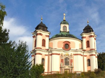
![Tocht Te voet Bad Wimsbach-Neydharting - Zur Paurakirche - Photo](https://media.geolcdn.com/t/350/260/89bae5f3-ecb4-43fe-95b2-1b83f52940f2.jpeg&format=jpg&maxdim=2)
![Te voet Te voet](https://static1.geolcdn.com/sitytour/trail-icons/100.png)
Km
Te voet
![](/images/other/stat-length.png)
![](https://static1.geolcdn.com/siteimages/upload/files/1508320355ic_sort_den_pos_24dp.png)
![](https://static1.geolcdn.com/siteimages/upload/files/1508320355ic_sort_den_neg_24dp.png)
![](https://static1.geolcdn.com/siteimages/upload/files/16400158638029165_repeat_loop_refresh_sync_direction_icon.png)
• Symbol: gelbe Pfeile
![Tocht Te voet Bad Wimsbach-Neydharting - Natur Pur - Photo](https://media.geolcdn.com/t/350/260/5042eb5d-faf6-416f-b1fd-ee97b9fffdd6.jpeg&format=jpg&maxdim=2)
![Te voet Te voet](https://static1.geolcdn.com/sitytour/trail-icons/100.png)
Km
Te voet
![](/images/other/stat-length.png)
![](https://static1.geolcdn.com/siteimages/upload/files/1508320355ic_sort_den_pos_24dp.png)
![](https://static1.geolcdn.com/siteimages/upload/files/1508320355ic_sort_den_neg_24dp.png)
![](https://static1.geolcdn.com/siteimages/upload/files/16400158638029165_repeat_loop_refresh_sync_direction_icon.png)
• Symbol: gelbe Pfeile
![Tocht Te voet Bad Wimsbach-Neydharting - Ins Land eini schaun - Photo](https://media.geolcdn.com/t/350/260/422d490d-556f-424a-b2a7-5aa24b9f1a43.jpeg&format=jpg&maxdim=2)
![Te voet Te voet](https://static1.geolcdn.com/sitytour/trail-icons/100.png)
Km
Te voet
![](/images/other/stat-length.png)
![](https://static1.geolcdn.com/siteimages/upload/files/1508320355ic_sort_den_pos_24dp.png)
![](https://static1.geolcdn.com/siteimages/upload/files/1508320355ic_sort_den_neg_24dp.png)
![](https://static1.geolcdn.com/siteimages/upload/files/16400158638029165_repeat_loop_refresh_sync_direction_icon.png)
• Symbol: gelbe Pfeile
![Tocht Te voet Bad Wimsbach-Neydharting - Über'n Markt - Photo](https://media.geolcdn.com/t/350/260/016f155f-0d7c-47d1-aaee-23c1868bd54b.jpeg&format=jpg&maxdim=2)
![Te voet Te voet](https://static1.geolcdn.com/sitytour/trail-icons/100.png)
Km
Te voet
![](/images/other/stat-length.png)
![](https://static1.geolcdn.com/siteimages/upload/files/1508320355ic_sort_den_pos_24dp.png)
![](https://static1.geolcdn.com/siteimages/upload/files/1508320355ic_sort_den_neg_24dp.png)
![](https://static1.geolcdn.com/siteimages/upload/files/16400158638029165_repeat_loop_refresh_sync_direction_icon.png)
• Symbol: gelbe Pfeile
![Tocht Te voet Bad Wimsbach-Neydharting - Zum Almspitz - Photo](https://media.geolcdn.com/t/350/260/cad5b10d-ed33-482c-ac16-a8c892a935d5.jpeg&format=jpg&maxdim=2)
![Te voet Te voet](https://static1.geolcdn.com/sitytour/trail-icons/100.png)
Km
Te voet
![](/images/other/stat-length.png)
![](https://static1.geolcdn.com/siteimages/upload/files/1508320355ic_sort_den_pos_24dp.png)
![](https://static1.geolcdn.com/siteimages/upload/files/1508320355ic_sort_den_neg_24dp.png)
![](https://static1.geolcdn.com/siteimages/upload/files/16400158638029165_repeat_loop_refresh_sync_direction_icon.png)
• Symbol: gelbe Pfeile
![Tocht Te voet Bad Wimsbach-Neydharting - Via Villa Rustica - Photo](https://media.geolcdn.com/t/350/260/ab399383-ab6b-4375-8f23-ac406713ca83.jpeg&format=jpg&maxdim=2)
![Te voet Te voet](https://static1.geolcdn.com/sitytour/trail-icons/100.png)
Km
Te voet
![](/images/other/stat-length.png)
![](https://static1.geolcdn.com/siteimages/upload/files/1508320355ic_sort_den_pos_24dp.png)
![](https://static1.geolcdn.com/siteimages/upload/files/1508320355ic_sort_den_neg_24dp.png)
![](https://static1.geolcdn.com/siteimages/upload/files/16400158638029165_repeat_loop_refresh_sync_direction_icon.png)
• Symbol: gelbe Pfeile
![Tocht Te voet Bad Wimsbach-Neydharting - Von Dorf zu Dorf - Photo](https://media.geolcdn.com/t/350/260/422d490d-556f-424a-b2a7-5aa24b9f1a43.jpeg&format=jpg&maxdim=2)
![Te voet Te voet](https://static1.geolcdn.com/sitytour/trail-icons/100.png)
Km
Te voet
![](/images/other/stat-length.png)
![](https://static1.geolcdn.com/siteimages/upload/files/1508320355ic_sort_den_pos_24dp.png)
![](https://static1.geolcdn.com/siteimages/upload/files/1508320355ic_sort_den_neg_24dp.png)
![](https://static1.geolcdn.com/siteimages/upload/files/16400158638029165_repeat_loop_refresh_sync_direction_icon.png)
• Symbol: gelbe Pfeile
![Tocht Te voet Bad Wimsbach-Neydharting - Über's Schloss - Photo](https://media.geolcdn.com/t/350/260/016f155f-0d7c-47d1-aaee-23c1868bd54b.jpeg&format=jpg&maxdim=2)
![Te voet Te voet](https://static1.geolcdn.com/sitytour/trail-icons/100.png)
Km
Te voet
![](/images/other/stat-length.png)
![](https://static1.geolcdn.com/siteimages/upload/files/1508320355ic_sort_den_pos_24dp.png)
![](https://static1.geolcdn.com/siteimages/upload/files/1508320355ic_sort_den_neg_24dp.png)
![](https://static1.geolcdn.com/siteimages/upload/files/16400158638029165_repeat_loop_refresh_sync_direction_icon.png)
• Symbol: gelbe Pfeile
![Tocht Te voet Bad Wimsbach-Neydharting - Georgsrunde - Photo](https://media.geolcdn.com/t/350/260/d98d1b3e-75b0-4385-8fd9-c7b97cbecf21.jpeg&format=jpg&maxdim=2)
![Te voet Te voet](https://static1.geolcdn.com/sitytour/trail-icons/100.png)
Km
Te voet
![](/images/other/stat-length.png)
![](https://static1.geolcdn.com/siteimages/upload/files/1508320355ic_sort_den_pos_24dp.png)
![](https://static1.geolcdn.com/siteimages/upload/files/1508320355ic_sort_den_neg_24dp.png)
![](https://static1.geolcdn.com/siteimages/upload/files/16400158638029165_repeat_loop_refresh_sync_direction_icon.png)
• Symbol: gelbe Pfeile
![Tocht Te voet Bad Wimsbach-Neydharting - Über'd Moosleitn - Photo](https://media.geolcdn.com/t/350/260/88783550-ac92-440c-9f9d-0d49bfb7ef04.jpeg&format=jpg&maxdim=2)
![Te voet Te voet](https://static1.geolcdn.com/sitytour/trail-icons/100.png)
Km
Te voet
![](/images/other/stat-length.png)
![](https://static1.geolcdn.com/siteimages/upload/files/1508320355ic_sort_den_pos_24dp.png)
![](https://static1.geolcdn.com/siteimages/upload/files/1508320355ic_sort_den_neg_24dp.png)
![](https://static1.geolcdn.com/siteimages/upload/files/16400158638029165_repeat_loop_refresh_sync_direction_icon.png)
• Symbol: gelbe Pfeile
![Tocht Te voet Bad Wimsbach-Neydharting - Vom Wasser zum Most - Photo](https://media.geolcdn.com/t/350/260/016f155f-0d7c-47d1-aaee-23c1868bd54b.jpeg&format=jpg&maxdim=2)
![Te voet Te voet](https://static1.geolcdn.com/sitytour/trail-icons/100.png)
Km
Te voet
![](/images/other/stat-length.png)
![](https://static1.geolcdn.com/siteimages/upload/files/1508320355ic_sort_den_pos_24dp.png)
![](https://static1.geolcdn.com/siteimages/upload/files/1508320355ic_sort_den_neg_24dp.png)
![](https://static1.geolcdn.com/siteimages/upload/files/16400158638029165_repeat_loop_refresh_sync_direction_icon.png)
• Symbol: gelbe Pfeile
11 tochten weergegeven op 11
Gratisgps-wandelapplicatie