![](/images/other/stat-length.png)
- Tochten
- Te voet
- Austria
- Neder-Oostenrijk
- Bezirk Mödling
Bezirk Mödling, Neder-Oostenrijk, Te voet: Top van de beste wandelroutes, trajecten, tochten en wandelingen
Bezirk Mödling: Ontdek de beste tochten: 67 te voet en 1 stappen. Al deze tochten, trajecten, routes en outdoor activiteiten zijn beschikbaar in onze SityTrail-apps voor smartphones en tablets.
De beste trajecten (68)
![Tocht Te voet Gemeinde Biedermannsdorf - Runnersfun Runde - Photo](https://media.geolcdn.com/t/350/260/a0d6cd9e-42da-42c7-9acd-1719f0534d66.jpeg&format=jpg&maxdim=2)
![Te voet Te voet](https://static1.geolcdn.com/sitytour/trail-icons/100.png)
Km
Te voet
![](/images/other/stat-length.png)
![](https://static1.geolcdn.com/siteimages/upload/files/1508320355ic_sort_den_pos_24dp.png)
![](https://static1.geolcdn.com/siteimages/upload/files/1508320355ic_sort_den_neg_24dp.png)
![](https://static1.geolcdn.com/siteimages/upload/files/16400158638029165_repeat_loop_refresh_sync_direction_icon.png)
• Trail created by Runnersfun. Symbol: gelber Pfeil, B2
![Tocht Te voet Gemeinde Biedermannsdorf - Heat Runde - Photo](https://media.geolcdn.com/t/350/260/6359e391-f45b-4b26-a871-7b08a6809cdd.jpeg&format=jpg&maxdim=2)
![Te voet Te voet](https://static1.geolcdn.com/sitytour/trail-icons/100.png)
Km
Te voet
![](/images/other/stat-length.png)
![](https://static1.geolcdn.com/siteimages/upload/files/1508320355ic_sort_den_pos_24dp.png)
![](https://static1.geolcdn.com/siteimages/upload/files/1508320355ic_sort_den_neg_24dp.png)
![](https://static1.geolcdn.com/siteimages/upload/files/16400158638029165_repeat_loop_refresh_sync_direction_icon.png)
• Trail created by Runnersfun. Symbol: roter Pfeil, B3
![Tocht Te voet Gemeinde Gumpoldskirchen - Königswein Runde bei Gumpoldskirchen - Photo](https://media.geolcdn.com/t/350/260/06cd12e5-5d35-4666-9d22-7efbab55c909.jpeg&format=jpg&maxdim=2)
![Te voet Te voet](https://static1.geolcdn.com/sitytour/trail-icons/100.png)
Km
Te voet
![](/images/other/stat-length.png)
![](https://static1.geolcdn.com/siteimages/upload/files/1508320355ic_sort_den_pos_24dp.png)
![](https://static1.geolcdn.com/siteimages/upload/files/1508320355ic_sort_den_neg_24dp.png)
![](https://static1.geolcdn.com/siteimages/upload/files/16400158638029165_repeat_loop_refresh_sync_direction_icon.png)
• Trail created by Runnersfun. Symbol: dunkelblauer Pfeil und Nummer 3
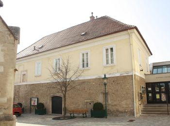
![Tocht Te voet Brunn am Gebirge - SPORTaktiv Runde - Photo](https://media.geolcdn.com/t/350/260/b1e41855-ed7f-4339-bf1d-cd5700486e95.jpeg&format=jpg&maxdim=2)
![Te voet Te voet](https://static1.geolcdn.com/sitytour/trail-icons/100.png)
Km
Te voet
![](/images/other/stat-length.png)
![](https://static1.geolcdn.com/siteimages/upload/files/1508320355ic_sort_den_pos_24dp.png)
![](https://static1.geolcdn.com/siteimages/upload/files/1508320355ic_sort_den_neg_24dp.png)
![](https://static1.geolcdn.com/siteimages/upload/files/16400158638029165_repeat_loop_refresh_sync_direction_icon.png)
• Trail created by Runnersfun. Markierung tlw. sehr schlecht Symbol: roter Pfeil, B6
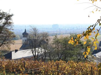
![Tocht Te voet Gemeinde Guntramsdorf - Runnersfun Runde (Guntramsdorf) - Photo](https://media.geolcdn.com/t/350/260/c113addb-d86d-427f-99ef-f58f748261ea.jpeg&format=jpg&maxdim=2)
![Te voet Te voet](https://static1.geolcdn.com/sitytour/trail-icons/100.png)
Km
Te voet
![](/images/other/stat-length.png)
![](https://static1.geolcdn.com/siteimages/upload/files/1508320355ic_sort_den_pos_24dp.png)
![](https://static1.geolcdn.com/siteimages/upload/files/1508320355ic_sort_den_neg_24dp.png)
![](https://static1.geolcdn.com/siteimages/upload/files/16400158638029165_repeat_loop_refresh_sync_direction_icon.png)
• Trail created by Runnersfun. Symbol: dunkelroter Pfeil, G1 Website: https://www.guntramsdorf.at/ONLWYSIWYG/IMG/ls_...
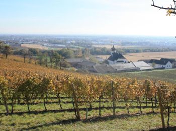
![Tocht Te voet Gemeinde Guntramsdorf - Rauch Immobilien Runde (Guntramsdorf) - Photo](https://media.geolcdn.com/t/350/260/c17bce65-4238-4873-be8c-f9ffa6c61775.jpeg&format=jpg&maxdim=2)
![Te voet Te voet](https://static1.geolcdn.com/sitytour/trail-icons/100.png)
Km
Te voet
![](/images/other/stat-length.png)
![](https://static1.geolcdn.com/siteimages/upload/files/1508320355ic_sort_den_pos_24dp.png)
![](https://static1.geolcdn.com/siteimages/upload/files/1508320355ic_sort_den_neg_24dp.png)
![](https://static1.geolcdn.com/siteimages/upload/files/16400158638029165_repeat_loop_refresh_sync_direction_icon.png)
• Trail created by Runnersfun. Symbol: gelber Pfeil, G2
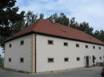
![Tocht Te voet Gemeinde Vösendorf - Raiffeisen Runde - Photo](https://media.geolcdn.com/t/350/260/0839e94c-7788-4b5f-b505-6a081b707870.jpeg&format=jpg&maxdim=2)
![Te voet Te voet](https://static1.geolcdn.com/sitytour/trail-icons/100.png)
Km
Te voet
![](/images/other/stat-length.png)
![](https://static1.geolcdn.com/siteimages/upload/files/1508320355ic_sort_den_pos_24dp.png)
![](https://static1.geolcdn.com/siteimages/upload/files/1508320355ic_sort_den_neg_24dp.png)
![](https://static1.geolcdn.com/siteimages/upload/files/16400158638029165_repeat_loop_refresh_sync_direction_icon.png)
• Trail created by Runnersfun.
![Tocht Te voet Gemeinde Vösendorf - 1A Installateur Runde - Photo](https://media.geolcdn.com/t/350/260/4a503fdc-3ee3-41b3-8afd-8692fad0a31c.jpeg&format=jpg&maxdim=2)
![Te voet Te voet](https://static1.geolcdn.com/sitytour/trail-icons/100.png)
Km
Te voet
![](/images/other/stat-length.png)
![](https://static1.geolcdn.com/siteimages/upload/files/1508320355ic_sort_den_pos_24dp.png)
![](https://static1.geolcdn.com/siteimages/upload/files/1508320355ic_sort_den_neg_24dp.png)
![](https://static1.geolcdn.com/siteimages/upload/files/16400158638029165_repeat_loop_refresh_sync_direction_icon.png)
• Trail created by Runnersfun.
![Tocht Te voet Gemeinde Wiener Neudorf - ecoplus Runde - Photo](https://media.geolcdn.com/t/350/260/683bd57f-866e-4573-9016-427719cd48f9.jpeg&format=jpg&maxdim=2)
![Te voet Te voet](https://static1.geolcdn.com/sitytour/trail-icons/100.png)
Km
Te voet
![](/images/other/stat-length.png)
![](https://static1.geolcdn.com/siteimages/upload/files/1508320355ic_sort_den_pos_24dp.png)
![](https://static1.geolcdn.com/siteimages/upload/files/1508320355ic_sort_den_neg_24dp.png)
![](https://static1.geolcdn.com/siteimages/upload/files/16400158638029165_repeat_loop_refresh_sync_direction_icon.png)
• Trail created by Runnersfun.
![Tocht Te voet Gemeinde Wiener Neudorf - Pearl iZUMi Runde - Photo](https://media.geolcdn.com/t/350/260/d5f2f066-6acc-4b13-a6bc-e3a47d662c91.jpeg&format=jpg&maxdim=2)
![Te voet Te voet](https://static1.geolcdn.com/sitytour/trail-icons/100.png)
Km
Te voet
![](/images/other/stat-length.png)
![](https://static1.geolcdn.com/siteimages/upload/files/1508320355ic_sort_den_pos_24dp.png)
![](https://static1.geolcdn.com/siteimages/upload/files/1508320355ic_sort_den_neg_24dp.png)
![](https://static1.geolcdn.com/siteimages/upload/files/16400158638029165_repeat_loop_refresh_sync_direction_icon.png)
• Trail created by Runnersfun.
![Tocht Te voet Gemeinde Wiener Neudorf - Klosterpark Runde - Photo](https://media.geolcdn.com/t/350/260/558a7a99-cd5c-4f46-87dc-d34ed6b7256c.jpeg&format=jpg&maxdim=2)
![Te voet Te voet](https://static1.geolcdn.com/sitytour/trail-icons/100.png)
Km
Te voet
![](/images/other/stat-length.png)
![](https://static1.geolcdn.com/siteimages/upload/files/1508320355ic_sort_den_pos_24dp.png)
![](https://static1.geolcdn.com/siteimages/upload/files/1508320355ic_sort_den_neg_24dp.png)
![](https://static1.geolcdn.com/siteimages/upload/files/16400158638029165_repeat_loop_refresh_sync_direction_icon.png)
• Trail created by Runnersfun.
![Tocht Te voet Gemeinde Laxenburg - Sisi Runde - Photo](https://media.geolcdn.com/t/350/260/838abbe1-d402-44fb-aacb-3df7b024360d.jpeg&format=jpg&maxdim=2)
![Te voet Te voet](https://static1.geolcdn.com/sitytour/trail-icons/100.png)
Km
Te voet
![](/images/other/stat-length.png)
![](https://static1.geolcdn.com/siteimages/upload/files/1508320355ic_sort_den_pos_24dp.png)
![](https://static1.geolcdn.com/siteimages/upload/files/1508320355ic_sort_den_neg_24dp.png)
![](https://static1.geolcdn.com/siteimages/upload/files/16400158638029165_repeat_loop_refresh_sync_direction_icon.png)
• Ist tatsächlich mit dieser Schreibweise beim Start angeschrieben
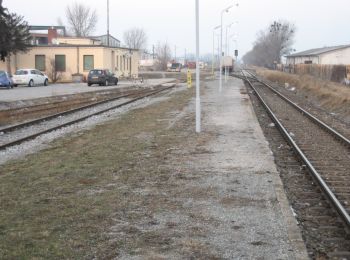
![Tocht Te voet Gemeinde Guntramsdorf - Pro Consult Runde (Guntramsdorf) - Photo](https://media.geolcdn.com/t/350/260/ba491c30-be4d-4817-865a-8d5a8181be08.jpeg&format=jpg&maxdim=2)
![Te voet Te voet](https://static1.geolcdn.com/sitytour/trail-icons/100.png)
Km
Te voet
![](/images/other/stat-length.png)
![](https://static1.geolcdn.com/siteimages/upload/files/1508320355ic_sort_den_pos_24dp.png)
![](https://static1.geolcdn.com/siteimages/upload/files/1508320355ic_sort_den_neg_24dp.png)
![](https://static1.geolcdn.com/siteimages/upload/files/16400158638029165_repeat_loop_refresh_sync_direction_icon.png)
• Trail created by Runnersfun. Symbol: hellblauer Pfeil, G4
![Tocht Te voet Gemeinde Guntramsdorf - Salomon Runde (Guntramsdorf) - Photo](https://media.geolcdn.com/t/350/260/44a0ea6a-4b86-44dc-a215-9983737c4de6.jpeg&format=jpg&maxdim=2)
![Te voet Te voet](https://static1.geolcdn.com/sitytour/trail-icons/100.png)
Km
Te voet
![](/images/other/stat-length.png)
![](https://static1.geolcdn.com/siteimages/upload/files/1508320355ic_sort_den_pos_24dp.png)
![](https://static1.geolcdn.com/siteimages/upload/files/1508320355ic_sort_den_neg_24dp.png)
![](https://static1.geolcdn.com/siteimages/upload/files/16400158638029165_repeat_loop_refresh_sync_direction_icon.png)
• Trail created by Runnersfun. Symbol: roter Pfeil, G5
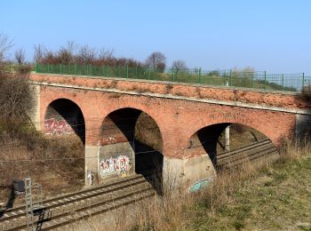
![Tocht Te voet Gemeinde Guntramsdorf - Playfit Runde (Guntramsdorf) - Photo](https://media.geolcdn.com/t/350/260/af484f36-614a-488d-a9d1-c534ffed1c94.jpeg&format=jpg&maxdim=2)
![Te voet Te voet](https://static1.geolcdn.com/sitytour/trail-icons/100.png)
Km
Te voet
![](/images/other/stat-length.png)
![](https://static1.geolcdn.com/siteimages/upload/files/1508320355ic_sort_den_pos_24dp.png)
![](https://static1.geolcdn.com/siteimages/upload/files/1508320355ic_sort_den_neg_24dp.png)
![](https://static1.geolcdn.com/siteimages/upload/files/16400158638029165_repeat_loop_refresh_sync_direction_icon.png)
• Trail created by Runnersfun. Symbol: roter Pfeil, G3
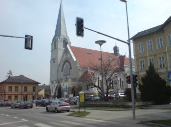
![Tocht Te voet Gemeinde Breitenfurt bei Wien - Pressbaum - Drei Berge - Hochroterd - Photo](https://media.geolcdn.com/t/350/260/a2da2bea-ed7d-420b-bafe-250dea97b922.jpeg&format=jpg&maxdim=2)
![Te voet Te voet](https://static1.geolcdn.com/sitytour/trail-icons/100.png)
Km
Te voet
![](/images/other/stat-length.png)
![](https://static1.geolcdn.com/siteimages/upload/files/1508320355ic_sort_den_pos_24dp.png)
![](https://static1.geolcdn.com/siteimages/upload/files/1508320355ic_sort_den_neg_24dp.png)
![](https://static1.geolcdn.com/siteimages/upload/files/16400158638029165_repeat_loop_refresh_sync_direction_icon.png)
• Trail created by Österreichischer Touristenklub, Sektion Wienerwald. Symbol: weiss-rot-weiss
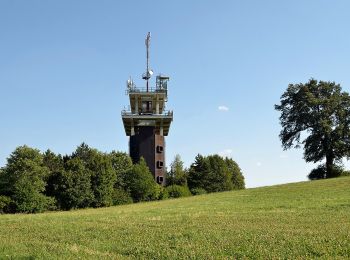
![Tocht Te voet Gemeinde Wienerwald - Stangau - Wöglerin - Gruberau - Photo](https://media.geolcdn.com/t/350/260/909341d1-332c-4fb9-bb3c-b6007701c7fd.jpeg&format=jpg&maxdim=2)
![Te voet Te voet](https://static1.geolcdn.com/sitytour/trail-icons/100.png)
Km
Te voet
![](/images/other/stat-length.png)
![](https://static1.geolcdn.com/siteimages/upload/files/1508320355ic_sort_den_pos_24dp.png)
![](https://static1.geolcdn.com/siteimages/upload/files/1508320355ic_sort_den_neg_24dp.png)
![](https://static1.geolcdn.com/siteimages/upload/files/16400158638029165_repeat_loop_refresh_sync_direction_icon.png)
• Trail created by Österreichischer Touristenklub. Symbol: roter, waagrechter Balken
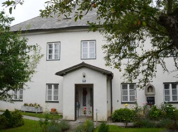
![Tocht Te voet Gemeinde Wienerwald - Stangau - Buchelbach - Klausenleopoldsdorf - Photo](https://media.geolcdn.com/t/350/260/2dd49768-ce14-4691-8f0b-ffe2dcface54.jpeg&format=jpg&maxdim=2)
![Te voet Te voet](https://static1.geolcdn.com/sitytour/trail-icons/100.png)
Km
Te voet
![](/images/other/stat-length.png)
![](https://static1.geolcdn.com/siteimages/upload/files/1508320355ic_sort_den_pos_24dp.png)
![](https://static1.geolcdn.com/siteimages/upload/files/1508320355ic_sort_den_neg_24dp.png)
![](https://static1.geolcdn.com/siteimages/upload/files/16400158638029165_repeat_loop_refresh_sync_direction_icon.png)
• Trail created by Österreichischer Touristenklub. Symbol: roter, waagrechter Balken
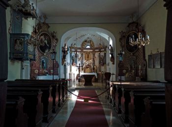
![Tocht Te voet Gemeinde Kaltenleutgeben - Kaltenleutgeben - Sulz - Wöglerin - Hochroterd - Photo](https://media.geolcdn.com/t/350/260/0e139704-a956-48b9-841b-e9bf097b0e1c.jpeg&format=jpg&maxdim=2)
![Te voet Te voet](https://static1.geolcdn.com/sitytour/trail-icons/100.png)
Km
Te voet
![](/images/other/stat-length.png)
![](https://static1.geolcdn.com/siteimages/upload/files/1508320355ic_sort_den_pos_24dp.png)
![](https://static1.geolcdn.com/siteimages/upload/files/1508320355ic_sort_den_neg_24dp.png)
![](https://static1.geolcdn.com/siteimages/upload/files/16400158638029165_repeat_loop_refresh_sync_direction_icon.png)
• Trail created by Österreichischer Touristenklub. Symbol: blauer, waagrechter Balken
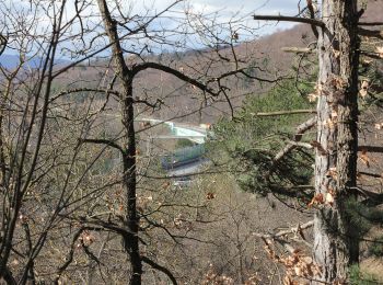
![Tocht Te voet Gemeinde Gießhübl - Mittlere Gießhübler Runde - Photo](https://media.geolcdn.com/t/350/260/76baa73c-ac04-43df-91da-f6d094737e61.jpeg&format=jpg&maxdim=2)
![Te voet Te voet](https://static1.geolcdn.com/sitytour/trail-icons/100.png)
Km
Te voet
![](/images/other/stat-length.png)
![](https://static1.geolcdn.com/siteimages/upload/files/1508320355ic_sort_den_pos_24dp.png)
![](https://static1.geolcdn.com/siteimages/upload/files/1508320355ic_sort_den_neg_24dp.png)
![](https://static1.geolcdn.com/siteimages/upload/files/16400158638029165_repeat_loop_refresh_sync_direction_icon.png)
• Trail created by Gemeinde Gießhübl. Symbol: blauer Punkt
20 tochten weergegeven op 68
Gratisgps-wandelapplicatie
Activiteiten
Nabije regio's
- Brunn am Gebirge
- Gaaden
- Gemeinde Biedermannsdorf
- Gemeinde Breitenfurt bei Wien
- Gemeinde Gießhübl
- Gemeinde Gumpoldskirchen
- Gemeinde Guntramsdorf
- Gemeinde Hinterbrühl
- Gemeinde Kaltenleutgeben
- Gemeinde Laxenburg
- Gemeinde Mödling
- Gemeinde Münchendorf
- Gemeinde Perchtoldsdorf
- Gemeinde Vösendorf
- Gemeinde Wiener Neudorf
- Gemeinde Wienerwald
- Laab im Walde