![](/images/other/stat-length.png)
![Percorso Cavallo Neufchâteau - Cousteumont et le bois d'Ospau 2 - Photo](https://media.geolcdn.com/t/1900/400/ext.pjpeg?maxdim=2&url=https%3A%2F%2Fservices.sitytrail.com%2FGeolivesWS%2FDownloadMedia.ashx%3FTrailID%3D856350%26Media%3D20171102161310.jpg)
Cousteumont et le bois d'Ospau 2
alfreson
Utente
![Lunghezza](/images/other/stat-length.png)
Lunghezza
12,3 km
![Altitudine massima](https://static1.geolcdn.com/siteimages/upload/files/1508320355ic_sort_altitude_max_24dp.png)
Altitudine massima
485 m
![Dislivello positivo](https://static1.geolcdn.com/siteimages/upload/files/1508320355ic_sort_den_pos_24dp.png)
Dislivello positivo
234 m
![Km-Effort](/images/other/stat-length.png)
Km-Effort
15,4 km
![Altitudine minima](https://static1.geolcdn.com/siteimages/upload/files/1508320355ic_sort_altitude_min_24dp.png)
Altitudine minima
389 m
![Dislivello negativo](https://static1.geolcdn.com/siteimages/upload/files/1508320355ic_sort_den_neg_24dp.png)
Dislivello negativo
234 m
![Boucle](https://static1.geolcdn.com/siteimages/upload/files/16400158638029165_repeat_loop_refresh_sync_direction_icon.png)
Boucle
Sì
Data di creazione :
2018-04-17 12:03:02.411
Ultima modifica :
2018-04-17 12:03:02.411
![Cavallo](https://static1.geolcdn.com/sitytour/trail-icons/300.png)
2h25
Difficoltà : Facile
![Scannerizza questo codice QR per aprire il percorso nell'applicazione SityTrail](https://capi.geolives.com/qq0zvz2zws4bq2lad0pu/sitytour/trails/856350/qr.png?size=200)
Applicazione GPS da escursionismo GRATUITA
Chi siamo
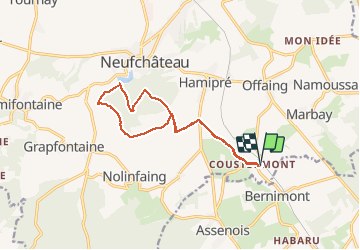
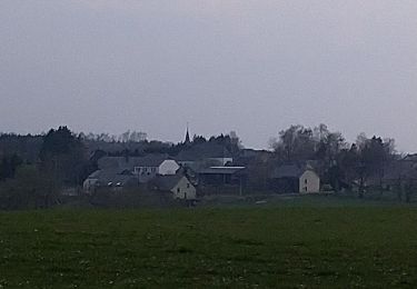
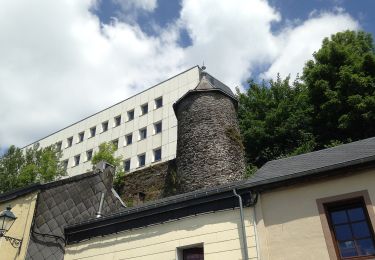
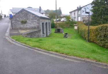
Percorso Cavallo di 12,3 km da scoprire a Wallonie, Luxembourg, Neufchâteau. Questo percorso è proposto da alfreson.
Descrizione
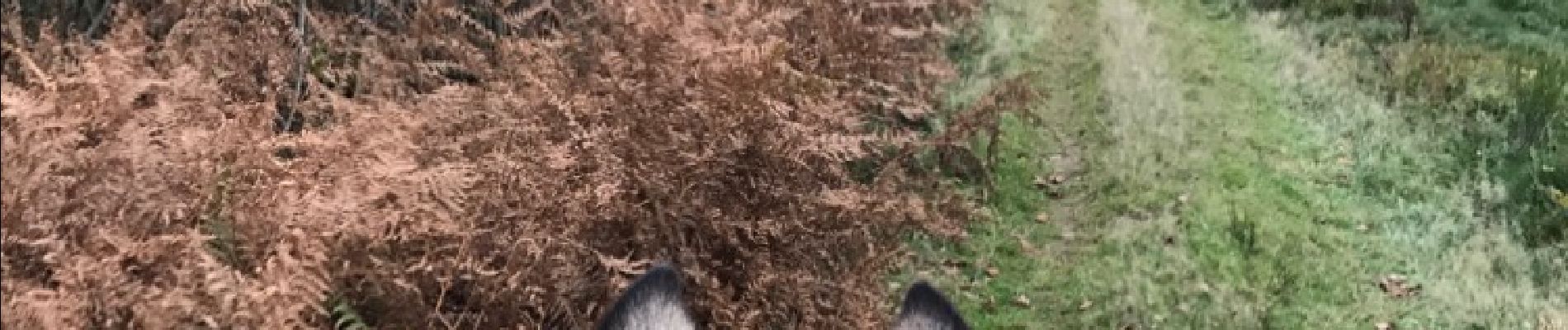
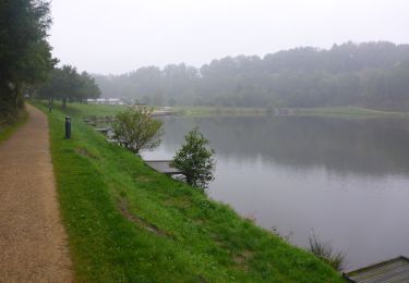
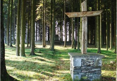
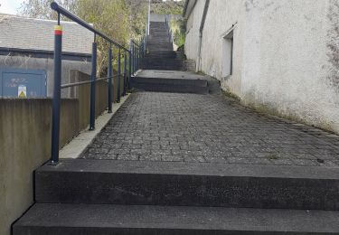
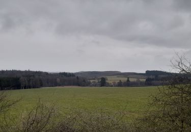
Campagne, bois et lac de Neufchâteau... un passage délicat le long de la rivière, sur une sente étroite avec de la rubalise qui indique le danger à gauche, avec le talus presque à pic qui surplombe la rivière...
Localizzazione
Paese:
Belgium
Regione :
Wallonie
Dipartimento/Provincia :
Luxembourg
Comune :
Neufchâteau
Località :
Hamipré
Partenza:(Dec)
Partenza:(UTM)
678069 ; 5521266 (31U) N.
Commenti
Percorsi nelle vicinanze
![Marcia Marcia](https://static1.geolcdn.com/sitytour/trail-icons/101.png)
RB-Lu-21_Neufchâteau
Marcia
Molto facile
(8)
Neufchâteau,
Wallonie,
Luxembourg,
Belgium
![](/images/other/stat-length.png)
24 km | 31 km-effort
6h 29min
![](https://static1.geolcdn.com/siteimages/upload/files/16400158638029165_repeat_loop_refresh_sync_direction_icon.png)
Sì
![Marcia Marcia](https://static1.geolcdn.com/sitytour/trail-icons/101.png)
RB-Lu-21_Neufchâteau_via-racc-1
Marcia
Molto facile
(2)
Neufchâteau,
Wallonie,
Luxembourg,
Belgium
![](/images/other/stat-length.png)
11,2 km | 14,4 km-effort
3h 4min
![](https://static1.geolcdn.com/siteimages/upload/files/16400158638029165_repeat_loop_refresh_sync_direction_icon.png)
Sì
![Percorso Marcia Léglise - Ebly - Vaux-lez-Chêne - Photo](https://media.geolcdn.com/t/375/260/4443fdba-4049-42b8-95b3-28f013a869fb.jpg&format=jpg&maxdim=2)
![Marcia Marcia](https://static1.geolcdn.com/sitytour/trail-icons/101.png)
Ebly - Vaux-lez-Chêne
Marcia
Facile
(1)
Léglise,
Wallonie,
Luxembourg,
Belgium
![](/images/other/stat-length.png)
3 km | 3,9 km-effort
45min
![](https://static1.geolcdn.com/siteimages/upload/files/16400158638029165_repeat_loop_refresh_sync_direction_icon.png)
Sì
![Percorso Marcia Neufchâteau - Le Sentier du Bois d'Ospôt - Photo](https://media.geolcdn.com/t/375/260/ext.jpg?maxdim=2&url=https%3A%2F%2Fservices.sitytrail.com%2FGeolivesWS%2FDownloadMedia.ashx%3FTrailID%3D314177%26Media%3Da3f0c943-b6aa-42ba-a976-375fc630bff4.jpg)
![Marcia Marcia](https://static1.geolcdn.com/sitytour/trail-icons/101.png)
Le Sentier du Bois d'Ospôt
Marcia
Facile
(2)
Neufchâteau,
Wallonie,
Luxembourg,
Belgium
![](/images/other/stat-length.png)
6,6 km | 8,2 km-effort
1h 48min
![](https://static1.geolcdn.com/siteimages/upload/files/16400158638029165_repeat_loop_refresh_sync_direction_icon.png)
Sì
![Percorso Marcia Léglise - Marche ADEPS 10KM600 à Leglise. - Photo](https://media.geolcdn.com/t/375/260/22df4f57-b50c-4a03-931b-ccb162dab65d.jpg&format=jpg&maxdim=2)
![Marcia Marcia](https://static1.geolcdn.com/sitytour/trail-icons/101.png)
Marche ADEPS 10KM600 à Leglise.
Marcia
Facile
Léglise,
Wallonie,
Luxembourg,
Belgium
![](/images/other/stat-length.png)
10,6 km | 13 km-effort
2h 8min
![](https://static1.geolcdn.com/siteimages/upload/files/16400158638029165_repeat_loop_refresh_sync_direction_icon.png)
Sì
![Percorso Marcia Neufchâteau - Marche ADEPS 8K500?? à (Namoussart) Neufchateau - Photo](https://media.geolcdn.com/t/375/260/394ab4a5-c5a6-43e2-b98b-c33bbaf2a33e.jpg&format=jpg&maxdim=2)
![Marcia Marcia](https://static1.geolcdn.com/sitytour/trail-icons/101.png)
Marche ADEPS 8K500?? à (Namoussart) Neufchateau
Marcia
Facile
Neufchâteau,
Wallonie,
Luxembourg,
Belgium
![](/images/other/stat-length.png)
8,5 km | 10,4 km-effort
1h 43min
![](https://static1.geolcdn.com/siteimages/upload/files/16400158638029165_repeat_loop_refresh_sync_direction_icon.png)
Sì
![Percorso A piedi Neufchâteau - Promenade des Vannettes - Photo](https://media.geolcdn.com/t/375/260/c94cab10-49b6-4e98-8b22-803163741678.jpeg&format=jpg&maxdim=2)
![A piedi A piedi](https://static1.geolcdn.com/sitytour/trail-icons/100.png)
Promenade des Vannettes
A piedi
Facile
Neufchâteau,
Wallonie,
Luxembourg,
Belgium
![](/images/other/stat-length.png)
12,4 km | 16 km-effort
3h 38min
![](https://static1.geolcdn.com/siteimages/upload/files/16400158638029165_repeat_loop_refresh_sync_direction_icon.png)
Sì
![Marcia Marcia](https://static1.geolcdn.com/sitytour/trail-icons/101.png)
RB-Lu-21_Neufchâteau_via-racc-2
Marcia
Molto facile
Neufchâteau,
Wallonie,
Luxembourg,
Belgium
![](/images/other/stat-length.png)
16,5 km | 21 km-effort
4h 32min
![](https://static1.geolcdn.com/siteimages/upload/files/16400158638029165_repeat_loop_refresh_sync_direction_icon.png)
Sì
![Percorso Mountainbike Léglise - 41km autour de Léglise - Photo](https://media.geolcdn.com/t/375/260/ext.jpg?maxdim=2&url=https%3A%2F%2Fstatic1.geolcdn.com%2Fsiteimages%2Fupload%2Ffiles%2F1524743154velo.jpg)
![Mountainbike Mountainbike](https://static1.geolcdn.com/sitytour/trail-icons/202.png)
41km autour de Léglise
Mountainbike
Medio
(2)
Léglise,
Wallonie,
Luxembourg,
Belgium
![](/images/other/stat-length.png)
41 km | 51 km-effort
2h 22min
![](https://static1.geolcdn.com/siteimages/upload/files/16400158638029165_repeat_loop_refresh_sync_direction_icon.png)
Sì