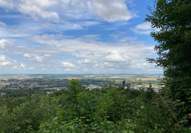
Percorso Marcia Vandœuvre-lès-Nancy - 5km AREMIG suite - Photo
© OpenStreetMap contributors
Lunghezza
Lunghezza
3,4 km
Altitudine massima
Altitudine massima
408 m
Dislivello positivo
Dislivello positivo
40 m
Km-Effort
Km-Effort  
4 km
Altitudine minima
Altitudine minima
385 m
Dislivello negativo
Dislivello negativo
43 m
Boucle
Boucle
Sì
Data di creazione :
2017-04-07 00:00:00.0
Ultima modifica :
2017-04-07 00:00:00.0

(0 Recensione)

Marcia
Marcia
1h23
Difficoltà : Molto facile

Scannerizza questo codice QR per aprire il percorso nell'applicazione SityTrail

Applicazione GPS da escursionismo GRATUITA

Logo SityTrail SityTrail

IGN / Istituti geografici

Scarica SityTrail dall'App Store Scarica SityTrail da Google Play

Logo SityTrail SityTrail World

Il mondo è tuo

Scarica SityTrail dall'App Store Scarica SityTrail da Google Play Scarica SityTrail da Huawei AppGallery

Chi siamo

Percorso Marcia di 3,4 km da scoprire a Grande Est, Meurthe-et-Moselle, Vandœuvre-lès-Nancy. Questo percorso è proposto da DanielROLLET.

Profilo altimetrico

Punti di interesse

Punto di interesse Vandœuvre-lès-Nancy - jonctionPoint 1 - Photo
DanielROLLET
VANDŒUVRE-LÈS-NANCY 
Punto di interesse Vandœuvre-lès-Nancy - jonctionPoint 2 - Photo
DanielROLLET
VANDŒUVRE-LÈS-NANCY 
Punto di interesse Vandœuvre-lès-Nancy - intersectionPoint 3 - Photo
DanielROLLET
VANDŒUVRE-LÈS-NANCY 
Punto di interesse Vandœuvre-lès-Nancy - jonctionPoint 4 - Photo
DanielROLLET
VANDŒUVRE-LÈS-NANCY 
Punto di interesse Vandœuvre-lès-Nancy - jonctionPoint 5 - Photo
DanielROLLET
VANDŒUVRE-LÈS-NANCY 
Punto di interesse Vandœuvre-lès-Nancy - jonctionPoint 6 - Photo
DanielROLLET
VANDŒUVRE-LÈS-NANCY 
Punto di interesse Vandœuvre-lès-Nancy - jonction GPoint 7 - Photo
DanielROLLET
VANDŒUVRE-LÈS-NANCY 
Punto di interesse Vandœuvre-lès-Nancy - jonction GPoint 8 - Photo
DanielROLLET
VANDŒUVRE-LÈS-NANCY 
Punto di interesse Vandœuvre-lès-Nancy - Point 9 - Photo
DanielROLLET
VANDŒUVRE-LÈS-NANCY 
Punto di interesse Vandœuvre-lès-Nancy - intersection route/sentierPoint 10 - Photo
DanielROLLET
VANDŒUVRE-LÈS-NANCY 
Punto di interesse Vandœuvre-lès-Nancy - jonction sentier DPoint 11 - Photo
DanielROLLET
VANDŒUVRE-LÈS-NANCY 
Punto di interesse Houdemont - axe pontPoint 12 - Photo
DanielROLLET
HOUDEMONT 
Punto di interesse Houdemont - jonction DPoint 13 - Photo
DanielROLLET
Punto di interesse Houdemont - jonction DPoint 14 - Photo
DanielROLLET
Punto di interesse Houdemont - jonction DPoint 15 - Photo
DanielROLLET
Punto di interesse Ludres - jonction AD Point 16 - Photo
DanielROLLET
Punto di interesse Houdemont - intersectionPoint 17 - Photo
DanielROLLET
Punto di interesse Houdemont - intersectionPoint 18 - Photo
DanielROLLET
Punto di interesse Houdemont - intersectionPoint 19 - Photo
DanielROLLET
Punto di interesse Houdemont - jonction AvG Point 20 - Photo
DanielROLLET
Punto di interesse Houdemont - jonction GPoint 21 - Photo
DanielROLLET
Punto di interesse Houdemont - jonction DPoint 22 - Photo
DanielROLLET
Punto di interesse Houdemont - 2Point 23 - Photo
DanielROLLET
HOUDEMONT 
Punto di interesse Houdemont - 2  jonctions Point 24 - Photo
DanielROLLET
Punto di interesse Houdemont - intersection Point 25 - Photo
DanielROLLET
Punto di interesse Houdemont - axe pont Point 26 - Photo
DanielROLLET
Punto di interesse Vandœuvre-lès-Nancy - jonction DPoint 27 - Photo
DanielROLLET
VANDŒUVRE-LÈS-NANCY 
Punto di interesse Vandœuvre-lès-Nancy - intersectionPoint 28 - Photo
DanielROLLET
VANDŒUVRE-LÈS-NANCY 
Punto di interesse Vandœuvre-lès-Nancy - intersection route Point 29 - Photo
DanielROLLET
VANDŒUVRE-LÈS-NANCY 

Localizzazione

Paese:
France
Regione :
Grande Est
Dipartimento/Provincia :
Meurthe-et-Moselle
Comune :
Vandœuvre-lès-Nancy
Località :
Unknown
Partenza:(Dec)
Partenza:(UTM)
290758 ; 5391806 (32U) N.

Percorsi nelle vicinanze

Percorso A piedi Fléville-devant-Nancy - Fléville-devant-Nancy et son château - Photo
A piedi
GUIDE+

A piedi

Facile
Fléville-devant-Nancy, Grande Est, Meurthe-et-Moselle, France
7,9 km | 9,4 km-effort
2h 8min
Sì
Percorso sport Ludres - Ludres - Photo
sport
CZA

sport

Molto facile
Ludres, Grande Est, Meurthe-et-Moselle, France
11,6 km | 14,9 km-effort
Sconosciuto
Sì
Percorso Marcia Ludres - SityTrail - Marche gourmande 11km - Photo
Marcia

Marcia

Difficile
(2)
Ludres, Grande Est, Meurthe-et-Moselle, France
10,4 km | 12,1 km-effort
2h 45min
Sì
Percorso Marcia Vandœuvre-lès-Nancy - Randonnée USEP 2023 - Photo
Marcia
nicolas54230

Marcia

Difficile
(1)
Vandœuvre-lès-Nancy, Grande Est, Meurthe-et-Moselle, France
11,7 km | 15,2 km-effort
3h 27min
No
Percorso Marcia Ludres - marche nuit - Photo
Marcia
JJG54

Marcia

Medio
Ludres, Grande Est, Meurthe-et-Moselle, France
8,7 km | 10,1 km-effort
2h 11min
Sì
Percorso Marcia Villers-lès-Nancy - RANDO DUO AVEC ALEXIS - Photo
Marcia
Toyot 8

Marcia

Difficile
(1)
Villers-lès-Nancy, Grande Est, Meurthe-et-Moselle, France
38 km | 45 km-effort
10h 19min
No
Percorso A piedi Villers-lès-Nancy - Promenade d'Hardeval - Photo
A piedi
GUIDE+

A piedi

Facile
Villers-lès-Nancy, Grande Est, Meurthe-et-Moselle, France
3,2 km | 4,3 km-effort
58min
Sì
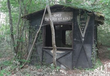
Percorso Camminata nordica Ludres - Randonnée Ludres la mine la maison Patrick et Nini - Photo
Camminata nordica
JJG54

Camminata nordica

Facile
Ludres, Grande Est, Meurthe-et-Moselle, France
6,7 km | 8,4 km-effort
1h 48min
No
Percorso Camminata nordica Ludres - Randonnée Ludres Belvédère  - Photo
Camminata nordica
JJG54

Camminata nordica

Facile
Ludres, Grande Est, Meurthe-et-Moselle, France
6,7 km | 8 km-effort
1h 44min
Sì


Chiudi
I miei abbonamenti