J M Cramant Avize SityTrail > Percorsi > Outdoor > France > Grande Est > Marna > Cramant SityTrail > Percorsi > Outdoor > France > Grande Est > Marna > Cramant J M Cramant Avize animatricemartine Utente 3D © OpenStreetMap contributors Lunghezza 8,2 km Altitudine massima 254 m Dislivello positivo 163 m Km-Effort 10,3 km Altitudine minima 145 m Dislivello negativo 165 m Boucle Sì Data di creazione : 2024-06-23 07:55:11.534 Ultima modifica : 2024-06-23 08:00:14.402 (0 Recensione) A piedi 2h21 Difficoltà : Facile Applicazione GPS da escursionismo GRATUITA SityTrail IGN / Istituti geografici SityTrail World Il mondo è tuo Chi siamo 
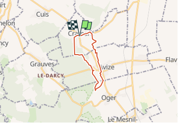
Percorso A piedi di 8,2 km da scoprire a Grande Est, Marna, Cramant. Questo percorso è proposto da animatricemartine. Legende | Maggiori dettagli (PDF) Profilo altimetrico Legende > 15% 15% - 10% 10% - 5% di piatto 5% - 10% 10% - 15% 15% - 30% > 30% Localizzazione Paese: France Regione : Grande Est Dipartimento/Provincia : Marna Comune : Cramant Località : Unknown Partenza:(Dec) 48.98615406394759 / 3.991255758883199 Partenza:(UTM) 572523 ; 5426390 (31U) N. Commenti Accedi per lasciare un commento o una valutazione Percorsi nelle vicinanze carolinevk 3e dag Epernay-Lucy sport Molto facile Épernay, Grande Est, Marna, France 26 km | 31 km-effort Sconosciuto No neitag61 Entre Gramant et Cuis Marcia Medio Cramant, Grande Est, Marna, France 7,7 km | 9,4 km-effort 2h 30min Sì usben 190830 Cramant Falaise de Cuis Cuis Cramant Marcia Molto facile Cramant, Grande Est, Marna, France 8,3 km | 10,1 km-effort 2h 16min Sì Nico222 Mothelon 1 Marcia Facile Monthelon, Grande Est, Marna, France 5,5 km | 7,3 km-effort 1h 35min Sì Nico222 Monthelon 2 Marcia Facile Monthelon, Grande Est, Marna, France 14,3 km | 18,9 km-effort 4h 4min Sì